

Trolltunga is a horizontal slab of rock jutting from a cliff about 700 metres above the Ringedalsvatnet lake, near ODDA in Vestland, western Norway. The photograph at the top of this post is the reason perhaps 80,000 people a year walk to it, from almost nobody twenty years ago.
Disclosure: This post contains affiliate links. If you buy through them, Roman Trail earns a small commission at no extra cost to you.
This post is mostly about the walk, because the walk is the thing people get wrong. The standard route from Skjeggedal is ABOUT 28 KILOMETRES THERE AND BACK WITH ROUGHLY 800 METRES OF ASCENT, taking 8 to 12 hours. It is not technical and it is not a scramble. It is long, exposed, high and weather-beaten, and the Norwegian rescue services are called to it repeatedly every season.
What Is Here
The rock itself takes about ten seconds to see and the queue for a photograph on it can take an hour in high season. There is no barrier and no fence. People sit on the end with their legs over the drop, which is how the photographs are made, and that is entirely at their own risk.
The route starts at SKJEGGEDAL and the parking is the first decision. From the lower car park the walk is the full 28 kilometres; from the upper P3 car park, reached by a toll road or a shuttle bus, it is shorter by several kilometres and several hundred metres of climb. Shuttles run in season and they fill.

THE SEASON IS NARROW AND IT IS NOT A SUGGESTION. The route is generally considered safe to walk unguided from roughly mid June to mid September. Outside that, snow covers the path and the markers, the weather turns faster, the days are short and A GUIDE IS STRONGLY ADVISED OR REQUIRED. Winter trips do run and they are guided expeditions rather than hikes.
What else is nearby is worth knowing, because the hike is a whole day. Odda sits at the head of the Sorfjorden with the FOLGEFONNA glacier above it, the LATEFOSSEN twin waterfall is on the road in, and the Hardanger region is at its most spectacular in May when the fruit orchards flower along the fjord.
The third image here is the view in summer, which is what the walk delivers for ten of the eleven hours that are not the photograph.
When to Go
Mid June to mid September is the unguided season, with July and August the busiest and the most reliable.
Early and late in that window the weather is less dependable and the daylight shorter, which matters on an 8 to 12 hour walk.
Outside it, the walk is a guided winter expedition. The photographs of Trolltunga in snow are real and they were not taken by people who turned up and started walking.
Start early whatever the month. The rescue services' most repeated advice is that people set off at eleven, reach the rock at four and are descending in the dark.
Getting There
By car, Odda is about three hours from Bergen and five from Oslo, then Skjeggedal and the car parks. The P3 toll road is narrow and has limited spaces.
By bus, services run to Odda from Bergen, with seasonal shuttles from Odda and Tyssedal to the trailhead.
By cruise, ships call at Eidfjord and Ulvik in the Hardanger, from where excursions run.
Norway's driving rules include one limit framed in a way that makes it immediately clear and two that catch visitors by surprise. ON ALCOHOL, the FCDO says that if you are found to have A QUARTER OF ENGLAND'S LEGAL LIMIT of alcohol in your system you may get a fine and possible imprisonment, and that THERE ARE FREQUENT ROADSIDE CHECKS. In practice that is one drink too many, so the working rule is none. ON TYRES, winter tyres with a MINIMUM 3MM TREAD are required if there is snow or ice on the roads, and studded tyres or chains may also be needed. And the two a visitor simply would not know: KEEP YOUR HEADLIGHTS ON, DIPPED, DURING THE DAYTIME ALL YEAR ROUND IN ALL PLACES, and ON ROADS NOT MARKED WITH A PRIORITY SIGN, THE YELLOW DIAMOND, YOU MUST GIVE WAY TO TRAFFIC COMING FROM THE RIGHT. That second one is the genuine hazard, because a car emerging from a side road on your right has priority and will take it. Driving offences carry on-the-spot fines of up to 10,000 Norwegian krone.
One point of confusion is worth settling before you look at entry rules, because Norway sits in an unusual position. NORWAY IS NOT IN THE EUROPEAN UNION, and it IS IN THE SCHENGEN AREA. Both halves matter and they work in opposite directions. For borders, Schengen membership is what counts, so the European Entry/Exit System and its biometric registration apply here exactly as they do in Germany or Spain, and an arrival from another Schengen country is an internal movement rather than an entry. For money and goods, EU membership is what counts, so Norway is outside the customs union, keeps its own currency in the KRONE, and has its own and fairly strict duty-free allowances, particularly on alcohol, which are enforced rather than nominal. The practical upshot for a traveller is that the passport queue behaves like the EU and the customs hall does not.
Is Trolltunga Safe for Women?
The village and the roads are as safe as anywhere in Norway. The hike is the most serious single undertaking in this batch. Norway's advisory describes the conditions a packing list has to answer, and it is worth quoting rather than paraphrasing. THE WEATHER CAN CHANGE QUICKLY, PRODUCING ARCTIC CONDITIONS EVEN IN SUMMER ON EXPOSED MOUNTAIN TOPS. THE WINTER IS LONG AND CAN LAST WELL INTO APRIL. TEMPERATURES CAN DROP TO MINUS 25C AND BELOW. THERE IS ALSO A HIGH WIND CHILL FACTOR, PARTICULARLY IN UNSHELTERED AREAS AND MOUNTAIN RANGES. Three things follow from that and they are not the same thing as owning a warm coat. A long winter means the shoulder seasons are winter, so an April trip is a winter trip. Wind chill rather than air temperature is what you dress against, which makes a windproof outer layer worth more than a thicker insulating one. And conditions changing quickly on a mountain in summer means carrying the layer you do not currently need, which is the entire argument for base layers that pack to nothing and do not hold damp.
THE NUMBERS ARE THE ARGUMENT: 28 KILOMETRES, 800 METRES OF ASCENT, 8 TO 12 HOURS. That is a full mountain day for a fit walker. The rescue callouts here are overwhelmingly for exhaustion, hypothermia, inadequate footwear and darkness, not for falls, and they cluster among people who treated it as a sightseeing walk.
There is no fence at the rock and no barrier anywhere on the upper route. The exposure is constant in the last few kilometres.
The weather at 1,100 metres is not the weather in Odda. The FCDO's own line that conditions can produce ARCTIC CONDITIONS EVEN IN SUMMER applies here as literally as anywhere in Norway, and the plateau has no shelter at all.
TURNING BACK IS THE SKILL. Set a turnaround time before you start and keep it regardless of how close you think you are.
Two Norwegian rules exist that a visitor is likely to break by accident and neither is about driving. POLICE ENFORCE BANS ON CAMPFIRES IN MANY HIKING AREAS DURING THE SUMMER MONTHS, which sits oddly beside Norway's famous right to roam: you may legally camp in a great deal of open country and still not be allowed to light anything. And DRONES require registration as an operator in Norway or an EU or EFTA country plus LIABILITY INSURANCE, with no-fly zones in force, so a drone packed for the fjords is a licensing question before it is a photography one.
The Trolltunga Packing List
Eight to twelve hours on an exposed plateau with no shelter and no shops.
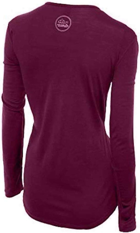
Our merino base layers are 100% Australian merino at 17.5 micron, and a long sleeve merino wool base layer for women is the single most important garment on this walk, and the reason is the mechanism that puts people in trouble here. You climb 800 metres and sweat into whatever is against your skin; then you stop at the top in wind at 1,100 metres; and if that layer is cotton it is now wet, cold and pulling heat out of you for the entire descent. THAT IS HOW HYPOTHERMIA HAPPENS ON THIS ROUTE IN JULY. Wool keeps insulating damp. A heavyweight merino base layer is worth carrying as a dry spare even in summer.
Over it, an insulated mid layer and a Marmot PreCip Eco rain jacket with a hood, plus waterproof overtrousers, which on this plateau are equipment rather than luxury.
Merrell Moab 3 waterproof hiking boots with Darn Tough merino socks, and inadequate footwear is the most cited factor in rescues here. The path is rock, bog and stream crossings for 28 kilometres.
Kahtoola MICROspikes for the shoulder-season snow patches, which persist on the plateau into July.
Not linked and worth packing, and this list is closer to mandatory than usual: A HEADTORCH, because descending in the dark is common; FOOD AND AT LEAST TWO LITRES OF WATER, since there is nothing on the route; a HAT AND GLOVES in any month; a MAP AND COMPASS or a charged offline GPS, because cloud erases the markers; a POWER BANK; and a SPARE DRY TOP in a bag. Register your plan with someone before you start.
Recommended Tours and Experiences
Essential Resources for Women at Trolltunga
Emergency numbers: Norway uses three direct numbers and the distinction matters more here than elsewhere, because 112 IS THE POLICE NUMBER rather than a general router: 112 for police, 113 FOR AN AMBULANCE and 110 for the fire service. For a medical emergency, 113 is the faster call. All three work from any phone including a locked mobile and operators speak English. For a non-urgent medical problem, 116117 reaches the out-of-hours doctor service. And the one specific to this country: in the mountains and at sea, remember that the FCDO states EMERGENCY MEDICAL ASSISTANCE AND SEARCH AND RESCUE ARE LIMITED across the half of Norway inside the Arctic Circle, so the call connects quickly and the help may still be a long way off.
THE STANDARD ROUTE IS ABOUT 28 KILOMETRES ROUND TRIP WITH ROUGHLY 800 METRES OF ASCENT AND TAKES 8 TO 12 HOURS. It is a full mountain day, not a sightseeing walk. THE UNGUIDED SEASON IS ROUGHLY MID JUNE TO MID SEPTEMBER; outside it snow covers the path and the markers and a guide is strongly advised or required. The P3 upper car park, reached by toll road or shuttle, removes several kilometres and several hundred metres of climb. START EARLY AND SET A TURNAROUND TIME: rescue callouts here are overwhelmingly for exhaustion, hypothermia, inadequate footwear and darkness rather than falls. THERE IS NO FENCE AT THE ROCK. Carry a headtorch, food, two litres of water and a dry spare layer.
US State Department travel advisory: the Norway advisory. Read the current level there directly rather than relying on a figure printed in any guide.
UK FCDO travel advice: gov.uk/foreign-travel-advice/norway, and read the safety and security page rather than only the landing page, because that is where the substance sits.
Main hospital: Odda has a hospital, Odda sjukehus, which serves the district and is where walkers are taken, with Haukeland University Hospital in Bergen about three hours away as the regional trauma centre. Mountain rescue and air ambulance cover the plateau and are reached through 113 or 112. Norway is in the EEA rather than the EU, and that distinction does not cost you anything here: a UK Global Health Insurance Card or an EU European Health Insurance Card gives you state-provided medically necessary care on the same terms as a resident, which in Norway means paying the same patient contribution a Norwegian pays rather than nothing. Travel insurance sits on top of it, and in Norway it should specifically cover SEARCH AND RESCUE AND AIR AMBULANCE, because the terrain rather than the medicine is what makes a Norwegian incident expensive. A pharmacy is an APOTEK, they handle minor problems without an appointment, and the larger towns have one open late. TAP WATER IS AMONG THE BEST IN THE WORLD and buying bottled water here is purely a waste of money. There are no required vaccinations and no endemic tropical disease. TICKS occur along the southern coast and in the south east, carrying Lyme and, in a narrow coastal band, tick-borne encephalitis, which is a reason to check after walking in long grass. The real medical risk in Norway is environmental rather than infectious: cold, wet and exposure, which is what the clothing on this page is for.
Official health authority: Helsenorge, the Norwegian public health service portal. covers the Vestland hospital network
US Embassy: the United States Embassy in Oslo.
Official tourism authority: Visit Norway, the official travel guide. publishes the Trolltunga season dates, the trail status, the shuttle timetables and the guided winter arrangements
Takeaways
Twenty eight kilometres and 800 metres of climb. Plan a mountain day, not a viewpoint.
Mid June to mid September unguided. Outside that it is a guided expedition.
Boots, headtorch, food, water, spare layer. The rescue reports name the missing ones.
Set a turnaround time and keep it. The rock is not worth descending in the dark for.
Solo women safety assessment: Trolltunga is the most serious single undertaking in this batch, and the risk has nothing to do with other people. Norway has one of the lowest violent crime rates in the world, the trail is busy in season, Odda is an ordinary safe town, and a woman walking this route alone is unremarkable, though walking it with someone is sensible for reasons of terrain rather than company. NORWAY'S EMERGENCY NUMBERS ARE SPLIT RATHER THAN POOLED: 112 IS THE POLICE, 113 the ambulance and 110 fire. THE WALK IS THE WHOLE RISK AND THE NUMBERS MAKE THE CASE: about 28 kilometres round trip, roughly 800 metres of ascent, 8 to 12 hours, on an exposed plateau at up to 1,100 metres with no shelter, no facilities and no water. The Norwegian rescue services are called here repeatedly every season, and the callouts are overwhelmingly for EXHAUSTION, HYPOTHERMIA, INADEQUATE FOOTWEAR AND DARKNESS rather than for falls from the rock. The mechanism for hypothermia in July is worth stating because it is not obvious: you sweat climbing 800 metres, you stop in wind at the top, and a cotton layer then holds that moisture against you for the whole descent. A wool base layer and a dry spare are the practical answer. THE SEASON IS NARROW. Roughly mid June to mid September is the unguided window; outside it snow covers both the path and its markers, daylight is short, and a guide is strongly advised or required, with winter trips being guided expeditions rather than hikes. THERE IS NO FENCE AT THE ROCK and no barrier on the upper route. START EARLY, CARRY A HEADTORCH, AND SET A TURNAROUND TIME BEFORE YOU LEAVE, because the most common error on this mountain is continuing when the sensible thing was to go back. Leave your plan with someone.
Reading On
Trolltunga is Hardanger and the fjords run west from it. The Bergen packing list covers the city three hours away that most trips start from, and the Flam packing list and Aurland packing list the Sognefjord to the north. The Geiranger packing list and Alesund packing list cover the northern fjords, with the Trollstigen packing list and Atlantic Road packing list for the two great roads and the Stavanger packing list for Preikestolen to the south. North, the Lofoten packing list, Svolvaer packing list, Reine packing list, Senja packing list and Tromso packing list cover the Arctic. The Oslo packing list covers the capital. For the country the Norway travel guide for women and the Norway packing list carry the transport, the weather and the practical material in full. For why a wool base layer is the difference between a long day and a rescue, read the guide to merino wool base layers for women. Every destination we cover is indexed at the travel packing guide for women, and the base layers are at the Roman Trail collection.

If the outer journey is calling you, the inner one usually is too. Explore SoulMap at romantrail.com/blogs/soulmap.