

The Atlantic Road, the Atlanterhavsvegen, is an eight kilometre stretch of the county road 64 in More og Romsdal on Norway's west coast, running between Averoy and the mainland across a scatter of small islands and skerries on eight bridges and several causeways. It opened in 1989, it is free, and it takes about ten minutes to drive.
Disclosure: This post contains affiliate links. If you buy through them, Roman Trail earns a small commission at no extra cost to you.
What makes it worth a journey is not length. The road is built out into open water with nothing between it and the Atlantic, the largest bridge, Storseisundet, curves and rises in a way that from certain angles appears to end in mid air, and in a storm the sea comes over the carriageway. It is one of very few roads anywhere that people deliberately drive in bad weather.
One honest note about the photographs. Our set is three frames by three photographers, which is the minimum this library builds on, with nothing in reserve. The three here are the bridges spanning the islands at Averoy, the road and the open ocean from above, and sunrise over it.
We receive a fee when you get a quote from World Nomads using this link. We do not represent World Nomads. This is not a recommendation to buy travel insurance.
What Is Here
Storseisundet is the bridge everyone photographs and the effect is a trick of perspective. It is 260 metres long and curves as it rises, so from the approach at certain angles the far side is hidden and the road appears to stop at the top. It is entirely safe and the photograph has been doing the rounds for thirty years. The best view of it is from the laybys on the Averoy side rather than from the road itself.
The storm season is the real reason to come, and this is unusual enough to state plainly. From roughly October to March, Atlantic depressions drive waves over the road, and the route is marketed, correctly, as a storm-watching drive. The road closes when conditions become dangerous and the closure is published; driving it in a storm when it is OPEN is a legitimate and spectacular thing to do, and getting out of the car on the exposed sections in those conditions is not.

There are fishing platforms and laybys along the route, and this is genuinely good sea fishing: cod, coalfish and pollock from the rocks, with the Eldhusoya walkway giving a circular path out over the skerries on a raised boardwalk.
At the Averoy end, Kvernes has a stave church, and the Bremsnes cave is a short walk. At the eastern end the road continues towards Kristiansund through the Atlanterhavstunnelen, a 5.7 kilometre subsea tunnel that drops to 250 metres below sea level and is worth knowing about before you drive into it.
Molde is about an hour south west and Kristiansund about half an hour north east, and the road is usually driven as part of a longer route between them rather than as a destination in itself.
When to Go
October to March for storms, June to August for light. That is the whole decision and the two are completely different trips.
In autumn and winter the Atlantic depressions arrive one after another, the sea is enormous, and the road is at its most dramatic. Days are short, the road sometimes closes, and you need to be willing to wait a day.
In summer the light lasts most of the night, the sea is usually calm, the fishing is good and the road is busy with motorhomes. It is pretty rather than spectacular.
May and September are the compromise and September is the better of the two, with the first autumn weather and still-reasonable daylight.
Whenever you come, check the road status before setting out. One point of confusion is worth settling before you look at entry rules, because Norway sits in an unusual position. NORWAY IS NOT IN THE EUROPEAN UNION, and it IS IN THE SCHENGEN AREA. Both halves matter and they work in opposite directions. For borders, Schengen membership is what counts, so the European Entry/Exit System and its biometric registration apply here exactly as they do in Germany or Spain, and an arrival from another Schengen country is an internal movement rather than an entry. For money and goods, EU membership is what counts, so Norway is outside the customs union, keeps its own currency in the KRONE, and has its own and fairly strict duty-free allowances, particularly on alcohol, which are enforced rather than nominal. The practical upshot for a traveller is that the passport queue behaves like the EU and the customs hall does not.
Getting There
By car, and there is no sensible alternative. From Molde it is about an hour via the Tussen tunnel and ferry or round by road; from Kristiansund about half an hour through the subsea tunnel; from Alesund around two and a half hours including a ferry. The road itself is county road 64 and is free.
By air, Molde and Kristiansund both have airports with domestic connections, and Alesund has more.
There is no public bus along the Atlantic Road as a scenic route, and organised tours run from Molde, Kristiansund and the cruise port at Alesund.
Norway's driving rules include one limit framed in a way that makes it immediately clear and two that catch visitors by surprise. ON ALCOHOL, the FCDO says that if you are found to have A QUARTER OF ENGLAND'S LEGAL LIMIT of alcohol in your system you may get a fine and possible imprisonment, and that THERE ARE FREQUENT ROADSIDE CHECKS. In practice that is one drink too many, so the working rule is none. ON TYRES, winter tyres with a MINIMUM 3MM TREAD are required if there is snow or ice on the roads, and studded tyres or chains may also be needed. And the two a visitor simply would not know: KEEP YOUR HEADLIGHTS ON, DIPPED, DURING THE DAYTIME ALL YEAR ROUND IN ALL PLACES, and ON ROADS NOT MARKED WITH A PRIORITY SIGN, THE YELLOW DIAMOND, YOU MUST GIVE WAY TO TRAFFIC COMING FROM THE RIGHT. That second one is the genuine hazard, because a car emerging from a side road on your right has priority and will take it. Driving offences carry on-the-spot fines of up to 10,000 Norwegian krone.
Is the Atlantic Road Safe for Women?
The Atlantic Road is safe from crime and has one genuine hazard that is the same thing as its attraction. One sentence in Norway's advisory changes the planning for a large part of the country. NEARLY HALF OF NORWAY IS IN THE ARCTIC CIRCLE, INCLUDING SOME VERY REMOTE AREAS OF LAND AND SEA, and in those areas EMERGENCY MEDICAL ASSISTANCE AND SEARCH AND RESCUE ARE LIMITED. That is not a warning about danger so much as a statement about response time, and the honest consequence is that self-sufficiency does the work an ambulance does elsewhere: tell someone your route and your expected return, carry more warmth than the forecast justifies, carry a way to signal that does not depend on mobile coverage, and treat a plan that works only if nothing goes wrong as no plan at all.
The sea is the risk and it is not theoretical. In storm conditions waves break over the carriageway and across the rocks and laybys beside it, and the water arrives with enough force to move a person. People have been swept off the exposed rocks here while photographing. The rule is simple: the road is for driving in a storm and the rocks are not for standing on. If the sea is coming over, stay in the vehicle, and if the road is closed, it is closed.
The bridges are narrow with low parapets and the laybys fill with photographers in summer, so the second hazard is the ordinary one of people stopping suddenly and walking into the carriageway. Use the marked laybys and the Eldhusoya walkway rather than the verge.
Norway's advisory describes the conditions a packing list has to answer, and it is worth quoting rather than paraphrasing. THE WEATHER CAN CHANGE QUICKLY, PRODUCING ARCTIC CONDITIONS EVEN IN SUMMER ON EXPOSED MOUNTAIN TOPS. THE WINTER IS LONG AND CAN LAST WELL INTO APRIL. TEMPERATURES CAN DROP TO MINUS 25C AND BELOW. THERE IS ALSO A HIGH WIND CHILL FACTOR, PARTICULARLY IN UNSHELTERED AREAS AND MOUNTAIN RANGES. Three things follow from that and they are not the same thing as owning a warm coat. A long winter means the shoulder seasons are winter, so an April trip is a winter trip. Wind chill rather than air temperature is what you dress against, which makes a windproof outer layer worth more than a thicker insulating one. And conditions changing quickly on a mountain in summer means carrying the layer you do not currently need, which is the entire argument for base layers that pack to nothing and do not hold damp.
Two Norwegian rules exist that a visitor is likely to break by accident and neither is about driving. POLICE ENFORCE BANS ON CAMPFIRES IN MANY HIKING AREAS DURING THE SUMMER MONTHS, which sits oddly beside Norway's famous right to roam: you may legally camp in a great deal of open country and still not be allowed to light anything. And DRONES require registration as an operator in Norway or an EU or EFTA country plus LIABILITY INSURANCE, with no-fly zones in force, so a drone packed for the fjords is a licensing question before it is a photography one.
The Atlantic Road Packing List
Wind off the open Atlantic, spray, a short drive you will stop on repeatedly, and possibly a storm you came for.
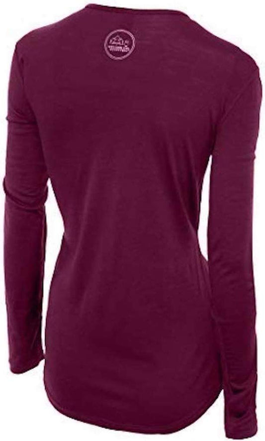
Our merino base layers are 100% Australian merino at 17.5 micron, and a long sleeve merino wool base layer for women is the correct first layer in every month, and Norway's own advisory makes the argument better than we can: it warns of ARCTIC CONDITIONS EVEN IN SUMMER on exposed ground and a HIGH WIND CHILL FACTOR in unsheltered areas. This road is the definition of unsheltered. Wool keeps insulating when it is damp with spray, which is the condition you will actually be in. A heavyweight merino base layer from October.
Over it, a Marmot PreCip Eco rain jacket with a hood that stays up, which here is doing the work of a storm shell rather than a raincoat. The wind is the thing you dress against rather than the temperature, and a windproof outer layer is worth more than a thicker insulating one. From November add an insulated jacket beneath it.
Merrell Moab 3 waterproof hiking boots with Darn Tough merino socks. The rocks and the Eldhusoya boardwalk are wet, weeded and slick in any season, and the laybys are gravel. In a storm you should not be on the rocks at all, and in calm weather a smooth sole on wet coastal granite is how people fall in.
A waterproof dry bag for the camera, which on this road is not a precaution: salt spray reaches the laybys and it is corrosive in a way fresh water is not.
Not linked and worth packing: a NECK GAITER, where the only entry in our range has a contested product identity and which is among the most useful things you can own in Atlantic wind; a hat and gloves in any month; a thermos, because there is one cafe and the laybys are where you will want to sit; and a full tank, since fuel on this stretch is limited.
Recommended Tours and Experiences
Essential Resources for Women on the Atlantic Road
Emergency numbers: Norway uses three direct numbers and the distinction matters more here than elsewhere, because 112 IS THE POLICE NUMBER rather than a general router: 112 for police, 113 FOR AN AMBULANCE and 110 for the fire service. For a medical emergency, 113 is the faster call. All three work from any phone including a locked mobile and operators speak English. For a non-urgent medical problem, 116117 reaches the out-of-hours doctor service. And the one specific to this country: in the mountains and at sea, remember that the FCDO states EMERGENCY MEDICAL ASSISTANCE AND SEARCH AND RESCUE ARE LIMITED across the half of Norway inside the Arctic Circle, so the call connects quickly and the help may still be a long way off.
In storm conditions waves break over the carriageway and across the rocks and laybys, with enough force to move a person, and people have been swept off the exposed rocks here while photographing. The road is for driving in a storm and the rocks are not for standing on; if the sea is coming over, stay in the vehicle, and a published closure is not a suggestion. The bridges are narrow with low parapets, so use the marked laybys and the Eldhusoya walkway rather than the verge. The Atlanterhavstunnelen towards Kristiansund is a 5.7 kilometre subsea tunnel reaching 250 metres below sea level.
US State Department travel advisory: the Norway advisory. Read the current level there directly rather than relying on a figure printed in any guide.
UK FCDO travel advice: gov.uk/foreign-travel-advice/norway, and read the safety and security page rather than only the landing page, because that is where the substance sits.
Main hospital: there is nothing on the road itself. The nearest hospitals are in Kristiansund, about thirty minutes north east, and Molde, about an hour south west, with the regional referral centre in Trondheim or Alesund. Norway is in the EEA rather than the EU. The FCDO says a UK national can use a UK passport to get free state-provided medical treatment in hospitals, that some doctors may charge elsewhere, and that a Global Health Insurance Card or European Health Insurance Card can now also be used for medically necessary state healthcare. Travel insurance sits on top of it, and in Norway it should specifically cover SEARCH AND RESCUE AND AIR AMBULANCE, because the terrain rather than the medicine is what makes a Norwegian incident expensive. A pharmacy is an APOTEK, they handle minor problems without an appointment, and the larger towns have one open late. TAP WATER IS AMONG THE BEST IN THE WORLD and buying bottled water here is purely a waste of money. There are no required vaccinations and no endemic tropical disease. TICKS occur along the southern coast and in the south east, carrying Lyme and, in a narrow coastal band, tick-borne encephalitis, which is a reason to check after walking in long grass. The real medical risk in Norway is environmental rather than infectious: cold, wet and exposure, which is what the clothing on this page is for.
Official health authority: Helsenorge, the Norwegian public health service portal, covers the More og Romsdal hospital network
US Embassy: the United States Embassy in Oslo.
Official tourism authority: Visit Norway, the official travel guide, publishes the road status and the storm-watching season
Takeaways
Decide which trip you want. October to March is storms and short days; June to August is light and calm water, and they are not the same place.
Photograph Storseisundet from the Averoy laybys. The bridge appearing to end in mid air is a trick of perspective and you cannot see it from the bridge.
Stay in the car when the sea is over the road. People have been swept off these rocks, and the road being open is not permission to stand on them.
Pair it with Trollstigen. They share one heading in our Alesund guide, they are both seasonal, and the pass is shut when the Atlantic Road is at its best.
Solo women safety assessment: the Atlantic Road is as safe from crime as anywhere in Norway, which has one of the lowest violent crime rates in the world, and its one genuine hazard is the same thing as its attraction. The FCDO's Norway page carries almost nothing on crime beyond a small risk of petty theft at Oslo's airport and stations, and the warnings that matter here are environmental: it states that the weather can change quickly producing ARCTIC CONDITIONS EVEN IN SUMMER on exposed ground, with a HIGH WIND CHILL FACTOR in unsheltered areas, and this road is the definition of unsheltered. It also records that nearly half of Norway lies inside the Arctic Circle with LIMITED EMERGENCY ASSISTANCE AND SEARCH AND RESCUE, which is about response time rather than danger. THE SEA IS THE RISK. In storm conditions waves break over the carriageway and across the rocks and laybys with enough force to move a person, and people have been SWEPT OFF THESE ROCKS WHILE PHOTOGRAPHING. The road is for driving in a storm; the rocks are not for standing on. If the sea is coming over, stay in the vehicle, and treat a published closure as final. The secondary hazard is ordinary and avoidable: narrow bridges with low parapets, and laybys full of photographers in summer stepping into the carriageway, so use the marked stopping places and the Eldhusoya boardwalk rather than the verge. On driving, Norway's limit is effectively zero at A QUARTER OF ENGLAND'S, with frequent roadside checks; headlights must be on dipped all year in all places; and on roads without a yellow diamond priority sign you must GIVE WAY TO TRAFFIC FROM THE RIGHT, which is the rule visitors most often do not know.
Reading On
The Atlantic Road is one half of a pair in this part of Norway. The Trollstigen packing list covers the mountain pass inland, which shares a heading with this road in our Alesund guide and which is SHUT from roughly October to late May, exactly when this road is at its most dramatic. The Aurland packing list covers the fjord village further south. For the country as a whole the Norway travel guide for women and the Norway packing list carry the driving rules, the ferries and the practical material in full. For why wool is the layer when you are damp with salt spray in wind off the open Atlantic, read the guide to merino wool base layers for women. Every destination we cover is indexed at the travel packing guide for women, and the base layers are at the Roman Trail collection.

If the outer journey is calling you, the inner one usually is too. Explore SoulMap at romantrail.com/blogs/soulmap.