

Jotunheimen is a national park of about 1,150 square kilometres in central southern Norway, roughly four hours north west of Oslo, and the name means HOME OF THE GIANTS. That is literal rather than poetic: THE PARK AND ITS IMMEDIATE SURROUNDINGS HOLD ALL OF THE HIGHEST MOUNTAINS IN NORTHERN EUROPE, including GALDHOPIGGEN at 2,469 metres and GLITTERTIND just behind it, and somewhere in the order of two hundred and fifty summits above two thousand metres.
AND IT IS NOT A VILLAGE OR A RESORT. IT IS A PLACE YOU ENTER FROM A ROAD END, WHICH CHANGES EVERY PRACTICAL DECISION ABOUT A TRIP HERE. There is no town inside the park. What exists is a ring of trailhead settlements and mountain lodges, GJENDESHEIM and the Besseggen boat at the eastern end, LOM and BOVERDALEN for Galdhoppigen in the north, TURTAGRO and the Sognefjellet road on the west, and a network of DNT huts in between, mostly a day's walk apart. So "where do I stay in Jotunheimen" has a different answer depending on which mountain you came for, and getting that wrong is the commonest way this trip disappoints people.
Disclosure: This post contains affiliate links. If you buy through them, Roman Trail earns a small commission at no extra cost to you.
What Is Here
THE BESSEGGEN RIDGE IS THE SINGLE MOST WALKED DAY ROUTE IN NORWAY AND THE SECOND PHOTOGRAPH IS IT. The standard version is roughly fourteen kilometres with about 1,100 metres of ascent, and it is done in one direction on purpose: take the morning boat from GJENDESHEIM along Lake Gjende to MEMURUBU, then walk back east along the ridge. The reason is the view. Gjende is a deep glacial lake fed by glacial meltwater and sits an extraordinary green, roughly 984 metres above sea level, and from the ridge you look down on it on one side and on the dark blue BESSVATNET on the other, with about four hundred metres of height between the two lakes. Walking west to east keeps that in front of you and gets the steep scramble over with early.
IT IS A SIX TO EIGHT HOUR MOUNTAIN DAY AND IT HAS ONE SECTION THAT GENUINELY SCARES PEOPLE. The climb off the Memurubu side includes a steep rock step where you use your hands, with exposure beside it. There is no technical equipment needed and no chain to clip into, and it stops a certain number of walkers every summer. If heights are a real problem for you, this is a route to read about honestly before you book the boat. THE OTHER THING IS THE BOAT ITSELF, which runs only in the short summer season and to a timetable that the whole day depends on: miss the last sailing in the other direction and you are walking.

KNUTSHOE IS THE BETTER ANSWER FOR MOST PEOPLE AND ALMOST NOBODY KNOWS IT, which is why the third photograph is there. It is a much smaller ridge above the same valley at about 1,517 metres, roughly six to seven kilometres round from the Leirungsdalen road, with a knife-edge section of its own and a view across to Besseggen and down the Sjodalen. It takes half a day rather than all of one, needs no boat, costs nothing and is quiet on an August Saturday when the Besseggen path is a queue.
GALDHOPIGGEN IS THE OTHER REASON PEOPLE COME AND IT IS ABSENT FROM OUR PHOTOGRAPHS ENTIRELY. So are the Sognefjellet road, the DNT huts and Memurubu. The mountain is climbed in two ways and the difference matters: from SPITERSTULEN it is a long non-glaciated slog of about 1,470 metres of ascent that needs no guide, and from JUVASSHYTTA it is shorter but CROSSES A GLACIER, for which a guided roped party is the only sensible option and is sold as a scheduled service through the summer. A glacier crossing is not a thing to improvise, and crevasses do not care how fit you are.
AND THE SOGNEFJELLET ROAD, Rv55, IS THE HIGHEST MOUNTAIN PASS ROAD IN NORTHERN EUROPE at about 1,434 metres. It is a National Tourist Route, it crosses the western side of the massif between Lom and Luster, and it is SHUT BY SNOW FOR ROUGHLY HALF THE YEAR, typically opening in May and closing some time in the autumn, with convoy driving at the shoulders. If an itinerary depends on that road, check its status before you commit to it rather than after.
When to Go
The season is genuinely short. Mid-July to early September is the whole of it, and that is not conservatism. Snow lies on the high routes well into the summer, the Gjende boat and most DNT huts open around late June and close in mid-September, and the Besseggen ridge frequently holds snow patches into July. OUTSIDE THAT WINDOW the boat does not run, the huts are unstaffed or shut, the Sognefjellet road may be closed and the high routes require winter mountaineering rather than walking.
AUGUST IS THE SAFEST BET AND LATE AUGUST THE BEST OF IT, with the most reliable snow-free conditions, the mosquitoes thinning after their July peak and the first autumn colour on the lower slopes. July is warmer, busier and buggier. Expect daytime temperatures around ten to fifteen degrees in the valleys in high summer and SINGLE FIGURES OR BELOW ON THE RIDGES, with wind that takes it lower.
AND A NORWEGIAN MOUNTAIN SUMMER DAY CAN DELIVER ALL FOUR SEASONS, which is the whole argument of the packing list below. Snow in August above 1,500 metres is unremarkable. The light is the compensation: this far north in July you have usable daylight for most of the twenty four hours, so a late start is forgiving in a way it is not anywhere further south.
Norway's advisory describes the conditions a packing list has to answer, and it is worth quoting rather than paraphrasing. THE WEATHER CAN CHANGE QUICKLY, PRODUCING ARCTIC CONDITIONS EVEN IN SUMMER ON EXPOSED MOUNTAIN TOPS. THE WINTER IS LONG AND CAN LAST WELL INTO APRIL. TEMPERATURES CAN DROP TO MINUS 25C AND BELOW. THERE IS ALSO A HIGH WIND CHILL FACTOR, PARTICULARLY IN UNSHELTERED AREAS AND MOUNTAIN RANGES. Three things follow from that and they are not the same thing as owning a warm coat. A long winter means the shoulder seasons are winter, so an April trip is a winter trip. Wind chill rather than air temperature is what you dress against, which makes a windproof outer layer worth more than a thicker insulating one. And conditions changing quickly on a mountain in summer means carrying the layer you do not currently need, which is the entire argument for base layers that pack to nothing and do not hold damp.
Getting There
Oslo is the airport and it is about four hours by road to the eastern trailheads. The usual approach for Besseggen is the E6 north to Otta and then the Rv51 over Valdresflye to GJENDESHEIM, which is itself one of the great Norwegian mountain drives. For Galdhoppigen the route is Otta, Lom and up Boverdalen. From Bergen the western approach by the Sognefjellet road is roughly six hours in summer and impossible in winter.
PUBLIC TRANSPORT EXISTS AND IT IS A REAL CONSTRAINT RATHER THAN AN INCONVENIENCE. There are summer express coaches from Oslo to Gjendesheim and local services up the valleys, running a handful of times a day in season and barely at all outside it. A car gives you the trailheads, the Knutshoe road end and the flexibility to move with the weather, which in these mountains is the thing you most want to be able to do.
Norway's driving rules include one limit framed in a way that makes it immediately clear and two that catch visitors by surprise. ON ALCOHOL, the FCDO says that if you are found to have A QUARTER OF ENGLAND'S LEGAL LIMIT of alcohol in your system you may get a fine and possible imprisonment, and that THERE ARE FREQUENT ROADSIDE CHECKS. In practice that is one drink too many, so the working rule is none. ON TYRES, winter tyres with a MINIMUM 3MM TREAD are required if there is snow or ice on the roads, and studded tyres or chains may also be needed. And the two a visitor simply would not know: KEEP YOUR HEADLIGHTS ON, DIPPED, DURING THE DAYTIME ALL YEAR ROUND IN ALL PLACES, and ON ROADS NOT MARKED WITH A PRIORITY SIGN, THE YELLOW DIAMOND, YOU MUST GIVE WAY TO TRAFFIC COMING FROM THE RIGHT. That second one is the genuine hazard, because a car emerging from a side road on your right has priority and will take it. Driving offences carry on-the-spot fines of up to 10,000 Norwegian krone.
One point of confusion is worth settling before you look at entry rules, because Norway sits in an unusual position. NORWAY IS NOT IN THE EUROPEAN UNION, and it IS IN THE SCHENGEN AREA. Both halves matter and they work in opposite directions. For borders, Schengen membership is what counts, so the European Entry/Exit System and its biometric registration apply here exactly as they do in Germany or Spain, and an arrival from another Schengen country is an internal movement rather than an entry. For money and goods, EU membership is what counts, so Norway is outside the customs union, keeps its own currency in the KRONE, and has its own and fairly strict duty-free allowances, particularly on alcohol, which are enforced rather than nominal. The practical upshot for a traveller is that the passport queue behaves like the EU and the customs hall does not.
The Jotunheimen Packing List
A six to eight hour mountain day above 1,400 metres, single figure temperatures and wind in August, rain that arrives without notice, a boat timetable, and no shelter whatever between the two ends of a ridge.
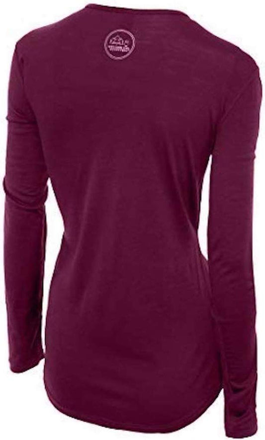
Our merino base layers are 100% Australian merino at 17.5 micron, and a long sleeve merino wool base layer for women is the most important single item here, for a reason specific to this terrain rather than general to wool. On Besseggen you climb 1,100 metres sweating hard, then walk a high exposed ridge for hours in wind with nowhere to shelter and no way to shorten the day. A cotton or cheap synthetic layer that is wet from the climb becomes a cooling layer exactly there, and hypothermia in Norwegian mountains in summer is a genuine and recurring cause of rescue. Wool holds usable insulation while damp, which is the whole mechanism.
A heavyweight merino base layer as the second layer or for a shoulder-season visit, when a ridge in early July or late September is a different proposition from one in August.
A Marmot PreCip Eco rain jacket, and in Jotunheimen a waterproof shell is MANDATORY EQUIPMENT rather than a comfort item. Norwegian mountain safety advice treats wind and waterproof layers as non-negotiable for any high route, in any month.
Waterproof hiking trousers for the same reason, because bare legs on a wet exposed ridge in a wind lose heat faster than most walkers expect.
Merrell Moab 3 waterproof hiking boots, not trail shoes. The Besseggen scramble, the boulder fields and the wet rock all want ankle support and a stiff sole, and the ground holds standing water even in August.
A Smartwool merino beanie, which on a high Norwegian ridge is doing far more work than its weight suggests and is the item people most often leave behind in July.
Not linked and worth packing: SUNGLASSES, with no eyewear entry in this registry at all, which matter on snow patches and on bright rock at altitude; SUNSCREEN, with no entry either and more necessary at 1,500 metres than the air temperature suggests; GLOVES, which the registry does carry and which did not make this post's six-link cap; INSECT REPELLENT, because July mosquitoes and midges in the valleys and around the lakes are serious and the registry's two repellents were also squeezed out by the cap; and CASH OR A CARD FOR THE HUTS, plus a PAPER MAP AND COMPASS, since phone signal is absent across most of the park and a navigation app with no signal and a dead battery is not navigation.
Recommended Tours and Experiences
Essential Resources for Women in Jotunheimen
Emergency numbers: Norway uses three direct numbers and the distinction matters more here than elsewhere, because 112 IS THE POLICE NUMBER rather than a general router: 112 for police, 113 FOR AN AMBULANCE and 110 for the fire service. For a medical emergency, 113 is the faster call. All three work from any phone including a locked mobile and operators speak English. For a non-urgent medical problem, 116117 reaches the out-of-hours doctor service. And the one specific to this country: in the mountains and at sea, remember that the FCDO states EMERGENCY MEDICAL ASSISTANCE AND SEARCH AND RESCUE ARE LIMITED across the half of Norway inside the Arctic Circle, so the call connects quickly and the help may still be a long way off.
THE MOUNTAIN IS THE ENTIRE SAFETY STORY AND NORWAY HAS A CODE FOR IT THAT IS WORTH FOLLOWING RATHER THAN SKIMMING. The Norwegian Trekking Association's FJELLVETTREGLENE, the mountain code, is the local standard: plan your route and tell someone where you are going, respect the weather and the forecast, take proper equipment including wind and waterproof layers, understand that there is no shame in turning back, and do not go further than your condition allows. The specifics here are an early start on Besseggen, a fixed turnaround time, checking the boat timetable the day you travel, never attempting the Juvasshytta glacier route unguided, and leaving your route with your lodge. MOUNTAIN RESCUE IN NORWAY IS A PUBLIC SERVICE AND IS NOT CHARGED TO THE PERSON RESCUED, which is the opposite of the Alps, so there is no financial reason to delay calling 113 if you are in trouble. That said, a helicopter cannot fly in cloud, so a rescue may take many hours.
Two Norwegian rules exist that a visitor is likely to break by accident and neither is about driving. POLICE ENFORCE BANS ON CAMPFIRES IN MANY HIKING AREAS DURING THE SUMMER MONTHS, which sits oddly beside Norway's famous right to roam: you may legally camp in a great deal of open country and still not be allowed to light anything. And DRONES require registration as an operator in Norway or an EU or EFTA country plus LIABILITY INSURANCE, with no-fly zones in force, so a drone packed for the fjords is a licensing question before it is a photography one.
US State Department travel advisory: the Norway advisory. Read the current level there directly rather than relying on a figure printed in any guide.
UK FCDO travel advice: gov.uk/foreign-travel-advice/norway, and read the safety and security page rather than only the landing page, because that is where the substance sits.
Main hospital: there is no hospital inside the park and the distances are the point. The nearest hospitals are at LILLEHAMMER and GJOVIK, two to three hours from the eastern trailheads, with the regional hospital in Oslo further again, and anything serious in the mountains is an AIR AMBULANCE job rather than a road one. There are medical centres at Otta, Lom and Vagamo. Norway is in the EEA rather than the EU, and that distinction does not cost you anything here: a UK Global Health Insurance Card or an EU European Health Insurance Card gives you state-provided medically necessary care on the same terms as a resident, which in Norway means paying the same patient contribution a Norwegian pays rather than nothing. Travel insurance sits on top of it, and in Norway it should specifically cover SEARCH AND RESCUE AND AIR AMBULANCE, because the terrain rather than the medicine is what makes a Norwegian incident expensive. A pharmacy is an APOTEK, they handle minor problems without an appointment, and the larger towns have one open late. TAP WATER IS AMONG THE BEST IN THE WORLD and buying bottled water here is purely a waste of money. There are no required vaccinations and no endemic tropical disease. TICKS occur along the southern coast and in the south east, carrying Lyme and, in a narrow coastal band, tick-borne encephalitis, which is a reason to check after walking in long grass. The real medical risk in Norway is environmental rather than infectious: cold, wet and exposure, which is what the clothing on this page is for.
Official health authority: Helsenorge, the Norwegian public health service portal. is the Norwegian Institute of Public Health
US Embassy: the United States Embassy in Oslo.
Official tourism authority: Visit Norway, the official travel guide. covers the country, and the Norwegian Trekking Association, DNT, publishes hut opening dates, route conditions and the mountain code, while the Norwegian Public Roads Administration publishes the Sognefjellet road status, which decides whether the western approach exists at all
Takeaways
Jotunheimen holds the highest mountains in Northern Europe, Galdhopiggen at 2,469m among them.
There is no town in the park. Choose your trailhead by which mountain you came for.
Besseggen is a 14km, 1,100m day with a real scramble, walked west to east off the morning boat.
Knutshoe is half the day, needs no boat, and has nearly the same view.
The season is mid-July to early September. Outside it the boat and most huts do not run.
Waterproof and windproof layers are mandatory equipment here, not a comfort. Snow in August is normal.
Mountain rescue is free in Norway. Call 113 early rather than late.
Solo women safety assessment: Jotunheimen is one of the safest destinations in this library from people and one of the most demanding from terrain, and the two should not be confused. Norway is among the safest countries in the world, THERE ARE NO ADVISED-AGAINST AREAS ANYWHERE IN IT, and the trailhead lodges and DNT huts are sociable, mixed and entirely used to women walking alone; Besseggen in August is busy enough that you are rarely out of sight of other walkers. WHAT WILL ACTUALLY HURT YOU IS WEATHER AND GROUND. The risks are hypothermia from being wet in wind at altitude, a fall on the scramble or on wet rock, and the ordinary navigation problem of cloud coming down on an exposed ridge with no phone signal. So the solo-specific habits matter more here than the social ones: leave your route and expected return with your lodge every single day, carry a paper map and compass as well as a phone, carry more layers and more food than the day appears to need, start early, and turn back without arguing with yourself about it. Do not attempt the glacier route on Galdhopiggen alone or unroped, ever. Rescue is free and prompt by helicopter when the cloud allows, so call 113 early. 112 for police, 113 for ambulance and mountain rescue.
Reading On
Jotunheimen is the high interior, and this library covers the country around it. South east, the Lillehammer packing list covers the nearest town of any size and the hospital you would be taken to, and the Oslo packing list covers the capital and the airport. West, the Geiranger packing list, the Trollstigen packing list and the Aurland packing list cover the fjord country the Sognefjellet road drops into, with the Flam packing list on the railway and the Bergen packing list at the coast. For the other great Norwegian walks, the Trolltunga packing list covers a day of comparable commitment further south west. North, the Lofoten packing list and the Tromso packing list cover the Arctic. For the country as a whole, including the costs, the driving and the seasons, the Norway travel guide for women and the Norway packing list carry it in full. For why wool still insulates when you are wet from a climb, read the guide to merino wool base layers for women. Every destination we cover is indexed at the travel packing guide for women, and the base layers are at the Roman Trail collection.

If the outer journey is calling you, the inner one usually is too. Explore SoulMap at romantrail.com/blogs/soulmap.