

Aurland is a municipality on the Aurlandsfjord, an arm of the Sognefjord, about two and a half hours by road from Bergen. The village of Aurlandsvangen has around 800 people, and the municipality also contains FLAM, which is the cruise and railway village four kilometres down the water and the reason most people arrive at all.
Disclosure: This post contains affiliate links. If you buy through them, Roman Trail earns a small commission at no extra cost to you.
The geography here is worth getting straight, because the names overlap confusingly. The SOGNEFJORD is Norway's longest fjord. The AURLANDSFJORD is a narrow arm of it. The NAEROYFJORD branches off that and is the UNESCO-listed one, 250 metres across at its narrowest with walls rising 1,700 metres. All three are the same body of water, narrowing.
One honest note about the photographs. STEGASTEIN, the viewing platform that juts out 650 metres above the fjord and is the image most associated with Aurland, IS NOT PICTURED IN THIS POST, because the only frame of it available to us is a near-duplicate of a photograph already published elsewhere on this site. It is described below and it is worth your morning.
What Is Here
Stegastein is a 30 metre wooden and steel platform running out from the Aurlandsfjellet road at 650 metres, ending in a glass panel angled down at the water. It is free, it is about ten minutes by car above Aurlandsvangen on a steep hairpin road, and a shuttle bus runs it in season. The road up, the BJORGAVEGEN or snow road, is closed through the winter, though the lookout itself is usually reachable from the Aurland side.
The Flam Railway is one of the steepest adhesion railways in the world, climbing from sea level at Flam to Myrdal at 867 metres in 20 kilometres, with a gradient of one in eighteen on most of the route. It is spectacular, it is expensive, it is extremely busy in cruise season, and it connects at Myrdal with the Bergen to Oslo main line, which makes the Norway in a Nutshell route work.

The Naeroyfjord is seen by boat from Flam or Gudvangen, and electric ferries now run the route, which is quieter than the old diesel boats and better for exactly this kind of water.
The Aurlandsdalen valley walk is the thing most visitors never hear about and is the best reason to stay. It runs from Osterbo down to Vassbygdi, roughly 17 kilometres through a deep valley of waterfalls, old farmsteads and gorge paths, takes six to seven hours and is one of the finest valley walks in Norway. It is a summer route only and a bus serves both ends.
The Laerdal Tunnel next door is 24.5 kilometres long and was the longest road tunnel in the world when it opened, with blue-lit caverns inside to break the monotony. And the AURLAND SHOE is a genuine local claim: the penny loafer derives from a design made here, and there is still a shoe factory in the village.
When to Go
June to August gives long light, the snow road open, the Aurlandsdalen walk clear and every boat and train running. It is also cruise season, so Flam can hold several thousand day visitors while Aurlandsvangen four kilometres away stays quiet, which is an argument for staying here rather than there.
May and September are excellent: waterfalls at full volume in May from the melt, autumn colour in September, and far fewer people.
Winter is beautiful, with the fjord dark and the mountains white, which is the second and third images here. The snow road closes, the Aurlandsdalen is out of the question, the Flam Railway runs year round and daylight is short.
Whenever you come, note that the fjord has its own weather: it can be raining at sea level and clear at 650 metres, or the reverse.
Getting There
By train, Bergen or Oslo to Myrdal on the main line, then the Flam Railway down. This is the classic approach and needs no car.
By boat, express boats run Bergen to Flam, and the Naeroyfjord ferries connect Gudvangen and Flam.
By car, the E16 from Bergen or Oslo through the Laerdal Tunnel, about two and a half to three hours from Bergen. Norway's driving rules include one limit framed in a way that makes it immediately clear and two that catch visitors by surprise. ON ALCOHOL, the FCDO says that if you are found to have A QUARTER OF ENGLAND'S LEGAL LIMIT of alcohol in your system you may get a fine and possible imprisonment, and that THERE ARE FREQUENT ROADSIDE CHECKS. In practice that is one drink too many, so the working rule is none. ON TYRES, winter tyres with a MINIMUM 3MM TREAD are required if there is snow or ice on the roads, and studded tyres or chains may also be needed. And the two a visitor simply would not know: KEEP YOUR HEADLIGHTS ON, DIPPED, DURING THE DAYTIME ALL YEAR ROUND IN ALL PLACES, and ON ROADS NOT MARKED WITH A PRIORITY SIGN, THE YELLOW DIAMOND, YOU MUST GIVE WAY TO TRAFFIC COMING FROM THE RIGHT. That second one is the genuine hazard, because a car emerging from a side road on your right has priority and will take it. Driving offences carry on-the-spot fines of up to 10,000 Norwegian krone.
By bus, services connect Flam, Aurlandsvangen and Gudvangen, and a seasonal shuttle runs up to Stegastein.
One point of confusion is worth settling before you look at entry rules, because Norway sits in an unusual position. NORWAY IS NOT IN THE EUROPEAN UNION, and it IS IN THE SCHENGEN AREA. Both halves matter and they work in opposite directions. For borders, Schengen membership is what counts, so the European Entry/Exit System and its biometric registration apply here exactly as they do in Germany or Spain, and an arrival from another Schengen country is an internal movement rather than an entry. For money and goods, EU membership is what counts, so Norway is outside the customs union, keeps its own currency in the KRONE, and has its own and fairly strict duty-free allowances, particularly on alcohol, which are enforced rather than nominal. The practical upshot for a traveller is that the passport queue behaves like the EU and the customs hall does not.
Is Aurland Safe for Women?
Norway is among the safest countries in the world and nothing here is about crime. Norway's advisory describes the conditions a packing list has to answer, and it is worth quoting rather than paraphrasing. THE WEATHER CAN CHANGE QUICKLY, PRODUCING ARCTIC CONDITIONS EVEN IN SUMMER ON EXPOSED MOUNTAIN TOPS. THE WINTER IS LONG AND CAN LAST WELL INTO APRIL. TEMPERATURES CAN DROP TO MINUS 25C AND BELOW. THERE IS ALSO A HIGH WIND CHILL FACTOR, PARTICULARLY IN UNSHELTERED AREAS AND MOUNTAIN RANGES. Three things follow from that and they are not the same thing as owning a warm coat. A long winter means the shoulder seasons are winter, so an April trip is a winter trip. Wind chill rather than air temperature is what you dress against, which makes a windproof outer layer worth more than a thicker insulating one. And conditions changing quickly on a mountain in summer means carrying the layer you do not currently need, which is the entire argument for base layers that pack to nothing and do not hold damp.
The fjord weather is the hazard and the Aurlandsdalen is where it matters. A 17 kilometre valley walk with gorge sections, river crossings and no mobile signal in places is a serious day, and the usual mistake is starting it late on a fine morning. Check the forecast, start early, and tell someone your plan.
The snow road is a mountain road. Steep hairpins, no barrier in places, and it closes for a reason. In shoulder season it can be open and icy at the same time.
Stegastein's platform is safe and the road to it is the part people underestimate, particularly in a hire car with a nervous driver and a coach coming down. The shuttle exists for exactly this reason.
Two Norwegian rules exist that a visitor is likely to break by accident and neither is about driving. POLICE ENFORCE BANS ON CAMPFIRES IN MANY HIKING AREAS DURING THE SUMMER MONTHS, which sits oddly beside Norway's famous right to roam: you may legally camp in a great deal of open country and still not be allowed to light anything. And DRONES require registration as an operator in Norway or an EU or EFTA country plus LIABILITY INSURANCE, with no-fly zones in force, so a drone packed for the fjords is a licensing question before it is a photography one.
The Aurland Packing List
Fjord weather at sea level and mountain weather 650 metres above it, in the same hour.
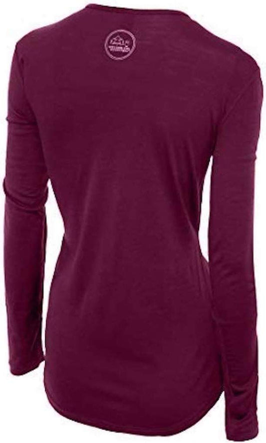
Our merino base layers are 100% Australian merino at 17.5 micron, and a long sleeve merino wool base layer for women is the Norwegian answer to the Norwegian problem, and Norwegians will tell you so before we do: the pattern here is sitting still on a cold boat deck, then climbing, then standing on an exposed platform in wind, all in one day, often damp throughout. Wool is the only common fibre that stays comfortable across that and keeps insulating when it is wet. A heavyweight merino base layer from September through May, and on the fjord boats in any month.
Over it, a Marmot PreCip Eco rain jacket with a hood that stays up, because western Norway rains in every month, plus an insulated mid layer.
Merrell Moab 3 waterproof hiking boots with Darn Tough merino socks. The Aurlandsdalen is wet rock, gorge path and stream crossings for seven hours and it is not a trainers walk.
Kahtoola MICROspikes from October to April, for the village paths and the Stegastein approach, which ices.
Not linked and worth packing: a HAT AND GLOVES IN EVERY MONTH, which sounds excessive until you stand on an open boat deck in July; a DRY BAG for the camera on the fjord boats; a REFILLABLE BOTTLE, since Norwegian tap water is excellent and everything bought here is expensive; and a PACKED LUNCH for the Aurlandsdalen, which has nothing on it. Norway is almost entirely CARD-BASED, so cash is the thing you do not need.
Recommended Tours and Experiences
Essential Resources for Women in Aurland
Emergency numbers: Norway uses three direct numbers and the distinction matters more here than elsewhere, because 112 IS THE POLICE NUMBER rather than a general router: 112 for police, 113 FOR AN AMBULANCE and 110 for the fire service. For a medical emergency, 113 is the faster call. All three work from any phone including a locked mobile and operators speak English. For a non-urgent medical problem, 116117 reaches the out-of-hours doctor service. And the one specific to this country: in the mountains and at sea, remember that the FCDO states EMERGENCY MEDICAL ASSISTANCE AND SEARCH AND RESCUE ARE LIMITED across the half of Norway inside the Arctic Circle, so the call connects quickly and the help may still be a long way off.
The Aurlandsdalen valley walk is about 17 kilometres from Osterbo to Vassbygdi, takes six to seven hours through gorge paths and stream crossings, has no mobile signal in places and is a summer route only. Start early, carry food and leave your plan with someone. The BJORGAVEGEN snow road up to Stegastein closes through the winter and is a steep hairpin mountain road when open, with a seasonal shuttle that exists precisely so you do not have to drive it. Fjord weather differs between sea level and 650 metres in the same hour, and the FCDO notes that conditions can change quickly and produce arctic conditions even in summer.
US State Department travel advisory: the Norway advisory. Read the current level there directly rather than relying on a figure printed in any guide.
UK FCDO travel advice: gov.uk/foreign-travel-advice/norway, and read the safety and security page rather than only the landing page, because that is where the substance sits.
Main hospital: there is no hospital in Aurland. The local medical centre handles routine matters, Laerdal Hospital is the nearest at roughly 30 to 40 minutes through the tunnel, and the regional hospital is Haukeland University Hospital in Bergen, about two and a half to three hours away, which is where serious cases go. Air ambulance covers the fjords. Norway is in the EEA rather than the EU, and that distinction does not cost you anything here: a UK Global Health Insurance Card or an EU European Health Insurance Card gives you state-provided medically necessary care on the same terms as a resident, which in Norway means paying the same patient contribution a Norwegian pays rather than nothing. Travel insurance sits on top of it, and in Norway it should specifically cover SEARCH AND RESCUE AND AIR AMBULANCE, because the terrain rather than the medicine is what makes a Norwegian incident expensive. A pharmacy is an APOTEK, they handle minor problems without an appointment, and the larger towns have one open late. TAP WATER IS AMONG THE BEST IN THE WORLD and buying bottled water here is purely a waste of money. There are no required vaccinations and no endemic tropical disease. TICKS occur along the southern coast and in the south east, carrying Lyme and, in a narrow coastal band, tick-borne encephalitis, which is a reason to check after walking in long grass. The real medical risk in Norway is environmental rather than infectious: cold, wet and exposure, which is what the clothing on this page is for.
Official health authority: Helsenorge, the Norwegian public health service portal. covers the Vestland hospital network
US Embassy: the United States Embassy in Oslo.
Official tourism authority: Visit Norway, the official travel guide. publishes the Aurlandsfjord boat and Flam Railway arrangements and the Bjorgavegen snow road status
Takeaways
Stay in Aurlandsvangen, not Flam. Four kilometres apart, and one of them holds several thousand cruise passengers.
Walk the Aurlandsdalen. Seventeen kilometres, seven hours, and the best thing here that nobody books.
Take the shuttle to Stegastein. The road is the hard part, not the platform.
Pack for two altitudes. Sea level and 650 metres have different weather at the same moment.
Solo women safety assessment: Aurland is about as safe as travel gets and nothing here concerns other people. Norway is among the safest countries in the world, the villages are tiny and ordinary, English is universal, the transport is reliable and card-based, and a woman travelling the fjords alone is completely unremarkable. The FCDO's Norway advice carries no crime warning of substance and concerns itself almost entirely with weather, water and the outdoors, which is the correct emphasis. NOTE THAT NORWAY'S EMERGENCY NUMBERS ARE SPLIT RATHER THAN POOLED: 112 IS THE POLICE, 113 is the ambulance and 110 is fire, so dialling 112 for a medical emergency routes you to the wrong service, and that distinction matters more here than in most of Europe. THE REAL HAZARD IS WEATHER AND EXPOSURE. The FCDO says plainly that conditions can change quickly and produce ARCTIC CONDITIONS EVEN IN SUMMER on high ground, and Aurland demonstrates that within a few kilometres: it can be mild and raining at the fjord and freezing in wind on the Stegastein platform 650 metres above it in the same hour. THE AURLANDSDALEN IS THE SERIOUS UNDERTAKING, a 17 kilometre valley route with gorge sections, stream crossings, no signal in places and six to seven hours of committed walking, and the recurring mistake is beginning it late on a fine morning; start early, carry food and water, and leave your plan with someone. THE SNOW ROAD TO STEGASTEIN is a steep hairpin mountain road that closes in winter and can be open and icy in the shoulder season, and the seasonal shuttle exists so that nobody has to drive it in a hire car; take it. Norwegian alcohol limits for driving are far stricter than most visitors expect, police enforce summer campfire bans in many hiking areas, and almost everything here is paid by card.
Reading On
Aurland is the Sognefjord and western Norway opens around it. The Bergen packing list covers the city most fjord trips start from, and the Geiranger packing list the other great fjord village to the north. The Alesund packing list covers the art nouveau town on the coast, with the Trollstigen packing list and Atlantic Road packing list for the two famous roads between them. North, the Lofoten packing list and Tromso packing list cover the Arctic, and the Trondheim packing list and Stavanger packing list the other coastal cities, with the Oslo packing list for the capital. For the country the Norway travel guide for women and the Norway packing list carry the transport, the weather and the practical material in full. For why wool is the layer on a cold boat deck in July, read the guide to merino wool base layers for women. Every destination we cover is indexed at the travel packing guide for women, and the base layers are at the Roman Trail collection.

If the outer journey is calling you, the inner one usually is too. Explore SoulMap at romantrail.com/blogs/soulmap.