

Tawang is a town of about 12,000 in the far north west of Arunachal Pradesh, at roughly 3,000 metres, in the corner of India where Bhutan and Tibet meet. It holds TAWANG MONASTERY, THE LARGEST IN INDIA AND THE SECOND LARGEST IN THE WORLD after Lhasa's Potala complex, founded in 1680 and the birthplace of the sixth Dalai Lama.
Disclosure: This post contains affiliate links. If you buy through them, Roman Trail earns a small commission at no extra cost to you.
One honest note about the photographs. TAWANG MONASTERY IS NOT IN THIS SET, which is to say the single reason most people make a journey of two days to get here. What you see is the prayer flags on the pass road, the lakes and the snow. The monastery is described below.
What Is Here
THE MONASTERY IS A WALLED COMPLEX ON A SPUR above the town, home to several hundred monks of the Gelug school, with a three-storey assembly hall, an eight metre gilded Buddha and a library of manuscripts. It is a working monastic city rather than a monument, and the morning prayers are open to visitors who arrive quietly.
THE SELA PASS IS THE JOURNEY AND IT IS AT 4,170 METRES. The only road in crosses it, with a lake at the top that freezes in winter, and it is the thing that makes Tawang hard to reach: snow closes it, and when it closes, the town is cut off. Drivers watch the weather rather than the clock.

The lakes and snow are the second image, and the high country around Tawang is full of them: PT Tso, Sangetsar, and dozens of unnamed tarns.
THE 1962 WAR IS PRESENT EVERYWHERE. The Jaswant Garh memorial on the pass road commemorates a rifleman who held a position alone, and the Tawang War Memorial in town lists the dead of the Sino-Indian conflict. This is a border region with a heavy army presence and that is part of the texture.
THE MONPA ARE THE PEOPLE, Tibetan Buddhist, with their own language, weaving, paper-making and the Torgya festival in January. Nuranang falls and the Urgelling monastery, the sixth Dalai Lama's actual birthplace, are the other sights.
BUM LA PASS ON THE CHINESE BORDER CAN BE VISITED with an additional permit arranged locally through the army, which is a remarkable thing to be able to do.
When to Go
April to October, with May, June, September and October the most reliable.
THE SELA PASS IS THE CONSTRAINT IN WINTER. From November to March it closes with snow, sometimes for days at a time, and Tawang becomes genuinely inaccessible by road. Travel then only with flexible plans.
The monsoon, June to September, brings landslides on the Bhalukpong to Bomdila road, which is the other half of the journey.
Nights are cold in every month at 3,000 metres, and winter is severe.
Getting There
By air to Guwahati or Tezpur, then TWO DAYS BY ROAD, usually overnighting at Dirang or Bomdila. There is a helicopter service from Guwahati which is weather-dependent and frequently cancelled.
By road, roughly 450km from Guwahati over the Sela Pass, which takes two days and is the whole point rather than the inconvenience.
FOREIGN NATIONALS NEED A PROTECTED AREA PERMIT FOR ARUNACHAL PRADESH, applied for in advance, usually in a group of two or more depending on current rules, and it is checked. Indian nationals need an Inner Line Permit. The rules change: verify the current position before booking anything.
Is Tawang Safe for Women?
Tawang is a quiet Monpa Buddhist town with a large army presence and is very safe. The risks are altitude, roads and weather. The FCDO does publish advised-against areas for India, and being precise about them matters more than a general warning. It advises against all travel to the Union Territory of Jammu and Kashmir, except air travel to and movement within the city of Jammu, and against all travel within 10km of the India-Pakistan border, where the Wagah-Attari crossing is closed. It advises against all but essential travel to the state of Manipur, including Imphal. None of that is anywhere near this destination, and it is worth knowing which parts of a very large country the warnings actually describe.
North-east India carries conditions rather than a prohibition, and they are about movement rather than crime. The FCDO records that sudden flareups and skirmishes happen along inter-state borders including the Assam-Meghalaya boundary, that there have been skirmishes on the India-Bangladesh border, and that protests, blockades and large gatherings are common across the region, can begin without warning, and disrupt traffic on the national highways that connect these states to each other and to Assam. Check with local authorities before travelling in the region, avoid any crowd that forms, and build slack into a schedule that depends on one road. Note separately that the FCDO advises against all but essential travel to MANIPUR because of ethnic violence since May 2023.
THE SELA PASS AT 4,170 METRES IS A REAL ALTITUDE AND THE GAIN IS FAST. You go from near sea level at Guwahati to 4,170 metres within two days, which is quick. Headache, nausea and breathlessness are common on the pass; the town at 3,000 metres is more comfortable. Do not fly in by helicopter and go straight up to Bum La at 4,600 metres on the same day.
THE ROADS ARE AMONG THE MOST DEMANDING IN INDIA: two days of mountain highway, landslide-prone, with long unsurfaced sections and drops without barriers. Travel in daylight, use an experienced local driver, and accept that the schedule belongs to the weather.
THERE IS LITTLE MOBILE SIGNAL AND LIMITED POWER outside the town, and medical facilities are basic.
This is a sensitive border region. Photography near military installations is prohibited, army checkposts are frequent, and carrying your permit at all times is required rather than advisable.
The Tawang Packing List
Three thousand metres, cold in every month, with two days of road to get there.
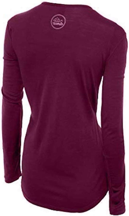
Our merino base layers are 100% Australian merino at 17.5 micron, and a long sleeve merino wool base layer for women is the foundation of this kit rather than an accessory. At 3,000 metres with unheated rooms, two days in a jeep and a 4,170 metre pass in the middle, you will wear the same layer continuously for days, and wool is the fibre that stays warm when damp and does not become unpleasant. A heavyweight merino base layer is essential in every month here, not just winter.
A Columbia Powder Lite insulated hooded jacket and a Marmot PreCip Eco rain jacket as the shell. Fleece-lined thermal leggings for the pass and the nights.
Merrell Moab 3 waterproof hiking boots with Darn Tough merino socks: snow on the pass, mud at the monastery, and stone everywhere.
Not linked and worth packing: A WARM HAT AND GLOVES, non-negotiable at the pass in any month; SUNGLASSES and high-factor sun protection, since UV at 4,000 metres is severe and snow doubles it; A POWER BANK, because power is limited; A HEAD TORCH; MOTION SICKNESS TABLETS for two days of switchbacks; A WATER PURIFICATION METHOD; PERMIT PAPERWORK AND PHOTOCOPIES, carried at all times; and ALL THE CASH YOU NEED, because ATMs are unreliable and often empty this far out.
Recommended Tours and Experiences
Essential Resources for Women in Tawang
Emergency numbers: 112 is the single national emergency number and works from any phone. 100 reaches police directly, 108 ambulance and 101 fire. 1091 is the national women's helpline and 1098 the child helpline.
Foreign nationals need a Protected Area Permit for Arunachal Pradesh, applied for in advance and often required in a group of two or more depending on current rules; Indian nationals need an Inner Line Permit. Both are checked at frequent army checkposts and must be carried at all times, and the rules change, so verify the current position before booking anything. THE SELA PASS AT 4,170 METRES IS THE ONLY ROAD IN and closes with snow from November to March, cutting the town off: the schedule belongs to the weather. THE ALTITUDE GAIN IS FAST, from near sea level at Guwahati to 4,170 metres in two days, so do not fly in and go straight to Bum La at 4,600 on the same day. THE ROADS ARE TWO DAYS of landslide-prone mountain highway with unbarriered drops. THERE IS LITTLE MOBILE SIGNAL and medical facilities are basic. PHOTOGRAPHY NEAR MILITARY INSTALLATIONS IS PROHIBITED in this border region.
US State Department travel advisory: the India advisory. Read the current level there directly rather than relying on a figure printed in any guide.
UK FCDO travel advice: gov.uk/foreign-travel-advice/india, and read the safety and security page rather than only the landing page, because that is where the substance sits.
Main hospital: Tawang has a district hospital with basic facilities and the army maintains its own medical capability. Anything serious means Guwahati, which is two days by road or a weather-dependent helicopter flight. Dial 108 for an ambulance. INSURANCE COVERING HELICOPTER AND REMOTE EVACUATION IS MORE IMPORTANT HERE THAN ANYWHERE ELSE IN THIS LIBRARY. Healthcare in the large Indian cities is genuinely good in the private hospitals and variable in the public ones, and the private sector expects payment or a direct insurance guarantee up front. Carry insurance with a high medical limit and repatriation cover, and carry proof of it. The commonest problem by far is not dramatic: it is stomach upset, so drink sealed bottled or filtered water, and be more careful with raw salad and cut fruit than with hot food cooked in front of you.
Official health authority: the Indian Ministry of Health and Family Welfare. covers the Arunachal Pradesh state health service
US Embassy: the United States Embassy in New Delhi.
Official tourism authority: Incredible India, the Ministry of Tourism's official site. publishes the Protected Area Permit arrangements for Arunachal Pradesh, the Sela Pass status and the Bum La visiting procedure
Takeaways
Sort the permit first. No permit, no Arunachal.
Two days by road each way, over a 4,170 metre pass. That is the trip.
The monastery is the largest in India. Arrive quietly for morning prayers.
Insurance that covers helicopter evacuation. Guwahati is two days away.
Solo women safety assessment: Tawang is remote rather than risky, and for a woman alone the social picture is reassuring: Monpa Buddhist society is gentle and unintrusive, the town is small and everyone is visible, there is a very large and disciplined army presence throughout the district, and the pilgrims and domestic tourists on the monastery route are families. The harassment that wears travellers down in the plains is essentially absent. Dress warmly and modestly, remove shoes and cover your shoulders at the monastery, and nothing else is required socially. 112 IS THE NATIONAL EMERGENCY NUMBER, with 100 for police, 108 for an ambulance and 1091 the women's helpline, BUT THE HONEST POINT IS THAT NONE OF THEM REACHES YOU FAST: there is little mobile signal outside the town, the district hospital is basic, and anything serious means Guwahati, two days by road or a weather-dependent helicopter. Insurance covering remote and helicopter evacuation matters more here than anywhere else in this library. THE FCDO'S NORTH-EASTERN GUIDANCE APPLIES, about inter-state flareups and protests and blockades that close the highways without warning, and it separately advises against all but essential travel to MANIPUR, a different state. THE THREE REAL HAZARDS ARE ALTITUDE, ROAD AND PERMIT. ALTITUDE FIRST: you climb from near sea level at Guwahati to the Sela Pass at 4,170 metres inside two days, which is fast, and the common mistake is to fly in by helicopter and go straight up to Bum La at 4,600 the same day. Sleep at Dirang or Bomdila, drink more than you want, and treat a headache that will not clear as an instruction to descend. THE ROAD SECOND: two days of landslide-prone mountain highway with long unsurfaced stretches and drops without barriers, which is statistically the dangerous part of this trip. Daylight, an experienced local driver, and a schedule that belongs to the weather. THE PERMIT THIRD, and it is simply administrative: no Protected Area Permit, no Arunachal, and it is checked repeatedly.
Reading On
Tawang is Arunachal and the eastern Himalaya runs west from it. The Shillong packing list covers Meghalaya, the Kaziranga packing list the Assam grassland on the route in, and the Pelling packing list and Gangtok packing list Sikkim, with the Darjeeling packing list for the tea hills. South, the Kolkata packing list covers the city most trips route through. For other high Buddhist country the Ladakh packing list and Spiti Valley packing list cover the western trans-Himalaya and the Dharamsala packing list the Tibetan exile community. For the country the India travel guide for women and the India packing list carry the transport, the permits and the practical material in full. For why one wool layer is worn for days at altitude, read the guide to merino wool base layers for women. Every destination we cover is indexed at the travel packing guide for women, and the base layers are at the Roman Trail collection.

If the outer journey is calling you, the inner one usually is too. Explore SoulMap at romantrail.com/blogs/soulmap.