Snowdonia Travel Guide for Women: Everything You Need to Know

Snowdonia National Park, officially Eryri, covers 2,176 square kilometres of northwest Wales and was the first national park designated in Wales, in 1951. It contains Yr Wyddfa at 1,085 meters, the highest mountain in Wales and England, along with fourteen summits above 3,000 feet across the Snowdon, Glyderau and Carneddau ranges, and some of the oldest exposed rock in Britain at over 500 million years.
Disclosure: This post contains affiliate links. If you buy through them, Roman Trail earns a small commission at no extra cost to you.
The park authority formally adopted the Welsh names in 2022, so Eryri and Yr Wyddfa now appear on signage, maps and rescue communications ahead of Snowdonia and Snowdon. Both are understood and using the Welsh is a small courtesy that is noticed and appreciated.
This matters because Gwynedd is a Welsh-speaking heartland. In parts of the county a clear majority speak Welsh as a first language, you will hear it constantly in shops and pubs, and it is a living political and cultural matter rather than heritage decoration. Everyone also speaks English.
The other defining history here is slate. North Wales roofed the industrial world, and the Slate Landscape of Northwest Wales became a UNESCO World Heritage site in 2021: vast quarry terraces, inclines, cottage rows and narrow-gauge railways, which are among the most striking industrial landscapes anywhere and now double as walking, climbing and zip-line country.
Two facts shape any visit. The weather is Atlantic and fast, with parts of the park taking over 4,000 millimetres of rain a year and Yr Wyddfa's summit in cloud roughly two days in three. And the routes up Yr Wyddfa differ enormously in seriousness while looking identical on a map, which is the single biggest cause of trouble here.
This guide covers that route question first, then safety, seasons, the ranges, transport, costs, accommodation and packing.
The Six Routes Up Yr Wyddfa, Ranked Honestly
All six appear on an Ordnance Survey map with the same symbol. They are not equivalent.
1. Llanberis Path. About 14 kilometres return, the longest and the gentlest, following the mountain railway on a graded track. Busy, and the correct choice for most people and most weather.
2. Miners' Track. From Pen-y-Pass, flat and beautiful past three lakes, then a steep loose scree climb to join the Pyg near the top. The contrast catches people out.
3. Pyg Track. Also from Pen-y-Pass, rockier throughout and slightly shorter. Commonly combined with the Miners', up one and down the other, and the most popular day on the mountain.
4. Rhyd Ddu Path. Quieter, with a narrow ridge section near the summit that feels exposed in wind.
5. Watkin Path. The hardest of the walking routes: the most total ascent, starting near sea level, with a final section on loose steep scree that many walkers find genuinely unnerving and where people slip.
6. Crib Goch. Not a walking route. A grade one scramble along a knife-edge arête with sheer drops on both sides, no escape once committed, and hands-on climbing throughout. It requires a head for heights and settled dry conditions. People die on Crib Goch, and in wind, wet or winter ice it is a mountaineering route requiring crampons and an axe. It is not the place to discover whether you like scrambling.
The railway: the Snowdon Mountain Railway has run from Llanberis since 1896 and is a legitimate way to reach the top, with a café and visitor centre at the summit. In poor weather trains terminate below the summit, and a ticket does not guarantee reaching it.
Recommended Tours and Experiences

Is Snowdonia Safe for Women Travelers
In the ordinary sense, yes. Crime is low, the villages are small and friendly, solo walkers are completely normal, and the hostel and bunkhouse network is sociable and mixed in age.
The mountain risk here is real and specific, and it is about route choice more than anything else.
Llanberis Mountain Rescue Team is frequently the busiest rescue team in the United Kingdom, with several hundred call-outs a year concentrated on Yr Wyddfa. The pattern is consistent: walkers on Crib Goch who did not understand what it was, slips on the Watkin or Miners' scree, people benighted after a late start, and casualties in trainers in February.
Navigation. There is no waymarking on the mountains. No blazes, no summit signposts, no route numbers. With the summit in cloud two days in three, a paper OS map and compass are the baseline expectation rather than an enthusiast's affectation.
Wet slate and volcanic rock are treacherous, and the old quarry landscapes carry loose spoil.
Weather. Systems arrive off the Irish Sea with nothing to slow them. A dry morning in Llanberis can be driving rain and 40mph wind on the summit ridge by midday, and the temperature difference between town and top is routinely 10 degrees before wind chill.
Tryfan has no walking route to its summit at all. Every line involves scrambling. The summit monoliths, Adam and Eve, have a traditional leap between them with a significant drop behind; there is no obligation.
Emergency numbers: 999 or 112, asking for police, then mountain rescue. Register for emergencySMS by texting register to 999 before you travel, which permits a text where signal cannot carry a call.
Best Time to Visit Snowdonia
May, June and September
The best months. 13 to 19 degrees, long daylight through June, and the best statistical chance of a clear summit, which is still not a good chance. September is quieter with more settled spells.
July and August
15 to 20 degrees and extremely busy. Pen-y-Pass parking now requires pre-booking and fills regardless, and the Sherpa'r Wyddfa bus network is the practical way in. Yr Wyddfa can see several thousand people on a fine summer Saturday. Still wet.
October and November
The wettest and most atmospheric, with autumn colour in the Ogwen and Gwydir valleys and very few walkers. Short days.
December to March
2 to 8 degrees in the valleys, well below freezing on the tops, with snow and ice from December into April. Winter on Yr Wyddfa is a mountaineering activity: the Pyg Track ices into a serious proposition and Crib Goch becomes full winter climbing. The slate landscapes, the coast and the valleys are quiet, cheap and excellent, and a low-level winter trip is a sound plan.
Top Regions and What Each One Requires
The Snowdon massif and Llanberis
Llanberis is the main base: gear shops, cafés, the railway terminus, the slate museum, and the Dolbadarn castle. Above it the six routes and the Llanberis Pass, which is among the best rock climbing in Britain and where the sport's postwar culture was formed.
Terrain: graded track to knife-edge arête depending entirely on your choice.
Pack: full waterproofs, boots, map and compass, head torch.
The Ogwen Valley and the Glyderau
Better walking than Yr Wyddfa and a fraction of the people. Llyn Idwal in its glacial cwm, the Devil's Kitchen, Glyder Fawr and Glyder Fach with the Cantilever Stone, and Tryfan rising straight off the road. Rough, rocky, and genuinely mountainous.
Terrain: boulder fields, scrambling, no easy lines.
Pack: everything, plus hands free.
The Carneddau
The largest area of high ground in Wales and the emptiest, with wild Carneddau ponies, broad grassy summits and long days. Navigation matters more here than anywhere in the park because the plateaux are featureless in cloud.
The slate landscape and the south
Blaenau Ffestiniog and the quarry terraces, now a UNESCO site, with Zip World and underground trampolines in the old workings, which is either a travesty or brilliant depending on your view. The Ffestiniog and Welsh Highland narrow-gauge railways are genuinely lovely journeys. Betws-y-Coed is the walking village in the eastern woods, and Coed y Brenin is a mountain biking centre.
The coast and the Llŷn
Harlech and Criccieth castles, part of Edward I's ring of fortresses and a UNESCO site, plus Portmeirion, the Italianate village built by Clough Williams-Ellis and used as the location for The Prisoner. The Llŷn Peninsula beyond has beaches and a strongly Welsh-speaking character.
What to Pack for Snowdonia: Women's Packing List
The full detail is in the Snowdonia packing list for women. The essentials:
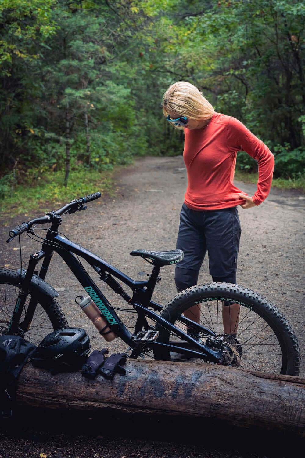
Base layers. Two Roman Trail Women's Merino Wool Base Layers ($49-59) in long sleeve. The argument is damp rather than cold: you will get wet, and merino at 17.5 micron and 160 gsm keeps insulating damp where cotton stops and then chills you. The moment it matters is standing on a summit ridge in wind in a soaked shirt, which is how people get dangerously cold here in August.
Mid layer. The Columbia Women's Fast Trek II Jacket ($65), with a second insulated layer in winter.
The waterproof, non-negotiable. The Marmot Women's PreCip Eco Rain Jacket ($110), hooded and genuinely waterproof, plus waterproof overtrousers. Over 4,000 millimetres a year in places, driven horizontally off the Irish Sea, defeats a showerproof jacket in twenty minutes.
Footwear. The Merrell Women's Moab 3 Waterproof Hiking Boot ($140), broken in, with a genuinely lugged sole for wet slate, and ankle support for the Miners' and Watkin scree. The Darn Tough Women's Hiker Micro Crew Merino Socks ($28), three pairs, which stay warm wet. Dry shoes for afterwards.
Navigation and safety. An Ordnance Survey map, OL17 for Snowdon and Conwy Valley and OL18 for Harlech and Bala, plus a compass, because nothing is waymarked and the summit is clouded two days in three. A whistle, a head torch, and a power bank.
Everything else. Trekking poles for descents, though not on Crib Goch where your hands are occupied. Two litres of water capacity. A hat and gloves even in summer. The Eagle Creek Pack-It Cube Set ($59) with a dry liner inside the rucksack, since a pack cover does not stop sideways rain. Blister plasters.

Welsh Place Names, and Saying Them
Welsh is phonetically regular, which makes the names far more approachable than they look. A few rules cover most of what you will read on a map here.
Ll is not an English L. Put your tongue where you would for an L and blow air around the sides of it. Llanberis, Llyn. Getting it approximately right is appreciated; getting it wrong is completely fine.
W is a vowel, pronounced like the oo in book. Cwm, a valley or glacial bowl, sounds close to coom. Y is also a vowel, usually like the u in under.
Dd is the th in the. F is an English v, and ff is an English f. Ch is as in the Scottish loch.
The useful vocabulary, because it decodes half the map: llyn lake, cwm valley or corrie, bwlch pass, mynydd mountain, carnedd cairn or peak, afon river, coed wood, aber river mouth, pen head or top, bach small, mawr large.
So Pen-y-Pass is the head of the pass, Llyn Idwal is Idwal's lake, and Yr Wyddfa means roughly the tumulus or burial mound, from a legend that a giant is buried beneath the summit cairn.
A bore da for good morning or diolch for thank you goes a long way in Gwynedd, and nobody expects more than that.
Getting There and Getting Around
By train: the North Wales Coast Line runs to Bangor and Llandudno Junction from Chester and Crewe, connecting from London in about three and a half hours. The Conwy Valley Line branches inland to Betws-y-Coed and Blaenau Ffestiniog, which is a beautiful ride and genuinely useful.
The Sherpa'r Wyddfa buses are the answer to the parking problem, circling the Snowdon massif and linking Llanberis, Pen-y-Pass, Beddgelert and Betws-y-Coed. They let you walk linear routes rather than returning to a car, which is the real advantage, and they are cheap.
Parking: Pen-y-Pass requires pre-booking and is small, and the laybys on the Llanberis Pass fill before eight in summer with active enforcement. Plan the bus instead.
Narrow-gauge railways: the Ffestiniog, the Welsh Highland and the Snowdon Mountain Railway are attractions in their own right and also practical transport, with the Welsh Highland running Caernarfon to Porthmadog through the park.
Car: useful for the Ogwen Valley, the Llŷn and the coast, and a liability around Snowdon in summer. Roads are narrow with passing places and sheep on the carriageway.
Costs: What to Budget
Snowdonia is among the better value walking destinations in Britain, with the mountains free.
Budget, 50 to 80 pounds a day: a YHA or bunkhouse bed at 20 to 38, self-catering with a pub lunch, Sherpa bus fares, and free mountains.
Mid-range, 120 to 190 pounds a day: a B&B or inn at 80 to 140, pub dinners at 16 to 28, a narrow-gauge railway trip, a castle or two.
Higher end, 280 pounds and up: country hotels from 180, Portmeirion, guided scrambling days, Zip World packages.
Specific costs: access to the mountains is free; Pen-y-Pass pre-booked parking around 20 pounds a day with the Sherpa bus a few pounds; the Snowdon Mountain Railway 45 to 55 return and booked ahead; the Ffestiniog Railway around 30; Harlech or Caernarfon castle around 11 to 14; the National Slate Museum free; a guided scrambling day on Crib Goch with an instructor 150 to 250, which is genuinely the right way to do that route; a pub main 14 to 20.
Money: pounds sterling. Cards and contactless work almost everywhere including buses and car parks, with a few rural pubs cash-preferred. Tipping: 10 percent for table service, not expected at a bar. Conditions, parking and route advice at eryri.llyw.cymru.
Where to Stay: Hostels, Bunkhouses and Inns for Women
Llanberis is the practical base: closest to the routes, with gear shops, cafés, buses and the widest accommodation range. Busy and unglamorous, which suits a walking trip.
Betws-y-Coed is prettier, wooded, on the train line, with more B&Bs and restaurants, and thirty minutes from the Snowdon trailheads.
Beddgelert is the loveliest village in the park, small and quiet, well placed for the Watkin Path and the Welsh Highland Railway.
Capel Curig and the Ogwen Valley put you at the foot of the Glyderau and Tryfan, with bunkhouses and two famous climbers' inns. This is where you stay if the Ogwen ranges are the point.
Caernarfon and the coast give you a proper town, a UNESCO castle and Welsh-speaking street life, twenty-five minutes from Llanberis.
Hostels and bunkhouses: Snowdonia has an excellent network, including YHA properties at Pen-y-Pass and Idwal Cottage in remarkable locations, plus independent bunkhouses aimed squarely at climbers. Female dorms, drying rooms, kitchens and gear storage are standard, and the clientele is all ages.
What to check as a woman travelling alone: whether there is a drying room, which in this climate is the most valuable facility on offer; whether the property is on a Sherpa bus route if you have no car; whether breakfast is early enough for a mountain start; and whether there is somewhere to leave luggage if you are walking a linear route.
Essential Resources for Women in Snowdonia
Emergency numbers in the UK: 999 or 112, asking for police, then mountain rescue.
Mountain rescue: Llanberis Mountain Rescue Team is often the busiest in the United Kingdom, with several hundred call-outs a year, alongside the Ogwen Valley and Aberglaslyn teams. All are volunteer-staffed and the service is free. Register for emergencySMS by texting register to 999 before you travel, which permits a text when signal will not carry a call, and is the most useful two minutes of preparation for any walk here.
Weather and conditions: the Met Office Mountain Forecast for Snowdonia and the national park's conditions page. Check the mountain forecast rather than the town one: Llanberis and the summit routinely differ by 10 degrees and 40 miles per hour of wind.
Police: North Wales Police, 101 non-emergency. The UK has no tourist police.
US consular services: the US Embassy in London covers the UK, with a consulate in Edinburgh and no post in Wales. Contact details at uk.usembassy.gov.
Main hospitals: Ysbyty Gwynedd in Bangor holds the main emergency department, about 30 minutes from Llanberis, with Ysbyty Alltwen at Tremadog covering the south. NHS emergency care is free at the point of delivery for visitors in a genuine emergency, with follow-up potentially chargeable, so insurance remains sensible. 111 is the NHS non-emergency advice line.
Official health authority: NHS Wales at 111.wales.nhs.uk.
Official tourism authority: visitwales.com and the national park at eryri.llyw.cymru.
US State Department travel advisory for the UK: current advisory level and detail.
UK entry information: visitor requirements at gov.uk.
Solo women safety assessment: Snowdonia is a safe and welcoming place to walk alone. Crime is low, villages are small and friendly, solo walkers are unremarkable, and the bunkhouse and hostel network makes company easy to find. Welsh is widely spoken alongside English, and using the Welsh names is a courtesy that lands well. What endangers people here is route choice, which is the distinctive Snowdonia problem: Llanberis Mountain Rescue is frequently Britain's busiest team, and the recurring causes are walkers who took Crib Goch without understanding it was a knife-edge scramble, slips on the Watkin or Miners' scree, and late starts ending in darkness. The protections are straightforward. Take the Llanberis Path or the Miners' and Pyg combination unless you actively scramble. Carry a paper OS map and compass, since nothing is waymarked and the summit is clouded two days in three. Check the Met Office mountain forecast rather than a town app. Carry a head torch. Leave your route with your accommodation. Register for emergencySMS before you leave home. And turn back, which is standard practice here.
Reading On
Snowdonia has Britain's best scrambling and its most misjudged routes, and the slate landscape alongside it is a genuine surprise. The Snowdonia packing list for women has the gear detail. For comparable British hill country, the Lake District travel guide for women covers England's wettest corner, and further north the Scotland travel guide for women and the Isle of Skye travel guide for women cover rougher and emptier ground, with London and Edinburgh as gateways. The Ireland travel guide for women shares the Atlantic weather. For higher mountains, see Chamonix, the Dolomites travel guide for women and Zermatt. The travel packing guide for women is the parent for every destination. For why merino suits 4,000 millimetres of annual rain, the merino wool base layer guide explains it, and the full range is at Roman Trail women's merino base layers.
If the outer journey is calling you, the inner one usually is too. Explore SoulMap at romantrail.com/blogs/soulmap.
Blog posts
View all-

Packing List for Sihanoukville, Cambodia: What ...
What to pack for Sihanoukville, Cambodia: the island ferry port, the half built city, the three FCDO warnings that name it and honest advice for women travelling alone.
Packing List for Sihanoukville, Cambodia: What ...
What to pack for Sihanoukville, Cambodia: the island ferry port, the half built city, the three FCDO warnings that name it and honest advice for women travelling alone.
-

Packing List for Vang Vieng, Laos: What Women S...
What to pack for Vang Vieng, Laos: limestone towers over a river town, the caves and lagoons, the methanol warning in full and honest advice for women travelling alone.
Packing List for Vang Vieng, Laos: What Women S...
What to pack for Vang Vieng, Laos: limestone towers over a river town, the caves and lagoons, the methanol warning in full and honest advice for women travelling alone.
-

Packing List for Tagaytay, Philippines: What Wo...
What to pack for Tagaytay, Philippines: the ridge above Taal Lake, cool air an hour from Manila, and a volcano inside a lake inside a volcano.
Packing List for Tagaytay, Philippines: What Wo...
What to pack for Tagaytay, Philippines: the ridge above Taal Lake, cool air an hour from Manila, and a volcano inside a lake inside a volcano.


Contact form

Roman Trail Outfitters
Merino Wool Women's Long Sleeve Top | Crew Neck Shirt | Deep Olive