Lake District Travel Guide for Women: Everything You Need to Know

The Lake District National Park covers 2,362 square kilometres of Cumbria in northwest England, making it the largest national park in England, and it was inscribed as a UNESCO World Heritage site in 2017 as a cultural landscape rather than a purely natural one. It holds every English mountain over 3,000 feet, the deepest lake in England at Wastwater, the longest at Windermere, and the country's highest point at Scafell Pike, 978 meters.
Disclosure: This post contains affiliate links. If you buy through them, Roman Trail earns a small commission at no extra cost to you.
It is also the wettest inhabited part of England by a considerable margin. Seathwaite in Borrowdale takes around 3,300 millimetres of rain a year, roughly three times London's total, and holds several British records for rainfall in 24 and 48 hours. Some fell summits exceed 4,000 millimetres.
The cultural weight here is unusual for a landscape. Wordsworth was born in Cockermouth and lived at Dove Cottage in Grasmere; the Romantic movement's idea of landscape as something spiritually significant was substantially invented in these valleys. Beatrix Potter farmed here and left 4,000 acres to the National Trust, which is why much of it remains open. And Alfred Wainwright, a Blackburn borough treasurer, spent thirteen years handwriting and illustrating seven Pictorial Guides covering 214 fells, published between 1955 and 1966, which remain the definitive catalogue and whose completion is a lifetime ambition for a great many British walkers.
The critical thing for a visitor to understand is that the fells are mountains that happen to be short. They are low by Alpine standards and behave like mountains in every way that matters: exposure, sudden cloud, no shelter, unmarked paths. Lake District mountain rescue teams handle over 600 call-outs a year, the busiest in Britain.
This guide covers safety and navigation honestly, seasons, the valleys and the fells, transport, costs, accommodation and the packing list.
Is the Lake District Safe for Women Travelers
In the ordinary sense, very. Crime is low, villages are friendly, solo fell walkers are entirely normal and unremarkable, and the walking culture here is practical and helpful rather than competitive, which makes asking for advice in a shop or a hostel easy and productive.
The risk is the terrain, and it is consistently underestimated because the numbers look small.
Navigation, which is the specific British thing
Visitors from countries with waymarked trail systems find this genuinely surprising: Lakeland paths are largely unmarked. No blazes, no signposts on the summits, no colour-coded routes, no numbered junctions. On a broad summit plateau in cloud, with a phone that has died in the cold, people become properly lost, and that is a large share of the rescue statistics.
Carry an Ordnance Survey map and a compass and have some idea how to use them. Treat the phone as backup.
Weather that turns inside an hour
A clear morning in Keswick can be cloud at 400 meters by eleven. Summit winds regularly exceed 50 miles per hour. Temperature falls about one degree per 100 meters of ascent before wind chill, so a mild 12-degree valley is 6 degrees on Helvellyn and feels near zero in wind.
Wet rock
Lakeland geology is volcanic rock and slate, slippery when wet, and it is wet most of the time. Slips on descent are the commonest injury.
Darkness
One of the top causes of call-outs. Sunset is before four in December, walkers routinely underestimate descent times, and a head torch weighs nothing.
The two routes that deserve naming
Striding Edge on Helvellyn is a grade one scramble with exposure and drops on both sides. In dry summer conditions it is achievable and exhilarating for a confident walker. In wind, wet or winter ice it is a mountaineering route requiring crampons and an axe, and people die on it, most often in winter.
Scafell Pike is climbed by very large numbers of poorly equipped people. The summit is a boulder field where the path effectively disappears in cloud, and the Three Peaks Challenge brings walkers here at night and exhausted.
Emergency numbers: 999 or 112, asking for police, then mountain rescue. Register for emergencySMS before you travel by texting register to 999, which allows a text where a call will not connect. It takes two minutes and is the most useful preparation you can do.
Best Time to Visit the Lake District
May, June and September
The best months. 12 to 20 degrees, the longest daylight in June with light until ten at night, marginally less rain than autumn, and the fells at their greenest. September brings early colour, thinner crowds and stable spells.
July and August
15 to 21 degrees and by far the busiest. Windermere, Bowness, Ambleside and Keswick are genuinely crowded, car parks fill by nine in the morning, and the single-track roads become slow. Still wet. The compensation is long evenings and everything open.
October and November
The wettest months and arguably the most beautiful, with autumn colour in Borrowdale, Grasmere and around Derwentwater, mist on the water in the mornings, and far fewer people. Short days.
December to March
2 to 8 degrees in the valleys and below freezing on the summits, with snow and ice on the tops from December into April. Winter fell walking here is a mountaineering activity: crampons, an ice axe and the skills to use them, and the Helvellyn edges become serious routes. The valleys, meanwhile, are quiet, cheap, atmospheric and lovely, and a low-level winter trip is a genuinely good idea.
Recommended Tours and Experiences

Top Regions and What Each One Requires
The central fells: Grasmere, Ambleside and Langdale
The heart of it. Grasmere has Dove Cottage and Wordsworth's grave, and the gingerbread shop that has operated since 1854. Ambleside is the walking town, full of gear shops and the place to buy the map you forgot. Great Langdale is the classic valley, with the Langdale Pikes above it and two of the best walkers' pubs in England at its head.
Terrain: steep fellsides straight off the valley floor, rock underfoot, and the Langdale routes involve scrambling.
Pack: full waterproofs, boots, map and compass.
Keswick and the northern fells
Keswick is the best base for most first visits: a proper market town on Derwentwater, with launches crossing the lake, the Theatre by the Lake, and fells rising directly behind. Catbells, 451 meters, is the friendly introduction, ninety minutes up with disproportionate views. Skiddaw and Blencathra are the big northern fells, and Borrowdale running south is the wettest and possibly loveliest valley in England.
Pack: as above, plus a swimming costume if wild swimming appeals, which it does to a lot of people here.
Wasdale and the west
The serious end. Wasdale Head sits beneath Scafell Pike, Great Gable and the England's deepest lake at Wastwater, with its screes running straight into the water. This is where British rock climbing was invented in the 1880s, and the valley is remote, largely undeveloped and a long drive from anywhere.
Terrain: unrelenting rock, the hardest walking in England.
Pack: everything, and navigation you trust.
Ullswater and Helvellyn
Ullswater is the second longest lake and the prettiest, with steamers, the Aira Force waterfall, and the excellent low-level Ullswater Way. Above it, Helvellyn, 950 meters, with Striding Edge and Swirral Edge, is the most popular mountain day in England.
The south: Windermere and Coniston
Windermere is the longest lake and the busiest area, with steamers, Beatrix Potter's Hill Top, and the crowds. Coniston is quieter, with the Old Man of Coniston above it, Brantwood, and Donald Campbell's water speed record history on the lake. Tarn Hows is the accessible beauty spot with a surfaced circuit.
What to Pack for the Lake District: Women's Packing List
The full detail is in the Lake District packing list for women. The essentials:
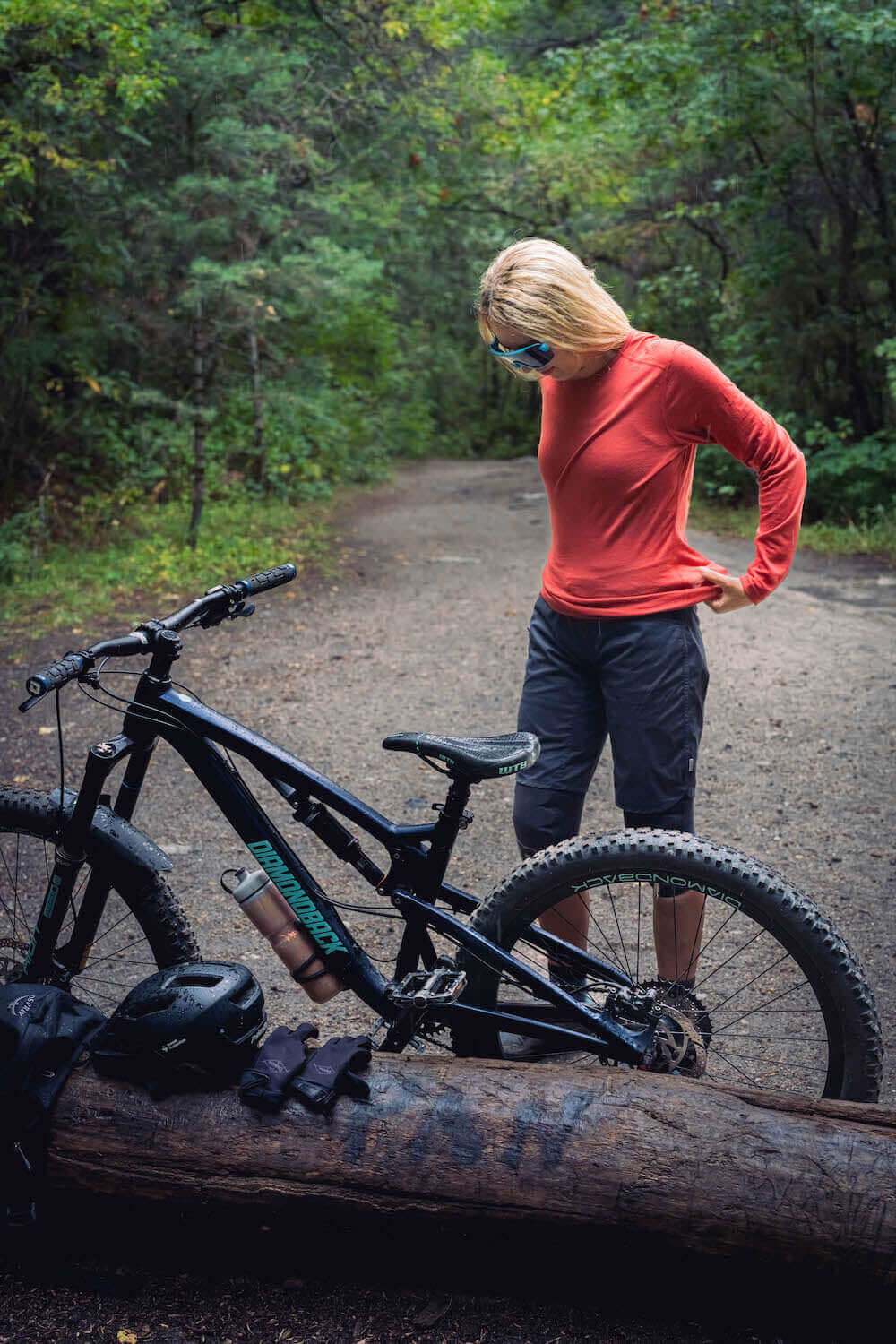
Base layers. Two Roman Trail Women's Merino Wool Base Layers ($49-59) in long sleeve. The case here is damp rather than cold: you will get wet repeatedly, and merino at 17.5 micron and 160 gsm keeps insulating when damp where cotton stops entirely and then actively chills you. That matters most when you stop moving: climbing in rain you are warm, standing on a summit in wind in a wet cotton shirt is how hypothermia starts in July.
Mid layer. The Columbia Women's Fast Trek II Jacket ($65), with a second insulated layer in winter.
The waterproof, the single most important item. The Marmot Women's PreCip Eco Rain Jacket ($110), hooded, taped seams, genuinely waterproof rather than water-resistant, plus waterproof overtrousers for anything above the valley floor. The overtrousers are what people leave behind and regret, because the rain arrives on wind and soaks you from the knees down in twenty minutes.
Footwear. The Merrell Women's Moab 3 Waterproof Hiking Boot ($140), broken in, for ankle support on rocky descents, waterproofing through bog, and a lugged sole on wet slate. The Darn Tough Women's Hiker Micro Crew Merino Socks ($28), three pairs, which stay warm wet. Dry shoes for the pub, which is part of the local routine rather than a luxury.
Navigation and safety, which is not optional here. An Ordnance Survey map, the OL4 to OL7 Explorer sheets, and a compass, because paths are unmarked. A whistle. A head torch, since darkness is a leading cause of rescue call-outs and the sun sets before four in December. A power bank for the phone as backup rather than primary.
Everything else. Trekking poles for descents, two litres of water capacity though becks are plentiful, a hat and gloves even in summer because a windy summit is cold in August, midge repellent between May and September, blister plasters, and the Eagle Creek Pack-It Cube Set ($59) with a dry bag or liner inside the rucksack, since a pack cover does not stop sideways rain.

Getting There and Getting Around
By train: the West Coast Main Line runs to Oxenholme, with a branch to Windermere, and to Penrith for the northern lakes. London to Oxenholme takes about two hours forty, Manchester about an hour and a half. This is the sensible arrival.
Buses: better than visitors expect. The 555 runs Kendal to Keswick through Windermere, Ambleside and Grasmere, the 508 serves Ullswater, the 77 Honister Rambler loops Borrowdale and Buttermere, and the 599 open-top runs the Windermere corridor in summer. A Central Lakes or Explorer day ticket is good value, and the buses let you do linear walks, which is the real advantage over a car.
Lake launches: Windermere, Derwentwater, Ullswater and Coniston all run passenger boats, and they double as walkers' transport. Catching a launch one way and walking back is one of the most pleasant things to do here.
Car: useful for Wasdale and the remoter valleys and a genuine liability in August. Roads are narrow with passing places, the passes at Hardknott and Wrynose are among the steepest in England at 1 in 3 with hairpins, and honeypot car parks fill by nine. Pay-and-display is the norm and enforcement is real.
The Coast to Coast: Wainwright's 300-kilometre route from St Bees to Robin Hood's Bay starts on the western edge and takes around two weeks.
Costs: What to Budget
The Lake District is moderately priced for the UK, with accommodation the main cost and the walking free.
Budget, 55 to 85 pounds a day: a YHA or independent hostel bed at 22 to 40, self-catering with a pub lunch at 12 to 18, bus day tickets, and free fells.
Mid-range, 130 to 200 pounds a day: a B&B or inn at 85 to 150, pub dinners at 18 to 30, a lake launch, occasional taxis.
Higher end, 300 pounds and up: country house hotels from 200, tasting menus at the several genuinely excellent restaurants in the region, guided walking days.
Specific costs: access to the fells is free, which is the headline and a consequence of the National Trust and the right of way network; car parking 6 to 12 pounds a day and National Trust members park free at their sites; a Windermere or Derwentwater launch 10 to 20; Dove Cottage around 13; Hill Top around 15 and it books out; a bus day ticket around 11 to 14; a pub main 15 to 22; a guided navigation course 80 to 150, which is genuinely worth it if you intend serious fell days.
Money: pounds sterling. Cards and contactless are accepted essentially everywhere including buses and car parks, and a few remote pubs and farm shops remain cash-preferred. Tipping: 10 percent in restaurants with table service, not expected at a bar. Parking, route and weather information at lakedistrict.gov.uk.
Where to Stay: Hostels, Guesthouses and Inns for Women
Keswick is the best base for a first visit: a real town rather than a resort, on Derwentwater, with fells immediately behind, the widest choice of accommodation and food, and good bus connections.
Ambleside is the walkers' town, central for the whole park, full of gear shops and hostels, and busy.
Grasmere is smaller and prettier with the Wordsworth connection, and quieter in the evening.
Windermere and Bowness have the largest supply and the most crowds, and are the easiest arrival by train.
Coniston, Buttermere and Wasdale are the quiet choices. Wasdale in particular is remote, has essentially one hotel and a campsite, and is where you stay if Scafell Pike is the point.
Hostels: the YHA network here is extensive and excellent, including some in remarkable buildings and locations, with female dorms, drying rooms, kitchens and a mixed-age clientele. Independent bunkhouses and camping barns fill the gaps. For a solo walker these are both the affordable and the sociable choice, and drying rooms matter more than anything else on the list.
What to check as a woman travelling alone: whether there is a drying room, which in this climate is the single most valuable facility; whether the property is on the 555 or 77 bus route if you have no car; whether they do an early breakfast, since fell days start early and many B&Bs serve from eight; and whether they will store luggage, which matters if you are walking a linear route.
Essential Resources for Women in the Lake District
Emergency numbers in the UK: 999 or 112. Ask for police, then mountain rescue.
Mountain rescue: twelve volunteer teams cover the Lake District and handle over 600 call-outs a year, the busiest in Britain. The service is free and entirely volunteer-staffed. Register for emergencySMS before you travel by texting register to 999, which lets you text for help when signal is too weak for a call. This is the most useful two minutes of preparation for any Lakeland walk.
Weather and fell conditions: the Met Office Mountain Forecast for the Lake District, and the Lake District Weatherline, which publishes a daily report from a fell-top assessor physically on the summits through the winter. Both are authoritative and both are what locals check.
Police: Cumbria Constabulary, with 101 as the non-emergency line. The UK has no tourist police.
US consular services: the US Embassy in London covers the UK, with a consulate in Edinburgh. Contact details and emergency arrangements are at uk.usembassy.gov.
Main hospitals: West Cumberland Hospital in Whitehaven and the Cumberland Infirmary in Carlisle hold the nearest emergency departments, with Westmorland General in Kendal serving the south, and minor injuries units at Keswick and Ambleside. NHS emergency care is free at the point of delivery for visitors in a genuine emergency, with follow-up potentially chargeable, so insurance remains sensible. 111 is the NHS non-emergency advice line.
Official health authority: the NHS at nhs.uk.
Official tourism authority: visitbritain.com nationally and lakedistrict.gov.uk for the national park.
US State Department travel advisory for the UK: current advisory level and detail.
UK entry information: the FCDO does not issue advice for the UK itself; entry requirements for visitors are at gov.uk.
Solo women safety assessment: This is an easy and pleasant place to walk alone. Crime is low, villages are friendly, a woman on the fells by herself is entirely ordinary, and the walking culture is unpretentious and generous with advice. The YHA hostels are sociable and mixed in age, which makes finding company straightforward if you want it. What genuinely endangers people here is the terrain, and it is underestimated precisely because the fells are short. Rescue teams here are Britain's busiest, and the causes are mundane: a slip on wet rock, cloud arriving on an unmarked summit, a dead phone, and darkness coming faster than planned. The protections are unglamorous and effective. Carry a paper OS map and compass and know the basics. Check the Met Office mountain forecast and the Weatherline fell-top report rather than a phone weather app. Tell someone your route and expected return. Carry a head torch even on a summer afternoon. Register for emergencySMS before you leave home. And turn back, which experienced fell walkers do routinely and without any embarrassment at all.
Reading On
The Lake District is the finest hill walking in England and the wettest corner of it, which are the same fact. The Lake District packing list for women has the gear detail. For harder and emptier British walking, the Scotland travel guide for women and the Isle of Skye travel guide for women go further north, with Edinburgh the gateway city and London under three hours by train. Across the Irish Sea the Ireland travel guide for women covers comparable weather. For higher mountains, see Chamonix, the Dolomites travel guide for women and Zermatt. The travel packing guide for women is the parent for every destination. For why merino is correct where it rains 200 days a year, the merino wool base layer guide explains it, and the full range is at Roman Trail women's merino base layers.
If the outer journey is calling you, the inner one usually is too. Explore SoulMap at romantrail.com/blogs/soulmap.
Blog posts
View all-

Packing List for Sihanoukville, Cambodia: What ...
What to pack for Sihanoukville, Cambodia: the island ferry port, the half built city, the three FCDO warnings that name it and honest advice for women travelling alone.
Packing List for Sihanoukville, Cambodia: What ...
What to pack for Sihanoukville, Cambodia: the island ferry port, the half built city, the three FCDO warnings that name it and honest advice for women travelling alone.
-

Packing List for Vang Vieng, Laos: What Women S...
What to pack for Vang Vieng, Laos: limestone towers over a river town, the caves and lagoons, the methanol warning in full and honest advice for women travelling alone.
Packing List for Vang Vieng, Laos: What Women S...
What to pack for Vang Vieng, Laos: limestone towers over a river town, the caves and lagoons, the methanol warning in full and honest advice for women travelling alone.
-

Packing List for Tagaytay, Philippines: What Wo...
What to pack for Tagaytay, Philippines: the ridge above Taal Lake, cool air an hour from Manila, and a volcano inside a lake inside a volcano.
Packing List for Tagaytay, Philippines: What Wo...
What to pack for Tagaytay, Philippines: the ridge above Taal Lake, cool air an hour from Manila, and a volcano inside a lake inside a volcano.


Contact form

Roman Trail Outfitters
Merino Wool Women's Long Sleeve Top | Crew Neck Shirt | Deep Olive