

Tarma is a town of about 50,000 people at roughly 3,050 metres in the central Peruvian Andes, four or five hours east of Lima, and Peruvians call it LA PERLA DE LOS ANDES. It is a flower-growing town, which sounds like a tourist-board line and is in fact the local economy: the valley around it supplies cut flowers across the country. ONCE A YEAR THAT ECONOMY BECOMES THE REASON TO COME. For Semana Santa, Holy Week, the people of Tarma and the villages around it lay ALFOMBRAS DE FLORES, carpets of cut flower petals in enormous geometric and religious designs, across the streets of the town overnight. In the morning the processions walk over them. THE ENTIRE WORK IS MADE IN ORDER TO BE DESTROYED WITHIN HOURS, and that is not a quirk, it is the point: the carpet is an offering, not a display.
Disclosure: This post contains affiliate links. If you buy through them, Roman Trail earns a small commission at no extra cost to you.
What Is Here
SEMANA SANTA IS THE DESTINATION AND THE REST OF THE YEAR IS A QUIET HIGHLAND TOWN. That is an honest thing to say rather than a dismissive one. During Holy Week Tarma fills completely, the flower carpets run through the centre in front of the cathedral in the first photograph, and the processions and costumed groups in the second photograph move through streets that are carpeted end to end. OUTSIDE THAT WEEK you will find a pleasant, cool, unhurried provincial town with a good market, a cathedral, flower fields, and almost no other foreign visitors. Decide which of those two trips you want before you book, because they are not the same place.
THE SANCTUARY OF EL SENOR DE MURUHUAY IS ABOVE ACOBAMBA, nine kilometres out, and is one of the most visited pilgrimage sites in the central Andes. The image venerated there is PAINTED ON ROCK rather than carved or hung, and the modern sanctuary was built around the rock face. In early May the Fiesta del Senor de Muruhuay brings large crowds and dancing, which is the other time of year the town is full.

THE GRUTA DE HUAGAPO IS THE MOST UNDERRATED THING IN THIS PART OF PERU. About 30 kilometres away near Palcamayo, the Huagapo cave is the largest and deepest explored cave in Peru and among the largest in South America, with a river running out of its mouth. THE FIRST CHAMBER IS WALKABLE in ordinary clothes and is already enormous; beyond it the system continues for kilometres and requires a guide, a light, a helmet and a willingness to get wet, and it has been the subject of international speleological expeditions. Local guides at the entrance arrange the deeper trip. It is cold inside, which surprises people who have just walked uphill in the sun to reach it.
AND TARMA IS THE TOP OF ONE OF SOUTH AMERICA'S GREAT ROAD DESCENTS. From here the road drops east into the CHANCHAMAYO valley, losing around 2,200 metres in roughly two hours to reach San Ramon and La Merced at about 800 metres. YOU GO FROM COLD HIGHLAND GRASSLAND TO COFFEE AND CITRUS COUNTRY IN AN AFTERNOON, through cloud forest with waterfalls beside the road. A great many Peruvian holidays consist of exactly that drive.
THE THIRD PHOTOGRAPH IS WHAT THE SURROUNDING COUNTRY LOOKS LIKE: women in highland clothing against the mountains above the town. Those are working clothes in the villages around Tarma rather than a costume, and the same courtesy applies as anywhere in the Andes, which is to ask before taking a photograph of anybody.
When to Go
Semana Santa, which moves with Easter, is the one date that changes the trip. Book months ahead and expect prices to rise. The carpets are laid at night, so the thing to be awake for is late evening and very early morning.
EARLY MAY for the Senor de Muruhuay festival is the second date, and the dry season from MAY TO SEPTEMBER is the easiest weather: bright days in the high teens, hard sun, and nights near or below freezing because at 3,050 metres with dry air the temperature falls the moment the light goes.
THE WET SEASON FROM NOVEMBER TO MARCH brings heavy afternoon rain, green hills, mud on the road to the cave and landslide risk on the Chanchamayo descent and the Lima road. The FCDO records that heavy rain can disrupt road travel between provinces and that rockslides and mudslides affect mountain routes. Easter often falls inside this window, which is worth knowing: the flower carpets are a wet-season event as often as not.
Tarma is cool all year and never hot. There is no month when a visitor does not need a warm layer for the evening.
Getting There
From Lima it is four to five hours by road and the road crosses a pass over 4,800 metres. The Carretera Central climbs from sea level to TICLIO, one of the highest paved road passes in the world, then drops to La Oroya and runs on to Tarma. THAT CROSSING IS THE REAL PHYSIOLOGICAL EVENT OF THE JOURNEY: you will be substantially higher in the bus than you will be in the town, within a few hours of leaving sea level, and people feel it there rather than at the destination. Buses run frequently; do it in daylight if you can, both for the scenery and because the road carries heavy mining freight.
HUANCAYO IS ABOUT TWO AND A HALF HOURS SOUTH through the Mantaro valley, which is the standard central-highlands pairing. LA OROYA is an hour west and is a junction rather than a destination.
SAN RAMON AND LA MERCED are two hours east and 2,200 metres down, which is the jungle descent described above and the most popular onward trip from Tarma.
AND ONE DIRECTION DESERVES A CHECK BEFORE YOU TAKE IT, which is the road continuing south east beyond Chanchamayo towards Satipo. That is the way the region runs down into the central selva, and it is the direction in which an itinerary from Tarma can approach the country the FCDO advises against. The safety section below says exactly what the advisory does and does not cover and where the authoritative boundary is published. Nothing about Tarma itself, the Lima road, Huancayo or the Chanchamayo descent to La Merced is affected.
The Tarma Packing List
Cold nights at 3,050 metres, strong high-altitude sun, a 4,800 metre pass on the way in, a cold wet cave and a 2,200 metre descent into humid jungle if you go east.
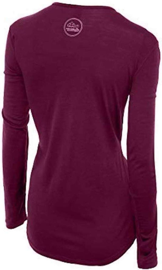
Our merino base layers are 100% Australian merino at 17.5 micron, and a long sleeve merino wool base layer for women does more work at this destination than at most, because TARMA IS A TRIP WITH A 4,000 METRE RANGE IN IT. You cross a pass above 4,800 metres to arrive, sleep at 3,050 in an unheated room, and may spend an afternoon at 800 metres in the jungle two days later. One wool layer is comfortable across all of that, which no other single garment manages: it insulates when the sun goes down and it does not become unbearable in Chanchamayo heat. Add a heavyweight merino base layer for the nights, which are the coldest thing about Tarma.
A Columbia Fast Trek II fleece for every evening of the year and for the cave, which is cold and damp whatever the weather outside, and a Marmot PreCip Eco rain jacket, which in the wet season and at Easter is essential.
A wide brim UPF 50 sun hat, because the ultraviolet at this altitude is severe and the Muruhuay sanctuary and the flower fields are both fully exposed.
Waterproof walking boots for the cave, where the floor is wet rock and mud even in the walkable first chamber.
A rechargeable headlamp, which is the one piece of kit that genuinely changes what you can do here: the guides at Huagapo provide lights for the deeper trip, and having your own good one means you are not dependent on a shared lamp in a cave system, and it covers the power cuts too.
Not linked and worth packing: HIGH FACTOR SUNSCREEN AND LIP BALM, reapplied, since this registry holds no sunscreen entry and dry altitude air splits lips in a day; SOLES IN SMALL NOTES for the market, the colectivos, the cave guides and the sanctuary, since cards are of little use outside the main hotels; SOMETHING WARM FOR THE BUS, because the Ticlio crossing is cold and the heating is a matter of opinion; AND A PLAN FOR THE ALTITUDE, which here means taking the first evening slowly rather than any product.
Recommended Tours and Experiences
Essential Resources for Women in Tarma
Emergency numbers in Peru: 105 reaches the Policia Nacional, 106 the ambulance service and 116 the fire service. IPERU, THE FREE STATE TOURIST INFORMATION LINE, IS ON 01 574 8000, is free and answers in English, and is the body the FCDO names for checking whether a tour operator is licensed, which at this destination means a cave guide. Coverage is good in the town and absent inside Huagapo.
THE ADVISORY QUESTION HERE IS A RIVER NAME, AND IT NEEDS SAYING PLAINLY RATHER THAN QUIETLY. UK FCDO: Peru has TWO advised-against areas and neither is on the normal tourist circuit. The FCDO advises against all but essential travel to THE VALLEY OF THE APURIMAC, ENE AND MANTARO RIVERS, the VRAEM, where remnants of the Shining Path occasionally attack police and military and where it notes both Peruvian and British Embassy assistance is severely limited. IT ALSO CLARIFIES, IN ITS OWN WORDS, THAT 'SOME PARTS OF THE APURIMAC RIVER IN THE DEPARTMENTS OF CUSCO AND AREQUIPA ARE NOT WITHIN THE VRAEM', which is the sentence that matters for anyone travelling in the Sacred Valley. The second area is within 20km south of the PUTUMAYO RIVER on the Colombian border in Loreto, excepting the Amazon River itself and the triple-border stretch from Caballococha to Santa Rosa de Yavari. Separately the FCDO warns that ARMED ROBBERS HAVE ATTACKED LONE WALKERS AT LAKE TITICACA and advises travelling in a group at the southern end at night, that ARMED RIVER PIRATES operate on the Amazon, and that states of emergency are declared from time to time with the current list published in El Peruano. TARMA IS IN NEITHER AREA, and Junin region is named nowhere in the FCDO's regional risks page. The reason to spend a paragraph on it is that one of the two areas is defined by RIVERS, and ONE OF THOSE RIVERS IS THE MANTARO, WHICH RISES IN JUNIN AND RUNS PAST JAUJA AND HUANCAYO, roughly 60 to 100 kilometres south of Tarma, through some of the most ordinary and most visited highland country in Peru. Read the three river names, look at a map, and you would reasonably conclude that Tarma's own neighbourhood is covered. IT IS NOT, AND THE ADVISORY ITSELF WARNS AGAINST READING IT THAT WAY: it adds, verbatim, "Note that some parts of the Apurimac River in the Departments of Cusco and Arequipa are not within the VRAEM." In other words the FCDO says that naming a river overstates the zone, and it publishes A DETAILED MAP as a PDF on its warnings and insurance page. THAT MAP IS THE AUTHORITY ON THE BOUNDARY AND NOT THE RIVER NAMES, so read it rather than a map of the Mantaro. THE PRACTICAL VERSION IS ABOUT DIRECTION OF TRAVEL. Tarma, the Carretera Central to Lima, the Mantaro valley south to Huancayo and the descent east to San Ramon and La Merced are all outside the area. An itinerary that keeps going south east from Chanchamayo towards Satipo is heading into the region the advisory concerns, and that is the leg to check against the map before booking, because TRAVELLING AGAINST FCDO ADVICE CAN INVALIDATE TRAVEL INSURANCE, which turns a route choice into a financial one. The FCDO also notes that STATES OF EMERGENCY HAVE BEEN DECLARED IN SOME PARTS OF PERU with the current list published in the official gazette, EL PERUANO.
Peru's real risk is ordinary crime handled badly, and the FCDO is specific about taxis. It warns that tourists, especially those travelling alone, are at risk of EXPRESS KIDNAPPING, where someone is held and forced to withdraw money from ATMs for their release, usually at night, and that incidents often involve armed criminals POSING AS TAXI DRIVERS or drivers working for gangs. So: use licensed telephone or app-based taxis, never hail one in the street, ask your accommodation to book, and at an airport or bus terminal use only the registered desks inside the terminal. The FCDO also records armed hold-ups of provincial and inter-city buses, robberies at gunpoint of British tourists including in the Lima tourist districts of Miraflores and Barranco, and advises not resisting and agreeing to any demand for cash. Street crime, muggings and bag-snatching are a significant problem in Lima, Cusco and Arequipa: use ATMs inside banks or supermarkets in business hours, do not use a phone at the roadside because motorbike riders snatch them, and do not walk alone in quiet areas or at night. COUNTERFEIT US AND PERUVIAN BANKNOTES CIRCULATE, and the FCDO notes street money changers in Cusco's tourist areas passing off intis, a currency withdrawn decades ago. Carry ID at all times, which the police may ask for. And note that it is illegal for foreigners to take part in political activity or demonstrations, with detention or deportation the stated consequence, while protests and mining strikes are announced with little notice and close roads and railways.
ALTITUDE, THE ROAD AND THE CAVE ARE THE DAILY HAZARDS. THE PASS IS HIGHER THAN THE TOWN AND THAT IS WHERE PEOPLE SUFFER: Ticlio is above 4,800 metres and you reach it within hours of leaving Lima at sea level, so headache and nausea on the bus are common and usually resolve as you descend to Tarma. At 3,050 metres the town itself is moderate by Andean standards, and the rule is unchanged: symptoms that worsen rather than settle, confusion, unsteadiness or breathlessness at rest mean going down, and from Tarma down is straightforward in either direction. THE CARRETERA CENTRAL IS A SERIOUS ROAD, carrying heavy mining traffic on tight mountain curves with landslides in the wet season; travel it in daylight with a reputable operator and expect delays rather than planning around a schedule. THE CAVE DESERVES RESPECT: the walkable first chamber is fine in boots, and beyond it the system is wet, cold, and genuinely dangerous without a guide, equipment and a light, so do not go past the lit section on your own initiative. THE FLOWER CARPETS MEAN CROWDS, with the centre closed to traffic, large processions and pickpocketing opportunities that do not exist in Tarma for the other fifty-one weeks. And ordinary highland facts: the nights are freezing in unheated rooms, the sun burns on cold days, and the jungle descent east means insect repellent and a different climate within two hours. El Nino, late 2026 to April 2027. The FCDO carries a current warning that the El Nino event is expected to generate heavy rainfall with possible flooding, landslides and mudslides, especially on the northern and central coast, and that these may close roads and disrupt access to essential services. The Peruvian government publishes official updates through ENFEN and real-time road alerts, both in Spanish. Check them in the week before you travel rather than relying on a seasonal average, because this is exactly the kind of condition that makes a normally dry coastal road impassable.
US State Department travel advisory: the Peru advisory. Read the current level there directly rather than relying on a figure printed in any guide.
UK FCDO travel advice: gov.uk/foreign-travel-advice/peru, and read the safety and security page rather than only the landing page, because that is where the substance sits.
Main hospital: the Hospital Felix Mayorca Soto in Tarma handles routine and emergency care for the province, with larger facilities in HUANCAYO two and a half hours south and the serious option being LIMA, four to five hours by road over the pass. That road is the thing to think about: there is no air ambulance service to assume here and a medical evacuation means a long mountain drive, so insurance that covers repatriation is worth more at this destination than at a coastal one. Dial 106 for an ambulance. Peru has no reciprocal health agreement with the UK or the United States, so insurance with medical cover and repatriation is essential, and it should cover trekking at altitude if you intend to walk. Private clinics in Lima, Cusco and Arequipa are good and will want payment or an insurance guarantee up front; public provision outside the cities is thin. A farmacia handles minor problems. DO NOT DRINK THE TAP WATER anywhere in Peru. ALTITUDE IS THE REAL HEALTH RISK rather than anything exotic: Cusco is 3,400 metres and the Sacred Valley around 2,800, soroche is common, and the honest response is to arrive low, ascend slowly, drink more water than feels necessary and treat a bad headache as a reason to descend. YELLOW FEVER vaccination is recommended for the Amazon lowlands and some onward countries ask for a certificate.
Official health authority: the Peruvian Ministry of Health, covers the health ministry's own pages, including the altitude guidance that matters on the Ticlio crossing
US Embassy: the United States Embassy in Lima.
Official tourism authority: PromPeru, the national tourism board, covers the country, and iPeru can confirm the Semana Santa dates, the Huagapo cave opening arrangements and whether a guide or operator is licensed
Takeaways
The flower carpets are made overnight to be walked over the next morning. That is the point of them, not a shame.
The Gruta de Huagapo is Peru's deepest explored cave and the first chamber needs nothing but boots.
Tarma is not in an advised-against area. The VRAEM is named by rivers and one of them rises in Junin, so read the FCDO's own map rather than a map of the Mantaro.
The pass on the way in is higher than the town. That is where altitude is felt.
Solo women safety assessment: Tarma is a quiet, conservative provincial highland town and an easy place to be alone, with the single exception of Semana Santa, when it is extremely crowded. Outside that week you will be one of very few foreign visitors, which in the central Andes generally means curiosity and helpfulness rather than hassle; eating alone is normal and the market and the plaza are busy and ordinary by day. THE ADVISORY POSITION IS WORTH UNDERSTANDING RATHER THAN SKIMMING. Peru has two advised-against areas, the VRAEM and a strip south of the Putumayo river, and TARMA IS IN NEITHER, with Junin named nowhere in the FCDO's regional advice. But the VRAEM is defined by the Apurimac, Ene and Mantaro rivers, and the Mantaro rises in Junin and flows past Huancayo well south of here, so the river names make the zone look larger than it is. The FCDO itself says naming a river overstates it and publishes a detailed map, which is what to read; the leg that genuinely needs checking is any onward route running south east from Chanchamayo towards Satipo, because travelling against FCDO advice can invalidate insurance. ON ORDINARY CRIME the Peruvian pattern applies and is manageable: booked or hotel taxis rather than street cabs after dark, a day's cash rather than everything, a closed bag held in front of you in the Semana Santa crowds, and hand it over if you are robbed. THE PHYSICAL RISKS ARE THE PASS AND THE ROAD. Ticlio is above 4,800 metres a few hours out of Lima, which is where altitude sickness actually strikes on this trip, and the Carretera Central is a heavy-freight mountain road best travelled in daylight. In the cave, do not go beyond the lit first chamber without a guide and a light. IPERU ON 01 574 8000 IS FREE AND ANSWERS IN ENGLISH. 105 is the police and 106 the ambulance.
Reading On
Tarma is the central Andes, which this library reaches from several directions. West over the pass, the Lima packing list covers the capital four to five hours away and the sea-level start of the climb to Ticlio. North in the highlands, the Huaraz packing list covers the Cordillera Blanca and the Cajamarca packing list the northern highlands where the Inca empire ended. East and down, the Tarapoto packing list covers the high jungle on the same eastern slope of the Andes that the Chanchamayo road drops into, and the Iquitos packing list the lowland Amazon beyond it. South in the Inca heartland, the Cusco packing list, Chinchero packing list, Ollantaytambo packing list and Machu Picchu packing list cover the Sacred Valley and the citadel, with the Puno packing list on Lake Titicaca and the Arequipa packing list and Colca Canyon packing list further south again. On the desert coast, the Huacachina packing list and Nazca packing list cover the oasis and the geoglyphs. For the country, the Peru travel guide for women carries the regions, the altitude and the seasons in full. For why one wool layer covers a trip with a four thousand metre range in it, read the guide to merino wool base layers for women. Every destination we cover is indexed at the travel packing guide for women, and the base layers are at the Roman Trail collection.

If the outer journey is calling you, the inner one usually is too. Explore SoulMap at romantrail.com/blogs/soulmap.