

Chinchero is a village of a few thousand people on the high plain between Cusco and the Sacred Valley, and the first thing to know about it is the number: IT SITS AT ABOUT 3,760 METRES, WHICH IS HIGHER THAN CUSCO AND NEARLY A THOUSAND METRES ABOVE MACHU PICCHU. Almost every visitor arrives here on their first or second day in Peru, on the standard Sacred Valley tour out of Cusco, which means a great many people meet their worst altitude of the whole trip at the stop they were told was a brief one. It is also the best place in the country to understand Andean weaving, because the cooperatives here demonstrate the whole process from the raw fleece to the finished cloth, and the dyes come out of plants and insects collected on the hillsides you can see from the square.
Disclosure: This post contains affiliate links. If you buy through them, Roman Trail earns a small commission at no extra cost to you.
What Is Here
THE CHURCH IS BUILT ON AN INCA PALACE AND YOU CAN SEE THE JOIN. Chinchero was the royal estate of TUPAC INCA YUPANQUI, the tenth Inca, and when the Spanish arrived they demolished what stood there and put a church on the foundations. The whitewashed adobe building in the third photograph sits on Inca walls, and the masonry at the base is visibly better than everything above it: tight polygonal stonework under five hundred years of mud brick and lime. Inside, the ceiling and walls are covered in seventeenth century religious painting of the Cusco school. It opens with the ticket rather than independently.
THE WEAVING IS THE REASON TO STAY LONGER THAN THE TOUR ALLOWS. The cooperatives, which are run by women and are the village's main income beside farming, will show you the whole sequence: washing fleece with a root that lathers like soap, spinning on a drop spindle, dyeing with cochineal for reds, a plant called chilca for greens and indigo for blues, then backstrap weaving. IT IS A DEMONSTRATION THAT ENDS IN A SALES PITCH AND THAT IS FINE: the pitch is the point of the cooperative and the prices reflect weeks of work. Buy or do not buy, but do not haggle hard over a textile that took a month.

THE TERRACING IS INCA AND IT IS STILL CULTIVATED. The stepped platforms in the first photograph were agricultural infrastructure for the royal estate, and the broad flat area below the church was levelled by the Inca as well. Walk down through them away from the square and the village gets very quiet very quickly.
THE SUNDAY MARKET IS THE ONE WORTH TIMING FOR. There is a daily tourist market under the arcades, and on Sunday morning a genuine local market where highland families come down to trade produce, some of it still by barter. It is busier, cheaper and considerably less staged.
AND A WALK MOST VISITORS NEVER HEAR ABOUT. A path drops from Chinchero through the valley to URQUILLOS in the Sacred Valley floor, around two and a half to three hours downhill through farmland and Inca canals. IT GOES DOWN ABOUT 800 METRES, which is the right direction for anybody acclimatising, and it ends near Huayllabamba with transport to Urubamba.
AND THE THING THAT IS CHANGING THE VILLAGE: THE NEW CUSCO INTERNATIONAL AIRPORT IS BEING BUILT ON THE PLAIN BESIDE IT. The project has been under construction and under argument for years, intended to replace Cusco's constrained city airport and to take long haul traffic directly into the region. We deliberately print no opening date, because the date has moved repeatedly and anything we published would be wrong by the time you read it. What matters for a visitor is that the plain north of the village is an active construction site, the road carries heavy plant, and Chinchero is a village in the middle of becoming something else.
When to Go
The dry season from May to September is the right window and the nights are the coldest in the valley. Daytime in the high teens in the sun, which is deceptive, and nights at or below freezing, because at 3,760 metres with no humidity the heat leaves the moment the sun does.
June and July are the coldest and clearest, and this is also when the Sacred Valley is busiest. Chinchero absorbs it better than Pisac because most groups stay under an hour.
The wet season from November to April brings heavy afternoon rain, and the FCDO names the Cusco region specifically for rainy season disruption to road and rail travel including the Machu Picchu routes. The plain turns to mud, the Urquillos walk becomes slippery and the village is green and very quiet.
Sunday is the market and Sunday morning is the best three hours of the week here.
Getting There
Chinchero is about 30 kilometres from Cusco and the drive takes forty five minutes to an hour. It is the first stop on almost every Sacred Valley tour, which is convenient and is also the problem described below.
COLECTIVOS RUN FROM CUSCO ALL DAY and are the cheap independent option, leaving from the Sacred Valley terminals when full, and they will drop you in the village. The same vehicles continue to Urubamba, so you can go on down into the valley rather than back to Cusco.
Ollantaytambo is about an hour on, and Urubamba around forty minutes, so Chinchero is a natural morning before an afternoon lower down. THAT DIRECTION IS ALSO THE SENSIBLE ONE PHYSIOLOGICALLY, because you finish the day a thousand metres lower than you started it.
THE SACRED VALLEY TOURIST TICKET, the BOLETO TURISTICO, is the mechanism rather than the price: Chinchero's church and ruins are covered by the partial or full circuit ticket and cannot be paid for separately at the gate. Buy the right one in Cusco for the sites you actually intend to see, and note that the full ticket covers a long list over ten days. We print no price, because they change.
The Chinchero Packing List
The highest point on the standard Sacred Valley day, severe sun, freezing nights, and a dusty plain.
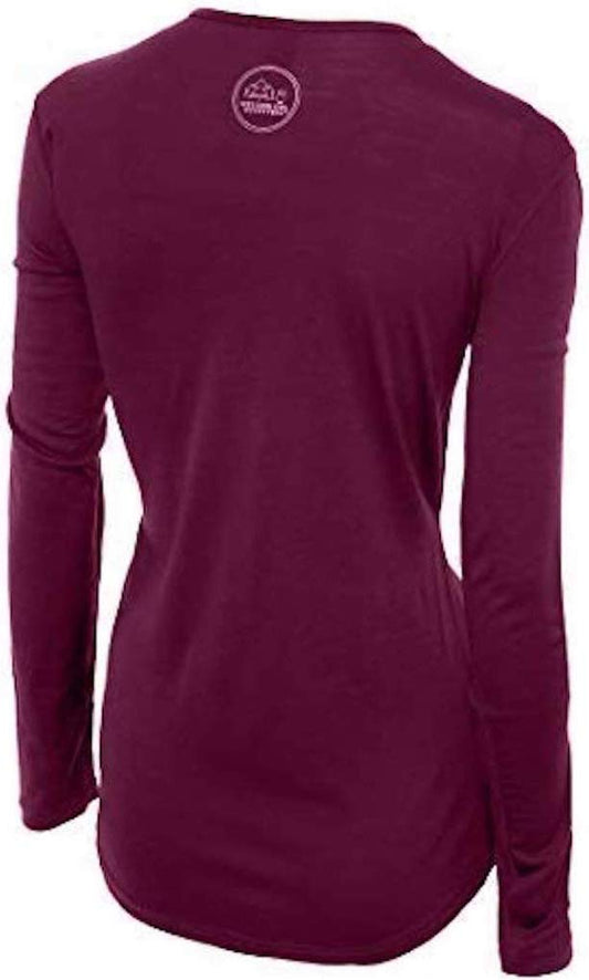
Our merino base layers are 100% Australian merino at 17.5 micron, and a long sleeve merino wool base layer for women is the single most useful thing in a bag at this altitude, for the reason the whole Andes shares and Chinchero shows at its most extreme: THE SWING BETWEEN SUN AND SHADE HERE IS BRUTAL. Stand in the square in the sun and it is pleasant; step into the church and you are cold. Wool handles that without the clammy stage, and it is also the right fibre to be wearing in a village that will show you where wool comes from. Add a heavyweight merino base layer for the nights if you are staying, which are colder than Cusco's.
A Columbia Fast Trek II fleece and a Marmot PreCip Eco rain jacket, which in the wet season is essential and in the dry season still earns its place as a windproof layer on an exposed plain.
A wide brim UPF 50 sun hat, because the ultraviolet at 3,760 metres in the tropics is extreme and the plain has no shade at all. This is the item people most regret leaving behind.
Salomon X Ultra 4 GTX hiking shoes for the terraces and the Urquillos descent, which is loose, stepped and steep in places.
Merino wool glove liners for an early start, which on a June morning here is genuinely below freezing in an open vehicle.
Not linked and worth packing: SUNSCREEN AT HIGH FACTOR AND LIP BALM WITH SUN PROTECTION, reapplied, since this registry holds no sunscreen entry and altitude sun cracks lips within a day; PERUVIAN SOLES IN SMALL NOTES, because the cooperatives and the market are cash and change is scarce; COCA TEA OR SWEETS are offered everywhere and are the local answer to the altitude; and A DAY OF ACCLIMATISATION IN CUSCO OR LOWER BEFORE YOU COME, which is not a product and is the most useful thing on this list.
Recommended Tours and Experiences
Essential Resources for Women in Chinchero
Emergency numbers in Peru: 105 reaches the Policia Nacional, 106 the ambulance service and 116 the fire service. IPERU, THE FREE STATE TOURIST INFORMATION LINE, IS ON 01 574 8000 and answers in English; it is also the body the FCDO names for checking whether a tour operator is licensed. Cusco has a tourist police office, which is the nearest one. Mobile coverage is adequate in the village and drops out on the Urquillos path.
ALTITUDE IS THE REAL HAZARD HERE AND THE ITINERARY IS WHAT MAKES IT ONE. At about 3,760 metres Chinchero is higher than Cusco, and a very large number of visitors arrive on day one or two of a Peru trip having flown into Cusco from sea level the day before. So the standard Sacred Valley tour takes an unacclimatised person to the highest point of her trip so far and keeps her there for an hour, usually in the morning, often after an early start and no breakfast. HEADACHE, NAUSEA, BREATHLESSNESS AND POOR SLEEP ARE COMMON AND ARE NOT DANGEROUS IN THEMSELVES. What matters is the rule that does not bend: SYMPTOMS THAT GET WORSE RATHER THAN BETTER, CONFUSION, UNSTEADINESS ON THE FEET OR BREATHLESSNESS AT REST MEAN GOING DOWN, immediately and without debate, and from here down is easy because the valley floor is a thousand metres below. Do not treat it with alcohol, do not push through a hike, and if you have a choice of order, do Chinchero after a day or two in Cusco rather than on arrival. Acetazolamide is a conversation to have with a travel clinic before leaving home, not something to buy in a pharmacy here on a bad morning.
THE ADVISED-AGAINST AREAS ARE NOWHERE NEAR THE SACRED VALLEY. UK FCDO: Peru has TWO advised-against areas and neither is on the normal tourist circuit. The FCDO advises against all but essential travel to THE VALLEY OF THE APURIMAC, ENE AND MANTARO RIVERS, the VRAEM, where remnants of the Shining Path occasionally attack police and military and where it notes both Peruvian and British Embassy assistance is severely limited. IT ALSO CLARIFIES, IN ITS OWN WORDS, THAT 'SOME PARTS OF THE APURIMAC RIVER IN THE DEPARTMENTS OF CUSCO AND AREQUIPA ARE NOT WITHIN THE VRAEM', which is the sentence that matters for anyone travelling in the Sacred Valley. The second area is within 20km south of the PUTUMAYO RIVER on the Colombian border in Loreto, excepting the Amazon River itself and the triple-border stretch from Caballococha to Santa Rosa de Yavari. Separately the FCDO warns that ARMED ROBBERS HAVE ATTACKED LONE WALKERS AT LAKE TITICACA and advises travelling in a group at the southern end at night, that ARMED RIVER PIRATES operate on the Amazon, and that states of emergency are declared from time to time with the current list published in El Peruano. CHINCHERO IS IN NEITHER AREA. It is in the Cusco region, and the only thing the FCDO says about Cusco specifically is that rainy season rockslides and mudslides can disrupt road and rail travel including the routes to Machu Picchu.
Peru's real risk is ordinary crime handled badly, and the FCDO is specific about taxis. It warns that tourists, especially those travelling alone, are at risk of EXPRESS KIDNAPPING, where someone is held and forced to withdraw money from ATMs for their release, usually at night, and that incidents often involve armed criminals POSING AS TAXI DRIVERS or drivers working for gangs. So: use licensed telephone or app-based taxis, never hail one in the street, ask your accommodation to book, and at an airport or bus terminal use only the registered desks inside the terminal. The FCDO also records armed hold-ups of provincial and inter-city buses, robberies at gunpoint of British tourists including in the Lima tourist districts of Miraflores and Barranco, and advises not resisting and agreeing to any demand for cash. Street crime, muggings and bag-snatching are a significant problem in Lima, Cusco and Arequipa: use ATMs inside banks or supermarkets in business hours, do not use a phone at the roadside because motorbike riders snatch them, and do not walk alone in quiet areas or at night. COUNTERFEIT US AND PERUVIAN BANKNOTES CIRCULATE, and the FCDO notes street money changers in Cusco's tourist areas passing off intis, a currency withdrawn decades ago. Carry ID at all times, which the police may ask for. And note that it is illegal for foreigners to take part in political activity or demonstrations, with detention or deportation the stated consequence, while protests and mining strikes are announced with little notice and close roads and railways.
THE OTHER DAILY RISKS ARE SUN, COLD AND ONE PIECE OF ETIQUETTE. THE ULTRAVIOLET AT THIS HEIGHT BURNS PEOPLE ON COOL DAYS, which is the commonest minor injury in the Andes and is entirely preventable with a hat and sunscreen. THE NIGHTS ARE BELOW FREEZING in buildings that are generally unheated, so an evening layer is not optional if you stay. THE URQUILLOS DESCENT is 800 metres of loose path with no facilities and patchy signal: tell somebody, carry water, and do not start it late in the day. AND THE ETIQUETTE POINT IS SIMPLE AND MATTERS: ASK BEFORE PHOTOGRAPHING ANYONE, including the women in traditional dress who are the reason many people come. Some will ask for a small payment and that is a fair transaction; the women in the second photograph are at work, not at an attraction. The llamas held on leads near the square are the same arrangement. El Nino, late 2026 to April 2027. The FCDO carries a current warning that the El Nino event is expected to generate heavy rainfall with possible flooding, landslides and mudslides, especially on the northern and central coast, and that these may close roads and disrupt access to essential services. The Peruvian government publishes official updates through ENFEN and real-time road alerts, both in Spanish. Check them in the week before you travel rather than relying on a seasonal average, because this is exactly the kind of condition that makes a normally dry coastal road impassable.
US State Department travel advisory: the Peru advisory. Read the current level there directly rather than relying on a figure printed in any guide.
UK FCDO travel advice: gov.uk/foreign-travel-advice/peru, and read the safety and security page rather than only the landing page, because that is where the substance sits.
Main hospital: there is a health post in the village for minor matters and the real medical infrastructure is in CUSCO, forty five minutes away, which has both a regional hospital and private clinics used to altitude illness and to foreign patients. That proximity is genuinely reassuring and is one of the reasons Chinchero is an easier high-altitude destination than most in this library. Anything major is a flight to Lima. Dial 106 for an ambulance. Peru has no reciprocal health agreement with the UK or the United States, so insurance with medical cover and repatriation is essential, and it should cover trekking at altitude if you intend to walk. Private clinics in Lima, Cusco and Arequipa are good and will want payment or an insurance guarantee up front; public provision outside the cities is thin. A farmacia handles minor problems. DO NOT DRINK THE TAP WATER anywhere in Peru. ALTITUDE IS THE REAL HEALTH RISK rather than anything exotic: Cusco is 3,400 metres and the Sacred Valley around 2,800, soroche is common, and the honest response is to arrive low, ascend slowly, drink more water than feels necessary and treat a bad headache as a reason to descend. YELLOW FEVER vaccination is recommended for the Amazon lowlands and some onward countries ask for a certificate.
Official health authority: the Peruvian Ministry of Health, covers the health ministry's own pages, including its altitude guidance
US Embassy: the United States Embassy in Lima.
Official tourism authority: PromPeru, the national tourism board, covers the country, and iPeru maintains an office in Cusco that publishes the Boleto Turistico circuits, the site opening hours and current Sacred Valley road conditions
Takeaways
Chinchero is higher than Cusco at about 3,760 metres, and most people come here on day one. Acclimatise first if you can choose.
The church stands on Tupac Inca Yupanqui's palace and the Inca foundations are still visible at the base.
Sunday morning is the real market. The weaving demonstration ends in a sales pitch and that is the point of it.
A new international airport is being built on the plain beside the village. We print no opening date on purpose.
Solo women safety assessment: Chinchero is one of the easier places in Peru to be alone. It is a small farming and weaving village of a few thousand people, the cooperatives are run by women, the square is busy with visitors and locals through the middle of the day, and Cusco is forty five minutes away with a tourist police office and real hospitals. The ordinary Peruvian precautions still apply and are enough: use booked or hotel taxis rather than street cabs in Cusco after dark, carry a day's cash in small notes rather than everything, keep your bag closed and in front of you in a crowded colectivo or market, and if you are robbed, hand it over. PERU HAS TWO ADVISED-AGAINST AREAS, the VRAEM and a 20km strip south of the Putumayo river, and NEITHER IS WITHIN HUNDREDS OF KILOMETRES OF HERE. THE GENUINE RISK IS THE ALTITUDE, not people. At 3,760 metres on your first or second day in the country, symptoms are likely and mostly harmless, and the ones that mean descend rather than rest are worsening symptoms, confusion, unsteadiness or breathlessness while sitting still. Going down is unusually easy from here, since the valley floor is a thousand metres below and transport runs all day. If you walk the Urquillos path alone, tell your accommodation where you are going, start early, and carry water: it is 800 metres of descent with no facilities and intermittent signal. IPERU ON 01 574 8000 IS FREE AND ANSWERS IN ENGLISH. 105 is the police and 106 the ambulance.
Reading On
Chinchero is one stop in the Sacred Valley and this library covers the whole circuit. An hour down the valley, the Ollantaytambo packing list covers the living Inca town and the railhead for the train, and the Machu Picchu packing list covers what that train is for. Above it, the Cusco packing list covers the Inca capital where almost every Chinchero visit begins and where the Boleto Turistico is bought. Further afield in the Andes, the Puno packing list covers Lake Titicaca at a higher altitude again, the Arequipa packing list and Colca Canyon packing list the white city and the condor canyon, the Huaraz packing list the Cordillera Blanca, and the Cajamarca packing list the northern highlands where the Inca empire ended. On the coast and in the jungle, the Lima packing list covers the capital, the Huacachina packing list the desert oasis, and the Iquitos packing list the Amazon and the high jungle. For the country, the Peru travel guide for women carries the regions, the altitude and the seasons in full. For why wool is the right fibre in a place that will show you how wool is made, read the guide to merino wool base layers for women. Every destination we cover is indexed at the travel packing guide for women, and the base layers are at the Roman Trail collection. Away from the Sacred Valley, the Nazca packing list covers the geoglyphs on the desert coast and the Tarapoto packing list the high jungle on the eastern slope of the Andes.

If the outer journey is calling you, the inner one usually is too. Explore SoulMap at romantrail.com/blogs/soulmap.