

The Colca Canyon is in the Peruvian Andes about 160 kilometres north west of Arequipa, and at its deepest it drops more than 3,200 metres from rim to river, which makes it roughly twice the depth of the Grand Canyon. That statistic gets quoted constantly and is slightly misleading, because Colca is not a sheer-walled gorge: it is a long, wide, inhabited valley with agricultural terraces on its flanks that have been farmed continuously since pre-Inca times, in the photograph at the top of this page, narrowing to a genuine canyon lower down.
Disclosure: This post contains affiliate links. If you buy through them, Roman Trail earns a small commission at no extra cost to you.
People come for two things. The first is the Andean condor, which rides the morning thermals out of the canyon at a viewpoint called Cruz del Condor and is in the second photograph. The second is the trek, which is a descent of about 1,200 metres to the river and the oasis of Sangalle, a night there, and a climb back out. The third photograph is the rim at Cabanaconde, which is where the trek starts. This page covers both, and it spends a great deal of its length on altitude, because altitude is what decides whether the trip works.
What Is Here
Cruz del Condor is the condor viewpoint and it is a dawn appointment rather than a sight you drop in on. The condors rise on the thermals as the canyon warms, which in practice means between about seven and nine in the morning, with the best of it usually in the first hour. Later in the day you may see nothing at all. The viewpoint is on the road between Chivay and Cabanaconde, it is ticketed through the valley-wide tourist ticket, and the Andean condor is the largest flying bird in the world by wing area, with a span over three metres; seeing one pass below you at eye level is the reason this place is on itineraries.
Cabanaconde is the trekking village and Chivay is the valley town, and choosing between them matters. Chivay, at about 3,650 metres, is the larger settlement at the valley's eastern end, with the hot springs at La Calera, most of the hotels, and the bus connections. Cabanaconde, at about 3,290 metres, is a much smaller village at the western end, past Cruz del Condor, and is where every trek into the canyon begins and ends. Most organised tours stay in Chivay and never reach Cabanaconde; most trekkers stay in Cabanaconde and barely see Chivay.
The Sangalle trek is the classic and the numbers are the thing to understand before booking. From Cabanaconde the path drops about 1,200 metres over roughly four to five kilometres of switchbacks to the canyon floor at Sangalle, an oasis of palms and swimming pools, which takes three to four hours going down. You stay the night. The climb back out is the same 1,200 metres and takes four to six hours, usually started before dawn to avoid the sun, and it is genuinely hard: a continuous ascent at altitude with no flat sections. Mules can be hired to carry you or your bag. The three-day version adds the villages of San Juan de Chuccho, Cosnirhua and Malata on the far side and is the better trip.
The valley itself has more than the canyon. The terraces around Yanque, Coporaque and Maca are pre-Inca and still worked, the colonial churches in each village are disproportionately grand for their size, and the Yanque hot springs and the La Calera baths at Chivay are the reward after the climb. The road in from Arequipa crosses the Patapampa pass at about 4,900 metres, which is higher than anything in the Alps and comes with a viewpoint over six volcanoes.

When to Go
April to November is the dry season and is the window. May to September is the best of it. Those months bring clear mornings, which is what the condor viewing needs, and dry trails, which is what the descent needs. Daytime temperatures on the rim run about fifteen to twenty degrees and nights drop to around freezing or below at Chivay, which is the part people underpack for.
December to March is the wet season and the trek is genuinely compromised. Rain makes the switchbacks slippery and the risk of rockfall real, cloud hides both the condors and the views, and sections of road into the valley can wash out. Some agencies stop running the trek entirely. It is also the greenest the valley gets, which is a thin consolation.
The daily rhythm matters more than the month, and it is the single most useful thing on this page after the altitude advice. Condors fly in the early morning. The canyon floor is brutally hot by midday and the ascent out is done before dawn for that reason. So a Colca trip is structured around early starts in a way a Cusco or Arequipa trip is not, and an itinerary that has you arriving at Cruz del Condor at eleven has been sold to you badly.
Getting There
Arequipa is the gateway and there is no way around it. The city is at 2,335 metres, has an airport with frequent Lima flights, and is where every Colca trip starts.
By bus, public services run from Arequipa to Chivay in about four hours and on to Cabanaconde in about six, crossing the Patapampa pass. They are cheap and adequate. By tour, the standard offering is a two-day trip from Arequipa taking in Cruz del Condor and Chivay, often leaving at three in the morning, and the one-day version of that is a genuinely punishing sixteen-hour round trip that we would advise against on altitude grounds alone. For trekking, get yourself to Cabanaconde and either hire a local guide there or walk the well-marked main route independently.
And the acclimatisation point belongs here rather than in the safety section, because it is a booking decision. Arequipa is at 2,335 metres and Chivay is at 3,650, with the road crossing 4,900. Going from Arequipa to Chivay on day one of a Peru trip is how people spend their Colca trip in a hotel room with a headache. Spend two or three nights in Arequipa first, and if you are coming from Cusco or Puno you are already acclimatised and higher, so the direction of travel matters.
Is Colca Canyon Safe for Women Travelers
UK FCDO: Peru has TWO advised-against areas and neither is on the normal tourist circuit. The FCDO advises against all but essential travel to THE VALLEY OF THE APURIMAC, ENE AND MANTARO RIVERS, the VRAEM, where remnants of the Shining Path occasionally attack police and military and where it notes both Peruvian and British Embassy assistance is severely limited. IT ALSO CLARIFIES, IN ITS OWN WORDS, THAT 'SOME PARTS OF THE APURIMAC RIVER IN THE DEPARTMENTS OF CUSCO AND AREQUIPA ARE NOT WITHIN THE VRAEM', which is the sentence that matters for anyone travelling in the Sacred Valley. The second area is within 20km south of the PUTUMAYO RIVER on the Colombian border in Loreto, excepting the Amazon River itself and the triple-border stretch from Caballococha to Santa Rosa de Yavari. Separately the FCDO warns that ARMED ROBBERS HAVE ATTACKED LONE WALKERS AT LAKE TITICACA and advises travelling in a group at the southern end at night, that ARMED RIVER PIRATES operate on the Amazon, and that states of emergency are declared from time to time with the current list published in El Peruano.
The Colca valley carries no advised-against designation and is one of the more straightforward parts of Peru for a woman travelling alone. Cabanaconde and the valley villages are small, agricultural and used to trekkers, the trail to Sangalle carries a steady stream of walkers in season, and solo female trekkers are common here. What is dangerous is the altitude, the descent and the sun, in that order.
Peru's real risk is ordinary crime handled badly, and the FCDO is specific about taxis. It warns that tourists, especially those travelling alone, are at risk of EXPRESS KIDNAPPING, where someone is held and forced to withdraw money from ATMs for their release, usually at night, and that incidents often involve armed criminals POSING AS TAXI DRIVERS or drivers working for gangs. So: use licensed telephone or app-based taxis, never hail one in the street, ask your accommodation to book, and at an airport or bus terminal use only the registered desks inside the terminal. The FCDO also records armed hold-ups of provincial and inter-city buses, robberies at gunpoint of British tourists including in the Lima tourist districts of Miraflores and Barranco, and advises not resisting and agreeing to any demand for cash. Street crime, muggings and bag-snatching are a significant problem in Lima, Cusco and Arequipa: use ATMs inside banks or supermarkets in business hours, do not use a phone at the roadside because motorbike riders snatch them, and do not walk alone in quiet areas or at night. COUNTERFEIT US AND PERUVIAN BANKNOTES CIRCULATE, and the FCDO notes street money changers in Cusco's tourist areas passing off intis, a currency withdrawn decades ago. Carry ID at all times, which the police may ask for. And note that it is illegal for foreigners to take part in political activity or demonstrations, with detention or deportation the stated consequence, while protests and mining strikes are announced with little notice and close roads and railways.
Altitude is the primary risk and it is worth being precise rather than reassuring. Chivay is at 3,650 metres and the pass in is at 4,900. Altitude sickness, soroche, starts with headache, nausea, breathlessness and disturbed sleep, and it affects fit young people as readily as anyone else; fitness is not protection. The serious forms, fluid on the lungs or swelling of the brain, are rare but they are what kills, and the warning signs are breathlessness at rest, a cough, confusion, loss of coordination or a severe headache that does not respond to painkillers. The only reliable treatment is descent, and the saving grace of Colca is that descent is always available: the canyon floor is 1,200 metres lower and Arequipa is 1,300 metres lower. Acclimatise in Arequipa first, go up slowly, drink far more water than usual, avoid alcohol for the first day or two, and if symptoms get worse rather than better overnight, go down.
The descent and the ascent are where injuries happen. The path to Sangalle is loose dirt and stone switchbacks with drops beside them and no handrails, and it is the descent rather than the climb that hurts people: knees, ankles and falls on loose scree. Trekking poles help enormously, good boots matter, and going down slowly is faster in the end than going down fast and stopping. Do not start the descent in the afternoon heat, carry considerably more water than you think, and if you have any doubt about the climb out, hire a mule in advance rather than discovering the problem at 4am halfway up.
The sun at this altitude is punishing and it is the most consistently underestimated hazard in the Andes. At 3,500 metres the atmosphere filters far less ultraviolet, the air is cool so you do not feel the burn arriving, and the canyon reflects light. People get serious sunburn here on days they describe as cold.
Two more. There is no mobile coverage on most of the trail and none at Sangalle, so tell your accommodation in Cabanaconde your plan and expected return. And the road in crosses 4,900 metres and some travellers are affected by that pass alone on a day trip, which is another argument against the one-day tour.
The Colca Canyon Packing List
This is a high-altitude trekking list with a thirty-degree temperature swing in a single day, and that swing is the whole design problem.
Merino base layers, top and bottom, which do more work here than anywhere
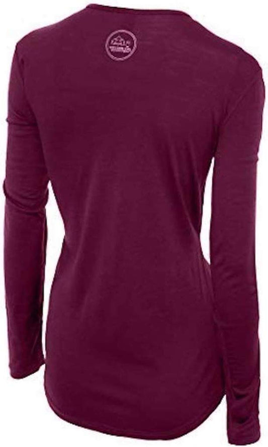
Our merino base layers are 100% Australian merino at 17.5 micron, and a long sleeve merino wool base layer for women with a merino base layer bottom is the foundation. The Colca pattern is a pre-dawn start at or below freezing, a hard climb that soaks you, and a rim at twenty degrees in fierce sun, repeated. Wool handles that because it insulates when damp and does not stink after three days without washing, which on a three-day trek with one change of clothes is a practical rather than aesthetic point. The bottoms are for the Chivay nights and the 4am start.
A fleece and an insulated jacket, because the nights are genuinely cold
A Columbia Fast Trek fleece and a Columbia Powder Lite insulated jacket over it. Chivay at night is around freezing and many guesthouses in the valley are unheated with thin walls, so the insulated layer is for sitting still indoors as much as for the dawn at Cruz del Condor, where you will be standing in cold wind waiting for thermals to build.
Boots, and this is the item that decides whether the descent goes well
Merrell Moab 3 waterproof hiking boots with Darn Tough merino hiking socks. The path is loose dirt and stone on steep switchbacks, and ankle support plus a sole that grips on scree is what keeps you upright on the way down. Break them in before you come. Take two pairs of socks for the overnight.
Sun protection, which matters more than the cold
A wide brim sun hat, high-factor sunscreen reapplied, and sunglasses with real UV protection. At 3,500 metres the burn arrives without the heat that usually warns you, and the rim has no shade at all. A long-sleeved layer is better sun protection than sunscreen on a trek.
The small things, and several are specific to altitude
Far more water capacity than you expect, two litres minimum for the descent and three for the climb out, because dehydration both worsens altitude symptoms and is harder to notice in dry cold air. Rehydration salts. Coca tea is offered everywhere and genuinely helps mild symptoms; acetazolamide is worth discussing with a doctor before you travel rather than buying on arrival. A head torch, because the climb out starts in the dark and Sangalle has limited power. Trekking poles, which help on the descent more than anything else on this list and which we mention without a link because the only poles entry in our product register has an unresolved product identity. Cash in soles, since Cabanaconde and Sangalle have no reliable card facilities and the valley tourist ticket is cash. Lip balm and moisturiser for the dry air. And a swimsuit, for the Sangalle pools and the hot springs, which is the one luxury of this trip.
Recommended Tours and Experiences
Essential Resources for Women in Colca Canyon
Emergency numbers: 105 for police and 116 for fire and ambulance, with very limited English. iPeru, the state tourist information and assistance service, is the number worth saving, reachable on 01 574 8000 and with an office in Arequipa; it is free, it handles complaints about operators and it is the body that will tell you whether a trekking agency is registered, which on a trek at altitude is a safety question rather than a consumer one. There is no mobile coverage on most of the Colca trail or at Sangalle.
US State Department travel advisory: the Peru advisory. Read the current level there directly rather than relying on a figure printed in any guide.
UK FCDO travel advice: gov.uk/foreign-travel-advice/peru, and read the safety and security page rather than only the landing page, because that is where the substance sits.
Peru has no reciprocal health agreement with the UK or the United States, so insurance with medical cover and repatriation is essential, and it should cover trekking at altitude if you intend to walk. Private clinics in Lima, Cusco and Arequipa are good and will want payment or an insurance guarantee up front; public provision outside the cities is thin. A farmacia handles minor problems. DO NOT DRINK THE TAP WATER anywhere in Peru. ALTITUDE IS THE REAL HEALTH RISK rather than anything exotic: Cusco is 3,400 metres and the Sacred Valley around 2,800, soroche is common, and the honest response is to arrive low, ascend slowly, drink more water than feels necessary and treat a bad headache as a reason to descend. YELLOW FEVER vaccination is recommended for the Amazon lowlands and some onward countries ask for a certificate.
Main hospital: Chivay has a small health post and Cabanaconde has a basic clinic, and neither is equipped for anything serious. Arequipa is the medical destination and it is four to six hours away by road, with the Clinica Arequipa and the Hospital Nacional Carlos Alberto Seguin the main options and the city holding the only facilities in the region capable of handling a serious altitude illness or a major injury. That distance is the central medical fact of a Colca trip: an evacuation from the canyon floor means being carried or ridden out on a mule to Cabanaconde first, then driven. Confirm that your insurance covers trekking above 3,000 metres and evacuation, because many standard policies exclude altitude trekking and the exclusion is usually set somewhere between 2,500 and 4,000 metres, which is exactly the band this trip sits in. Carry the policy number and the insurer's emergency line somewhere reachable without the internet.
Official health authority: the Peruvian Ministry of Health. ALTITUDE IS THE PRIMARY MEDICAL RISK. Chivay sits at 3,650 metres and the road in crosses 4,900, fitness is not protection, and the only reliable treatment is descent, which Colca fortunately always offers. The warning signs that mean going down immediately are breathlessness at rest, a cough, confusion, loss of coordination or a severe headache that does not respond to painkillers. CHECK THAT YOUR INSURANCE COVERS TREKKING ABOVE 3,000 METRES, because many policies exclude it
US Embassy: the United States Embassy in Lima.
Official tourism authority: PromPeru, the national tourism board. TWO THINGS THAT DECIDE THE TRIP. CRUZ DEL CONDOR IS A DAWN APPOINTMENT: the condors ride the thermals between roughly seven and nine in the morning and later in the day you may see nothing, so an itinerary arriving at eleven has been sold badly. And ACCLIMATISE IN AREQUIPA FIRST for two or three nights, because going from 2,335 metres to 3,650 on day one of a Peru trip is how people spend Colca in a hotel room. The valley-wide tourist ticket is cash
Acclimatise in Arequipa for two or three nights before going up. Fitness is not protection against altitude.
Be at Cruz del Condor between seven and nine in the morning. Later and you may see nothing at all.
Check that your insurance covers trekking above 3,000 metres. Many policies exclude exactly this band.
If altitude symptoms are worse in the morning than the night before, go down. Descent is always available here.
Solo women safety assessment: The Colca valley is one of the more straightforward parts of Peru for a woman travelling alone. It carries no advised-against designation, Cabanaconde and the valley villages are small agricultural places thoroughly used to trekkers, the Sangalle trail carries a steady stream of walkers in season, and solo female trekkers are common and unremarkable here. The ordinary Peruvian precautions apply in Arequipa at either end of the trip, principally about taxis booked rather than hailed and bags watched on buses. WHAT IS ACTUALLY DANGEROUS IS ALTITUDE, THE DESCENT AND THE SUN. Chivay is at 3,650 metres and the road in crosses 4,900; altitude sickness affects fit young people as readily as anyone, fitness is not protection, and the signs that mean descending immediately are breathlessness at rest, a cough, confusion, loss of coordination or a severe headache that painkillers do not touch. The one mercy is that descent is always available, with the canyon floor 1,200 metres lower and Arequipa 1,300 lower, so acclimatise in Arequipa for two or three nights first, go up slowly, drink far more than usual, skip alcohol at first, and go down if symptoms worsen overnight. THE DESCENT HURTS MORE PEOPLE THAN THE CLIMB: loose dirt and stone switchbacks with unguarded drops, where knees, ankles and falls on scree are the injuries, so use poles, wear boots with ankle support, go down slowly and do not start in afternoon heat. If you doubt the 1,200 metre climb out, hire a mule in advance rather than discovering the problem at four in the morning. THE SUN AT THIS ALTITUDE IS THE MOST UNDERESTIMATED HAZARD IN THE ANDES, burning hard on days that feel cold, with no shade on the rim. There is no mobile coverage on most of the trail or at Sangalle, so leave your plan and expected return with your accommodation in Cabanaconde. Medically you are four to six hours from Arequipa, an evacuation from the canyon floor starts with a mule, and many insurance policies exclude trekking in exactly this altitude band.
Reading On
Colca is reached from Arequipa and sits in the high Andes between two better-known destinations. The Arequipa packing list covers the city four to six hours south that is the gateway, the acclimatisation stop and the nearest real hospital, and which carries its own section on this canyon; this page is the longer version and the two should be read together. The Puno packing list covers Lake Titicaca, which is higher again and is the usual onward leg. The Cusco packing list covers the city most Peru trips revolve around. For the country as a whole the Peru travel guide for women and the Peru packing list carry the altitude guidance, the transport and the practical material in full. For why wool is the right fibre for a thirty-degree swing in a single day, read the guide to merino wool base layers for women. Every destination we cover is indexed at the travel packing guide for women, and the base layers are at the Roman Trail collection.

If the outer journey is calling you, the inner one usually is too. Explore SoulMap at romantrail.com/blogs/soulmap.