

Salt Lake City sits at about 4,300 feet in a valley with the Wasatch Range rising more than 7,000 feet directly above its eastern suburbs and a shrinking salt lake to the west. It was founded in 1847 by Mormon pioneers who had walked across the continent, it is laid out on a grid of enormous blocks numbered outward from one point, and it has four world-class ski resorts within forty minutes of the airport.
Disclosure: This post contains affiliate links. If you buy through them, Roman Trail earns a small commission at no extra cost to you.
What Is Here
TEMPLE SQUARE IS THE CENTRE OF THE CITY AND THE TABERNACLE IS THE HERO IMAGE. The 1867 Tabernacle is an extraordinary building: a self-supporting domed roof spanning 150 feet built without interior columns, with acoustics so precise that the guides demonstrate them by dropping a pin at the front, and an organ of over 11,000 pipes. THE TABERNACLE CHOIR REHEARSES THURSDAY EVENINGS AND PERFORMS SUNDAY MORNINGS AND BOTH ARE FREE AND OPEN TO ANYONE, which is the single best free thing in the city and almost no visitor plans for it. Organ recitals run most days. CHECK THE CURRENT SCHEDULE, because it moves.
AND THE TEMPLE ITSELF IS NOT VISIBLE AS YOU WOULD EXPECT, WHICH IS WORTH KNOWING BEFORE YOU ARRIVE. The Salt Lake Temple has been closed for a major seismic renovation since 2019, with much of the square a construction site and the building scaffolded for years. It appears in none of our photographs and in many visitors' photographs it is behind hoarding. PARTS OF THE SQUARE HAVE REOPENED IN STAGES, so check what is accessible. Note also that the temple interior is never open to non-members, before or after the work; the square, the Tabernacle and the visitor centres are open to all.

THE UTAH STATE CAPITOL IS THE SECOND IMAGE AND IT IS FREE. A neoclassical dome on a hill above the city with a view down the valley, free to walk into, and the grounds carry cherry blossom in spring.
THE SKIING IS THE REAL ARGUMENT FOR THIS CITY AND THE PROXIMITY IS THE POINT. Alta and Snowbird up Little Cottonwood Canyon, Brighton and Solitude up Big Cottonwood, all within about forty minutes of the airport, with Park City over the hill. The snow is genuinely unusual: dry, light and abundant, because storms cross the Great Salt Lake and pick up moisture on the way. ALTA DOES NOT ALLOW SNOWBOARDS, which still surprises people.
THE CANYON ROADS CLOSE AND THE CLOSURES ARE AVALANCHE CONTROL RATHER THAN WEATHER. Little Cottonwood in particular runs under some of the most active avalanche terrain of any road in the country, and the Utah Department of Transportation closes it for control work and sometimes issues INTERLODGE, an order requiring everyone at Alta and Snowbird to stay indoors. If you are driving up, TRACTION LAWS APPLY and are enforced: four-wheel drive with mud-and-snow tyres, or chains. THE UTA SKI BUS IS OFTEN THE BETTER CHOICE because canyon parking now requires reservations at some resorts.
THE GREAT SALT LAKE IS SHRINKING AND THAT IS THE DEFINING ENVIRONMENTAL STORY HERE. It fell to record lows in 2022 and has partly recovered, and the exposed lakebed carries arsenic-bearing dust that blows into the valley. ANTELOPE ISLAND STATE PARK is the place to see the lake, with bison and a causeway, and visitors should know that the water is often far from the old shoreline and THE BRINE FLIES AND THE SMELL ARE REAL in summer.
THE THIRD IMAGE IS THE WASATCH OVER THE CITY, which is the view from almost everywhere.
THE GRID IS LOGICAL AND THE BLOCKS ARE ENORMOUS. Addresses count outward from Temple Square, so 400 South 300 East is four blocks south and three east of it. The blocks are about 200 metres on a side, which makes walking distances deceptive: a ten-block walk is two kilometres.
THE LIQUOR LAWS ARE UNUSUAL AND LOOSER THAN THEIR REPUTATION. Restaurants and bars serve alcohol; draught beer is capped at 5 per cent ABV; stronger beer, wine and spirits come from state liquor stores, which CLOSE ON SUNDAYS AND PUBLIC HOLIDAYS.
When to Go
December to early April for skiing, which is the main season, with February and March usually the best snow.
September and early October for hiking the canyons in autumn colour, which is the best non-ski time.
May and June are pleasant with snowmelt still running in the canyons.
July and August are hot and dry, frequently above 35 degrees Celsius in the valley, with the mountains twenty minutes away and fifteen degrees cooler.
JANUARY AND FEBRUARY BRING THE INVERSION AND IT IS THE REASON TO THINK TWICE ABOUT A MIDWINTER CITY BREAK HERE. Cold air settles in the valley under a lid of warmer air and pollution accumulates for days or weeks, producing some of the worst air quality in the United States. THE MOUNTAINS ARE ABOVE IT IN CLEAR SUNSHINE, which is the local answer: go up. If you have asthma or any respiratory condition, check the air quality index before booking winter dates.
Getting There
By air, Salt Lake City International is a Delta hub about fifteen minutes from downtown, with the TRAX GREEN LINE light rail running from the terminal to the centre cheaply. IT IS ONE OF THE CLOSEST MAJOR AIRPORTS TO SKIING ANYWHERE.
By car, on Interstates 15 and 80.
By train, Amtrak's California Zephyr stops in the middle of the night.
TRAX LIGHT RAIL AND THE FRONTRUNNER COMMUTER TRAIN ARE GOOD, and there is a FREE FARE ZONE covering much of downtown. The UTA ski buses serve all four Cottonwood resorts in season. You can do this city and the skiing without a car, which is rare in the American West.
Is Salt Lake City Safe for Women?
The FCDO publishes no advised-against areas anywhere in the United States and no country-level warning. Its guidance concentrates on the practical differences a British visitor meets: entry requirements and ESTA, the cost of healthcare without insurance, extreme weather including hurricanes on the Atlantic and Gulf coasts between June and November, and wildfires, which the FCDO describes as a danger in many dry areas, particularly in canyons, hills and forests.
Salt Lake City is a safe, easy city for a woman alone. Downtown, the Avenues, Sugar House, 9th and 9th and the university area are all comfortable. Property crime runs around the American urban average and car break-ins at canyon trailheads are the realistic risk. The area immediately west of downtown around the Rio Grande has a visible homelessness and drug problem and is not somewhere a visitor needs to be at night.
ALTITUDE AT 4,300 FEET IS MILD AND THE CANYONS ARE NOT. Trailheads start at 7,000 to 8,000 feet and peaks exceed 11,000, so arrivals from sea level will be breathless and dehydrated fast. Give yourself a day before a hard hike or a hard ski day.
AVALANCHE IS A SERIOUS AND LOCAL RISK, NOT A DISTANT ONE. The Cottonwood canyons have some of the most active avalanche terrain in the lower 48, the Utah Avalanche Center publishes a daily forecast, and ANY BACKCOUNTRY OR SIDECOUNTRY TRAVEL REQUIRES THAT FORECAST, a transceiver, a shovel, a probe and the training to use them. In-bounds skiing at the resorts is controlled; stepping outside a boundary rope is not.
WINTER AIR QUALITY DURING AN INVERSION IS A GENUINE HEALTH ISSUE and the official advice on bad days is to limit outdoor exertion in the valley.
THE SUN AT ALTITUDE ON SNOW IS SEVERE and burning on a chairlift in February is routine.
CANYON ROADS: TRACTION LAWS ARE ENFORCED, closures are frequent and INTERLODGE can confine you indoors. Do not attempt Little Cottonwood in a two-wheel-drive hire car on summer tyres in a storm.
FLASH FLOODING in the canyons and in Utah's slot country in the summer monsoon, and rattlesnakes in the foothills.
The Salt Lake City Packing List
Dry air, big daily swings, fierce sun on snow and genuine winter.
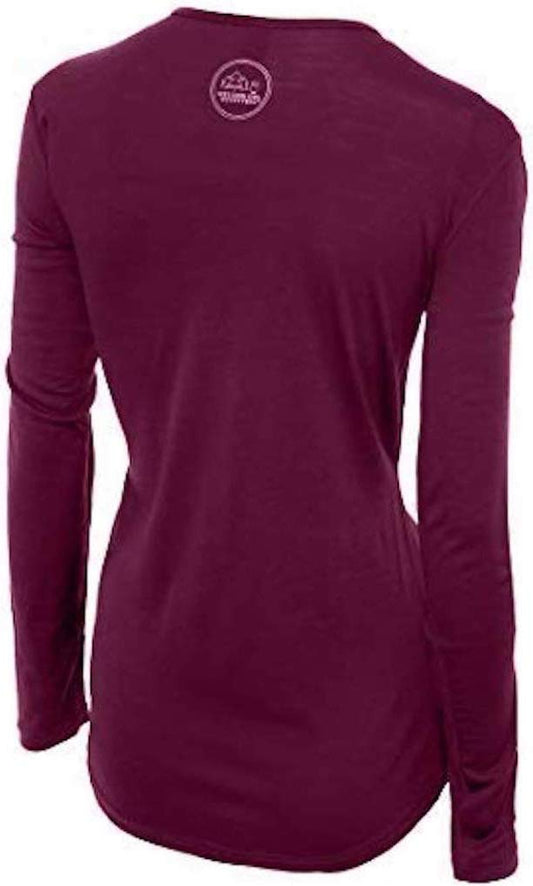
Our merino base layers are 100% Australian merino at 17.5 micron, and a long sleeve merino wool base layer for women is the foundation of a Utah winter bag, and the reason is the specific shape of a ski day here: you are cold on a chairlift, hot skiing down, and then in a warm restaurant in the valley, and wool is the only layer that handles being sweated through and then sat still in at altitude. From October to May add a heavyweight merino base layer and merino base layer bottoms.
A waterproof insulated ski parka for winter, over a Columbia Fast Trek II fleece.
A merino beanie and insulated winter gloves.
Not linked and worth packing, and the first two matter more here than almost anywhere: HIGH-FACTOR SUNSCREEN AND PROPER SNOW GOGGLES OR WRAPAROUND SUNGLASSES, because sun on snow at 9,000 feet burns faces and eyes within an hour; HEAVY MOISTURISER AND LIP BALM for air this dry; A LARGE WATER BOTTLE, since altitude plus dry air dehydrates you without sweating; MICROSPIKES for icy valley pavements and spring trails; AN AIR QUALITY APP for the inversion; AND A CHECK OF UDOT'S CANYON ROAD STATUS AND YOUR HIRE CAR'S TYRES before driving up. The US is almost entirely card-based and tipping is expected at 18 to 20 per cent.
Recommended Tours and Experiences
Essential Resources for Women in Salt Lake City
Emergency numbers: 911 for police, ambulance and fire, free from any phone including a locked mobile. Calls are answered locally and dispatchers will stay on the line. For non-urgent police matters many cities also run a 311 information line.
THE TABERNACLE CHOIR REHEARSES THURSDAY EVENINGS AND PERFORMS SUNDAY MORNINGS, BOTH FREE AND OPEN TO ANYONE, and organ recitals run most days: it is the best free thing in the city and almost nobody plans for it, so check the current schedule. THE SALT LAKE TEMPLE HAS BEEN CLOSED AND SCAFFOLDED FOR A MAJOR SEISMIC RENOVATION SINCE 2019 with Temple Square reopening in stages, so check what is accessible; the temple interior is never open to non-members, while the square, Tabernacle and visitor centres are open to all. THE UTAH STATE CAPITOL IS FREE. AVALANCHE IS A SERIOUS LOCAL RISK: the Cottonwood canyons hold some of the most active avalanche terrain in the lower 48, the UTAH AVALANCHE CENTER publishes a daily forecast, and any backcountry or sidecountry travel needs that forecast plus a transceiver, shovel, probe and the training to use them. CANYON ROADS CLOSE FOR AVALANCHE CONTROL, TRACTION LAWS ARE ENFORCED requiring four-wheel drive with mud-and-snow tyres or chains, and INTERLODGE orders can confine everyone at Alta and Snowbird indoors; the UTA SKI BUS is often the better choice since some resorts require parking reservations. ALTA DOES NOT ALLOW SNOWBOARDS. JANUARY AND FEBRUARY INVERSIONS produce some of the worst air quality in the United States for days or weeks, with the mountains above it in sunshine: check the air quality index before booking winter dates if you have a respiratory condition. ALTITUDE IS 4,300 FEET IN THE VALLEY AND 7,000 TO 11,000 IN THE CANYONS. SUN ON SNOW AT ALTITUDE BURNS WITHIN AN HOUR. THE BLOCKS ARE ABOUT 200 METRES, so a ten-block walk is two kilometres. STATE LIQUOR STORES CLOSE SUNDAYS AND HOLIDAYS and draught beer is capped at 5 per cent. THE GREAT SALT LAKE IS SHRINKING and exposed lakebed dust is an air quality concern. TRAX runs from the airport and downtown has a free fare zone.
US State Department travel advisory: there is none, and this is not an omission. The State Department issues travel advisories for other countries, not for the United States itself, so no US advisory for this destination exists to link. In its place, the Government of Canada advice for the United States gives an equivalent third-country assessment.
UK FCDO travel advice: gov.uk/foreign-travel-advice/usa, and read the safety and security page rather than only the landing page, because that is where the substance sits. The FCDO names no advised-against areas anywhere in the United States. The same advice also covers Puerto Rico, the US Virgin Islands, Guam, American Samoa and the Northern Mariana Islands.
Main hospital: the University of Utah Hospital on North Medical Drive is the region's Level I trauma centre with a 24 hour emergency department and serves a vast area of the Intermountain West; Intermountain Medical Center in Murray is the other major one. Dial 911 for police, ambulance or fire, and note that a backcountry or avalanche incident also goes through 911, which dispatches the county sheriff's search and rescue teams: give a canyon and a trailhead rather than a street. This is the single biggest practical difference for a visitor: there is no public health system, an emergency room visit without insurance can run into thousands of dollars, and an ambulance is billed separately and is not free. Comprehensive travel insurance with a high medical limit is not optional in the United States, and you should carry your policy number and the insurer's 24 hour number somewhere you can reach them. Urgent care clinics handle anything short of an emergency far more cheaply and quickly than an emergency room, and are the right choice for a sprain, an infection or stitches.
Official health authority: the CDC travellers' health pages, the US federal health authority for visitors, covers the US public health guidance, with the Utah air quality monitoring the authority for winter inversion advisories
Embassy contact: the United States is the host country, so there is no US embassy to contact. Your own country's embassy is in Washington DC, with consulates in New York, Los Angeles, Chicago, Houston, San Francisco, Miami and Boston. Find yours before you travel and save the number.
Official tourism authority: Brand USA, the national tourism marketing body, covers Salt Lake City and Utah visitor information, with the Utah Department of Transportation the authority for canyon road closures and traction laws and the Utah Avalanche Center for the daily avalanche forecast
Takeaways
The Tabernacle choir is free on Thursday evenings and Sunday mornings.
The temple is scaffolded for a seismic renovation. Check what is open.
Check the avalanche forecast and UDOT before any canyon day.
January inversions can give the worst air in the country. Go up the canyon.
Solo women safety assessment: Salt Lake City is an easy and comfortable city to travel alone. It is clean, orderly, laid out on a grid you cannot get lost in, and served by light rail from the airport and a free fare zone downtown, which makes it unusually navigable without a car for the American West. Downtown, the Avenues, Sugar House, 9th and 9th and the university district are all pleasant, and eating alone is unremarkable. The one area to note is immediately west of downtown around the Rio Grande, which has a visible homelessness and drug problem and is not anywhere a visitor needs to be after dark. Car break-ins at canyon trailheads are the realistic crime. 911 REACHES POLICE, AMBULANCE AND FIRE free from any phone; the University of Utah Hospital is the Level I trauma centre for a vast area of the Intermountain West; and 911 also dispatches county search and rescue, so if you are hurt in a canyon give the canyon and the trailhead. THE UNITED STATES HAS NO PUBLIC HEALTH SERVICE FOR VISITORS and insurance is essential, and should cover skiing if that is why you are here. TWO HAZARDS ARE SPECIFIC AND SERIOUS. Avalanche: the Cottonwood canyons carry some of the most active avalanche terrain in the lower 48, so in-bounds resort skiing is controlled and stepping past a boundary rope is not, the Utah Avalanche Center forecast is a daily necessity rather than a formality, and canyon roads close for control work with traction laws enforced. And the winter inversion, which traps pollution in this valley for days and can give it the worst air in the United States, while the mountains sit above it in clear sun. Altitude, dry air and sun on snow are the quieter three: you will dehydrate without sweating and burn on a chairlift in February.
Reading On
Salt Lake City is the gateway to southern Utah and the Wasatch, and the Zion packing list, the Bryce Canyon packing list and the Arches packing list cover the red rock parks that most visitors fly in here to reach. East along the Front Range, the Denver packing list, the Boulder packing list and the Colorado Springs packing list cover Colorado, which shares the altitude and the afternoon lightning. West, the Mammoth Lakes packing list and the Lake Tahoe packing list cover the Sierra and the Las Vegas packing list the desert south. North, the Yellowstone packing list and the Boise packing list cover the northern Rockies. For the country, the United States travel guide for women carries the transport, the health insurance question and the regions in full. For why wool handles a cold chairlift, a hot descent and a warm restaurant in one day, read the guide to merino wool base layers for women. Every destination we cover is indexed at the travel packing guide for women, and the base layers are at the Roman Trail collection.

If the outer journey is calling you, the inner one usually is too. Explore SoulMap at romantrail.com/blogs/soulmap.