

Boise is the capital of Idaho, a high desert city at about 2,700 feet where the Boise River comes out of the mountains and the foothills rise straight out of the suburbs. It is the fastest-growing small city in the American West, it has a downtown you can cross in fifteen minutes, and it holds something no other American city does at this scale: a Basque community with its own street, its own museum and its own living language.
Disclosure: This post contains affiliate links. If you buy through them, Roman Trail earns a small commission at no extra cost to you.
What Is Here
THE BASQUE BLOCK IS THE MOST UNUSUAL THING IN BOISE AND ALMOST NO VISITOR ARRIVES KNOWING ABOUT IT. Basque shepherds came to southern Idaho from the late nineteenth century and the community that grew here is among the largest outside the Basque Country itself. A short stretch of Grove Street holds the Basque Museum and Cultural Center, the 1864 Cyrus Jacobs-Uberuaga boarding house, a frontoi, which is the handball court, restaurants serving croquetas and beef tongue, and a mural. JAIALDI, the enormous Basque festival, runs every five years in late July and fills the city entirely, so check whether your dates coincide.
THE GREENBELT IS 25 MILES OF RIVERSIDE PATH AND IT IS THE SPINE OF THE CITY. Paved, flat, tree-shaded and almost entirely separated from traffic, running from Lucky Peak through the centre and out west. It is free, it is how locals commute, and it is the best thing here. The river beside it is the summer float: hire a raft or tube at Barber Park and come out at Ann Morrison Park about two to three hours later.

THE FOOTHILLS HOLD ABOUT 190 MILES OF TRAIL STARTING AT THE EDGE OF TOWN. The Ridge to Rivers network runs from trailheads you can reach on foot from downtown, up into dry grass and sagebrush with the whole valley below. SAID HONESTLY: our three photographs of Boise are a downtown street, a city sign and the university's football field, so the foothills and the greenbelt that are the real reasons to come are described in this post and not shown in it.
THE BLUE TURF IS THE THIRD IMAGE AND IT IS GENUINELY FAMOUS. Boise State's Albertsons Stadium has had a blue playing surface since 1986, the first non-green field in American football, and it is visible from the air. The campus sits on the river beside the greenbelt.
THE IDAHO STATE CAPITOL IS FREE TO WALK INTO, is the only state capitol in the United States heated by geothermal water, and Boise has one of the oldest geothermal district heating systems in the world, warming much of downtown from hot water out of the ground.
BOGUS BASIN IS SIXTEEN MILES UP A STEEP WINDING ROAD, a non-profit ski area with night skiing, and it is close enough that locals go after work. THE ROAD IS NARROW WITH SWITCHBACKS AND REQUIRES TRACTION IN WINTER.
THE OREGON TRAIL AND THE BIRDS OF PREY AREA are the day trips: the Morrison Knudsen Nature Center in town, and the Morley Nelson Snake River Birds of Prey National Conservation Area south of the city, which has one of the densest concentrations of nesting raptors in North America.
When to Go
May to June and September to October. Warm, dry, the foothills green in spring and gold in autumn.
July and August are hot, in the nineties and often over 100 degrees Fahrenheit, with very low humidity. The river and the greenbelt shade are what make it liveable, and the foothills become genuinely dangerous to hike in the afternoon.
WILDFIRE SMOKE IS THE SERIOUS SUMMER PROBLEM AND NO ADVISORY MENTIONS IT. From roughly July to September, smoke from fires across Idaho, Oregon, Washington, California and British Columbia settles into this valley for days at a time at unhealthy air quality levels, with the mountains disappearing entirely. CHECK THE AIR QUALITY INDEX ALONGSIDE THE FORECAST and take it seriously if you have asthma.
Winter is cold and grey with an INVERSION that traps fog and poor air in the valley for days, which is the other air quality season. Snow in town is light; Bogus Basin has it.
Getting There
By air, Boise Airport is ten minutes from downtown, with direct flights from most western hubs and a city bus.
By car, on Interstate 84. About five and a half hours from Salt Lake City, seven from Portland, nine from Seattle. IDAHO DISTANCES ARE LARGE and there is a great deal of empty road between towns.
THERE IS NO PASSENGER RAIL SERVICE TO BOISE. Amtrak withdrew the Pioneer route in 1997 and nothing has replaced it, which surprises people planning a western rail trip.
You can manage downtown without a car and will want one otherwise. Downtown, the greenbelt, the Basque Block, the capitol and the university are all walkable or a short bike ride, and the bike share covers it. Bogus Basin, the conservation area and most trailheads need a vehicle.
Is Boise Safe for Women?
The FCDO publishes no advised-against areas anywhere in the United States and no country-level warning. Its guidance concentrates on the practical differences a British visitor meets: entry requirements and ESTA, the cost of healthcare without insurance, extreme weather including hurricanes on the Atlantic and Gulf coasts between June and November, and wildfires, which the FCDO describes as a danger in many dry areas, particularly in canyons, hills and forests.
Boise is consistently among the safest cities of its size in the United States and is genuinely comfortable for a woman travelling alone. Downtown, the North End, Hyde Park, the Boise State area and the greenbelt are all easy, and crime against visitors is largely limited to car break-ins at trailheads, which is the western American constant. The greenbelt is busy by day and empties at dusk, so finish before dark or stay on the lit central stretches.
SUMMER HEAT IN THE FOOTHILLS IS THE MOST LIKELY WAY TO BE HURT HERE. Those trails have no shade, no water and no shelter, they are a short walk from town so people set out casually, and afternoon temperatures above 100 degrees Fahrenheit in bone-dry air cause heat illness fast. Go early, carry far more water than feels necessary, and turn round.
THE AIR IS EXTREMELY DRY and you dehydrate without visible sweating in both the summer heat and the winter cold.
THE BOISE RIVER IS COLD AND FASTER THAN IT LOOKS. It is snowmelt-fed, cold enough for cold-water shock in July, and the float is closed when flows are too high in early summer. CHECK WHETHER THE FLOAT IS OPEN rather than turning up with a tube, and wear a buoyancy aid.
WILDFIRE CLOSES TRAILS AND ROADS AT SHORT NOTICE in late summer, and fire restrictions can ban open flames entirely.
RATTLESNAKES ARE COMMON IN THE FOOTHILLS from spring to autumn, which is worth knowing because the trails look like gentle grassland. Stay on the path and watch where you step and sit.
TICKS ARE PRESENT IN SPRING in the sagebrush, and the Bogus Basin road is steep, winding and icy in winter.
The Boise Packing List
High desert: strong sun, very dry air, hot days, cool nights, cold river.
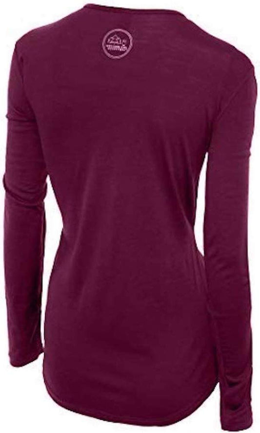
Our merino base layers are 100% Australian merino at 17.5 micron, and a long sleeve merino wool base layer for women fits the high desert pattern: the swing from a hundred-degree afternoon to a sixty-degree evening is routine, you get soaked on the river and then ride a shaded path, and wool is right in all three states where cotton is wrong in two. From November to March add a heavyweight merino base layer.
A Columbia Fast Trek II fleece for evenings in any month and for Bogus Basin, and a Marmot PreCip Eco rain jacket, which here is mostly a windbreaker for the foothills ridges.
A wide brim sun hat and a long sun hoodie, which are not optional on shadeless foothill trails in summer.
Walking shoes with grip for dusty, loose foothills trail that is slippery when dry.
Not linked and worth packing: HIGH-FACTOR SUNSCREEN, LIP BALM AND MOISTURISER, because Boise's dryness is in the same class as Albuquerque's; A LARGE WATER BOTTLE AND A SECOND ONE FOR THE FOOTHILLS, where there is no water at all; A SWIMSUIT AND SHOES YOU CAN SOAK for the river float; AN AIR QUALITY APP for smoke season and winter inversions; AND A BUOYANCY AID FOR THE FLOAT, which we give unlinked because our affiliate register holds no life jacket of any kind and pointing you at something else would be worse than saying so. The US is almost entirely card-based and tipping is expected.
Recommended Tours and Experiences
Essential Resources for Women in Boise
Emergency numbers: 911 for police, ambulance and fire, free from any phone including a locked mobile. Calls are answered locally and dispatchers will stay on the line. For non-urgent police matters many cities also run a 311 information line.
TWO AIR QUALITY SEASONS HERE AND NEITHER APPEARS IN ANY TRAVEL ADVISORY. WILDFIRE SMOKE from roughly July to September settles into this valley for days at unhealthy levels, with the mountains vanishing entirely and no advance warning; WINTER INVERSIONS trap fog and poor air for similar stretches. Check the air quality index beside the forecast and take it seriously with any respiratory condition. HEAT IN THE FOOTHILLS IS THE MOST LIKELY INJURY: those 190 miles of trail start at the edge of town, so people set off casually, and they have no shade, no water and no shelter in afternoon temperatures that exceed 100 degrees Fahrenheit in bone-dry air. Go early and carry far more water than feels needed. THE BOISE RIVER IS SNOWMELT-FED AND COLD ENOUGH FOR COLD-WATER SHOCK IN JULY, faster than it looks, and THE OFFICIAL FLOAT CLOSES WHEN FLOWS ARE HIGH IN EARLY SUMMER, so check before arriving with a tube and wear a buoyancy aid. RATTLESNAKES ARE COMMON IN THE FOOTHILLS spring to autumn on trails that look like gentle grassland, and ticks are present in spring sagebrush. WILDFIRE CLOSES TRAILS AND ROADS at short notice and restrictions can ban open flames. THE BOGUS BASIN ROAD is sixteen miles of steep switchbacks needing traction in winter. THERE IS NO PASSENGER RAIL TO BOISE. CAR BREAK-INS AT TRAILHEADS are the main crime against visitors. The greenbelt empties at dusk. JAIALDI, the Basque festival, fills the city every five years in late July.
US State Department travel advisory: there is none, and this is not an omission. The State Department issues travel advisories for other countries, not for the United States itself, so no US advisory for this destination exists to link. In its place, the Government of Canada advice for the United States gives an equivalent third-country assessment.
UK FCDO travel advice: gov.uk/foreign-travel-advice/usa, and read the safety and security page rather than only the landing page, because that is where the substance sits. The FCDO names no advised-against areas anywhere in the United States. The same advice also covers Puerto Rico, the US Virgin Islands, Guam, American Samoa and the Northern Mariana Islands.
Main hospital: Saint Alphonsus Regional Medical Center on West Curtis Road is the region's Level II trauma centre with a 24 hour emergency department, and St Luke's Boise Medical Center on East Bannock Street is the other central option. Dial 911 for police, ambulance or fire, and note that a foothills or river incident also goes through 911, which dispatches Ada County search and rescue, so name the trailhead or the river access point rather than a street. This is the single biggest practical difference for a visitor: there is no public health system, an emergency room visit without insurance can run into thousands of dollars, and an ambulance is billed separately and is not free. Comprehensive travel insurance with a high medical limit is not optional in the United States, and you should carry your policy number and the insurer's 24 hour number somewhere you can reach them. Urgent care clinics handle anything short of an emergency far more cheaply and quickly than an emergency room, and are the right choice for a sprain, an infection or stitches.
Official health authority: the CDC travellers' health pages, the US federal health authority for visitors, covers the US public health guidance, with the Idaho air quality monitoring the authority for wildfire smoke and winter inversions
Embassy contact: the United States is the host country, so there is no US embassy to contact. Your own country's embassy is in Washington DC, with consulates in New York, Los Angeles, Chicago, Houston, San Francisco, Miami and Boston. Find yours before you travel and save the number.
Official tourism authority: Brand USA, the national tourism marketing body, covers Boise and Idaho visitor information, the Ridge to Rivers foothills trail conditions and the official river float status
Takeaways
Go to the Basque Block. It is the most unusual thing in the city.
Check the air quality index: wildfire smoke in summer, inversions in winter.
The foothills have no shade and no water. Early mornings only in summer.
Check whether the river float is open before you hire a tube.
Solo women safety assessment: Boise is among the most comfortable American cities in this library to visit alone. It ranks consistently as one of the safest cities of its size in the United States, the downtown is compact enough to cross in fifteen minutes and busy into the evening, the North End and Hyde Park are quiet residential streets, and the greenbelt and university area are full of people on foot and bikes all day. There is no district to avoid and eating alone anywhere downtown is completely unremarkable. The crime that realistically affects visitors is the car break-in at foothills trailheads, which is endemic across the American West, so leave nothing visible in a parked vehicle. The greenbelt is busy by day and empties at dusk, so finish before dark or stay on the lit central stretches. 911 REACHES POLICE, AMBULANCE AND FIRE free from any phone; Saint Alphonsus Regional Medical Center on West Curtis Road is the region's Level II trauma centre; and 911 also dispatches Ada County search and rescue, so if you are hurt in the foothills give the trailhead name rather than a street. THE UNITED STATES HAS NO PUBLIC HEALTH SERVICE FOR VISITORS and insurance is essential. THE RISKS HERE ARE ENVIRONMENTAL AND THE FOOTHILLS ARE THE TRAP, precisely because they begin at the edge of the suburbs and look like gentle grassland: there is no shade, no water and no shelter, afternoon temperatures exceed 100 degrees Fahrenheit in air so dry you dehydrate without sweating, and rattlesnakes are common on exactly those trails from spring to autumn. Go early, carry more water than you think you need, and watch where you sit. The Boise River is snowmelt-fed and cold enough for cold-water shock in July, faster than it looks, and the official float closes in high flows. Both summer wildfire smoke and winter inversions can make the air genuinely unhealthy for days.
Reading On
Boise is the capital of a thinly covered corner of the American West and the distances from it are large, which is part of the character. North west, the Bend packing list is the closest comparable high desert town across the Oregon line, sharing the smoke season, the cold rivers and the volcanic ground; beyond it the Seattle packing list and the Olympic packing list cover the wet side of the Cascades. East, the Yellowstone packing list and the Glacier packing list cover the northern Rockies, with the Denver packing list and the Boulder packing list covering the Colorado Front Range, where the altitude is considerably higher. South, the Zion packing list and the Arches packing list cover the red rock country. For the country, the United States travel guide for women carries the transport, the health insurance question and the regions in full. For why wool works in hundred-degree dry heat, a sixty-degree evening and a cold river in the same day, read the guide to merino wool base layers for women. Every destination we cover is indexed at the travel packing guide for women, and the base layers are at the Roman Trail collection. East across the state line, the Spokane packing list covers the other inland Northwest city, on the dry side of the Cascades with the same cold clear winters and the same wildfire smoke seasons.

If the outer journey is calling you, the inner one usually is too. Explore SoulMap at romantrail.com/blogs/soulmap.