

Photograph: Park City, Utah by claralieu, CC BY 2.0, via Wikimedia Commons.
Park City is a nineteenth century silver town in the Wasatch Back that ran out of silver, nearly died, and was rebuilt as one of the most visited ski destinations in the United States. It sits 32 miles southeast of downtown Salt Lake City along Interstate 80, mostly higher than 7,000 feet above sea level, against a city you have just driven up from at about 4,300. The permanent population was 8,396 at the 2020 census, and 57.3 per cent of its housing units were recorded as vacant. That is the place in three numbers: a small town, mostly empty of residents, nearly three thousand feet above the airport.
The photograph at the top of this page is Main Street, and it argues against the destination. In the frame: painted nineteenth century storefronts down both kerbs, banners on the lampposts, bunting strung overhead, cars parked nose to tail, a handful of people on the pavement, bare trees, and a brown hillside closing the end of the street with only a smear of snow on a ridge behind it. Not in the frame: the skiing, which is why almost everybody comes; the two ski resorts, which are above and behind the camera rather than at the end of that street; the lifts; Deer Valley, on its own mountain across town; the snow, in any quantity; and the height and scale of the Wasatch, which is the most consequential fact about this place and which no photograph taken from the bottom of the hill can show you. We would rather name all of that than let a grey off-season street stand in for a mountain town.
Disclosure: This post contains affiliate links. If you buy through them, Roman Trail earns a small commission at no extra cost to you.
We receive a fee when you get a quote from World Nomads using this link. We do not represent World Nomads. This is not a recommendation to buy travel insurance.
What Is Here
Two large ski mountains, an intact Victorian mining town at the bottom of them, and a Winter Olympic venue four miles north. Park City Mountain and Deer Valley sit either side of the town, which is the arrangement that makes this different from a purpose-built base village: you sleep and eat in a real place with a history of its own. Sixty-four Victorian buildings on Main Street are listed in the National Register of Historic Places, which is what the photograph above is showing you. The Park City Museum is at 528 Main Street and the Egyptian Theatre, built in 1926, is at 328.
The Utah Olympic Park, four miles north of town, still has the 2002 bobsled, skeleton and luge track, along with the Alf Engen Ski Museum. The town co-hosted those Games, with Park City Mountain taking the giant slalom and the snowboarding parallel giant slalom and halfpipe, and Deer Valley taking the freestyle moguls and aerials and the alpine slalom. Both resorts are scheduled to take similar roles at the 2034 Winter Olympics, though venue plans for a Games that far out can change.
Summer is a second and much quieter destination. Park City was awarded a Gold-level Ride Center designation by the International Mountain Bicycling Association in 2011, there are hundreds of miles of hiking and biking trails on the same slopes, and Park City Mountain runs an alpine slide, an alpine coaster and zip lines through the warm months.
The Altitude Is the First Thing to Plan Around
Read this section twice, because a visitor arriving from sea level and going straight up a lift has an altitude problem before she has a skiing problem. Elevation in town runs from about 6,720 to 8,460 feet. Park City Mountain's base is at 6,900 feet and its summit at 10,026 feet, which is 3,056 metres. Salt Lake City airport sits at roughly 4,300 feet. So the standard first day is: land low, drive up two and a half thousand feet in under an hour, sleep high, and ride a lift another three thousand feet the next morning before doing anything strenuous.
The published thresholds say what that means. Altitude sickness typically occurs above 8,000 feet, but for some otherwise healthy people acute mountain sickness begins to appear at around 6,600 feet, which the medical literature notes is the altitude of many mountain ski resorts. Park City's lowest streets are above that figure. Acute mountain sickness occurs in about 20 per cent of people after rapidly going to 8,000 feet and in about 40 per cent after going to 10,000 feet, and the top of Park City Mountain is 10,026. Symptoms usually appear within about ten hours of ascent and generally pass within two days.
Two things in that literature contradict what people assume. The recommended rate of ascent is no more than about 1,000 feet a day, a standard nobody arriving for a long weekend of skiing meets or can meet. And being physically fit does not reduce your risk: a high level of activity is itself a risk factor and exertion aggravates the symptoms, so the fittest person in the group charging onto a black run on day one is doing the exact thing that brings it on.
Practically, sleep the first night as low as your booking allows and do not go up a mountain the day you land if the itinerary can stand it. Drink far more water than feels necessary, because fluid intake is one of the two things the sources name as treatment. Go easy on alcohol the first night, which in a town with this many bars is the hard part. Treat any headache, nausea, breathlessness or vomiting at altitude as altitude sickness rather than as a hangover, which is the explicit recommendation. And know the line that changes the plan: breathlessness while resting, a headache that does not respond to painkillers, an unsteady walk or confusion are the severe signs, and the only reliable treatment for those is to descend immediately. You are forty minutes from a city at 4,300 feet, which is a luxury most high-altitude destinations do not offer. If you have had altitude sickness before, have a heart or lung condition, or are pregnant, talk to your own doctor before the trip rather than after you arrive.
A Silver Town That Became a Ski Town
Main Street looks the way it does because of a metal, and the town is a monument to one price collapsing. Parley P. Pratt explored the canyon in 1848 and had a toll road through it finished by 1849. Silver, gold and lead found in the 1860s sparked the first mines. The Ontario mine, discovered by Herman Buden in 1872 and bought by George Hearst, was the first major producer; by 1892 the Silver King Mine, under Thomas Kearns and David Keith, was one of the most famous silver mines in the world. Between 1880 and 1920, when the mines were at their most productive, they produced more than 20 million tons of ore. The settlement was called Parley's Park City and the name was shortened at incorporation in 1884.
It was also brutal. Fire nearly destroyed the town in 1898, and in 1902 an explosion in the Daly West Mine killed 34 miners. Mining went on into the early 1970s, but silver prices fell and by the 1950s Park City had nearly become a ghost town. The Victorian fabric survived for the usual reason: nobody had the money to knock it down.
The ski resort was then built by the mining company, with federal money, and the first lift was literally a mine. United Park City Mines, the last surviving mining corporation in town, took a land redevelopment grant from the Kennedy administration and opened Treasure Mountain on 21 December 1963. When it first opened, skiers were carried nearly two and a half miles into the mountain through the pitch-black Spiro Tunnel on a mine train, then lifted 1,750 feet to the surface in a mining hoist, and skied from there. Aerial trams built for hauling ore were converted into chairlifts. The resort became Park City Ski Area in 1966 and Park City Mountain Resort in 1996. More than a thousand miles of old workings and tunnels still run underneath the slopes of both resorts, and above ground you can see mine buildings, hoists and the Silver King water towers, with most shafts sealed behind heavy steel doors.
The Resorts, Snowboarding, and What Happened to Sundance
The most itinerary-deciding fact in this post: snowboarding is prohibited at Deer Valley and always has been. It is one of only three American resorts that still bar snowboarders, with Alta and Mad River Glen, and it has been ski-only since it opened on 26 December 1981. If anyone in your party rides, Deer Valley is simply not available to them, and a group booking a Deer Valley ski-in hotel without knowing this has made an expensive mistake. Its terrain is also comparatively gentle by design, with roughly three quarters rated beginner or intermediate and the Daly Chutes its only genuinely expert ground, and it is in the middle of a large expansion onto the neighbouring Mayflower area announced in 2023, so a trail map more than a season old will be out of date.
Park City Mountain takes snowboards and is the bigger and busier of the two. Its Park City and Canyons Village sides were joined by an interconnect gondola and are skied as one mountain. No acreage or trail count is printed here, because our sources disagree about both. Lift tickets, passes and ownership in Utah have changed repeatedly, so check the resort's own current pages rather than any guide, including this one, for what a day costs and what a pass covers.
And Sundance has gone. The festival began in Salt Lake City in 1978, moved to Park City in 1981, shifted its dates from September to January because a Hollywood director pointed out that a film festival in a ski resort in winter would draw more attention, and was renamed the Sundance Film Festival in 1991. It ran every January in Utah through 2026. In March 2025 it was announced that the festival moves to Boulder, Colorado from 2027 onwards; its Park City hosting contract expired after the 2026 edition, and the festival was considered to have outgrown the town, with locals citing traffic. The Sundance Institute keeps its Utah office here.
That matters to you rather than to the film industry. For more than forty years the standard advice about visiting in January was to check whether the festival was on, because it filled hotels for miles, made Main Street impassable and moved prices. Most guides still say so, and from 2027 that advice is wrong. January here is now a ski month like any other, and in older writing about this town it is the thing most likely to be out of date.
When to Go
Park City has a humid continental climate, with the higher ground inside the city limits reaching subalpine and alpine conditions. Summers are warm with cool nights, winters are cold and snowy, and the swing between day and night temperature is much larger in summer than in winter, which is the detail that catches people out in July. The snow is what Utah sells: low winter humidity plus lake effect off the Great Salt Lake gives it a dry, powdery texture that the local resorts market as the Greatest Snow on Earth.
Winter is the main event and comes with an honest trade. The Park City resorts get less snow and have a shorter season than the Salt Lake County resorts such as Snowbird on the other side of the range, and they are very much easier to reach. If your priority is depth of snow you are in the wrong half of the Wasatch; if it is landing, getting to a bed and skiing without a difficult mountain road, this is the right half. Now the festival has moved, the busiest periods are the ordinary ones: the Christmas and New Year fortnight, and the American holiday weekends.
Late spring, summer and autumn are a different, cheaper, emptier town. The trail network is the draw, the Wasatch Front comes up here to escape the valley heat, and the Fourth of July and Labor Day parades are both long-standing local events. Two practical notes: ski lodges and condo blocks run on much thinner staffing out of season, so you may collect a key from a lockbox rather than a desk, and the photograph at the top of this page is roughly what April looks like, which is lovely for walking Main Street and shows you why nobody sells that month.
Getting There
Almost everybody arrives through Salt Lake City and drives east on Interstate 80 through Parleys Canyon. The lower canyon is twisty and narrow and had to be dynamited for the freeway, though the interstate runs six or more lanes wide the whole way up. At the top is Parleys Summit, at 7,120 feet the highest point of Interstate 80 anywhere in Utah, and beyond it the road drops into the Snyderville Basin where Park City sits. You come off at Kimball Junction, exit 145, onto State Route 224. The other way in is State Route 248, Kearns Boulevard, which runs east to US Route 40.
No journey time is printed here, deliberately, because the one that matters is the winter one and it is unknowable in advance. This is a mountain pass on an interstate in a snow belt: it closes for crashes and gets slow in storms, and the clear-weather figure you find online tells you nothing about the afternoon you will actually be driving it. Check the Utah Department of Transportation's live conditions at udottraffic.utah.gov before setting off in either direction, and if you are collecting a hire car in a storm, ask at the desk what the vehicle is fitted with rather than assuming. A wildlife overpass was built across the freeway here in 2018, which is a reminder that large animals cross this road at night.
Once you are here the buses are free, and that is the best practical fact in this post. Park City Transit has run fare-free public transport in the area since 1975. The routes connect Main Street, Kimball Junction, Prospector, Deer Valley, Park City Mountain and Canyons Village, and carrying skis or a snowboard on board is normal and expected. Main Street parking is metered and time-limited, with garage and alley parking nearby, so for a town stay a car is a liability rather than an asset: park it and use the bus. Routes and the live bus tracker are published by the city at parkcity.gov.
Is Park City Safe for Women Travelers
The FCDO publishes no advised-against areas anywhere in the United States and no country-level warning. Its guidance concentrates on the practical differences a British visitor meets: entry requirements and ESTA, the cost of healthcare without insurance, extreme weather including hurricanes on the Atlantic and Gulf coasts between June and November, and wildfire and heat risk in the west and south-west.
Park City is a small, affluent, heavily policed resort town, and the realistic risks here are environmental and medical rather than criminal. Walking back along Main Street alone at night is unremarkable. What Main Street does have is a dense concentration of bars in a few hundred metres, a large transient visitor population, and a lot of people drinking at altitude, where alcohol hits harder than it does at sea level. The ordinary precautions apply: watch your drink, keep your group together, and use the free bus or a licensed ride rather than walking a dark road out to accommodation outside town.
The town is built on a hill and in winter that hill is ice. Look at the gradient in the photograph at the top of this page and imagine it under packed snow. Falls on pavements and in car parks are among the commonest injuries in any ski town, and they happen to people walking to dinner rather than to people skiing. Footwear with real grip is a safety item here, not a comfort one.
If you go beyond the resort boundary the risk changes category entirely. Backcountry and sidecountry terrain around Park City is avalanche terrain, it is not controlled, and a lift ticket buys you nothing out there. The Utah Avalanche Center publishes the daily forecast for these mountains at utahavalanchecenter.org, and reading it is the minimum. Going out there without training, a transceiver, a probe, a shovel and partners who know how to use all four is not a judgement call. Inside the resort boundary on open runs, avalanche control is done for you.
The altitude is the hazard most visitors underestimate, and the section above is the one to act on. The other is cold: dry mountain air does not feel as cold as it is on a still sunny day, and the moment you stop moving on a lift is when frostnip starts on cheeks, fingers and ears.
The Park City Packing List
The layering system, which is genuinely load-bearing at this altitude
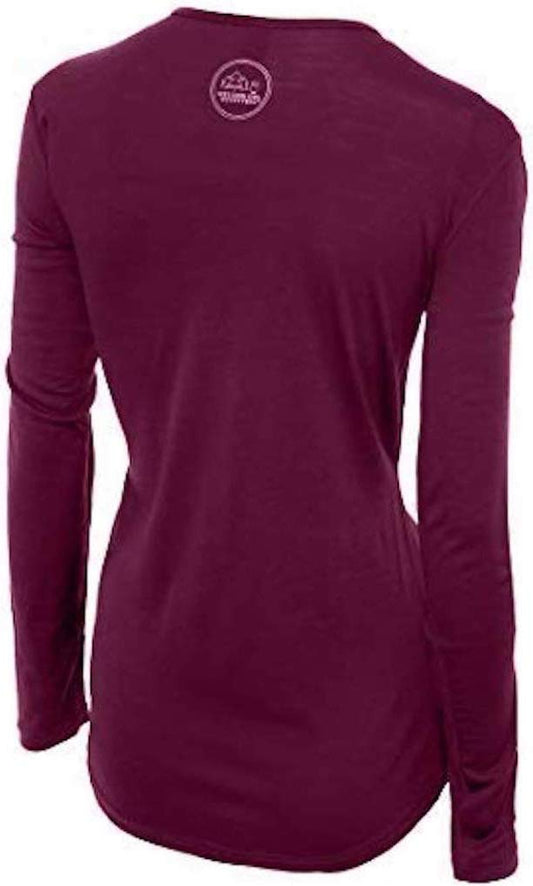
The specific problem here is stop-start exertion in dry cold. You work hard for four minutes going down, then sit motionless for fifteen minutes in moving air going back up, and you repeat that for six hours at over 3,000 metres. Cotton against the skin takes on sweat during the first half of that cycle and holds it against you during the second, which is why people are cold on the lift and not on the run. Our merino base layers are 100% Australian merino at 17.5 micron, and a long sleeve merino wool base layer for women is the right first layer precisely because merino keeps insulating while damp and does not hold odour over a multi-day trip. For deep winter, or if you run cold, wear a heavyweight merino base layer instead on the coldest mornings rather than doubling up thin layers, which just compresses them. Over the top, a Columbia Women's Fast Trek II Jacket or similar fleece is the mid layer you add and remove all day, and it is also the layer you wear to dinner. Your shell and insulated jacket sit over that.
Head, hands and feet, in a town on a hill
Extremities are what fail in the stop-start cycle, because blood goes to your core. A Smartwool Merino Reversible Cuffed Beanie packs flat and goes under a helmet or replaces one off the mountain, and merino keeps working after you have sweated in it. A pair of insulated gloves with a touchscreen tip means you are not taking a glove off in wind every time you check a map or a lift time, which is how fingers get cold. For the town rather than the mountain, a waterproof insulated snow boot is the item most visitors wish they had brought: look again at the slope of Main Street in the photograph above and picture it under packed snow and ice. Merino socks are worth packing and are unlinked here only because the six link cap is full, as are microspikes if you plan to walk any steep or icy trail in town.
Water, sun, and the two things we cannot link
Fluid intake is one of the two measures the medical sources name for altitude, alongside descent, so an insulated water bottle is doing real work here rather than being a nice-to-have. Insulated matters because an ordinary bottle in a pack at these temperatures turns into a block of ice by lunchtime.
The two things you most need are the two we cannot point you at. Our affiliate registry carries no SUNSCREEN entry and no EYEWEAR entry at all, so there is nothing for us to link, and at over 7,000 feet above snow both are closer to medical equipment than to comfort. Altitude and snow reflectivity are both inputs to the UV forecast and both push it up, and the index reaches its highest values at mountainous altitudes and over reflective surfaces. The light comes at you from above and bounces back up off the snow at the same time, which is how people burn the underside of the chin and nose in February. Bring high factor sunscreen and reapply it, bring goggles and real sunglasses, and bring lip balm with sun protection, which is also unlinked. A packable rain shell for summer afternoons is in the registry and is dropped here only for the cap.
Recommended Tours and Experiences
Essential Resources for Women in Park City
Emergency numbers: 911 for police, ambulance and fire, free from any phone including a locked mobile. Calls are answered locally and dispatchers will stay on the line. For non-urgent police matters many cities also run a 311 information line.
Tourist police: there is no tourist police service in the United States and no equivalent exists in Utah. The Park City Police Department is the municipal force and the Summit County Sheriff covers the surrounding area; both are reached through 911 in an emergency and through the city's non-emergency line otherwise.
Main hospital or clinic: PARK CITY HOSPITAL, part of Intermountain Health, at 900 Round Valley Drive, Park City, UT 84060, main number 435-658-7000. It is open around the clock and has an emergency department, and it is the nearest hospital to both resorts. Details and directions are at intermountainhealth.org. For a sprain, stitches or an infection, an urgent care clinic is the faster and far cheaper choice than an emergency department.
Healthcare costs: This is the single biggest practical difference for a visitor: there is no public health system, an emergency room visit without insurance can run into thousands of dollars, and an ambulance is billed separately and is not free. Comprehensive travel insurance with a high medical limit is not optional in the United States, and you should carry your policy number and the insurer's 24 hour number somewhere you can reach them. Urgent care clinics handle anything short of an emergency far more cheaply and quickly than an emergency room, and are the right choice for a sprain, an infection or stitches.
Road conditions and closures: the Utah Department of Transportation publishes live conditions, restrictions and closures for Interstate 80 over Parleys Summit and for the state routes into town at udottraffic.utah.gov. Check it before driving in either direction in winter rather than relying on a mapping app's estimate.
Avalanche forecast: the UTAH AVALANCHE CENTER publishes a daily backcountry forecast for these mountains at utahavalanchecenter.org. It applies to terrain outside the resort boundaries only. Inside the boundaries on open runs, control work is done by the resort.
US State Department travel advisory: there is none, and this is not an omission. The State Department issues travel advisories for other countries, not for the United States itself, so no US advisory for this destination exists to link. In its place, the Government of Canada advice for the United States gives an equivalent third-country assessment.
UK FCDO travel advice: gov.uk/foreign-travel-advice/usa, and read the safety and security page rather than only the landing page, because that is where the substance sits. The FCDO names no advised-against areas anywhere in the United States. The same advice also covers Puerto Rico, the US Virgin Islands, Guam, American Samoa and the Northern Mariana Islands.
Official health authority: the CDC travellers' health pages, the US federal health authority for visitors. is the US federal source for travel health guidance, and is worth reading on altitude before a first trip above 7,000 feet.
Embassy contact: the United States is the host country, so there is no US embassy to contact. Your own country's embassy is in Washington DC, with consulates in New York, Los Angeles, Chicago, Houston, San Francisco, Miami and Boston. Find yours before you travel and save the number.
Official tourism authority: Brand USA, the national tourism marketing body. covers the country, and the Park City Chamber and Visitors Bureau at visitparkcity.com publishes the local event calendar, the resort opening and closing dates and the free bus information, all of which are seasonal.
Local information and transit: Park City Municipal Corporation at parkcity.gov runs the free bus and publishes routes, a live bus tracker and winter parking rules. The visitor bureau is at visitparkcity.com.
Solo women travellers. Park City is an easy, low-stress place to travel alone and a woman on her own draws no attention at all, partly because a large share of the town's population on any given day is visiting. The free bus removes the biggest solo-travel expense and the biggest solo-travel risk in a ski town, which is getting home from a bar in the dark, so use it rather than walking out of the centre at night. Three specific cautions rather than general reassurance. First, altitude affects you more alone, because nobody is there to notice you have stopped making sense, so tell your accommodation or someone at home your plan for day one and check in. Second, alcohol at over 7,000 feet is not the drink you are used to, and Main Street's bars sit in a few hundred metres; pace it, especially on the first night. Third, skiing alone inside the resort boundary is normal and fine, but tell someone which mountain you are on, keep your phone charged and warm, and never duck a boundary rope on your own. Book early for the Christmas and New Year period and for American holiday weekends, and ignore any guide that tells you to plan around the film festival, because it is not here any more.
Takeaways
Park City is a real Victorian silver town, 64 of whose Main Street buildings are on the National Register, that nearly became a ghost town when silver collapsed and was rebuilt as a ski resort by the mining company itself in 1963, with the first skiers carried into the mountain on a mine train. The number that decides your trip is elevation: the town is mostly above 7,000 feet, Park City Mountain tops out at 10,026, and you will have come up from about 4,300 at the airport. Acute mountain sickness affects roughly 20 per cent of people going quickly to 8,000 feet and 40 per cent at 10,000, being fit does not protect you, exertion makes it worse, and the answers are water, patience on day one and descending if the severe signs appear. SNOWBOARDING IS PROHIBITED AT DEER VALLEY and always has been, which decides where a mixed group can stay. SUNDANCE RAN HERE FROM 1978 THROUGH 2026 AND MOVES TO BOULDER FROM 2027, so most January advice about this town is now out of date. The buses have been free since 1975 and a car is a liability in the centre. Pack merino first, a fleece to add and remove all day, a proper boot for an icy hill, more water than you think, and sun protection you would use on a glacier.
Reading On
Salt Lake City is the airport, the city you gain nearly three thousand feet leaving, and the place to sleep low on night one, so it is the obvious pair with this post. Telluride is the closest comparison anywhere: another Victorian silver town in a mountain box canyon that reinvented itself as a ski resort, and Breckenridge is the Colorado gold-rush equivalent at a higher altitude again, which makes it the useful reference point if you want to know how much worse the thin air gets. Jackson Hole and Steamboat Springs are the other western ski towns in this library. For the rest of Utah, Zion, Bryce Canyon and Arches are the red rock half of the state and make an obvious second week. The United States travel guide covers the regions, our guide to merino base layers for women has the fibre reasoning behind the layering section above, and the travel packing guide indexes the library.
If the outer journey is calling you, the inner one usually is too. Explore SoulMap at romantrail.com/blogs/soulmap.