

The Oeschinensee is a lake at 1,578 metres in a cirque above KANDERSTEG, in the canton of Bern. Walls rise around 2,000 metres above the water on three sides, the BLUMLISALP massif closes the far end, and it sits inside the SWISS ALPS JUNGFRAU-ALETSCH UNESCO World Heritage Site.
Disclosure: This post contains affiliate links. If you buy through them, Roman Trail earns a small commission at no extra cost to you.
How this differs from the village guide. The Kandersteg packing list covers the village, the Gasterntal, the Lotschberg car train and how to reach the valley at all. This post is the lake itself: getting up to it, walking around it, and the routes that climb beyond it, which are a different order of undertaking from the lakeside circuit.
We receive a fee when you get a quote from World Nomads using this link. We do not represent World Nomads. This is not a recommendation to buy travel insurance.
What Is Here
The gondola from Kandersteg and then a walk is how almost everyone arrives. The lift climbs to about 1,680 metres and the lake is roughly twenty minutes further on a good path, mostly downhill. ON FOOT FROM THE VILLAGE it is about an hour and a half with 400 metres of ascent, which is the better arrival if you have the legs and the time.
The lakeside circuit is the standard visit and it is not quite a stroll. About seven kilometres right around the water, taking two to three hours, with rocky sections, some scrambling over boulder fields on the far shore, and no facilities beyond the restaurants at the near end. Many people walk out and back along the north shore instead, which is easier.

The water is glacier-fed and people swim in it, briefly. It reaches perhaps 18 degrees at the surface in a hot August and is usually far colder, and rowing boats are hired at the near end, which is the more sensible way to be on it.
THE ROUTES ABOVE THE LAKE ARE REAL MOUNTAINEERING APPROACHES AND THIS IS THE DISTINCTION THAT MATTERS. The path to the BLUMLISALPHUTTE climbs to 2,834 metres and the HOHTURLI PASS is the highest point on the Bernese Oberland hut traverse; both are long, steep, exposed and often snow-covered well into summer. They begin at a lake that people reach in trainers from a gondola.
There is a summer toboggan run beside the gondola station and the near shore has two mountain restaurants, so the lake end is developed while everything beyond it is not.
When to Go
Late June to early October is the season, when the gondola runs, the circuit is clear of snow and the restaurants are open.
July and August are busiest, and the lake at eight in the morning is a different place from the lake at noon. The gondola queue at midday in August is substantial.
September and early October give the best light, thinner crowds and the first snow on the Blumlisalp.
In winter the lake freezes and is walked and skated on when conditions allow, with a winter walking path from the village, and the gondola runs a winter service. The circuit itself is not a winter route.
Getting There
By train to Kandersteg, about 35 minutes from Spiez and an hour from Interlaken or Bern, then the gondola from the edge of the village.
On foot from Kandersteg, roughly an hour and a half up and an hour down.
By car to Kandersteg, where the valley road ends. Three Swiss road facts matter more than the general advice. A VIGNETTE is required to use the motorways, bought at most border crossings, petrol stations and post offices or online, and driving without one risks a large fine. ROADS OUTSIDE URBAN AREAS ARE NARROW AND WINDING and the FCDO warns that conditions DETERIORATE FAST EVEN IN SUMMER, especially in heavy rain and in snowfall at altitude, so winter tyres and snow chains are the norm rather than a precaution. And traffic police ENFORCE STRICTLY, with any serious breach risking heavy fines or imprisonment. If you are in an accident, the orange emergency telephones along the roads are the way to call for help.
There is no road to the lake itself and no vehicle access beyond the gondola.
Is the Oeschinensee Safe for Women?
This is a busy, popular, well-served mountain lake and the risk rises sharply the moment you leave its shore. The FCDO publishes NO ADVISED-AGAINST AREAS ANYWHERE IN SWITZERLAND and the country has no regional-risks page at all, which answers the question most people are really asking. The advisory was last updated on 11 AUGUST 2026 and the change was to the European Entry/Exit System rather than to anything on the ground. On terrorism it uses the weaker of its two formulas, that attacks CANNOT BE RULED OUT, rather than the likely-to-try wording it applies to Austria and Sweden. What the page does carry is almost entirely about the mountains and the roads, which is the right emphasis for a country where the hazards are environmental rather than criminal.
The FCDO's alpine section is worth following literally, and the sentence that matters most is that THESE HAZARDS EXIST THROUGHOUT THE YEAR rather than only in winter: avalanches and snowdrifts, landslides and flooding, GLACIAL CREVASSES AND HOLLOWS, rockfalls, thunderstorms, altitude sickness, sun exposure and sudden weather changes. Its instructions are to check forecasts and conditions and be equipped for the WORST CASE rather than the forecast, to always carry a map, compass, GPS and a fully charged mobile outside urban areas, NOT TO UNDERTAKE ANY ACTIVITY ALONE, to consider hiring a guide, and to leave a copy of your itinerary with someone.
THE SPECIFIC TRAP HERE IS THE GONDOLA, and it is worth naming plainly. It delivers people in ordinary clothing to the edge of serious terrain in ten minutes. The lakeside circuit is a proper mountain walk with boulder fields; the routes to the Blumlisalphutte and the Hohturli are alpine undertakings with snow, exposure and a long way back.
ROCKFALL IS A LIVE HAZARD in a cirque of this shape, which the FCDO's alpine list names, and sections of the circuit close after events. The closures are posted.
The water is glacier-fed and cold enough for cold-water shock. Enter slowly if at all.
This is the single most expensive thing to get wrong in Switzerland and the FCDO is unusually specific about it. It states that BRITISH NATIONALS IN THE SWISS ALPS HAVE BEEN INVOLVED IN ACCIDENTS AND HAVE BEEN HOSPITALISED OR DIED, and for skiing, potholing and mountaineering, and for sports it classes as PARTICULARLY DANGEROUS, naming OFF-PISTE SKIING, MOUNTAIN BIKING, CLIMBING, PARAGLIDING AND BASE JUMPING, it lists three things your insurance must include: MOUNTAIN RESCUE SERVICES, HELICOPTER COSTS, and REPATRIATION HOME OR TRANSFER TO A NEIGHBOURING COUNTRY FOR TREATMENT. Read those three against your policy wording before you travel rather than at the clinic, because a Swiss helicopter evacuation is routine and is not cheap.
The Oeschinensee Packing List
A cirque at 1,578 metres that holds shade and cold air, reached in ten minutes from a warm valley.
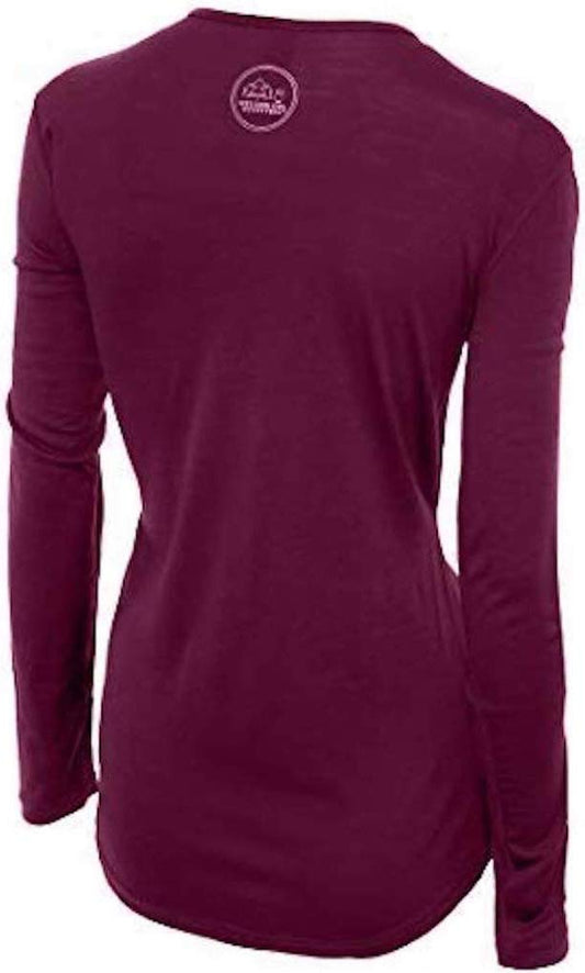
Our merino base layers are 100% Australian merino at 17.5 micron, and a long sleeve merino wool base layer for women is the right first layer here for a reason specific to the shape of the place: a cirque walled on three sides holds shade and cold air well into the morning and loses the sun early, so you walk warm in the open and are suddenly cold the moment the path turns into the shadow. Wool covers that without a change. A heavyweight merino base layer from October to May and for anything above the lake in any month.
Over it, an insulated mid layer and a Marmot PreCip Eco rain jacket, which in a cirque is a wind layer first.
Merrell Moab 3 waterproof hiking boots with Darn Tough merino socks, and the far shore of the circuit is the reason. It is boulder field and loose rock rather than path, and trainers are what the rescue reports mention.
Kahtoola MICROspikes from November to May, and worth carrying in June, because the shaded sections hold ice long after the village is green.
Not linked and worth packing: SWIMWEAR if you intend to get in, accepting that it is glacier cold; a SUN HAT AND HIGH FACTOR SUNCREAM, because a cirque reflects from three directions; WATER AND FOOD if you are going beyond the restaurants, since there is nothing on the far shore; and CASH for the boat hire. Note the gondola and the toboggan run are priced separately.
Recommended Tours and Experiences
Essential Resources for Women at the Oeschinensee
Emergency numbers: 112 works everywhere in Switzerland and routes you to the service you need, and the country also runs direct numbers that are sometimes quicker: 117 for police, 118 for fire and 144 for an ambulance. THE ONE TO SAVE BEFORE YOU GO INTO THE MOUNTAINS IS 1414, REGA, the Swiss Air-Rescue service, which is the helicopter operator for alpine emergencies and is reachable from anywhere in the country. The FCDO's own instruction for a medical emergency is to dial 112 or 144 and ask for an ambulance, and to contact your insurer quickly if you are referred on for treatment.
THE GONDOLA DELIVERS PEOPLE IN ORDINARY CLOTHING TO THE EDGE OF SERIOUS TERRAIN IN TEN MINUTES, and that is the whole safety picture here. The seven kilometre lakeside circuit is a proper mountain walk of two to three hours with BOULDER FIELDS on the far shore and no facilities beyond the near end. The routes above it to the BLUMLISALPHUTTE at 2,834 metres and the HOHTURLI PASS are alpine undertakings with snow well into summer. ROCKFALL closes sections of the circuit and the closures are posted. The water is glacier-fed and cold enough for cold-water shock. REGA air rescue is 1414.
US State Department travel advisory: the Switzerland advisory. Read the current level there directly rather than relying on a figure printed in any guide.
UK FCDO travel advice: gov.uk/foreign-travel-advice/switzerland, and read the safety and security page rather than only the landing page, because that is where the substance sits.
Main hospital: there is no hospital at the lake or in Kandersteg. The Spital Frutigen is about 15 minutes down the valley from the village, the Spital Thun roughly 40, and the Inselspital in Bern is the regional trauma centre at about an hour. REGA, the Swiss air rescue service, is 1414 and is the realistic route off the mountain. Switzerland is in neither the European Union nor the European Economic Area, but the FCDO says that to get medically necessary state healthcare there you need a UK Global Health Insurance Card or a European Health Insurance Card. That is not the same as free and it does not cover repatriation, a private clinic or MOUNTAIN RESCUE, which is the gap that matters here and is why the insurance paragraph above is not boilerplate. Swiss healthcare is excellent and expensive in equal measure. TICKS ARE A REAL CONSIDERATION rather than a footnote: the FCDO names biting insects and ticks ESPECIALLY BETWEEN APRIL AND OCTOBER and names TICK-BORNE ENCEPHALITIS, for which a vaccine exists and is worth discussing with a travel clinic at least 8 weeks ahead if you plan to walk in forest or long grass. ALTITUDE SICKNESS is named as a risk in the ski and hiking areas, and the advisory lists them by name, including Engelberg-Titlis, Saas-Fee, St Moritz, Corvatsch and the Matterhorn.
Official health authority: the Swiss Federal Office of Public Health, covers the Bernese Oberland hospital network
US Embassy: the United States Embassy in Bern.
Official tourism authority: Switzerland Tourism, publishes the Oeschinensee gondola season, the circuit conditions and any rockfall closures
Takeaways
Go early. The lake at eight and the lake at noon in August are different places.
The circuit is a mountain walk. Seven kilometres, boulder fields, two to three hours.
Boots, not trainers. The far shore is loose rock and that is what the rescue reports name.
Know where the lakeside ends. The Blumlisalp routes start where the easy walking stops.
Solo women safety assessment: The Oeschinensee is a busy, popular and well-served mountain lake where a woman walking alone is entirely unremarkable, and it is reached by public transport to Kandersteg and a gondola with no car needed. THE FCDO PUBLISHES NO ADVISED-AGAINST AREAS ANYWHERE IN SWITZERLAND and the country has no regional-risks page at all; the petty theft it names is in larger cities, at Geneva airport and on the Geneva trains. On terrorism it uses the weaker of its two formulas, that attacks cannot be ruled out. EVERYTHING THAT MATTERS HERE IS THE GAP BETWEEN HOW THE PLACE IS REACHED AND WHAT IT ACTUALLY IS. A gondola puts visitors in ordinary clothes at the edge of UNESCO alpine terrain in ten minutes, and the gradient of seriousness from there is steep: the near shore has restaurants and boat hire, the seven kilometre circuit is a two to three hour mountain walk crossing BOULDER FIELDS with no facilities on the far side, and the routes climbing beyond it to the Blumlisalphutte at 2,834 metres and the Hohturli pass are alpine undertakings carrying snow well into summer. The FCDO's alpine list, which it says applies THROUGHOUT THE YEAR, includes ROCKFALL, and in a cirque of this shape that is live: sections close after events and the closures are posted and should be obeyed. The lake is glacier-fed and cold enough that entering slowly matters. THE FCDO IS UNUSUALLY SPECIFIC ABOUT INSURANCE IN SWITZERLAND, naming MOUNTAIN RESCUE, HELICOPTER COSTS AND REPATRIATION as the three things a policy must cover and noting that British nationals in the Swiss Alps have been hospitalised and have died. REGA air rescue is 1414.
Reading On
The Oeschinensee sits above Kandersteg and the valley has a third lake. The Kandersteg packing list covers the village, the Gasterntal and the car train through the mountain, and the Blausee packing list the small blue lake ten minutes down the valley. North, the Spiez packing list, Thun packing list, Interlaken packing list and Brienz packing list cover the two Oberland lakes, with the Grindelwald packing list and Lauterbrunnen packing list under the Jungfrau. South through the tunnel, the Aletsch packing list, Sion packing list, Crans-Montana packing list and Zermatt packing list cover the Valais. East, the Lucerne packing list, Pilatus packing list, Rigi packing list and Engelberg packing list cover the central lakes. For the country the Switzerland travel guide for women and the Switzerland packing list carry the transport, the advisory and the practical material in full. For why wool suits a cirque that holds shade, read the guide to merino wool base layers for women. Every destination we cover is indexed at the travel packing guide for women, and the base layers are at the Roman Trail collection.

If the outer journey is calling you, the inner one usually is too. Explore SoulMap at romantrail.com/blogs/soulmap.