

Mendocino is a village of about nine hundred people on a headland on the northern Californian coast, roughly 250 kilometres above San Francisco, and it does not look Californian at all. It looks like coastal Maine, because that is where the men who built it came from: lumbermen who arrived in the 1850s for the redwood, put up clapboard salt-box houses with pitched roofs and widow's walks, and raised the timber WATER TOWERS in the first photograph that still define the skyline. The whole village is a National Historic Landmark district. It also stood in for Cabot Cove in Murder, She Wrote, which is why some visitors arrive with a strange sense of recognition.
Disclosure: This post contains affiliate links. If you buy through them, Roman Trail earns a small commission at no extra cost to you.
We receive a fee when you get a quote from World Nomads using this link. We do not represent World Nomads. This is not a recommendation to buy travel insurance.
What Is Here
THE VILLAGE IS THE DESTINATION AND IT IS VERY SMALL. Main Street and a handful of cross streets, galleries, a bookshop, inns in the old houses, and the MENDOCINO HEADLANDS STATE PARK wrapping it on three sides, which is unusual and is why the village feels like it is on a ship's bow. The headland trails are free, they loop the perimeter in an hour or so, and they are the best thing here.
MENDOCINO IS A VILLAGE AND MENDOCINO IS ALSO A COUNTY, AND THEY ARE NOT THE SAME TRIP. This matters because almost everything written online about Mendocino County is about something else: Fort Bragg is a working town of 7,000 ten miles north with the Glass Beach and the Skunk Train; Ukiah and Willits are inland; the county's wine country is in the Anderson Valley an hour south-east; and the county's cannabis industry is what dominates image searches. THE VILLAGE IS NONE OF THAT.

POINT CABRILLO LIGHT IS THE SECOND PHOTOGRAPH AND IT IS A SHORT WALK IN. A 1909 light station three miles north, with its original Fresnel lens still in place, standing on its own reserve. You park and walk about half a mile down to it, which keeps the crowds off.
THE REDWOODS ARE TWENTY MINUTES AWAY AND ARE THE OTHER HALF OF THE VISIT. RUSSIAN GULCH STATE PARK has a waterfall and a collapsed sea cave called the Devil's Punchbowl; VAN DAMME STATE PARK has the Fern Canyon trail and a pygmy forest where poor drainage has left century-old trees a metre high; and JUG HANDLE has an ecological staircase of marine terraces. The forest frames in this library's Mendocino set are mostly these.
AND THE SEASON HERE IS THE OPPOSITE OF WHAT PEOPLE ASSUME. July and August are the FOGGIEST and coolest months on this coast, because the cold upwelling offshore condenses the marine layer onto the shore, so a California summer holiday here can mean five days of grey at thirteen degrees. September and October are the clear warm months. That single fact decides more trips than anything else on this page.
When to Go
September and October are the best months by a wide margin. The fog lifts, daytime reaches the high teens to low twenties, the sea is at its least wild, and the light on the headlands is the reason photographers come.
Late April to June is good and greener, with wildflowers on the headland and the whale migration still passing, in the mid teens, and increasingly foggy as June goes on.
July and August are cool and grey. Daytime often in the low to mid teens with fog in and out all day. It is atmospheric rather than disappointing if you came expecting it, and a shock if you did not.
November to March is the storm season and is a genuine reason to come. Big Pacific swells, rain, daytime in the low teens, inns selling storm-watching rooms, and the mushroom season inland. It is also when Highway 1 is most likely to be closed by a slide.
Getting There
San Francisco is three and a half to four and a half hours and the range is the point. The fast way is inland on US-101 to Cloverdale then across on Highway 128 through the Anderson Valley; the slow way is Highway 1 the whole distance, which is spectacular and takes substantially longer than any map says. Santa Rosa's airport has limited service; San Francisco and Oakland are the practical ones.
You need a car and you should budget more time than the distance suggests. Highway 1 along this coast is two lanes, winding, often fogbound, with no overtaking and frequent cyclists, and the stretch over the headlands south of the village is slow by design.
The village itself is walkable in fifteen minutes and the headland trails start from it. Everything else, the lighthouse, the state parks and Fort Bragg, is a drive.
AND THERE IS NO PUBLIC TRANSPORT WORTH THE NAME, no train and a skeletal county bus. Fuel in Fort Bragg or inland rather than assuming the village has it cheaply.
The Mendocino Packing List
Cold damp fog in summer, wind off the Pacific, heavy winter rain and a cool year round.
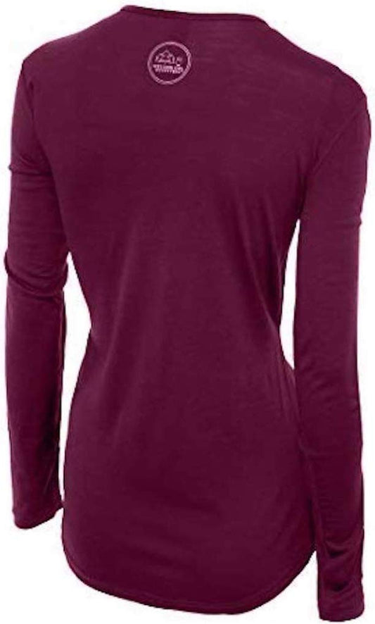
Our merino base layers are 100% Australian merino at 17.5 micron, and a long sleeve merino wool base layer for women is close to the correct answer for this coast, and the reason is precise rather than general. Mendocino is not cold, it is DAMP AND ABOUT TWELVE TO SIXTEEN DEGREES almost all year, which is exactly the band where cotton fails worst: it takes up the fog, stops insulating, and leaves you chilled for hours on a headland. Wool keeps insulating when damp, which here is the normal condition rather than an accident. From November to March add a heavyweight merino base layer.
A Columbia Fast Trek II fleece in every month of the year including August, and a Marmot PreCip Eco rain jacket, which on the headlands is a windproof shell first and a rain layer second. An umbrella is useless here.
Waterproof walking boots rather than trainers, for the headland trails, the Fern Canyon boardwalks and the Russian Gulch paths, which are wet, root-crossed and muddy for most of the year.
Merino glove liners and a merino beanie, both genuinely useful in July on this coast and necessary from October to May.
Not linked and worth packing: SOMETHING WINDPROOF OVER EVERYTHING, because wind rather than temperature is what makes a headland uncomfortable; A TORCH, since the village has very little street lighting by design and the inns are spread along unlit lanes; BINOCULARS, for the grey whale migration from December to April and the harbour seals below the cliffs; LAYERS YOU CAN CARRY, because the fog burns off and returns twice in a day; AND A PAPER MAP, since coverage drops on Highway 1 and in the redwood canyons.
Recommended Tours and Experiences
Essential Resources for Women in Mendocino
Emergency numbers: 911 for police, ambulance and fire, free from any phone including a locked mobile. Mendocino County runs the sheriff's office and there is no village police force; the United States Coast Guard covers this coast from Noyo Harbor at Fort Bragg and is reached through 911 or VHF channel 16. COVERAGE IS PATCHY TO ABSENT along Highway 1 and in the redwood canyons, which is the single most important practical fact in this section.
SNEAKER WAVES AND UNSTABLE CLIFFS ARE WHAT KILL PEOPLE ON THIS COAST AND THE VILLAGE SITS ON TOP OF BOTH. A sneaker wave is a wave far larger than the ones before it, arriving with no warning, running much further up a beach or over a rock platform and dragging people into water that is about 10 to 13 degrees all year, cold enough for incapacitating cold shock within minutes. NEVER TURN YOUR BACK ON THIS OCEAN, do not stand on wet rock or a jetty with waves breaking, and stay well back from the water in winter. THE HEADLAND CLIFFS ARE ACTIVELY ERODING AND ARE LARGELY UNFENCED: the Mendocino Headlands trails run close to drops with undercut edges, the ground near the lip can be unsupported, and people have died taking photographs there. Stay on the path and back from the edge, and keep children and dogs close. ROLLING DRIFT LOGS on the beaches are the companion hazard, inert-looking timber that a wave lifts and rolls. HIGHWAY 1 IS CLOSED BY LANDSLIDES in winter and the detour is long, so check Caltrans road conditions before driving the coast road in a storm. WILDFIRE reaches this county in late summer and autumn and brings PUBLIC SAFETY POWER SHUTOFFS as a precaution, so an inn may be running on a generator or not at all, and CAL FIRE publishes the active incidents. THE EARTHQUAKE POSITION IS WORTH STATING: this is the Cascadia coast's southern end and the Mendocino Triple Junction offshore is one of the most seismically active spots in California, so if an earthquake is LONG OR STRONG on this coast, MOVE INLAND OR UPHILL IMMEDIATELY rather than waiting for a warning, because a local tsunami arrives in minutes and the village is on a headland with high ground right behind it. POISON OAK lines the forest trails, and TICKS are present in the grass.
US State Department travel advisory: there is none, and this is not an omission. The State Department issues travel advisories for other countries, not for the United States itself, so no US advisory for this destination exists to link. In its place, the Government of Canada advice for the United States gives an equivalent third-country assessment.
UK FCDO travel advice: gov.uk/foreign-travel-advice/usa, and read the safety and security page rather than only the landing page, because that is where the substance sits. The FCDO names no advised-against areas anywhere in the United States. The same advice also covers Puerto Rico, the US Virgin Islands, Guam, American Samoa and the Northern Mariana Islands.
Main hospital: there is no hospital in the village. Adventist Health Mendocino Coast in FORT BRAGG, about 20 minutes north, has the nearest emergency department and it is a small coastal facility; anything serious goes inland to Ukiah or Santa Rosa, which is two hours away on winding roads, or by air. THAT IS THE THING TO PLAN AROUND: carry your own prescriptions with a margin and understand that a real emergency here is a transfer over a slow road. Dial 911 for any emergency. This is the single biggest practical difference for a visitor: there is no public health system, an emergency room visit without insurance can run into thousands of dollars, and an ambulance is billed separately and is not free. Comprehensive travel insurance with a high medical limit is not optional in the United States, and you should carry your policy number and the insurer's 24 hour number somewhere you can reach them. Urgent care clinics handle anything short of an emergency far more cheaply and quickly than an emergency room, and are the right choice for a sprain, an infection or stitches.
The authority that decides what is open: California State Parks runs the Mendocino Headlands, Russian Gulch, Van Damme and Jug Handle and publishes their closures, which in winter are frequent for storm damage and fallen trees, and the Point Cabrillo Light Station is also a state park with its own hours. Caltrans publishes Highway 1's status, which is the page that actually decides whether a coastal drive happens.
Official health authority: the CDC travellers' health pages, the US federal health authority for visitors, covers the national health information service and travel health guidance
Embassy contact: the United States is the host country, so there is no US embassy to contact. Your own country's embassy is in Washington DC, with consulates in New York, Los Angeles, Chicago, Houston, San Francisco, Miami and Boston. Find yours before you travel and save the number.
Official tourism authority: Brand USA, the national tourism marketing body, covers the region, and the Visit Mendocino office publishes the state park closures, the whale watching season and the storm watching information
Takeaways
July and August are the foggiest months. September and October are the clear ones.
The village is nine hundred people. Mendocino County is something else entirely.
Never turn your back on this ocean, and stay back from the unfenced headland edge.
No hospital in the village, patchy phone coverage, and Highway 1 closes for slides.
Solo women safety assessment: Mendocino is an easy and very quiet place to travel alone. It is a village of nine hundred people with inns, galleries and a bookshop, a visitor economy of walking, whale watching and storm watching, no nightlife and no district to avoid; eating alone is completely ordinary and the place is still by nine in the evening. The one real crime risk on this coast is theft from parked cars at trailheads and scenic pull-offs, so leave nothing visible. THE REAL RISKS ARE THE OCEAN, THE CLIFF AND THE DISTANCE. Sneaker waves arrive with no warning and drag people into water around 10 to 13 degrees all year, and the headland cliffs are actively eroding, largely unfenced and undercut, with deaths from photographs taken at the edge; never turn your back on the water and stay on the path. Rolling drift logs on the beaches are the companion hazard. If an earthquake is long or strong on this coast, move inland or uphill at once without waiting for a warning, because the Mendocino Triple Junction offshore is among the most seismically active places in California and a local tsunami arrives in minutes. Highway 1 closes for landslides in winter and the detour is long, wildfire brings precautionary power shutoffs in late summer, and phone coverage is patchy to absent along the coast road and in the redwood canyons, so tell someone your plan. THERE IS NO HOSPITAL IN THE VILLAGE: the nearest emergency department is twenty minutes north in Fort Bragg and is small, with real trauma care two hours inland. 911 WORKS WHERE THERE IS SIGNAL.
Reading On
Mendocino is on the far northern Californian coast and this library covers the state from here to the desert. South, the San Francisco packing list covers the city most visitors drive up from, the Sausalito packing list and Oakland packing list the bayside towns, and the Napa packing list the valley inland. Further down the same coast, the Monterey packing list and Big Sur packing list cover the peninsula and the cliff road, which is the other great Highway 1 stretch and carries the same slide closures. North into Oregon, the Newport packing list and Cannon Beach packing list cover a coast with the same sneaker wave and drift log hazards and the same Cascadia instruction, with the Portland packing list inland. Inland in California, the Yosemite packing list, Sequoia packing list and Lake Tahoe packing list cover the Sierra. For the country, the USA travel guide for women carries the regions, the driving and the seasons in full. For why wool is the right fibre in fog at twelve degrees, read the guide to merino wool base layers for women. Every destination we cover is indexed at the travel packing guide for women, and the base layers are at the Roman Trail collection.

If the outer journey is calling you, the inner one usually is too. Explore SoulMap at romantrail.com/blogs/soulmap.