

Photograph: Snøhetta - Dovrefjell - Norway by Bouke ten Cate, CC BY 4.0, via Wikimedia Commons.
Dovrefjell is a mountain range in central Norway that forms a natural barrier between eastern Norway and Trondelag, and almost everything on either side of it is national park. The highest mountain in the region is Snohetta at 2,286 metres, and until Jotunheimen was properly surveyed in the nineteenth century it was assumed to be the highest in the country. The photograph at the top of this page is Snohetta under heavy cloud, snow fields and dark rock and nothing else, which is a fair portrait of a range rather than a town.
What the photograph cannot show you is a musk ox, and the musk oxen are why most people come. There is no animal in it, no hut, no trail marker, and neither the E6 nor the Dovre Line that run through the pass. We would rather say so than let a cloud study imply an encounter we cannot illustrate.
Disclosure: This post contains affiliate links. If you buy through them, Roman Trail earns a small commission at no extra cost to you.
We receive a fee when you get a quote from World Nomads using this link. We do not represent World Nomads. This is not a recommendation to buy travel insurance.
What Is Here
A high, dry, treeless plateau that Norwegians treat as a national symbol. When Norway adopted its constitution in 1814 the assembly swore to be united and true until the mountains of Dovrefjell crumble, and the phrase is still in ordinary use. Ibsen put the Mountain King here in Peer Gynt, and the piece Grieg wrote for that scene is the music most people in the world have heard without knowing where it is set. The range is a residual massif, rock left standing while the land around it eroded away, which is why the skyline is rolling fell with one high summit rather than a row of peaks.
The protection is layered and the park is large. Dovrefjell Sunndalsfjella National Park was established in 2002, replacing and enlarging a smaller park dating from 1974, and it occupies 1,693 square kilometres across three counties. It exists to preserve a large, continuous and essentially untouched mountain area and, specifically, part of the range of the wild reindeer at Snohetta and Knutsho, possibly the last of Beringian origin in Europe.
The Musk Oxen, and the Distance Rule That Is Not Advice
Keep at least 200 metres from a musk ox, always, and understand why the number is that large. Unlike every other wild animal on mainland Norway, musk oxen do not run away. They form a defensive formation and they will attack when approached, and the figure our source gives for a charge is 60 kilometres an hour. That is the mechanism: the animal that does not flee is the animal you cannot test, and 200 metres is the distance at which your own judgement stops being the thing keeping you safe. The same source asks at least 300 metres from an Arctic fox, and says the wild reindeer here are far shyer than the semi domestic reindeer elsewhere in Norway. If you see them, back off calmly.
The herd is not native, and the introduction date is the one fact this post will not give you. The musk oxen were brought from Greenland last century and they live on the western side of the range, beyond the E6 and the railway. Two encyclopaedia articles about this same place give years fifteen apart for that import, so rather than pick the more quotable one we are telling you there is a disagreement. The animals are real, the distance rule is real, and the year is somebody else's argument.
A guided musk ox safari is a good idea and it is not compulsory. No fees or permits are needed for individual travellers in the park: you obey the park rules and you walk in. It is guided tours and other organised trips that need permission from the park authorities, so the paperwork belongs to the operator rather than to you. Book a safari because a guide knows where the herd was yesterday and will hold the distance for you, not because anyone requires it.
The other park rules are easy to break by accident. Drones are not allowed. Dogs must be on a lead from 1 March to 20 August. Camping wild, keep 150 metres from the nearest house and put back any stones you move.
When to Go
Summer, if you intend to walk the high ground, and the sources are blunt about who it is for. The marked routes are summer routes and the cabins are mostly unstaffed. Long trips, tough terrain and often harsh weather make this an area for the experienced hiker, and the park article says the same thing in different words: experienced and well equipped wanderers only, because of long walks between mostly unstaffed huts and great areas with no huts or trails at all. There is a second trip here for anyone who is not that hiker, because the valleys give plenty of undemanding day trips, and the plant life is a real attraction rather than a consolation: Dovrefjell is considered a botanical hotspot, with an alpine botanical garden at Kongsvoll to make sense of it.
The climate is the surprise. Dovrefjell has a dry, cool, continental climate, and some of the driest places in Norway and in Europe are on this plateau, Hjerkinn among them. If you have come from Bergen expecting Norwegian rain, the problem here is wind and exposure rather than water falling on you.
Norway's advisory describes the conditions a packing list has to answer, and it is worth quoting rather than paraphrasing. THE WEATHER CAN CHANGE QUICKLY, PRODUCING ARCTIC CONDITIONS EVEN IN SUMMER ON EXPOSED MOUNTAIN TOPS. THE WINTER IS LONG AND CAN LAST WELL INTO APRIL. TEMPERATURES CAN DROP TO MINUS 25C AND BELOW. THERE IS ALSO A HIGH WIND CHILL FACTOR, PARTICULARLY IN UNSHELTERED AREAS AND MOUNTAIN RANGES. Three things follow from that and they are not the same thing as owning a warm coat. A long winter means the shoulder seasons are winter, so an April trip is a winter trip. Wind chill rather than air temperature is what you dress against, which makes a windproof outer layer worth more than a thicker insulating one. And conditions changing quickly on a mountain in summer means carrying the layer you do not currently need, which is the entire argument for base layers that pack to nothing and do not hold damp.
Getting There
The main road and the main railway both go straight through, which makes this one of the most reachable wild places in Norway. European route E6 and the Dovrebanen railway run through a mountain pass in the range, splitting the park into a larger western part and a smaller eastern one. The highway runs year round and one source puts weather closures on both road and line at less than once a year. Dombas is about 340 kilometres from Oslo along the E6, and Oppdal about 80 kilometres on.
Two railway stops put you on the plateau with no town attached, and that is the point. Hjerkinn sits close to the highest point on the line and has no settlement, though there are campgrounds, hotels and a youth hostel; Kongsvoll has none either, with the Kongsvold mountain lodge nearby. Both lodges are medieval pilgrim inns still in service, and the Hjerkinn one was burnt down in 1718 to deny the Swedish army lodging. Check timetables and lodge seasons yourself, because both move.
Norway's driving rules include one limit framed in a way that makes it immediately clear and two that catch visitors by surprise. ON ALCOHOL, the FCDO says that if you are found to have A QUARTER OF ENGLAND'S LEGAL LIMIT of alcohol in your system you may get a fine and possible imprisonment, and that THERE ARE FREQUENT ROADSIDE CHECKS. In practice that is one drink too many, so the working rule is none. ON TYRES, winter tyres with a MINIMUM 3MM TREAD are required if there is snow or ice on the roads, and studded tyres or chains may also be needed. And the two a visitor simply would not know: KEEP YOUR HEADLIGHTS ON, DIPPED, DURING THE DAYTIME ALL YEAR ROUND IN ALL PLACES, and ON ROADS NOT MARKED WITH A PRIORITY SIGN, THE YELLOW DIAMOND, YOU MUST GIVE WAY TO TRAFFIC COMING FROM THE RIGHT. That second one is the genuine hazard, because a car emerging from a side road on your right has priority and will take it. Driving offences carry on-the-spot fines of up to 10,000 Norwegian krone.
Is Dovrefjell Safe for Women Travelers
There is no crime story to tell here, and the honest risks are weather, distance, navigation and one animal. What will hurt you is being wet in wind far from a road.
Mobile coverage exists in parts of the area and not in others, which changes the whole plan. What follows is the most useful instruction on this page and it is our source's own: expect drastic changes in the weather, and carry a map and compass and the skill to use them, or go with a guided tour.
One sentence in Norway's advisory changes the planning for a large part of the country. NEARLY HALF OF NORWAY IS IN THE ARCTIC CIRCLE, INCLUDING SOME VERY REMOTE AREAS OF LAND AND SEA, and in those areas EMERGENCY MEDICAL ASSISTANCE AND SEARCH AND RESCUE ARE LIMITED. That is not a warning about danger so much as a statement about response time, and the honest consequence is that self-sufficiency does the work an ambulance does elsewhere: tell someone your route and your expected return, carry more warmth than the forecast justifies, carry a way to signal that does not depend on mobile coverage, and treat a plan that works only if nothing goes wrong as no plan at all.
Dovrefjell sits well south of the Arctic Circle, so that geography does not reach it and the consequence still does. A helicopter cannot fly in the cloud the photograph above is full of, so call 113 early: what delay costs you here is flying weather.
The Dovrefjell Packing List
Layers, because wind chill rather than air temperature is the problem
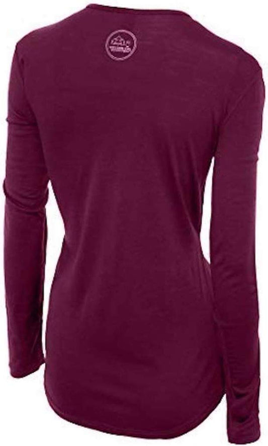
Our merino base layers are 100% Australian merino at 17.5 micron, and a long sleeve merino wool base layer for women is the first thing to pack, for a reason specific to this ground. You climb warm, then stand still on an exposed fell in wind with nothing to shelter behind, and a layer wet from the climb becomes a cooling layer exactly there. Wool holds usable insulation while damp. Over it, a packable rain jacket earns its place as a windproof shell more than as a raincoat, and an insulated jacket for the hours you spend not moving, which on a wildlife trip is most of them. A merino beanie does more work than its weight suggests.
Footwear for fell, bog and slate
The ground is rolling fell, loose slate, wet moss and bog, often all within an hour. A waterproof hiking boot with real grip is the right tool, with merino hiking socks and a dry spare pair. Trainers will do the valley day trips, not Snohetta.
Five things we cannot link and you still need
BINOCULARS are the single most useful object here and our registry has no entry for them at all. At a mandatory 200 metres a musk ox is a small dark shape, so the difference between a good trip and a disappointing one is optics rather than clothing. A PAPER MAP AND COMPASS, which our source asks for and which we do not carry. EYEWEAR and SUNSCREEN, neither of which has any entry in our range, against snow glare at this altitude. And A NECK GAITER: the one entry in our range has a contested product identity, so buy that locally.
Recommended Tours and Experiences
Essential Resources for Women at Dovrefjell
Emergency numbers: Norway uses three direct numbers and the distinction matters more here than elsewhere, because 112 IS THE POLICE NUMBER rather than a general router: 112 for police, 113 FOR AN AMBULANCE and 110 for the fire service. For a medical emergency, 113 is the faster call. All three work from any phone including a locked mobile and operators speak English. For a non-urgent medical problem, 116117 reaches the out-of-hours doctor service. And the one specific to this country: in the mountains and at sea, remember that the FCDO states EMERGENCY MEDICAL ASSISTANCE AND SEARCH AND RESCUE ARE LIMITED across the half of Norway inside the Arctic Circle, so the call connects quickly and the help may still be a long way off.
Medical care, and the distance is the planning constraint. There is no hospital on the plateau and no town on it either. The nearest services are in the valleys at Dombas and Oppdal, and full hospital care further again. Anything serious on the high ground is an air operation rather than a road one. Norway is in the EEA rather than the EU, and that distinction does not cost you anything here: a UK Global Health Insurance Card or an EU European Health Insurance Card gives you state-provided medically necessary care on the same terms as a resident, which in Norway means paying the same patient contribution a Norwegian pays rather than nothing. Travel insurance sits on top of it, and in Norway it should specifically cover SEARCH AND RESCUE AND AIR AMBULANCE, because the terrain rather than the medicine is what makes a Norwegian incident expensive. A pharmacy is an APOTEK, they handle minor problems without an appointment, and the larger towns have one open late. TAP WATER IS AMONG THE BEST IN THE WORLD and buying bottled water here is purely a waste of money. There are no required vaccinations and no endemic tropical disease. TICKS occur along the southern coast and in the south east, carrying Lyme and, in a narrow coastal band, tick-borne encephalitis, which is a reason to check after walking in long grass. The real medical risk in Norway is environmental rather than infectious: cold, wet and exposure, which is what the clothing on this page is for.
Two Norwegian rules exist that a visitor is likely to break by accident and neither is about driving. POLICE ENFORCE BANS ON CAMPFIRES IN MANY HIKING AREAS DURING THE SUMMER MONTHS, which sits oddly beside Norway's famous right to roam: you may legally camp in a great deal of open country and still not be allowed to light anything. And DRONES require registration as an operator in Norway or an EU or EFTA country plus LIABILITY INSURANCE, with no-fly zones in force, so a drone packed for the fjords is a licensing question before it is a photography one.
In this park the drone question is settled. Drones are not allowed in the national park at all, so the requirements above are beside the point.
US State Department travel advisory: the Norway advisory. Read the current level there directly rather than relying on a figure printed in any guide.
UK FCDO travel advice: gov.uk/foreign-travel-advice/norway, and read the safety and security page rather than only the landing page, because that is where the substance sits.
Official health authority: Helsenorge, the Norwegian public health service portal.
US Embassy: the United States Embassy in Oslo.
Official tourism authority: Visit Norway, the official travel guide. covers the country, while the Dovrefjell National Park Board publishes the park regulations that actually apply on the ground and the Norwegian Trekking Association, DNT, publishes hut arrangements and route conditions.
Solo women travellers. Dovrefjell is one of the easiest places in this library to be alone among people and one of the least forgiving to be alone in weather. The valley lodges are sociable and entirely used to women walking by themselves, and English is universal. The habits that matter here are about terrain: leave your route and return time with somebody, carry a map and compass as well as a phone, carry more warmth and food than the day needs, and turn back without negotiating with yourself. Alone in musk ox country, the 200 metre rule is not something you can trade against a better photograph, because there is nobody with you to call it.
Takeaways
Snohetta is 2,286 metres and was thought to be Norway's highest until Jotunheimen was surveyed. The park is 1,693 square kilometres, established in 2002 over a 1974 predecessor. Keep 200 metres from a musk ox and 300 from an Arctic fox, and remember that the musk ox is the animal that does not run. No permit is needed to walk in alone; the permits apply to tour operators. The climate is dry, cold and windy rather than wet, coverage is partial, drones are banned, and the high routes are for experienced walkers.
Reading On
Jotunheimen is the range that took Snohetta's title once it was properly surveyed, and it is the obvious pair with this one. Trolltunga covers a day of comparable commitment on a different plateau, and Olden is the fjord version of the same weather problem. Oslo is where both the E6 and the Dovre Line begin, and the Norway packing list covers a longer trip. The Norway travel guide covers the regions, our guide to merino base layers for women has the fibre reasoning, and the travel packing guide indexes this library. For the other side of the Norwegian uplands, the Geilo packing list covers the Hardangervidda, which is the same high plateau country reached from the Bergen line rather than from the E6.
If the outer journey is calling you, the inner one usually is too. Explore SoulMap at romantrail.com/blogs/soulmap.