

Photograph: Dusk in the Berkeley Hills by Joe Parks from Berkeley, CA, CC BY 2.0, via Wikimedia Commons.
Berkeley is a city of roughly 120,000 people on the eastern shore of San Francisco Bay, most of it on a plain rising gently to the base of the Berkeley Hills. It holds the oldest campus in the University of California and the Lawrence Berkeley National Laboratory, which the university runs with the US Department of Energy.
The photograph at the top of this page contains the whole argument of this post. The tower mid-frame is Sather Tower, the Campanile. The dome on the left is the laboratory on the hill. And THE GAP ON THE HORIZON IS THE GOLDEN GATE, which here is not scenery but the reason the weather is what it is: the city's own climate description says sitting directly opposite it "ensures that typical eastward fog flow blankets the city more often than its neighbors".
Disclosure: This post contains affiliate links. If you buy through them, Roman Trail earns a small commission at no extra cost to you.
We receive a fee when you get a quote from World Nomads using this link. We do not represent World Nomads. This is not a recommendation to buy travel insurance.
What Is Here
A university founded in 1868, and a laboratory above it that named two chemical elements after this place. The University of California was founded here in 1868, named after the Anglo-Irish philosopher George Berkeley, and is the state's first land-grant university and the founding campus of the UC system. Sather Tower, nicknamed the Campanile after St Mark's Campanile in Venice, is the thing in the photograph, and there is a lift to the top. Student-led walking tours run daily.
The dome on the left is where a great deal of the twentieth century happened. In the 1930s Ernest Lawrence established the Radiation Laboratory here, now Lawrence Berkeley National Laboratory, and invented the cyclotron, which won him the Nobel physics prize in 1939. Using it, Berkeley researchers discovered SIXTEEN CHEMICAL ELEMENTS, among them berkelium and californium. The darker half is in the same buildings: Lawrence's laboratory began contracting with the US Army to build the atomic bomb, and the physics professor J. Robert Oppenheimer became scientific head of the Manhattan Project in 1942.
The political history is not a museum piece. In 1964 the university banned the distribution of political literature on campus and provoked the mass protest that became the FREE SPEECH MOVEMENT, and in 1969 PEOPLE'S PARK was created by occupation on university land south of campus, bringing a month-long National Guard occupation ordered by the then governor, Ronald Reagan.
The food is a real reason to come, and the hills are the half visitors skip. Alice Waters opened CHEZ PANISSE in 1971 and it is described as the birthplace of California cuisine, Peet's Coffee's original store is here, and the strip in North Berkeley is nicknamed the GOURMET GHETTO for its concentration of food businesses. Above town, TILDEN REGIONAL PARK runs up Wildcat Canyon with free hiking, views of the Golden Gate and Lake Anza for swimming, while INDIAN ROCK PARK is an outcrop with steps carved into it, recommended for sunsets, which is the hour the photograph above was taken. The streets in Cragmont and La Loma Park are known for NUMEROUS PUBLIC STAIRWAYS AND PATHS, a footwear fact disguised as a planning note.
The Hayward Fault Runs Down the Middle of the Stadium
This is the city's most consequential fact and the easiest to overstate, so here it is at exactly the strength the sources give it. Berkeley is TRAVERSED BY the Hayward Fault Zone, a major branch of the San Andreas Fault out to the west. The fault runs along the BASE OF THE HILLS, so most of the city sits on the plain west of it. And A NOTORIOUS SEGMENT RUNS LENGTHWISE DOWN THE MIDDLE OF MEMORIAL STADIUM, at the mouth of Strawberry Canyon on campus, where its movement through the structure has been photographed and measured. YOU CAN ALSO SEE IT CREEPING: cracked roadways, sharp jogs in streams and springs mark its path.
What has and has not happened here matters, because the usual summary is wrong. NO LARGE EARTHQUAKE HAS OCCURRED ON THE HAYWARD FAULT NEAR BERKELEY IN HISTORIC TIMES, except possibly in 1836, though seismologists warn of a geologic record of large shocks in the deeper past. The 1868 Hayward earthquake, called the Great San Francisco earthquake before 1906, was on the SOUTHERN segment near Hayward itself, though it left a furrow in the ground along the fault line here. In 1906 the East Bay escaped serious damage and refugees crossed to it, which is not evidence of safety.
The planning facts, and then the drill. The United States Geological Survey treats a major Bay Area earthquake as likely and rates the Hayward Fault the likeliest Bay Area fault to be the epicentre; read the USGS for current figures rather than a number in a guide. Berkeley also has areas at risk of SOIL LIQUEFACTION, and the susceptible ground is the FLAT AREA CLOSER TO THE SHORE rather than the hills. None of this should change a trip. It should change that you know the drill: DROP, COVER AND HOLD ON away from windows, and DO NOT RUN OUTSIDE.
The Fog Comes Straight At Berkeley
The East Bay is supposed to be the sunny side, and Berkeley is the exception. It has a warm-summer Mediterranean climate, and its position directly opposite the Golden Gate means the eastward fog flow blankets it MORE OFTEN THAN ITS NEIGHBOURS. The summer pattern is reliable: cool foggy morning, sunny warm afternoon, fog back at night, with summers cooler than a Mediterranean climate normally runs because of upwelling ocean currents offshore. September is the warmest month, which surprises people, and mid-summer is often cooler. Winter brings rainstorms broken by bright sun and clear cold nights, February is normally the wettest month, and it does not normally snow.
The annual range is extraordinarily narrow and that is the whole packing list. The monthly average high runs from 58.9F in January to 76.3F in September and the low from 43.2F in December to 53.6F in September, with 2.9 days a year at 90F or above and 0.8 days at 32F or below. So NO MONTH HERE IS WARM AT NIGHT AND NO MONTH IS COLD IN THE AFTERNOON: one evening layer is the difference between comfortable and miserable, and a heavy coat is dead weight in every season. WIND IS A SEPARATE PROBLEM FROM COLD, and it comes off the bay in exposed places, meaning the marina and any hillside facing the water.
Autumn is fire season and it has killed people on this hillside. Strong offshore winds of sinking air bring heat and dryness, and by autumn extreme dryness prevails and the wildfire danger is real. In September 1923 a major fire swept the neighbourhoods north of the campus and stopped just short of downtown. On 20 OCTOBER 1991, gusty hot winds drove a conflagration along the Berkeley and Oakland border that KILLED 25 PEOPLE AND INJURED 150, destroying 2,449 single-family dwellings and 437 apartment and condominium units in an afternoon. Stay out of the hill parks on a red flag warning day, and expect smoke to foul the air for days in late summer.
When to Go
September and October, without much argument. September is the warmest month on the normals, the fog season has eased, and the light is what the photograph above is made of. The trade-off is that this is the dry, offshore-wind end of fire season, so watch the air quality as well as the forecast. July and August are foggier than people expect, and winter is wet and mild between storms.
But check the football calendar before booking near campus. Downtown and the campus area become extremely packed on CAL FOOTBALL GAME DAYS, which fall on about half the Saturdays of the autumn semester from late August to mid December. The stadium in question is the one with the fault down the middle of it.
Getting There
BART, and specifically the Downtown Berkeley station. Three stations serve the city, Ashby, Downtown Berkeley and North Berkeley, and Downtown Berkeley at Shattuck Avenue and Center Street is the one you want: a block from campus and the busiest here. Trains run roughly every fifteen to twenty minutes and take twenty to thirty minutes from the Market Street stations in downtown San Francisco. Oakland is the closest airport, with a BART connector from the terminal; from San Francisco International, BART reaches Berkeley in just under an hour while driving runs from 35 minutes without traffic to two hours at commute times.
Do not hire a car for Berkeley itself, and the reason is sourced rather than stylistic. Thousands of commuting university staff and students drive in every day, which makes parking for more than a few hours an expensive proposition. Walking is described as the least expensive and most effective way around downtown and near campus, and in term the Bear Transit shuttles run every fifteen minutes.
Is Berkeley Safe for Women Travelers
The FCDO publishes no advised-against areas anywhere in the United States and no country-level warning. Its guidance concentrates on the practical differences a British visitor meets: entry requirements and ESTA, the cost of healthcare without insurance, extreme weather including hurricanes on the Atlantic and Gulf coasts between June and November, and wildfire and heat risk in the west and south-west.
The single most useful fact on this page is a free phone number. The University of California police provide FREE NIGHT ESCORTS near campus, on 510-642-WALK, which is 510-642-9255. It is real, it is free, and it exists for the exact walk the rest of this section is about. The sources also note that cycling is generally a safe way to get around at night here.
The honest geography is specific rather than reassuring. West and South Berkeley, particularly the parts nearer Oakland, can be unsafe at night, the north side is quieter and generally safer, and the advice for all of it is to avoid walking alone after dark. Downtown, the campus, Northside, North Berkeley and the Gourmet Ghetto are ordinary by day. SOUTHSIDE AND TELEGRAPH AVENUE are a student district rather than a tourist one, with visible street homelessness, which is distressing rather than dangerous and is a housing failure rather than a safety one.
Protests are part of the city and the guidance about them is counterintuitive. The sources' assessment is that the overwhelming majority are raucous and the protesters typically strictly nonviolent, with the caveat that the same cannot always be said of the police response, so the instruction is to GIVE ANY IN-PROGRESS POLICE ACTION A WIDE BERTH rather than to avoid the demonstration. And the hill viewpoints are unfenced rock with carved steps, best at sunset, so the descent happens in the dark on polished stone.
The Berkeley Packing List
No month here is warm at night and no month is cold in the afternoon, which makes this the most layer-dependent destination in California and one of the easiest to pack light for.
One wool layer, because the fog comes back
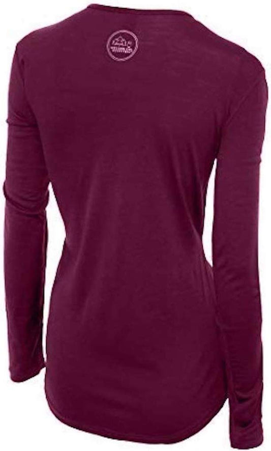
A sunny 74F afternoon on campus becomes a 53F evening on the same street, and crossing to San Francisco adds fog on top. Our merino base layers are 100% Australian merino at 17.5 micron, and a long sleeve merino wool base layer for women is right for that reason rather than for warmth. Add a fleece mid-layer, which you will want almost every evening of the year and which visitors leave at home in August and regret by nine.
Rain in winter, wind at the water
Winter is the wet season, February normally the wettest month, and the rain arrives in storms rather than drizzle, so a packable rain jacket is the answer between November and March and doubles as the windproof layer the marina needs in any month. A wide brim UPF sun hat earns its place in the hills. Three things we cannot link: SUNSCREEN and SUNGLASSES, because our registry carries no sunscreen entry and no eyewear entry at all; and an N95-TYPE MASK if you are coming in autumn, for the smoke days.
Footwear for a hill city with public stairways
Berkeley is steeper than it looks from the flats. The campus is hilly enough that its own walking tours warn you, the streets above town are threaded with public stairways, Tilden is real trail on steep duff, and Indian Rock is carved steps on bare outcrop. A waterproof hiking shoe with real grip with merino hiking socks covers all four and a smooth city sole does not. A small DAYPACK is worth having and we are not linking one, because the only entry we hold is marked verification pending.
Recommended Tours and Experiences
Essential Resources for Women at Berkeley
Emergency numbers: 911 for police, ambulance and fire, free from any phone including a locked mobile. Calls are answered locally and dispatchers will stay on the line. For non-urgent police matters many cities also run a 311 information line.
The number to save before you arrive: FREE NIGHT ESCORTS from the University of California police near campus, 510-642-WALK, which is 510-642-9255.
This is the single biggest practical difference for a visitor: there is no public health system, an emergency room visit without insurance can run into thousands of dollars, and an ambulance is billed separately and is not free. Comprehensive travel insurance with a high medical limit is not optional in the United States, and you should carry your policy number and the insurer's 24 hour number somewhere you can reach them. Urgent care clinics handle anything short of an emergency far more cheaply and quickly than an emergency room, and are the right choice for a sprain, an infection or stitches.
Main hospital, with a detail that belongs in this library. ALTA BATES SUMMIT MEDICAL CENTER began in 1904 as the Alta Bates Sanatorium FOR WOMEN AND CHILDREN, founded by a nurse, Alta Bates, whose name it still carries. Dial 911 for police, ambulance or fire. EARTHQUAKE INFORMATION comes from the United States Geological Survey and red flag warnings from the National Weather Service, not from 911.
US State Department travel advisory: there is none, and this is not an omission. The State Department issues travel advisories for other countries, not for the United States itself, so no US advisory for this destination exists to link. In its place, the Government of Canada advice for the United States gives an equivalent third-country assessment.
UK FCDO travel advice: gov.uk/foreign-travel-advice/usa, and read the safety and security page rather than only the landing page, because that is where the substance sits. The FCDO names no advised-against areas anywhere in the United States. The same advice also covers Puerto Rico, the US Virgin Islands, Guam, American Samoa and the Northern Mariana Islands.
Official health authority: the CDC travellers' health pages, the US federal health authority for visitors. with the United States Geological Survey the authority for earthquake information and the National Weather Service for red flag warnings and air quality.
Embassy contact: the United States is the host country, so there is no US embassy to contact. Your own country's embassy is in Washington DC, with consulates in New York, Los Angeles, Chicago, Houston, San Francisco, Miami and Boston. Find yours before you travel and save the number.
Official tourism authority: Brand USA, the national tourism marketing body. with the East Bay Regional Park District the practical authority for Tilden, the hill trails and any fire closure.
Solo women travellers. Berkeley is an easy city to visit alone and a better one than its 1960s reputation suggests: it is a university town, so a woman on her own walking, reading or sitting in a cafe is the most ordinary sight in it. The honest cautions are the ones above. Avoid walking alone at night, particularly in West and South Berkeley towards Oakland, use the free university police escort, and do not come down off a hill trail in the dark without proper shoes.
Takeaways
A university city opposite the Golden Gate, which is why it gets more fog than the rest of the East Bay rather than less. The monthly average high never reaches 77F and never falls below 58F, so pack one wool layer and a fleece and skip the coat. September is the warmest month and the dry end of fire season. The Hayward Fault traverses the city and runs down the middle of Memorial Stadium: learn drop, cover and hold on. Save 510-642-WALK for a free night escort.
Reading On
San Francisco is twenty to thirty minutes away under the bay and is the companion to this post, because the fog that defines Berkeley is pulled through the gap in the photograph above. Oakland is two BART stops south and is the sunnier half of the East Bay, which Berkeley is the exception to. North across the Golden Gate, Sausalito covers the ferry town and the headlands, Napa is the wine country where a car earns its keep, and Monterey is two hours down the coast. The United States travel guide for women carries the regions and the health insurance question in full, the reasoning behind one wool layer is in the guide to merino base layers for women, and every destination is indexed at the travel packing guide for women.
If the outer journey is calling you, the inner one usually is too. Explore SoulMap at romantrail.com/blogs/soulmap.