

Photograph: Zion National Park, the Narrows by Trougnouf, CC BY 4.0, via Wikimedia Commons. It is cropped and resized, with our badge added.
The Narrows is the narrowest section of Zion Canyon in Utah, where the National Park Service describes walls 1,000 feet tall and a river sometimes only 20 to 30 feet wide. Hiked from the bottom up, it is a walk in the Virgin River itself. This guide is about the route and the rules: how you reach it, how far you may go without a permit, how river flow changes the walk, and exactly when the park closes it.
The photograph above is by Trougnouf. It shows fast water running over rounded boulders beside a banded sandstone wall, with a gravel bar on the left. It does not show the paved Riverside Walk, the shuttle, other hikers or the river in flood.
Disclosure: This post contains affiliate links. If you buy through them, Roman Trail earns a small commission at no extra cost to you. As an Amazon Associate I earn from qualifying purchases.
Trail Summary
| Country and state | United States, Utah |
|---|---|
| Managing agency | National Park Service, Zion National Park |
| Start | Temple of Sinawava, Shuttle Stop 9, then the paved Riverside Walk for 1 mile to the river (NPS). |
| Distance | As far as Big Spring and back is, in the NPS's words, a strenuous ten-mile round trip and an all-day adventure. You can also turn round after an hour in the river. |
| Elevation gain | Not stated by the NPS on the pages we read. |
| Typical time | Up to all day to Big Spring and back (NPS). |
| Season | The NPS says most people hike it in summer and early autumn, that flash floods are more frequent in the monsoon season, and that winter and early spring bring high, cold water. |
| Typically hikeable | The NPS Narrows page says: "Most people hike The Narrows in the summer and early fall when the water level drops and tends to be at its warmest." It gives no months. Snowmelt closures: the NPS says "The river often closes to hiking during spring snowmelt (April, May, and possibly later)." Flash flood warnings: the NPS says "The river is also closed to hiking when the National Weather Service (NWS) issues flash flood warnings, which are common during the desert monsoon season (July through September)." Last checked 18 November 2026. |
| Permits | None from the bottom up as far as Big Spring (NPS). The 16-mile through-hike from Chamberlain's Ranch needs a wilderness permit. |
| Fees | Park entrance: the NPS gives a private vehicle pass at $35, valid for one to seven days, and an additional $100 per person for non-US residents aged 16 and over, unless admitted with an annual or America the Beautiful pass. |
| Closures | Closed to all travel above 150 cubic feet per second of river flow, when the National Weather Service issues a Flash Flood Warning, and for at least two hours after a warning is lifted (NPS). |
The Route
The walk begins with a shuttle ride. The Zion Canyon shuttle is free and needs no permit, ticket or reservation, the park says, and takes about 45 minutes from the Zion Canyon Visitor Center to the Temple of Sinawava, the last stop. During the shuttle season you cannot drive your own car on the Zion Canyon Scenic Drive, including before the shuttles start and after they stop. From the Temple, the paved Riverside Walk runs 1 mile up the canyon to where the path ends and the river begins.
From there you walk upstream in the Virgin River. The NPS Narrows safety page says at least 60 per cent of the hike is spent wading, walking and sometimes swimming in the river, and the main Narrows page compares it to walking on wet bowling balls. You can turn back at any point. Big Spring is the limit of the no-permit walk: the NPS says hiking upstream as far as Big Spring does not require a permit, and that the walk there and back is strenuous, ten miles and all day.
Watch the time on the way out. The shuttle page lists the last shuttle out of the canyon from the Temple of Sinawava at 6:15 p.m. from 25 October to 28 November, no service from 29 November to 25 December, and a last shuttle at 5:45 p.m. from 26 December to 2 January. It warns against waiting for the last shuttle, because if it is full or you miss it you may have to walk nine miles back to the visitor center.
River Flow and the Closure Rules
The park closes the Narrows on three rules, and they are worth knowing word for word. The NPS says: "If the flow goes over 150 CFS, The Narrows will be closed to all travel. The Narrows also closes when a Flash Flood Warning is issued by the National Weather Service. The Narrows will remain closed for at least two hours after a warning is lifted." For the top-down through-hike the threshold is lower, 120 cubic feet per second, according to the park's top-down page.
Below the closure line, flow decides how hard the walk is. The NPS says that below 70 cubic feet per second walking is moderately difficult, with knee-deep crossings and frequent pools up to waist deep, and that between 70 and 150 walking against the current becomes challenging, with frequent thigh-deep crossings and pools that can be chest deep. Spring snowmelt can push the river over 150 and close the Narrows; the park's own table records 2026 as open most of the time.
Our advice: check the flow and the forecast on the morning you go, at a visitor center or on the park's Narrows page, and treat a closure as final.
What to Wear and Pack
The NPS is specific about footwear: sturdy, closed-toe shoes are essential, hiking boots with good ankle support are best, and sandals, crocs and bare feet are not appropriate. It highly recommends a hiking pole or stick for balance and for testing depth, suggests dry bags for your belongings, and asks you to bring at least one gallon of water per person per day and never to drink from the river.
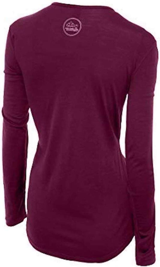
On layers, the park says the river is often colder than the air, that clothing made of wool or synthetic fibres has the best insulation, and that you should carry extra warm clothing in a dry bag in every season; it gives average summer water temperatures of 56 to 68 degrees Fahrenheit. Our merino base layers are 100% Australian merino at 17.5 micron, and a long sleeve merino wool base layer for women is the warm layer we would keep in that dry bag. For layering in Zion in detail, read the guide to what to wear hiking in Zion and the Zion packing list.
Feet, balance and bags
Wear waterproof hiking boots with merino wool socks, keep everything that must stay dry in a dry bag, and carry water in an insulated water bottle. For the walk back in the evening light, pack a rechargeable headlamp. That is our fifth affiliate link; the only trekking pole entry in our register is marked as contested, so we have not linked one. Bring or rent your own.
Safety and Conditions
Flash floods are the first hazard. The NPS says they are often caused by storms miles away, that the water can rise within minutes or even seconds, and that a flood can come down the canyon as a wall of water 12 feet high or more. Its signs to watch for are worsening weather, building clouds or thunder, water turning from clear to muddy, floating debris and the roar of water up-canyon; if you see any of them, seek higher ground immediately. The park's current conditions page adds that summer daytime temperatures regularly exceed 100 degrees Fahrenheit and that mid-to-late summer monsoons increase the chance of flash floods. Check the National Weather Service flash flood potential page the park links.
The park names the rest plainly. Lower leg fractures are among the most common injuries in its wilderness, and jumping from rocks is the most common cause, so lower yourself down instead. Cyanotoxins may be present in the water, with risk rising during and after rain. And hypothermia, it says, is the number one killer of outdoor recreationists, even in summer: avoid cotton, which provides no insulation when wet, and eat before you are chilled.
Lodging
There is one lodge inside the park. The Zion Lodge, managed by Xanterra and listed on the National Register of Historic Places, sits in Zion Canyon on the shuttle route, according to the NPS. Springdale is the community closest to the park's south entrance, the park's goods and services page says, and nearby towns offer lodging and camping.
Food
The NPS eating and sleeping page says the Zion Lodge is the only place in the park that serves food, with its Red Rock Grill open year-round. It also notes that most visitors stock up on food in the nearby towns. Our advice: carry your food and all your water for the day in the river.
Stores
The park lists no store at the Temple of Sinawava. Our advice: buy food and any forgotten gear in Springdale before you board the shuttle.
Urgent Care
For emergencies in the park, dial 911, the NPS goods and services page says. Outside the park it lists Zion Canyon Medical Clinic in Springdale and Dixie Regional Medical Center in St. George, among others. The NPS also says rescues in the Narrows are lengthy and uncomfortable.
Is the Narrows Safe for Women Hiking Alone
The FCDO names no area of the United States it advises against. On hiking it says risks are greater if you undertake any activity alone, and advises leaving copies of your itinerary with someone and checking the National Park Service website. In our view the hazards here are the river and the weather, not other people: a flood, a fall on wet rock, or cold water. Check the closure status and forecast that morning, tell someone your turnaround time, and come out well before the last shuttle.
Recommended Tours and Experiences
Essential Resources for Women on the Narrows
Emergency numbers: 911 for ambulance, fire and police, according to the FCDO's getting help page; its health page says to dial 911 and ask for an ambulance.
Closures, flow and safety: the NPS Narrows page, the Narrows safety page and the current conditions page.
Medical care: Zion Canyon Medical Clinic in Springdale and Dixie Regional Medical Center in St. George, as listed by the NPS.
Cost of care: the FCDO says medical treatment in the US is expensive, that there are no special arrangements for British visitors, and that some hospitals ask non-US residents for a deposit on admission; send any request for funds to your insurer first.
US State Department travel advisory: there is none, and this is not an omission. The State Department issues travel advisories for other countries, not for the United States itself, so no US advisory for this destination exists to link. In its place, the Government of Canada advice for the United States gives an equivalent third-country assessment.
UK FCDO travel advice: gov.uk/foreign-travel-advice/usa, and read the safety and security page rather than only the landing page, because that is where the substance sits. The FCDO names no advised-against areas anywhere in the United States. The same advice also covers Puerto Rico, the US Virgin Islands, Guam, American Samoa and the Northern Mariana Islands.
Official health authority: the CDC travellers' health pages, the US federal health authority for visitors.
Embassy contact: the United States is the host country, so there is no US embassy to contact. Your own country's embassy is in Washington DC, with consulates in New York, Los Angeles, Chicago, Houston, San Francisco, Miami and Boston. Find yours before you travel and save the number.
Official tourism authority: Brand USA, the national tourism marketing body, covers the whole country; for the trail itself, use the National Park Service pages above.
Solo women safety assessment: the FCDO advises against no part of the United States, says terrorists are very likely to try to carry out attacks in the US, and says violent crime and gun crime rarely affect tourists. On this walk, in our view, the hazards are flash floods, wet rock and cold water. Respect every closure, carry warm layers in a dry bag, and leave your plan and turnaround time with someone. Emergency 911.
Last checked: the route, closure rules, shuttle times, services and fees were checked against the National Park Service pages listed below on 18 November 2026.
Sources
- NPS, The Narrows (updated 18 September 2026), read 17 November 2026
- NPS, The Narrows Safety (updated 17 September 2026), read 17 November 2026
- NPS, The Narrows from the Top Down, read 17 November 2026
- NPS, Zion Canyon Shuttle System (updated 4 October 2026), read 17 November 2026
- NPS, Eating and Sleeping, NPS, Goods and Services, NPS, Current Conditions and NPS, Fees, read 17 November 2026
- FCDO, USA travel advice (updated 14 November 2026), read 17 November 2026
Reading On
For the whole park, read the Zion packing list, and for layering on Zion's trails, the guide to what to wear hiking in Zion. Every trail we cover is indexed at the women's trail hiking guide, and the USA travel guide for women covers the whole country. For why one wool layer works across a day of changing conditions, read the guide to merino wool base layers for women, and every destination we cover is indexed at the travel packing guide for women. The base layers themselves are in the Roman Trail collection. In Capitol Reef National Park, also in Utah, the Hickman Bridge Trail guide covers a short climb to a natural bridge where the park's flash flood advice applies too.
If the outer journey is calling you, the inner one usually is too. Explore SoulMap at romantrail.com/blogs/soulmap.