

Photograph: Hickman Bridge in the snow by National Park Service, Public domain, via Wikimedia Commons.
The Hickman Bridge Trail climbs to a natural sandstone bridge in Capitol Reef National Park, Utah, and the National Park Service trail guide lists it as 0.9 miles one way with 400 feet of elevation change, rated moderate, to a "133-foot natural bridge" with canyon views. It starts at the Hickman Bridge-Rim Overlook-Navajo Knobs Trailhead off Utah Highway 24. This guide covers the walk, the water you must carry, the heat, flash floods and winter ice the park warns about, and the one rule at the bridge itself: you walk under it, never on top.
The photograph above is a National Park Service image of Hickman Bridge with snow on the ground below it and cliffs through the opening. It does not show the trailhead, the climb or summer conditions.
Disclosure: This post contains affiliate links. If you buy through them, Roman Trail earns a small commission at no extra cost to you. As an Amazon Associate I earn from qualifying purchases.
Trail Summary
| Country and state | United States, Utah |
|---|---|
| Managing agency | National Park Service, Capitol Reef National Park |
| Trailhead | Hickman Bridge-Rim Overlook-Navajo Knobs Trailhead, off Utah Highway 24 (NPS). |
| Distance | 0.9 miles one way (NPS trail guide). |
| Elevation change | 400 feet (NPS trail guide). The park says many of its trails start at around 5,000 feet. |
| Typical time | Not stated by the NPS on the pages we read. The park says the average person hikes about 2 miles an hour. |
| Season | The park and campgrounds are open year round (NPS). |
| Typically hikeable | The NPS hiking page says: "Spring and fall are mild seasons and are the best times for hiking and backpacking." It gives no months for this trail. Flash floods: the NPS weather page says "Much of the precipitation falls during the summer monsoon season, usually from July to September." Winter: the NPS hiking page says "Winter (November-February) is cold with highs from 30 to 45 F (-1.1-7.2 C) and nighttime temperatures below freezing." Last checked 18 November 2026. |
| Permits | None for a day hike. Backcountry camping needs a free permit from the visitor center (NPS). |
| Fees | Park entrance: $20 per private vehicle, valid for 7 days, or $10 per person with no car (NPS). |
| Closures | None on this trail on 17 November 2026, when the conditions page read "Capitol Reef National Park is fully open." The top of the bridge is closed to the public at all times. |
The Walk
The trail guide gives 0.9 miles to the bridge and 400 feet of climb, which the park rates moderate. The same page warns that a starting elevation of around 5,000 feet "can make even 'easy' trails challenging for people visiting from lower elevations", so the climb can feel harder than the numbers suggest if you have come up from the coast. The park says many of its trails are marked with rock cairns, and asks you to bring a map, stay on established trails and not shortcut switchbacks or throw rocks.
The park's hiking page says the average person hikes about 2 miles an hour. On that figure the round trip of 1.8 miles is a short outing, but our advice is to allow longer: you will stop at the bridge, and the heat or ice of the season sets the pace more than the distance does.
The trailhead has a history the park still records. On 23 March 2013, its news release says, "several hundred tons of material fell, blocking the only trail access to Hickman Bridge." A later release says the trail was realigned around the debris pile, and lists the "inherent dangers" as rock fall, flash floods, loose footing and lightning.
The Bridge and the Closed Top
The park's superintendent's compendium is direct: "The top of Hickman Natural Bridge is closed to the public." It gives the reason: the trail "passes directly underneath the bridge creating a hazard of falling debris if people were on top of the bridge." So the rule protects the hikers below you as much as the rock. The same document closes the cliffs and talus slopes north of Utah State Route 24 between the Fruita Schoolhouse at mile 80.1 and the Hickman Bridge Trailhead to entry. Stay on the trail and look from below.
Water and Heat
The park's hiking page says water is not available at any trailheads and many trails have little to no shade. Its safety page asks you to carry one gallon per person per day and says drinking water is available at the visitor center, the picnic area and Fruita Campground; the hiking page adds that the spigots there are seasonal. Fill up before you drive to the trailhead.
The hiking page describes summer months as hot, with temperatures near 100 F and intense sun, and says "rapid dehydration is common and could be fatal to the unprepared hiker." The safety page advises starting hikes at the beginning or end of the day to avoid the peak heat. The trail guide adds that parking at many trailheads fills by 9 am and stays crowded until after 4 pm, which in summer is a second reason to start early.
Flash Floods
The park's weather page says much of its rain falls in the summer monsoon season, usually from July to September, and that summer downpours can create dangerous flash floods. The safety page adds two lines worth remembering: "A flash flood can occur even if precipitation falls outside of the park," and "Sunny skies over Capitol Reef does not equal flash flood safety!" It advises checking the forecast before hiking and choosing trails outside canyons, or postponing, if thunderstorms are predicted. The park records a Fruita forecast each morning on its phone line. The repair release lists lightning among this trail's dangers Our advice: turn back if a storm builds.
Winter
The hiking page says winter, November to February, is cold, with highs from 30 to 45 F and nights below freezing. It says infrequent winter snows often melt the same day but can stay on the ground for days or weeks, and the safety page warns that winter snow "can obscure tripping hazards and even edges of steep drop-offs." The park's conditions page said on 17 November 2026 that the visitor center moves to winter hours, 9:00 am to 4:30 pm daily, from 29 November.
Getting There
The trailhead is off Utah Highway 24 in the Fruita area of the park, the NPS says. On 17 November 2026 the conditions page listed the park as fully open and the Scenic Drive as passable by two-wheel-drive vehicles, with the Grand Wash and Capitol Gorge roads closed; neither is the way to this trail. The fees page lists $20 per private vehicle for 7 days and $10 per person with no car. Pets are not permitted on trails, the hiking page says.
What to Wear and Pack
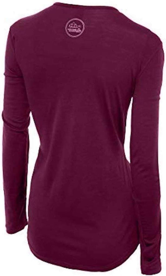
The park's own pages set the list: sun, heat, water, flash floods and, in winter, ice and cold. Our merino base layers are 100% Australian merino at 17.5 micron. In our view a lightweight long sleeve merino wool base layer for women works here as sun cover in spring and fall and as a warm first layer on a winter morning, when the park gives highs of 30 to 45 F.
Feet, sun and light
Wear waterproof hiking shoes and merino wool socks. For the sun the park describes, carry a wide brim sun hat and a long sleeve sun hoodie. If you start at first light to beat the heat, a rechargeable headlamp helps. Carry the gallon of water the park asks for in whatever bottles you own; our registry carries no water bottle we can link.
Respecting the Desert
The hiking page asks hikers to avoid stepping on biological soil crusts and not to swim in potholes, tanks, tinajas or waterpockets. It explains that these are important water sources for wild animals, and that sunscreen, lotion and oils on skin can pollute them. Stay on the trail and keep your hands out of standing water.
Lodging, Food and Stores
The park says its campgrounds are open year round. The conditions page said on 17 November 2026 that the Gifford House store would close for the season after Sunday, 22 November 2026. Our advice: buy food and water supplies before you reach Fruita, and fill bottles at the visitor center, picnic area or campground spigots while they run.
Urgent Care
In an emergency, call 911, the park's campground regulations say. Its local services page adds that you can call 911 from the payphone in Fruita Campground, next to the fee station in Loop A. The nearest medical care listed by the park is the Wayne Community Health Center in Bicknell, 19 miles west on Utah State Route 24, and the closest hospital is in Richfield, 75 miles west.
Is the Hickman Bridge Trail Safe for Women Hiking Alone
The FCDO names no area of the United States it advises against. On hiking it says risks are greater if you undertake any activity alone, and advises leaving copies of your itinerary with someone and checking the National Park Service website. In our view the risks on this short trail are heat, flash floods, loose footing and winter ice rather than other people. Carry the water the park asks for, check the forecast, and tell someone your plan and when you expect to return.
Recommended Tours and Experiences
Essential Resources for Women on the Hickman Bridge Trail
Emergency numbers: 911 for ambulance, fire and police, according to the FCDO's getting help page; its health page says to dial 911 and ask for an ambulance.
Trail, weather and closures: the NPS trail guide, the hiking page, the weather page and the current conditions page. The park records a Fruita forecast each morning on its phone line, 435-425-3791.
Medical care: the park's campground regulations place the Wayne Community Health Center in Bicknell, 19 miles west on Utah State Route 24, and the closest hospital in Richfield, 75 miles west. The local services page says the Bicknell centre offers basic medical and dental care and a pharmacy.
Cost of care: the FCDO says medical treatment in the US is expensive, that there are no special arrangements for British visitors, and that some hospitals ask non-US residents for a deposit on admission; send any request for funds to your insurer first.
US State Department travel advisory: there is none, and this is not an omission. The State Department issues travel advisories for other countries, not for the United States itself, so no US advisory for this destination exists to link. In its place, the Government of Canada advice for the United States gives an equivalent third-country assessment.
UK FCDO travel advice: gov.uk/foreign-travel-advice/usa, and read the safety and security page rather than only the landing page, because that is where the substance sits. The FCDO names no advised-against areas anywhere in the United States. The same advice also covers Puerto Rico, the US Virgin Islands, Guam, American Samoa and the Northern Mariana Islands.
Official health authority: the CDC travellers' health pages, the US federal health authority for visitors.
Embassy contact: the United States is the host country, so there is no US embassy to contact. Your own country's embassy is in Washington DC, with consulates in New York, Los Angeles, Chicago, Houston, San Francisco, Miami and Boston. Find yours before you travel and save the number.
Official tourism authority: Brand USA, the national tourism marketing body, covers the whole country; for the trail itself, use the National Park Service pages above.
Solo women safety assessment: the FCDO advises against no part of the United States, says terrorists are very likely to try to carry out attacks in the US, and says violent crime and gun crime rarely affect tourists. On this trail, in our view, the hazards are heat, flash floods, loose footing and winter ice rather than other people; carry water, check the forecast, and tell someone your plan. Emergency 911.
Last checked: distance, water, weather, closures, fees and medical care were checked against the National Park Service pages listed below on 18 November 2026.
Sources
- NPS, Capitol Reef Trail Guide, read 17 November 2026
- NPS, Hiking, NPS, Weather and NPS, Your Safety, read 17 November 2026
- NPS, Superintendent's Compendium, read 17 November 2026
- NPS, Current Conditions (updated 17 November 2026) and NPS, Operating Hours and Seasons, read 17 November 2026
- NPS, Fees and Passes, read 17 November 2026
- NPS, Rockfall Closes Hickman Bridge Trailhead (1 April 2013) and NPS, Hickman Bridge Trailhead Temporary Closures (10 March 2014), read 17 November 2026
- NPS, Campground Regulations and NPS, Local Services, read 17 November 2026
- FCDO, USA travel advice (updated 14 November 2026), read 17 November 2026
Reading On
In the same state, the Narrows guide covers a river hike in Zion where flash floods close the route, and the Bryce Canyon packing list and Canyonlands packing list cover two more Utah parks. Every trail we cover is indexed at the women's trail hiking guide, and the USA travel guide for women covers the whole country. For why one wool layer works across a day of changing conditions, read the guide to merino wool base layers for women, and every destination we cover is indexed at the travel packing guide for women. The base layers themselves are in the Roman Trail collection.
If the outer journey is calling you, the inner one usually is too. Explore SoulMap at romantrail.com/blogs/soulmap.