

Photograph: Main Street, Whitehorse by Rural Health Professions Action Plan, CC BY 2.0, via Wikimedia Commons.
Whitehorse is the capital of the Yukon and the largest city in Northern Canada, a place of 28,201 people at the 2021 census, set on the Yukon River and on the Alaska Highway. It is small enough to walk across in an afternoon and big enough to have a hospital, an airport and a good bakery, which up here is a lot. Most visitors come for one of two seasons: the winter, with its deep cold and its chance of northern lights, or the summer, when the days run almost round the clock and the river and the trails open up. Packing for it means packing for one of those two extremes, and getting the cold right matters more here than almost anywhere else this library covers.
Disclosure: This post contains affiliate links. If you buy through them, Roman Trail earns a small commission at no extra cost to you.
The photograph above was taken on a clear winter morning at a downtown corner. Low sun lights a brown and tan office block with a bank sign and street banners on the left, a green street sign reads 3rd Ave, and a long straight street of low buildings runs away to snowy wooded hills at the far end, with packed snow and ice on the road and parked pickups along it.
What the frame cannot show is most of what brings people north. The Yukon River, the sternwheeler on its bank, the basalt walls of Miles Canyon, the forest and mountains beyond the city, the northern lights and anything at all of summer are absent from it. What it does show honestly is the city's winter light and the ice underfoot on an ordinary street, which is what you will be walking on.
We receive a fee when you get a quote from World Nomads using this link. We do not represent World Nomads. This is not a recommendation to buy travel insurance.
What Is Here: A Gold Rush Town on a River
The city takes its name from the White Horse Rapids, which a traveller guide says resembled the mane of a white horse. They no longer exist: they disappeared under Miles Canyon and Schwatka Lake when a hydroelectric dam was built in 1958. Before that, the rapids were the head of navigation for paddle-wheel river boats, which could go no further, and that obstacle is the reason a town grew here at all.
The Klondike gold discovery of August 1896 changed everything. By July 1897, the encyclopaedia records, crowds of new prospectors had arrived by steamship and were camping at "White Horse". The White Pass and Yukon Route narrow-gauge railway linking Skagway to the town was completed in 1900, and in 1942 the US military built the Alaska Highway through it between March and November of that one year. In 1953 the territorial capital moved here from Dawson City after the Klondike Highway was built.
Dawson City is a separate place, far to the north up the Klondike Highway, and this guide does not cover it. Nor does it cover Yellowknife, which is the capital of a different territory. The pubs and hotels around the world called the White Horse have nothing to do with any of this.
In town, the S.S. Klondike National Historic Site is a sternwheeler paddleboat turned into a museum on the riverbank, and it is the clearest picture of how the territory was supplied before the road. The MacBride Museum covers local history, the Kwanlin Dun Cultural Centre showcases the Kwanlin Dun First Nation, and the Yukon Beringia Interpretive Centre tells the story of the land bridge between Asia and the Americas in the Ice Age. Below the dam, a wooden fish ladder lets migrating salmon past the hydroelectric station, with an underwater window for watching them. Check opening days before you go, because several of these keep shorter hours outside summer.
Outdoors: Miles Canyon, Trails and Hot Water
Miles Canyon lies on the Yukon River south of the city, where the river runs between walls of volcanic basalt, and it is the easiest piece of real landscape to reach without a car of your own. The Trans-Canada Trail runs through the city, and a traveller guide lists bike trails and a cross-country ski club with 85 kilometres of groomed trails and saunas for warming up afterwards.
North of town, off the Klondike Highway, an outdoor hot spring offers the odd pleasure of sitting in hot water while the air around you is far below freezing. Bring a hat you can wet and a dry layer for the walk back to the car, because wet hair freezes in a deep cold. Further afield, a traveller guide suggests driving west on the Alaska Highway towards Haines Junction for Kluane National Park, or south on the Klondike Highway towards Carcross and Skagway.
When to Go
Whitehorse is cold, dry and, in summer, very light. The encyclopaedia gives an average daily low of minus 19.2 degrees in January and an average daily high of 20.6 degrees in July, and adds that in cold snaps it is not uncommon for the temperature to fall below minus 40. It sits in the rain shadow of the Coast Mountains, and by the federal weather office's own reckoning it is Canada's driest city. It is also milder than comparable northern communities such as Yellowknife, which is worth knowing if you are choosing between them.
The city sits at about 60 degrees north, and summer days have just over 19 hours of daylight. In winter the days are short. A traveller guide notes that many winter visitors to the North come specifically to see the northern lights. We cannot give you a reliable season or a forecast for them, so book on the understanding that clear skies and solar activity both have to cooperate, and ask a local operator about the conditions on the nights you are there.
Dry cold is easier to live with than damp cold, but it is still cold: skin dries out, lips crack, and frostbite on exposed fingers and cheeks happens faster than a newcomer expects. Summer brings the opposite set of problems, long hot days on the trails and the late light that makes it hard to sleep.
Getting There and Getting Around
Most visitors fly. A traveller guide lists scheduled flights from Vancouver with Air Canada and with Air North, the Yukon's own airline, and seasonal flights from other Canadian cities. By road, two highways meet in the city: the Alaska Highway runs east to west through it, and the Klondike Highway runs north to Dawson City via Carmacks and south to Skagway in Alaska via Carcross. The city has a bus service and taxis, and downtown is walkable.
If you drive in winter, take it seriously. The FCDO says winter storms, including freezing rain, blizzards and hail, are frequent in many parts of Canada from November to April, that driving can be dangerous even when roads stay open, and that your vehicle should have snow tyres and emergency supplies. It also says to take extra care on country roads and watch for wild animals. Check road conditions on 511 Yukon before every long drive, carry warm clothing in the car rather than in the boot of a rental you might not reach, and tell someone your route.
On entry, the FCDO says most visitors need either a visa or an Electronic Travel Authorization, not both, that your passport must be valid for the length of your stay, and that some unofficial websites charge for applications, so apply through the Canadian government's own site.
Is Whitehorse Safe for Women Travelers
The FCDO advises against travel to no part of Canada, read on 8 November 2026, and carries no line specific to women travellers. The FCDO publishes no advised-against areas anywhere in Canada. Its safety page does carry a terrorism warning: terrorists are likely to try to carry out attacks in Canada, and attacks could be indiscriminate, including in places visited by foreign nationals. The named risks are overwhelmingly WEATHER AND WILDLIFE rather than crime, and they are seasonal. Hurricanes and post-tropical storms on the coasts from July to November. Winter storms from November to April, which close highways and make driving genuinely dangerous rather than merely slow. Wildfires, a year-round risk concentrated in the west and in Quebec. Avalanches in the mountains of Alberta and British Columbia. Tornadoes from May to September. On crime, the FCDO names theft from unattended luggage and of valuables left in view, which is the ordinary big-city caution. On wildlife, take particular care where bears have been sighted and keep your distance from all of it.
The FCDO's terrorism section is broader than that summary: it says terrorists are likely to try to carry out attacks in Canada and that attacks could be indiscriminate, including in places visited by foreign nationals. Its crime advice is ordinary: do not leave bags unattended, keep luggage out of sight in cars, and keep your passport and valuables somewhere safe.
In Whitehorse the realistic risks are the cold, the roads and the wild country a short distance from town, rather than crime against visitors. Downtown is compact, and the ordinary rules apply after dark: walk with someone or take a taxi late at night, keep your phone charged, which matters doubly because cold drains a battery fast, and do not set off on a winter walk or drive without telling someone where you are going. On the trails, the FCDO's wildlife advice applies directly: take particular care where bears have been sighted and keep a safe distance from all wildlife.
Recreational cannabis is legal in Canada, the FCDO notes, but laws vary by province and territory, and taking it across the Canadian border without a permit is illegal. The FCDO also says that parts of Canada lie in the Arctic Circle, where emergency medical help and search and rescue are limited. Whitehorse itself is well south of that, but the further you drive from it, the more that line describes where you are.
The Whitehorse Packing List
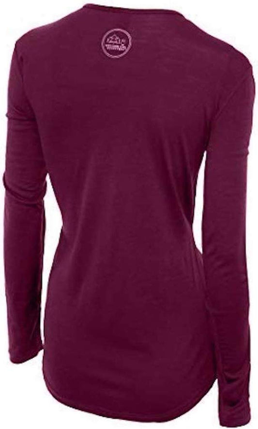
Our merino base layers are 100% Australian merino at 17.5 micron, and a long sleeve merino wool base layer for women is the single most useful garment for a Yukon trip in either season. In winter it is the layer that keeps you warm when you are standing still under a dark sky, and in summer it is the layer you can wear for days on the trail without it smelling.
For Deep Winter
Layering is the whole method. Over your base layer, add a heavyweight merino wool base layer on the coldest days, then a fleece or sweater, then a waterproof insulated ski parka long enough to cover your hips. On your feet, wool socks and waterproof insulated snow boots, and a traveller guide for the Yukon recommends buying winter boots one size up, which leaves room for thick socks and keeps blood moving to your toes. A tight boot is a cold boot.
Cover your head and hands properly: a merino beanie, a scarf or face covering, and merino wool glove liners under a warm outer mitt or glove, so you can take the outer layer off to use a camera or a phone without exposing bare skin. Our affiliate register carries no mitts, so we have left the outer mitts unlinked; buy the warmest you can find. For the packed ice you can see in the photograph above, Kahtoola MICROspikes slipped over your boots make walking on icy pavements much safer.
For Summer
Summer needs a lighter kit: hiking shoes, a fleece for the evenings, a light waterproof, sunscreen and an eye mask for the long light. Bring insect repellent for the trails, since the FCDO lists biting insects and ticks among Canada's health risks. We have not linked these, because we reached our limit of six product links on the winter list and the cold is where the right gear matters most.
Not linked, and why. Sunscreen, sunglasses and lip balm are unlinked because our register carries none of them, and in dry cold all three are worth packing. An insulated water bottle and a headlamp would earn their place too, and were left out to stay within the six link limit.
Recommended Tours and Experiences
Essential Resources for Women in Whitehorse
Emergency number: 911 for ambulance, fire and police, as the FCDO lists it. Ask for an ambulance by name.
Main hospital: Whitehorse General Hospital, run by the Yukon Hospital Corporation, is the only hospital in the city and the biggest in the Yukon, with emergency care around the clock. The FCDO says that for emergency healthcare you should go to a hospital emergency room or a walk-in clinic, that medical treatment in Canada can be very expensive, and that there are no special arrangements for British visitors, so carry insurance that covers treatment, evacuation and repatriation.
US State Department travel advisory: the Canada advisory. Read the current level there directly rather than relying on a figure printed in any guide.
UK FCDO travel advice: gov.uk/foreign-travel-advice/canada, and read the safety and security page rather than only the landing page, because that is where the substance sits.
Official health authority: the Public Health Agency of Canada.
US Embassy: the United States Embassy in Ottawa, is a very long way from the Yukon, so save its contact details before you travel.
Official tourism authority: Destination Canada, covers the whole country; for the territory itself see Travel Yukon.
Solo women safety assessment: Whitehorse is a small, friendly territorial capital where crime against visitors is not the main concern. The things that hurt people here are the cold, winter roads and wild country, so dress for the worst of the forecast, tell someone your plans before any drive or trail, check the road conditions first, and keep your phone warm and charged. After dark downtown, use a taxi if you are alone late at night. Emergency 911.
Takeaways
Pack in layers, with a heavyweight base layer and a long insulated parka for winter. Buy boots a size up. Take ice traction for the pavements. Treat the northern lights as a possibility rather than a promise. Check the roads before every long drive and tell someone your route. In summer, bring an eye mask for the light and repellent for the trails.
Reading On
For the country as a whole, start with the Canada travel guide for women and the Canada packing list. Most visitors connect through western Canada, so the Vancouver packing list, the Calgary packing list and the Edmonton packing list are the natural companions, and the Jasper packing list covers mountain winter further south. For Alaska at the other end of the highway, read the Juneau packing list and the Anchorage packing list. For other far northern winters, see the Tromso packing list and the Rovaniemi packing list, and if your hands and feet are always the first to go, read why women get cold hands and feet faster. For why wool rather than cotton matters most when it is genuinely cold, read the guide to merino wool base layers for women. Every destination we cover is indexed at the travel packing guide for women, and the base layers are in the Roman Trail collection. For the other northern capital, on Great Slave Lake in the Northwest Territories, the Yellowknife packing list covers it.
If the outer journey is calling you, the inner one usually is too. Explore SoulMap at romantrail.com/blogs/soulmap.