

Tacoma is on Puget Sound about 50 kilometres south of Seattle, and the structure in the first photograph is the reason most people have heard the name. THE TACOMA NARROWS BRIDGE is really two bridges now, a 1950 span and a 2007 twin, standing where the original opened on 1 July 1940 and FELL INTO THE WATER ON 7 NOVEMBER THE SAME YEAR. It had been nicknamed Galloping Gertie before it failed, because it visibly undulated in wind, and the film of its collapse is still shown in engineering courses around the world as the textbook case of aeroelastic flutter. The wreck is on the seabed below and is a protected site. The city around it is a working port that spent thirty years turning itself into a museum town, and it is a good deal more interesting than its reputation as Seattle's overlooked neighbour suggests.
Disclosure: This post contains affiliate links. If you buy through them, Roman Trail earns a small commission at no extra cost to you.
We receive a fee when you get a quote from World Nomads using this link. We do not represent World Nomads. This is not a recommendation to buy travel insurance.
What Is Here
DALE CHIHULY IS FROM TACOMA AND THE CITY IS BUILT AROUND THAT. The MUSEUM OF GLASS sits on the waterfront with a 27 metre steel cone over a working hot shop, where you can watch glassblowers all day from a raked auditorium, and the CHIHULY BRIDGE OF GLASS crosses the motorway from it to the museum district with his installations set into the structure. UNION STATION in the third photograph, the 1911 copper-domed terminal by the firm that did Grand Central, is now a FEDERAL COURTHOUSE with a Chihuly collection hanging in its rotunda, free to walk into on a weekday. Three serious museums stand within a few minutes of each other: glass, the Washington State History Museum and the Tacoma Art Museum.
THE PORT IS THE SECOND PHOTOGRAPH AND IT IS ENORMOUS. Tacoma handles one of the largest container volumes on the US west coast, and the cranes, the log stacks and the ships are part of the view from the waterfront rather than hidden behind it. The city's historic nickname was the AROMA OF TACOMA for the pulp mill smell, which is largely gone, and the honest version of this city is a working port that is now also a cultural one.

POINT DEFIANCE IS 700 ACRES ON A HEADLAND AND IS THE BEST FREE THING HERE. Old-growth forest, a five-mile drive with viewpoints over the Sound and the Narrows, gardens, a zoo and aquarium, and the ferry to Vashon Island leaving from below it. RUSTON WAY, the two-mile waterfront promenade south of it, is where the whole city walks in the evening.
MOUNT RAINIER IS 60 KILOMETRES AWAY AND VISIBLE ON A CLEAR DAY. Locals say "the mountain is out" when it is, because on most days it is not. It is also the subject of the safety section below, and the reason is not altitude or weather.
AND STADIUM HIGH SCHOOL IS WORTH THE DETOUR, a French chateau begun in 1891 as a railway hotel, converted to a school when the railway went bust, and used as the school in Ten Things I Hate About You.
When to Go
July to September is the dry season and it is genuinely lovely. Daytime in the low to mid twenties, long evenings, and this is when the mountain is actually out. Puget Sound summers are the Pacific Northwest's reward for the rest of the year.
May, June and October are good and quieter, in the mid to high teens, with June often grey into July, the local gloom the region jokes about.
November to March is mild, dark and wet. Daytime in the high single figures to low teens, rarely freezing, rarely snowing, and persistently drizzling. The museums are indoor and excellent, which makes winter here workable in a way it is not in a scenery destination.
THE RAIN IS NOT HEAVY AND IT IS CONSTANT, which is the distinction that decides the packing: Tacoma gets roughly 1,000mm a year spread thin, so the garment that matters is a light shell you keep on rather than a heavy one you deploy.
Getting There
Seattle-Tacoma International is 30 kilometres north and is closer to Tacoma than to central Seattle in traffic. Seattle is about 40 minutes without traffic and well over an hour with it, Portland about two and a half hours, Mount Rainier's Nisqually entrance about an hour and a half.
The SOUNDER commuter train runs to Seattle on weekdays and is the civilised way to do that trip, and Amtrak's Coast Starlight and Cascades both call at the new Freighthouse Square station.
Downtown, the museum district and the waterfront are walkable, connected by a free light rail line, the T Line, that runs the length of it. A car is wanted for Point Defiance, Ruston Way and the mountain.
AND IF YOU ARE GOING TO MOUNT RAINIER, READ THAT POST RATHER THAN THIS ONE. The park has timed entry in summer, the roads close with snow into June, and it is a different trip from a day in Tacoma.
The Tacoma Packing List
Persistent light rain, mild damp cool most of the year, a short dry summer and wind off the Sound.
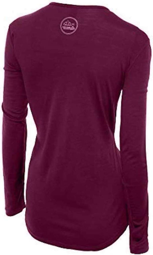
Our merino base layers are 100% Australian merino at 17.5 micron, and a long sleeve merino wool base layer for women is close to the ideal garment for Puget Sound, and the reason is specific. This is not a cold climate, it is a DAMP ONE AT ABOUT TEN TO FIFTEEN DEGREES for most of the year, which is exactly the band where cotton is at its worst: it takes up the drizzle, stops insulating, and leaves you chilled for hours in a city where you will be in and out of buildings all day. Wool keeps working damp.
A Marmot PreCip Eco rain jacket is the single most important item here and it should be the light packable kind rather than a heavy coat, because the rain is thin and constant rather than torrential. With it a Columbia Fast Trek II fleece, which is a year-round item on this coast including August evenings.
Waterproof walking boots rather than trainers if you intend to walk Point Defiance's forest trails, which are root-crossed and muddy for most of the year. For the city alone, walking shoes with grip are enough.
Merino glove liners and a merino beanie from October to April, for the waterfront where the wind comes off the water.
Not linked and worth packing: NO UMBRELLA, which is the local tell and is practical rather than affectation, because the rain comes with enough wind to make one useless and nobody here carries one; SOMETHING WINDPROOF OVER EVERYTHING for Ruston Way and the ferry; A DRY BAG OR WATERPROOF PHONE CASE if you take the Vashon ferry or a boat; AND LAYERS YOU CAN CARRY, since the museums are warm and the waterfront is not.
Recommended Tours and Experiences
Essential Resources for Women in Tacoma
Emergency numbers: 911 for police, ambulance and fire, free from any phone including a locked mobile. Tacoma has its own police department and Pierce County a sheriff's office; the United States Coast Guard covers Puget Sound and is reached through 911 or VHF channel 16. Coverage is good throughout the city.
THE VOLCANO IS THE THING ALMOST NO VISITOR KNOWS AND IT IS WHY THIS CITY HAS SIRENS. Mount Rainier is 60 kilometres away and the USGS rates it the MOST DANGEROUS VOLCANO IN THE UNITED STATES, not because it erupts often but because of what sits downhill from it. The hazard is a LAHAR, a fast mudflow of meltwater, ash and rock that can travel tens of kilometres down a river valley at the speed of a car, and Rainier's lahar paths run down the PUYALLUP AND CARBON VALLEYS straight through Orting, Sumner and Puyallup and into the Port of Tacoma's tideflats. A lahar can be triggered without an eruption, by the collapse of the mountain's own weakened flank. PIERCE COUNTY HAS AN OUTDOOR SIREN SYSTEM AND SIGNED EVACUATION ROUTES FOR IT, and the sirens are tested on the first Monday of each month, which is the thing to know so that a test is not mistaken for the real one. The instruction, if it is not a test, is to move to HIGH GROUND ON FOOT immediately and not to drive down a valley. The USGS Cascades Volcano Observatory publishes the alert level and Pierce County publishes the evacuation maps. THE OTHER GEOLOGY IS THE SAME AS SEATTLE'S: this is an earthquake coast, with the Cascadia subduction zone offshore and shallow crustal faults beneath the city, and the drill indoors is DROP, COVER, HOLD rather than running outside. On the open coast the rule would be to move inland after a long or strong quake; Tacoma is inside Puget Sound rather than on the ocean, which reduces but does not remove the tsunami question for the waterfront. THE EVERYDAY RISKS ARE ORDINARY: persistent wet pavement and mossy steps, which is where people actually fall; cold water, with the Sound at about 8 to 12 degrees year round and cold shock a real risk for anyone who goes in; and the usual urban property crime, with CAR PROWLING being Tacoma's specific problem and the reason every local leaves a car visibly empty. The National Weather Service office in Seattle covers the warnings for this stretch of the Sound.
US State Department travel advisory: there is none, and this is not an omission. The State Department issues travel advisories for other countries, not for the United States itself, so no US advisory for this destination exists to link. In its place, the Government of Canada advice for the United States gives an equivalent third-country assessment.
UK FCDO travel advice: gov.uk/foreign-travel-advice/usa, and read the safety and security page rather than only the landing page, because that is where the substance sits. The FCDO names no advised-against areas anywhere in the United States. The same advice also covers Puerto Rico, the US Virgin Islands, Guam, American Samoa and the Northern Mariana Islands.
Main hospital: Tacoma General Hospital and St Joseph Medical Center both have 24 hour emergency departments in the city, and Harborview in Seattle is the region's level one trauma centre about 45 minutes north. Mary Bridge is the children's hospital. Urgent care clinics are widespread. Dial 911 for any emergency. This is the single biggest practical difference for a visitor: there is no public health system, an emergency room visit without insurance can run into thousands of dollars, and an ambulance is billed separately and is not free. Comprehensive travel insurance with a high medical limit is not optional in the United States, and you should carry your policy number and the insurer's 24 hour number somewhere you can reach them. Urgent care clinics handle anything short of an emergency far more cheaply and quickly than an emergency room, and are the right choice for a sprain, an infection or stitches.
Official health authority: the CDC travellers' health pages, the US federal health authority for visitors. covers the national health information service and travel health guidance
Embassy contact: the United States is the host country, so there is no US embassy to contact. Your own country's embassy is in Washington DC, with consulates in New York, Los Angeles, Chicago, Houston, San Francisco, Miami and Boston. Find yours before you travel and save the number.
Official tourism authority: Brand USA, the national tourism marketing body. covers the Pacific Northwest, and Travel Tacoma publishes the Museum of Glass hot shop schedule, the T Line hours and the Point Defiance park information
Takeaways
Galloping Gertie fell into the Narrows in November 1940. The wreck is still down there.
Chihuly is from here. Watch the hot shop at the Museum of Glass and walk into Union Station.
Pierce County has lahar sirens for Mount Rainier. Tested first Monday monthly.
Thin constant rain, not downpours. A light shell beats a heavy coat, and nobody uses an umbrella.
Solo women safety assessment: Tacoma is an easy place to travel alone with the ordinary cautions of a mid-sized American port city. The museum district and the waterfront are compact, walkable and busy, the free T Line connects them, eating alone is completely ordinary, and the city's visitor economy is museums, glass and a park rather than nightlife. The sensible cautions are specific rather than vague: CAR PROWLING is Tacoma's characteristic crime and every local leaves a vehicle visibly empty, so do the same; the Hilltop neighbourhood has gentrified substantially and is fine by day while parts of South Tacoma and the area around the Puyallup Avenue corridor are worth avoiding late; and the ordinary drink-watching advice applies in the downtown bars. THE RISKS WORTH KNOWING ARE GEOLOGICAL AND WEATHER. Mount Rainier is the most dangerous volcano in the United States by population at risk, the hazard is a lahar down the Puyallup valley into the city's tideflats, Pierce County has outdoor sirens and signed evacuation routes for it, and the sirens are tested on the first Monday of each month so a test is not mistaken for the real thing; if it is real, go to high ground on foot and do not drive down a valley. This is also an earthquake coast, where the indoor drill is DROP, COVER, HOLD. Day to day the hazard is wet pavement and mossy steps, which is where people fall, and the Sound is 8 to 12 degrees year round and cold enough for cold shock. 911 WORKS, TWO CITY HOSPITALS HAVE EMERGENCY DEPARTMENTS, AND HARBORVIEW IN SEATTLE IS THE REGIONAL TRAUMA CENTRE.
Reading On
Tacoma sits between Seattle and Mount Rainier and this library covers the Pacific Northwest closely. The Seattle packing list covers the city forty minutes north that this one is constantly compared with, and the Olympic packing list the rainforest peninsula across the Sound. East over the Cascades, the Spokane packing list covers the semi-arid inland city that is nothing like this climate. South in Oregon, the Portland packing list, Cannon Beach packing list and Newport packing list cover the city and the coast that carries the Cascadia instruction in its sharpest form, with the Bend packing list and Crater Lake packing list inland. For the mountains, the Glacier packing list and Yellowstone packing list cover the northern Rockies. For the country, the USA travel guide for women carries the regions, the driving and the seasons in full. For why wool is the right fibre in a climate that is damp and twelve degrees most of the year, read the guide to merino wool base layers for women. Every destination we cover is indexed at the travel packing guide for women, and the base layers are at the Roman Trail collection. South down Interstate 5, the Olympia packing list covers the state capital half an hour away, which sits outside the Rainier lahar paths this city plans for and at the gateway to the Olympic peninsula instead.

If the outer journey is calling you, the inner one usually is too. Explore SoulMap at romantrail.com/blogs/soulmap.