

Selfoss is a town of about nine thousand people on the Olfusa river in south Iceland, fifty minutes east of Reykjavik, and it is the largest settlement in the whole of the south. Almost every visitor to Iceland passes through it and very few stop, because it sits at the junction where the ring road meets the routes to the Golden Circle and the south coast and it looks, from the car, like somewhere to buy fuel.
Disclosure: This post contains affiliate links. If you buy through them, Roman Trail earns a small commission at no extra cost to you.
It is worth a different reading than that. Selfoss is the most practical base in south Iceland: it is an hour from the Golden Circle, an hour and a half from the south coast waterfalls, fifty minutes from Keflavik's road and considerably cheaper to sleep in than Reykjavik. It is also a genuinely interesting example of what modern Iceland actually looks like, which the photographs of waterfalls do not show you.
One honest note, and it is a larger one than usual. FIRST: THERE ARE TWO PLACES CALLED SELFOSS IN ICELAND. This is the town. The other is a waterfall in the north of the country, on the Jokulsa a Fjollum about a kilometre upstream of Dettifoss, and if you search for Selfoss you will mostly find photographs of that. SECOND: our set for the town is thin. Three of the seven usable frames establish the place and they are houses, a street and the river. There is no frame of the bridge, the church or the Olfusa in flood, and the post says so rather than implying a set it does not hold.
We receive a fee when you get a quote from World Nomads using this link. We do not represent World Nomads. This is not a recommendation to buy travel insurance.
What Is Here
The Olfusa and its bridge are the reason the town exists. The river is one of the largest in Iceland by volume, draining the Hvita and the glacial outflow above it, and the first suspension bridge across it in 1891 created the settlement. The current bridge is a 1945 replacement and a new one is under construction. Standing on it, the water below is grey, fast and enormous, and it is the most impressive thing in the town centre.
The town is a working place and that is its interest. Selfoss grew around the dairy, which is still here, and the Mjolkurbuid building has been converted into a food hall of small producers that is the best eating in town. The streets around it are low concrete and timber, there is a swimming pool as every Icelandic town has, and the centre is being substantially rebuilt in a new scheme of timber-fronted buildings that is either a handsome revival or a theme park depending on who you ask.

The geothermal greenhouses around the town are the thing almost nobody knows about. South Iceland grows tomatoes, cucumbers, peppers and even bananas under glass heated by geothermal water, year round, at this latitude. Several of the growers nearby open to visitors, and Fridheimar, half an hour towards the Golden Circle, serves tomato soup in the greenhouse among the vines and is deservedly popular enough to need booking.
Just outside town, the Kerid crater is a volcanic caldera with a startling blue-green lake in it, on the Golden Circle route. Urridafoss, ten minutes east, is the highest-volume waterfall in Iceland and has roughly none of Gullfoss's visitors. The Olfusa estuary and the coast at Eyrarbakki, twenty minutes south, is a long black beach with a different, bleaker character than the famous ones.
Hveragerdi, fifteen minutes west, is the geothermal town where the ground steams in the middle of the village, and it has its own guide in this library.
When to Go
Summer, June to August, is the practical season and Selfoss is at its most useful then: everything within an hour's drive is open, the light lasts all night, and accommodation here costs a fraction of Reykjavik's in the same week.
Winter, November to March, is when a base in Selfoss earns its keep rather than merely saving money. You are already east of Reykjavik, which is the direction everything interesting lies, so when the weather gives you a six hour window you are an hour closer to using it. Aurora is visible from the edge of town on a clear night without driving anywhere.
The shoulder seasons, April to May and September to October, are the best value of all and September is the single best month: the roads are open, the coaches have gone, and the south Icelandic landscape turns.
One local note. The Olfusa floods, and the town's low ground along the river can be affected in spring melt or after heavy rain on the ice caps. It is managed and signed, and it is worth knowing if you are booking something on the riverbank.
Getting There
By car, Route 1 east from Reykjavik about fifty seven kilometres, fifty minutes, over the Hellisheidi pass. That pass is the one thing between here and the capital that closes in winter weather, and when it does, Selfoss is cut off from Reykjavik until it reopens.
By bus, Selfoss is on the scheduled coach network with several services a day to and from Reykjavik and onward along the south coast, which makes it one of the few places outside the capital you can genuinely use without a car.
From Keflavik airport it is about an hour and twenty minutes, bypassing Reykjavik entirely, which is worth knowing if you land late and want to start east in the morning.
If you hire a car in Iceland there is one clause worth knowing before you sign, and the FCDO states it rather than hinting at it: THE WEATHER CAN CAUSE DAMAGE TO RENTAL CARS THAT IS NOT COVERED BY INSURANCE. Strong winds are common and throw up sand and ash that strips paintwork, and in its own words BRITISH TOURISTS HAVE HAD TO PAY LARGE AMOUNTS OF MONEY to repair hire cars damaged that way. Sand and ash protection is sold as a separate product by most Icelandic hire companies and is the one add-on that is usually worth taking. Two related points: BREAKDOWN RECOVERY COSTS IN REMOTE AREAS CAN BE VERY HIGH, and OFF-ROAD DRIVING IS STRICTLY CONTROLLED and illegal outside marked tracks, with large fines, because the vegetation does not recover.
Is Selfoss Safe for Women?
Selfoss is an ordinary safe Icelandic town and the honest answer is that there is very little to say. Iceland has among the lowest violent crime rates in the world. This is a residential working town with a supermarket, a swimming pool and schools, rather than a tourist centre, and the practical consequence is that it feels less like a destination and more like somewhere people live, which for a woman travelling alone is usually a positive.
The risks here are the two that apply to all of south Iceland: the road and the weather. The Hellisheidi pass between here and Reykjavik closes in winter storms, and the drive east from Selfoss is where most visitors to Iceland have their accidents, because it is the first long stretch of open road after the airport and the wind is stronger than anyone expects.
The river is worth one line. The Olfusa is very large, very cold and very fast, with no barrier along much of the bank in town. It is not a swimming river and nobody treats it as one.
One sentence on Iceland's safety page deserves to be read twice, because it names the three things that actually hurt visitors and all three are things people come here to look at: GOING TOO CLOSE TO THE OCEAN, CLIFF EDGES AND HOT SPRINGS ARE COMMON CAUSES OF ACCIDENTS IN ICELAND. That is not a generic caution. The ocean here produces sneaker waves, which run far higher up a beach than the sets before them with no visible warning and which have killed people standing on black sand looking out to sea. Cliff edges in Iceland are frequently unfenced, often undercut, and made of material that gives way. Hot springs and mud pots are at or near boiling, the ground around them can be a thin crust over water at that temperature, and the burns are severe. The rule in all three cases is the same and it is unglamorous: keep back further than feels necessary, never turn your back on the sea, and stay on the boardwalks and marked paths in a geothermal area.
Icelandic driving rules differ from British ones in ways that carry fines of up to about five hundred pounds, and the FCDO lists them. KEEP DIPPED HEADLIGHTS ON YEAR ROUND, day and night, which is a legal requirement. Speed limits are lower than in the UK and the DRINK DRIVING LIMIT IS LOWER TOO. Suitable tyres are required, including winter tyres when conditions call for them. A UK photocard licence is valid for thirty days. Beyond the rules, the conditions are the thing: the weather changes fast, distances between towns are far greater than the map suggests, SOME MAIN ROUTES ARE GRAVEL OR DIRT, and some roads and bridges are SINGLE LANE WITH PASSING AREAS. Highland and interior F-roads need four wheel drive, open only for a short part of the summer, and where they cross rivers the instruction is to DRIVE AT FIVE TO TEN KILOMETRES AN HOUR and to understand that RIVER LEVELS CAN CHANGE WITHIN THE SAME DAY. Check the Icelandic Road Administration before every driving day rather than once at the start of the trip.
Iceland runs a national system for exactly the situation a visitor gets into and the FCDO points at it by name. SAFETRAVEL ICELAND publishes route conditions and hazard guides and LETS YOU LODGE A TRAVEL PLAN, so that if you do not return someone knows where to look, and the FCDO's own instruction is to leave your plans and contact details either with your hotel or on Safe Travel. Alongside it, the Icelandic Met Office carries weather and aurora and seismic alerts, the Road Administration carries road status, and 112 is both the emergency number and an app that transmits your position to the rescue services. None of that costs anything, and in a country where SEARCH AND RESCUE MAY BE LIMITED IN SOME AREAS, which the FCDO says plainly because Iceland is inside the Arctic Circle, using it is the difference between an incident and a statistic.
Two small legal points, and the first runs the opposite way from most of Europe. YOU DO NOT HAVE TO CARRY YOUR PASSPORT IN ICELAND. The FCDO suggests carrying some form of identification such as a photocard driving licence or a copy of your passport photo page, and keeping the passport itself somewhere safe, which is a welcome contrast to Poland, Czechia and Slovenia where carrying identification is a requirement. And IT IS ILLEGAL TO SMOKE OR USE AN E-CIGARETTE in restaurants, bars, on public transport and in public buildings, with a fine attached. Riding an electric scooter after drinking is treated as drink driving.
The Selfoss Packing List
A town base rather than a landscape, used for driving out of each morning in whatever the weather is doing.
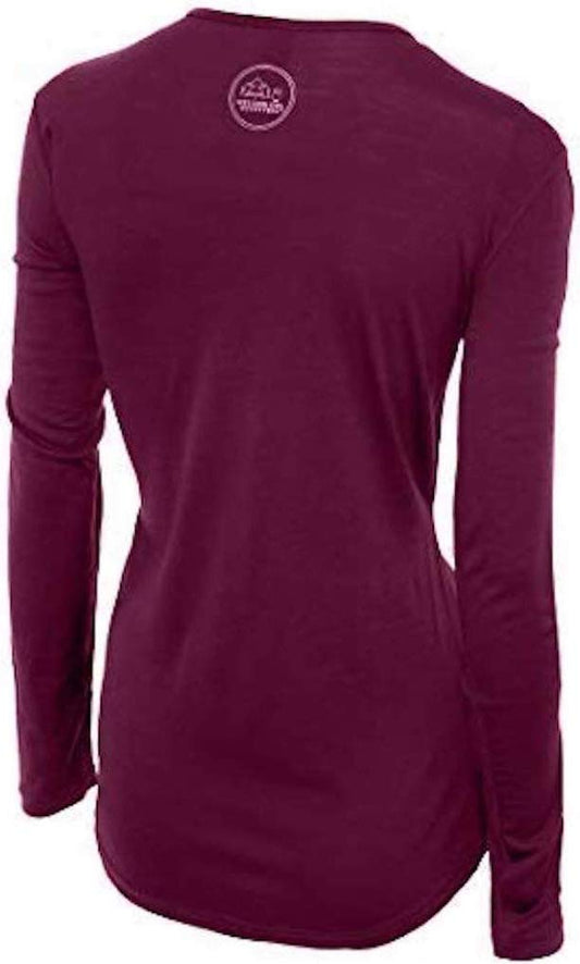
Our merino base layers are 100% Australian merino at 17.5 micron, and a long sleeve merino wool base layer for women is the layer that makes a touring base work. The pattern of a Selfoss trip is getting in and out of a car all day in changing weather, which means you are warm, then cold, then damp, then warm again, and wool is the only common fibre that is comfortable across all four without being changed. A heavyweight weight from October.
Over it, a Marmot PreCip Eco rain jacket and a fleece, which is the standard south Iceland pairing. The wind on the open ground east of town is the thing to dress for rather than the temperature.
Merrell Moab 3 waterproof hiking boots with Darn Tough merino hiking socks. You will not need boots in Selfoss itself, and you will need them at every single place you drive to from it.
Kahtoola MICROspikes from November to March. Icelandic towns grit the roads and not the pavements, and the walk from a guesthouse to the food hall is where the fall happens.
A packing cube set, which is the specific recommendation for a base-and-day-trip trip rather than a general one: you unpack once here and then take a different small selection out each day, and cubes are the difference between that being easy and being a daily excavation.
Worth packing and unlinked: a swimming costume and flip flops, because the town pool is excellent and cheap and the Icelandic shower etiquette is strictly enforced, so a costume is not optional; a NECK GAITER and TREKKING POLES, where the only entries in our range have a contested product identity; a HEADLAMP for winter; and an insulated bottle. A beanie and gloves go without saying from October.
Recommended Tours and Experiences
Essential Resources for Women in Selfoss
Emergency numbers: 112 reaches police, ambulance, fire and mountain and sea rescue from any phone including a locked mobile, and English is spoken. Download the 112 Iceland app before you travel: it sends your GPS position to the emergency services with one button and logs your location periodically so you can be found, which is the single most useful free thing a visitor to Iceland can do. For non-urgent medical advice the health service line is 1700.
Note that there are two places called Selfoss in Iceland: this town in the south, and a waterfall in the north above Dettifoss. Check which one a booking or a search result refers to. The Hellisheidi pass between Selfoss and Reykjavik closes in winter weather, which cuts the town off from the capital until it reopens; check road.is in both directions. The Olfusa river is very large, very cold and very fast with no barrier along much of the town bank. Weather at vedur.is.
US State Department travel advisory: the Iceland advisory. Read the current level there directly rather than relying on a figure printed in any guide.
UK FCDO travel advice: gov.uk/foreign-travel-advice/iceland, and read the safety and security page rather than only the landing page, because that is where the substance sits.
Main hospital: Selfoss has the regional hospital for south Iceland, Heilbrigdisstofnun Sudurlands, with an emergency department, which is why it matters as a base: it is the nearest hospital for the whole south coast as far east as Vik. The national referral centre is Landspitali in Reykjavik, fifty minutes away when the pass is open. A UK Global Health Insurance Card or an EU European Health Insurance Card gives you state-provided medically necessary care in Iceland on the same terms as a resident, which is not the same as free: Iceland charges patient co-payments for primary care and outpatient visits, so expect to pay something and keep the receipts. Travel insurance still matters and matters more here than in most of Europe, because the FCDO notes that EMERGENCY MEDICAL ASSISTANCE AND SEARCH AND RESCUE MAY BE LIMITED IN SOME AREAS and because an evacuation from a remote part of the country is expensive. Tap water is among the best in the world and buying bottled is pointless; the hot tap smells of sulphur because it is geothermal, which is harmless. Pharmacies are apotek.
Official health authority: the Directorate of Health of Iceland, covers the south Iceland regional hospital here in Selfoss
US Embassy: the United States Embassy in Reykjavik.
Official tourism authority: the Icelandic Tourist Board, publishes south Iceland conditions and the Hellisheidi pass status
Takeaways
Use Selfoss as a base rather than a sight. An hour from the Golden Circle, ninety minutes from the south coast waterfalls, and far cheaper than Reykjavik in the same week.
Eat at the old dairy. The Mjolkurbuid food hall is the best thing in the town centre and it is a two minute walk from the bridge.
Book Fridheimar if you want the greenhouse lunch. Tomato soup among the vines, heated by geothermal water at this latitude, and it fills up.
Check which Selfoss you are looking at. The famous photograph is a waterfall in the north of the country, not this town.
Solo women safety assessment: Selfoss is an ordinary safe Icelandic town and the honest assessment is that there is very little to report, which is itself the useful finding. Iceland has one of the lowest violent crime rates in the world, and this is a residential working town of nine thousand with a supermarket, a swimming pool, schools and a hospital rather than a tourist centre. The practical effect for a woman travelling alone is that it reads as somewhere people live rather than somewhere people visit, which is usually a comfort rather than a drawback, and guesthouses here are used to solo bookings and to people leaving before breakfast. English is universal. The FCDO's Iceland page carries no crime warning of substance and names environmental accidents instead, pointing at SafeTravel.is. THE RISKS ARE THE ROAD AND THE WEATHER, as they are everywhere in the south. The Hellisheidi pass between here and Reykjavik closes in winter storms and cuts the town off from the capital until it reopens, so check road.is in both directions before committing to a timed connection. The drive EAST from Selfoss is where a large share of visitor accidents in Iceland happen, because it is the first long stretch of open road most people meet and the crosswind is far stronger than it looks; hire car insurance generally excludes the sand and ash damage this coast produces. One local item: the Olfusa is among the largest rivers in Iceland by volume, very cold and very fast, with no barrier along much of the bank in town, and it is not a river anyone treats as swimmable.
Reading On
Selfoss is the practical centre of south Iceland and nearly everything in this library's Icelandic coverage is within two hours of it. The Hveragerdi packing list covers the geothermal town fifteen minutes west, where the ground steams in the village, and the Gullfoss packing list covers the Golden Circle waterfall an hour north. The Skogafoss packing list and the Reynisfjara packing list cover the waterfall and the black sand beach along the south coast, with the Skaftafell packing list and the Jokulsarlon packing list further east. The Landmannalaugar packing list covers the highlands inland and the Reykjavik packing list covers the capital fifty minutes west. For the country as a whole the Iceland travel guide for women and the Iceland packing list carry the transport, the weather and the practical material in full. For why wool suits a trip spent getting in and out of a car in changing weather, read the guide to merino wool base layers for women. Every destination we cover is indexed at the travel packing guide for women, and the base layers are at the Roman Trail collection.

If the outer journey is calling you, the inner one usually is too. Explore SoulMap at romantrail.com/blogs/soulmap.