

Landmannalaugar is a place in the Icelandic interior rather than a settlement: a geothermal area at about six hundred metres in the Fjallabak nature reserve, surrounded by rhyolite mountains that are genuinely the colours they appear in photographs, orange, pink, green and grey, because the rock is mineralised volcanic. There is a hut, a campsite, a warden, a shop in a converted bus, and nothing else.
Disclosure: This post contains affiliate links. If you buy through them, Roman Trail earns a small commission at no extra cost to you.
Two things bring people. It is the northern trailhead of the LAUGAVEGUR, which is the best known multi-day trek in Iceland and one of the better known in the world, running fifty five kilometres south to Thorsmork over four days. And it has a natural hot pool at the edge of the campsite, fed where a hot stream meets a cold one, which is where everybody ends up at the end of a day.
The thing to understand before anything else is access. Landmannalaugar is reached only by F-roads, the highland mountain tracks, which are open for a short summer season, require four wheel drive by law, and involve unbridged river crossings. Getting there is the hardest part of the destination and it is where people come unstuck.
One note about the photographs. We hold forty eight attributable frames and nearly all are coloured mountains, which would read as one photograph three times. The three here are the trail signposts, a walker on the Laugavegur and the geothermal ground, chosen to explain the place rather than to repeat it. The hot pool, the hut and Bláhnúkur are absent from the set and are covered in the text.
We receive a fee when you get a quote from World Nomads using this link. We do not represent World Nomads. This is not a recommendation to buy travel insurance.
What Is Here
The hot pool is the reason the campsite is where it is. A shallow natural stream pool a short walk from the huts, perhaps thirty eight to forty degrees where the hot and cold waters mix, with a boardwalk and no facilities beyond that. You walk to it in whatever the weather is doing and you walk back wet, which is the arrangement.
The Laugavegur starts here and runs fifty five kilometres to Thorsmork. Four days is standard, three is brisk, and the route crosses the Hrafntinnusker pass, the Alftavatn lakes, the black sands of Maelifellssandur and several unbridged rivers you wade. Huts are spaced along it and must be booked MONTHS ahead through Ferdafelag Islands; camping beside them is permitted with a fee. It is not technical and it is serious: the pass can hold snow in July and the weather is highland weather. Many people continue from Thorsmork over Fimmvorduhals to Skogar, which adds a long fifth day.
For a day visit rather than a trek, Bláhnúkur, the blue mountain, is a steep two to three hour loop directly above the campsite with the whole area laid out from the top, and the Laugahraun lava field walk is an easy hour through black obsidian flows that stopped in 1477.
The hut is run by Ferdafelag Islands, sleeps around seventy eight in bunk rooms, and is booked out well in advance in summer. The campsite takes tents with a warden, cold running water and toilets. There is no fuel, no bank, no reliable signal and the shop is a bus selling basics at highland prices.
The surrounding Fjallabak reserve holds Ljotipollur, a red crater lake, and Frostastadavatn, both a short drive or walk, and the whole area is within the volcanic system that produced the 1477 eruption of Torfajokull.

When to Go
Late June to mid September, and the window is decided by the roads rather than by the weather you will walk in. The F-roads into Landmannalaugar normally open somewhere between mid June and early July depending on snowmelt and river levels, and close in September. Outside that there is no access except by organised super-jeep in winter, which a few operators run.
Even inside the season this is highland weather at six hundred metres. July and August days run around eight to fifteen degrees, nights drop to near freezing, and snow in July on the Hrafntinnusker pass is normal rather than remarkable. Wind and horizontal rain are the default rather than the exception.
Check the opening dates of the specific F-roads rather than assuming the season. The Icelandic Road Administration publishes which F-roads are open daily, and F208 north, F208 south and F225 open at different times and in different conditions.
The Laugavegur hut bookings open months ahead and sell out, so if the trek is the plan the booking decides the dates rather than the other way round.
Getting There
The highland bus is the right answer for most visitors and it is not an admission of defeat. Scheduled buses run daily in season from Reykjavik, Hella and Hvolsvollur, take about four hours from the capital, cross the rivers in vehicles built for it, and remove the entire problem. Many people take the bus in, walk, and take it out.
Icelandic driving rules differ from British ones in ways that carry fines of up to about five hundred pounds, and the FCDO lists them. KEEP DIPPED HEADLIGHTS ON YEAR ROUND, day and night, which is a legal requirement. Speed limits are lower than in the UK and the DRINK DRIVING LIMIT IS LOWER TOO. Suitable tyres are required, including winter tyres when conditions call for them. A UK photocard licence is valid for thirty days. Beyond the rules, the conditions are the thing: the weather changes fast, distances between towns are far greater than the map suggests, SOME MAIN ROUTES ARE GRAVEL OR DIRT, and some roads and bridges are SINGLE LANE WITH PASSING AREAS. Highland and interior F-roads need four wheel drive, open only for a short part of the summer, and where they cross rivers the instruction is to DRIVE AT FIVE TO TEN KILOMETRES AN HOUR and to understand that RIVER LEVELS CAN CHANGE WITHIN THE SAME DAY. Check the Icelandic Road Administration before every driving day rather than once at the start of the trip.
If you drive, the F-road rules are law rather than guidance and the rivers are the real issue. F-roads require a genuine four wheel drive; a two wheel drive on them voids your insurance completely and is illegal. The approach from the north on F208 includes unbridged crossings, and the final crossing at the campsite is the one that catches people. The FCDO's own instruction is to DRIVE AT FIVE TO TEN KILOMETRES AN HOUR through water and to understand that RIVER LEVELS CHANGE WITHIN THE SAME DAY, rising through the afternoon as the snow melts. Water damage to a hire car is never covered by any Icelandic insurance product, so a stalled engine in a ford is a bill for the whole vehicle.
If you hire a car in Iceland there is one clause worth knowing before you sign, and the FCDO states it rather than hinting at it: THE WEATHER CAN CAUSE DAMAGE TO RENTAL CARS THAT IS NOT COVERED BY INSURANCE. Strong winds are common and throw up sand and ash that strips paintwork, and in its own words BRITISH TOURISTS HAVE HAD TO PAY LARGE AMOUNTS OF MONEY to repair hire cars damaged that way. Sand and ash protection is sold as a separate product by most Icelandic hire companies and is the one add-on that is usually worth taking. Two related points: BREAKDOWN RECOVERY COSTS IN REMOTE AREAS CAN BE VERY HIGH, and OFF-ROAD DRIVING IS STRICTLY CONTROLLED and illegal outside marked tracks, with large fines, because the vegetation does not recover.
The practical advice, which the hire companies and the wardens both give: if you are not confident reading a river, park on the near side and walk the last stretch, or take the bus.
Is Landmannalaugar Safe for Women Travelers
The FCDO publishes no advised-against areas anywhere in Iceland and the country has no /regional-risks page, so there is no partial advisory behind the summary. On terrorism it is unusually mild by its own standards, saying that ALTHOUGH THERE IS NO RECENT HISTORY OF TERRORISM IN ICELAND, ATTACKS CANNOT BE RULED OUT. On crime it says levels are LOW, with petty theft and antisocial behaviour PARTICULARLY AROUND BARS IN DOWNTOWN REYKJAVIK, which is the only location it names in the whole country. What the landing page does carry is a named VOLCANIC ERUPTIONS warning, and the detail there matters more than the headline: the eruptions since December 2023 have affected THE TOWN OF GRINDAVIK AND THE SURROUNDING AREA, and the FCDO states plainly that THE CAPITAL CITY, REYKJAVIK, KEFLAVIK INTERNATIONAL AIRPORT AND THE REST OF ICELAND HAVE NOT BEEN AFFECTED. So this is a named-town situation rather than a country-level one, which is the opposite of how a reader skimming headlines would take it.
A warden, a hut and a campsite in the Icelandic interior is not a personal safety question, and this section is about weather, water and the trail. The FCDO's single named crime location in Iceland is around bars in downtown Reykjavik, four hours away by road. Solo women walk the Laugavegur every season in numbers and the hut system means you are never far from other people on the route. What the place requires is self-sufficiency.
One sentence on Iceland's safety page deserves to be read twice, because it names the three things that actually hurt visitors and all three are things people come here to look at: GOING TOO CLOSE TO THE OCEAN, CLIFF EDGES AND HOT SPRINGS ARE COMMON CAUSES OF ACCIDENTS IN ICELAND. That is not a generic caution. The ocean here produces sneaker waves, which run far higher up a beach than the sets before them with no visible warning and which have killed people standing on black sand looking out to sea. Cliff edges in Iceland are frequently unfenced, often undercut, and made of material that gives way. Hot springs and mud pots are at or near boiling, the ground around them can be a thin crust over water at that temperature, and the burns are severe. The rule in all three cases is the same and it is unglamorous: keep back further than feels necessary, never turn your back on the sea, and stay on the boardwalks and marked paths in a geothermal area.
The hot springs clause applies directly here. This is an active geothermal area and the ground off the marked paths can be a thin crust over water at or near boiling. Stay on the boardwalks and the worn routes, and note that the bathing pool is the one safe water: other steaming ground is not an invitation.
The weather is the serious risk and it is the one that fills the rescue reports. At six hundred metres in the Icelandic interior, a summer day can produce sun, horizontal rain, fog that removes all visibility and snow within a few hours. Hypothermia on the Laugavegur, particularly around the Hrafntinnusker pass, is the recurring incident. The measures are the ordinary ones and they are not optional here: carry full waterproofs and spare insulation even for a day walk, do not start a section late, turn back without drama, and register your plan.
Iceland runs a national system for exactly the situation a visitor gets into and the FCDO points at it by name. SAFETRAVEL ICELAND publishes route conditions and hazard guides and LETS YOU LODGE A TRAVEL PLAN, so that if you do not return someone knows where to look, and the FCDO's own instruction is to leave your plans and contact details either with your hotel or on Safe Travel. Alongside it, the Icelandic Met Office carries weather and aurora and seismic alerts, the Road Administration carries road status, and 112 is both the emergency number and an app that transmits your position to the rescue services. None of that costs anything, and in a country where SEARCH AND RESCUE MAY BE LIMITED IN SOME AREAS, which the FCDO says plainly because Iceland is inside the Arctic Circle, using it is the difference between an incident and a statistic.
And the river crossings on the trail are a skill rather than an obstacle. The Laugavegur crosses several unbridged rivers on foot, cold and fast and sometimes thigh deep. The method matters: unclip your hip belt so you can shed the pack, face upstream, shuffle sideways, use poles or link arms, cross at the widest and shallowest point rather than the narrowest, and never cross barefoot or in bare boots. If a river looks higher than you expected, wait: levels drop overnight and rise through warm afternoons.
The Landmannalaugar Packing List
Highland weather at six hundred metres, river crossings on foot, a hot pool, and no shop worth the name.
Merino base layers, and here it is a safety item rather than a comfort one
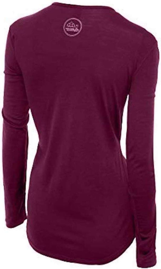
Our merino base layers are 100% Australian merino at 17.5 micron, and a long sleeve merino wool base layer for women is the foundation of any Landmannalaugar trip and the first line against the thing that actually hurts people here. Hypothermia on the Laugavegur happens to walkers who sweated climbing, got wet crossing, and then stopped in wind. Wool keeps insulating when it is soaked through, which cotton does not and which synthetics do less well, and it can be worn for four days without becoming unbearable, which matters on a trek with no laundry. A merino base layer bottom is not optional, for the nights near freezing as much as the days.
A fleece and a real insulated layer
A Columbia Fast Trek fleece and, for the evenings and the huts, a Columbia Powder Lite insulated jacket. Nights at six hundred metres drop to near freezing in July and the huts are heated variably. Carry the insulation even on a day walk, because the margin here is weather rather than distance.
Full waterproofs, not a showerproof shell
A Marmot PreCip Eco rain jacket and waterproof trousers to go with it. Horizontal rain with no shelter for hours is the normal condition, and the jacket alone is not enough on an exposed pass. A hood that cinches down and stays up in wind is the specific requirement.
Boots and a second pair of shoes for the rivers
Merrell Moab 3 waterproof hiking boots with Darn Tough merino hiking socks, broken in before you come. The ground is lava, scree, snow patch and bog. Bring a second pair of shoes or sandals with a closed toe and a strap specifically for river crossings: you do not cross in your boots and you do not cross barefoot, and we do not carry a suitable water shoe we are willing to recommend, because the only entry in our range has a contested product identity.
The small things
CASH, because the bus and the bus-shop may not take cards reliably and there is no bank. A swimsuit and a quick-dry towel for the hot pool. A head torch, since there is no lighting and late August nights are dark again. Trekking poles, which matter more on the river crossings than on the climbs and which we do not link because the only entry in our range is contested. A sleeping bag if you are in the hut, which provides mattresses and not bedding, and a tent rated for wind if you camp. Water, which is drinkable from streams here. The 112 Iceland app and a registered plan with Safe Travel. And a dry bag for everything inside your pack, because the rain gets in.
Recommended Tours and Experiences
Essential Resources for Women in Landmannalaugar
Emergency numbers: 112 reaches police, ambulance, fire and mountain and sea rescue from any phone including a locked mobile, and English is spoken. Download the 112 Iceland app before you travel: it sends your GPS position to the emergency services with one button and logs your location periodically so you can be found, which is the single most useful free thing a visitor to Iceland can do. For non-urgent medical advice the health service line is 1700.
There is no fuel, no bank, no reliable mobile signal and no shop beyond a converted bus selling basics. The hut is run by Ferdafelag Islands, sleeps around seventy eight and books out months ahead, as do the Laugavegur huts along the route; camping beside them is permitted with a fee and a warden is on site. Check the Icelandic Road Administration for which F-roads are open, because F208 north, F208 south and F225 open at different dates. Lodge your plan with Safe Travel Iceland, which is what the search and rescue system is built around.
US State Department travel advisory: the Iceland advisory. Read the current level there directly rather than relying on a figure printed in any guide.
UK FCDO travel advice: gov.uk/foreign-travel-advice/iceland, and read the safety and security page rather than only the landing page, because that is where the substance sits.
Main hospital: there is nothing in the highlands. The nearest health centre is at Hella or Hvolsvollur, around two and a half hours out on the F-roads, and the national hospital is Landspitali in Reykjavik, four hours away. A serious injury on the Laugavegur is a helicopter. A UK Global Health Insurance Card or an EU European Health Insurance Card gives you state-provided medically necessary care in Iceland on the same terms as a resident, which is not the same as free: Iceland charges patient co-payments for primary care and outpatient visits, so expect to pay something and keep the receipts. Travel insurance still matters and matters more here than in most of Europe, because the FCDO notes that EMERGENCY MEDICAL ASSISTANCE AND SEARCH AND RESCUE MAY BE LIMITED IN SOME AREAS and because an evacuation from a remote part of the country is expensive. Tap water is among the best in the world and buying bottled is pointless; the hot tap smells of sulphur because it is geothermal, which is harmless. Pharmacies are apotek.
Official health authority: the Directorate of Health of Iceland. THERE IS NO MEDICAL FACILITY IN THE HIGHLANDS AND NO RELIABLE MOBILE SIGNAL. The nearest health centre is at HELLA or HVOLSVOLLUR around two and a half hours out on F-roads, and LANDSPITALI in Reykjavik is four hours away; a serious injury on the Laugavegur means a helicopter. The FCDO states that EMERGENCY MEDICAL ASSISTANCE AND SEARCH AND RESCUE MAY BE LIMITED IN SOME AREAS of Iceland, which is a statement about exactly this terrain. THE RECURRING INCIDENT HERE IS HYPOTHERMIA, particularly around the Hrafntinnusker pass, and it happens to walkers who sweated climbing, got wet crossing a river and then stopped in wind. DOWNLOAD THE 112 ICELAND APP and lodge a plan with SAFE TRAVEL ICELAND
US Embassy: the United States Embassy in Reykjavik.
Official tourism authority: the Icelandic Tourist Board. ACCESS IS THE HARDEST PART OF THIS DESTINATION. Landmannalaugar is reached ONLY BY F-ROADS, which open roughly MID JUNE TO EARLY JULY depending on snowmelt and close in September, REQUIRE A GENUINE FOUR WHEEL DRIVE BY LAW, and include UNBRIDGED RIVER CROSSINGS. A two wheel drive on an F-road is illegal and voids insurance completely, and WATER DAMAGE IS NEVER COVERED BY ANY ICELANDIC HIRE PRODUCT. THE SCHEDULED HIGHLAND BUS from Reykjavik, Hella and Hvolsvollur takes about four hours, crosses the rivers in vehicles built for it, and is the right answer for most visitors. THIS IS THE NORTHERN TRAILHEAD OF THE LAUGAVEGUR, fifty five kilometres to Thorsmork over four days, whose HUTS MUST BE BOOKED MONTHS AHEAD through Ferdafelag Islands. CHECK THE ICELANDIC ROAD ADMINISTRATION for which specific F-roads are open
Take the highland bus unless you are confident reading a river. Four hours from Reykjavik, built for the crossings, and it removes the whole problem.
Book the Laugavegur huts months ahead. They sell out, and the booking decides your dates rather than the other way round.
Carry full waterproofs and spare insulation even for a day walk. Hypothermia is the recurring incident here and it happens to people who got wet and then stopped.
Bring a second pair of shoes for the river crossings. You do not cross in boots and you do not cross barefoot.
Solo women safety assessment: a warden, a hut and a campsite in the Icelandic interior is not a personal safety question, and solo women walk the Laugavegur every season in numbers, with the hut system meaning you are rarely far from other walkers on the route. The FCDO publishes no advised-against areas anywhere in Iceland and no regional risks page, describes crime levels as LOW, and the single location it names in the whole country is AROUND BARS IN DOWNTOWN REYKJAVIK. WHAT THIS PLACE REQUIRES IS SELF-SUFFICIENCY, and three things do the hurting. THE WEATHER IS FIRST AND IT FILLS THE RESCUE REPORTS: at six hundred metres in the interior a summer day can give sun, horizontal rain, fog that removes all visibility and snow within hours, and HYPOTHERMIA AROUND THE HRAFNTINNUSKER PASS is the recurring incident, happening to walkers who sweated climbing, got wet crossing and then stopped in wind. Carry full waterproofs and spare insulation even for a day walk, do not start a section late, and turn back without drama. THE RIVERS ARE SECOND and they are a skill rather than an obstacle: unclip your hip belt so you can shed the pack, face upstream, shuffle sideways, use poles or link arms, cross at the widest and shallowest point rather than the narrowest, never cross barefoot or in boots, and if a river is higher than expected wait, because levels drop overnight and rise through warm afternoons. THE ROADS ARE THIRD, and the FCDO's instruction to drive at FIVE TO TEN KILOMETRES AN HOUR through water with LEVELS THAT CHANGE WITHIN THE SAME DAY is about exactly these fords; F-roads require four wheel drive by law, a two wheel drive on them is illegal and voids insurance, and water damage is never covered by any product. The geothermal ground off the marked paths can be a thin crust over water at or near boiling. There is no reliable signal, no medical facility and a serious injury means a helicopter, so lodge a plan with Safe Travel Iceland and carry the 112 app.
Reading On
Landmannalaugar is the Icelandic interior and everything else in this guide is the coast. The Reykjavik packing list covers the capital four hours away, where the highland buses start. The Hveragerdi packing list covers the geothermal town on the way out of the city, which is the gentle version of the ground you will walk on here, and the Gullfoss packing list covers the Golden Circle. The Jokulsarlon packing list covers the glacier lagoon on the south coast. For the country as a whole the Iceland travel guide for women and the Iceland packing list carry the ring road, the F-road rules and the practical material in full. For why wool is a safety item rather than a comfort one on a wet exposed pass, read the guide to merino wool base layers for women. Every destination we cover is indexed at the travel packing guide for women, and the base layers are at the Roman Trail collection.

If the outer journey is calling you, the inner one usually is too. Explore SoulMap at romantrail.com/blogs/soulmap.