

Photograph: The Daily Telegraph Building, Napier by Daderot, CC0, via Wikimedia Commons.
Napier is a seaside city on the eastern coast of New Zealand's North Island, in the Hawke's Bay region, and the city centre a visitor sees exists because of one morning in 1931. An earthquake levelled most of the city on 3 February that year, the centre was rebuilt in the art deco style of the moment, and that rebuilt centre, along with a long pine-lined seafront and the wine country behind it, is what you are packing for.
Disclosure: This post contains affiliate links. If you buy through them, Roman Trail earns a small commission at no extra cost to you.
We receive a fee when you get a quote from World Nomads using this link. We do not represent World Nomads. This is not a recommendation to buy travel insurance.
What Is Here
The photograph at the top is the Daily Telegraph Building. The Daily Telegraph was Napier's newspaper, and its office was destroyed in 1931 along with nearly everything around it. The cream facade in the frame belongs to the rebuilt city: geometric ornament, strong vertical lines, the decoration of a place that had to start again all at once. Most of central Napier reads like this, block after block, and that is why people come.
The earthquake is worth understanding properly before you walk the streets. It struck at 10:47 in the morning, was centred 15 km north of the city, lasted two and a half minutes and had a magnitude of 7.8. It killed 256 people and it remains New Zealand's deadliest natural disaster. Fires broke out within minutes, and with the water mains broken they could not be stopped. The coast around Napier was lifted by around two metres, and some 40 square kilometres of seabed became dry land. The airport stands on the former Ahuriri Lagoon, raised out of the water that morning, and Napier Hill, almost an island before 1931, is now simply a hill.
One detail from that day is useful rather than merely interesting. People fled to the Marine Parade beach after the shaking, saw the sea pull back, and ran expecting a tsunami. None came: the shoreline had receded because the land itself had risen. On a New Zealand coast today the rule is to move inland or uphill after a long or strong quake without waiting to find out which explanation is right.
Rebuilding shaped the country as well as the city. Shops traded for about two years from a temporary centre known as Tin Town in Clive Square, New Zealand's first earthquake building code followed in 1935, and the centre has been protected and restored since the 1990s. MTG Hawke's Bay, the museum, art gallery and theatre, covers both the earthquake and the rebuild, and makes a good first stop.
Marine Parade is the other half of the city. It is a 3 km boulevard along the sea, lined with Norfolk pines, with gardens, fountains and the open air Sound Shell. Part of the foreshore was built up after the earthquake with rubble from destroyed buildings, so you are walking on the old city beside the new one. The statue of Pania, from the mythology of Ngati Kahungunu, in whose territory Napier lies, stands on the Parade, and the National Aquarium sits at the south end. Napier has been called the "Nice of the Pacific", and on a summer evening it earns it.
Bluff Hill is the high ground. Its north-east end drops as a steep cliff face to the port, with the historic former Napier Prison near the top and a scenic walk. The climb is short and steep and shows you how the city sits between the hill, the plains and the bay.
The wine country starts at the edge of town. Hawke's Bay is the second largest wine region in New Zealand after Marlborough, with dozens of wineries around Taradale, Hastings, Bay View and the Esk Valley. Hastings is about 18 km south, and a long network of cycle paths links the two cities with the vineyards, which makes a winery day by bike realistic. It also means a full day in the sun on open, flat ground.
And 20 km south-east is Cape Kidnappers, officially Cape Kidnappers / Te Kauwae-a-Maui. The headland at the southern end of Hawke Bay holds over 6,500 breeding pairs of Australasian gannets, one of the most accessible mainland gannet colonies anywhere. Road access ends at Clifton, and from there you reach the colony on foot along the coast or with a minibus tour on an inland road. The long-running tractor tours along the beach closed in 2023, after the beach track had been shut for two years following a 2019 landslide that injured two tourists. That tells you what you need to know about the cliffs: check current access with the Department of Conservation, and do not linger under them.
What the photograph does not show: the sea, Marine Parade and its pines, the Pania statue, Bluff Hill and the port, the vineyards and the plains, Cape Kidnappers and the gannets. The frame is one building on one sunny day.
When to Go
Napier's climate is warm and relatively dry, and it is that way for a geographic reason. The city lies on the east coast in the rain shadow of the central volcanic plateau and the ranges around it, so the weather that soaks the west of the island has often dropped its rain before it arrives. The long-term normals for 1991 to 2020 give January an average high of 24.7C and an average low of 14.7C, with about six rain days in the month and more than 250 hours of sunshine.
Summer, December to February, is the seafront season, warm and bright, with sun strong enough that a hat and covered shoulders matter more than any jacket. February also brings the Art Deco Festival, held every year since 1988, so book early if you want it and come either side if you want quiet streets. Autumn, March to May, is a good time for the wineries. Spring brings the gannets: nesting runs from mid-September to mid-December, and juveniles stay at the colony as late as May before leaving for Australia.
Winter is mild by day and cold at night. July averages a high of 14.5C and a low of 4.8C, and it is the wettest month in the record, with about 97 mm of rain over nine or so rain days. Pack a warm layer and a rain shell.
The rain, when it does come, can come hard. In February 2023 floods from Cyclone Gabrielle destroyed bridges over the Tutaekuri River and cut power across the region. The FCDO notes that flooding and landslides can happen in New Zealand, resulting in road closures and infrastructure damage. Watch road status in heavy rain.
On the official advice: The FCDO publishes no advised-against areas anywhere in New Zealand and no country-level warning. What it names instead is geology and weather: this is a seismically and volcanically active country, it sits on the boundary of two tectonic plates, and the advice is about knowing what to do rather than about avoiding anywhere. Alongside that it names rapidly changing alpine weather, flooding, and the ordinary caution about valuables left in a parked car, which is the one real crime risk a visitor meets here and which is concentrated at trailheads and scenic car parks.
Getting There and Getting Around
Most visitors fly in or drive over the ranges. Hawke's Bay Airport at Westshore, on that raised former lagoon, has flights from Wellington, Auckland and Christchurch. By road, State Highway 2 runs along the coast and State Highway 5 comes over from Taupo; the Taupo packing list covers the lake town at the other end of that road, and is the natural pairing with this one for a central North Island trip. There is no passenger train: the rail service in and out of Hawke's Bay ended in 2001.
Drive with time in hand. The FCDO's own description of New Zealand highways is that they can be narrow, winding and hilly. Allow more time than a map suggests for any road over the ranges, and do the crossing in daylight on a first visit.
In town you will walk. The centre and Marine Parade are compact and flat, and Go Bus runs nine Go Bay routes in the city. For the vineyards, a bike or a tour beats driving yourself.
Do not leave anything in the car. The FCDO's crime note for New Zealand is specific: thieves may target unattended vehicles, especially hire cars and camper vans in major tourist areas. A winery car park or the Clifton road end is exactly that kind of place.
The Napier Packing List
Pack for strong sun, sea wind, long walking days and cool nights, with a wet winter month at the other end of the year.
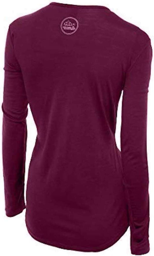
Our merino base layers are 100% Australian merino at 17.5 micron, and a long sleeve merino wool base layer for women earns its place in Napier in both directions. On a bright day it covers your arms from the sun without holding sweat the way a synthetic shirt does; on a July evening it is the warm layer under everything. Napier's port ships large amounts of sheep wool out of Hawke's Bay, so you are in a part of the world that understands the fibre.
A wide brim sun hat with UPF 50, for Marine Parade, the vineyards and the open walk to Cape Kidnappers.
A Columbia Benton Spring sun hoodie for long days outdoors, covering the back of the neck on a bike.
An insulated water bottle, because a day on the cycle paths is longer and drier than it looks, and the sea wind hides how much you are losing.
A Columbia Fast Trek II fleece for waterfront evenings and for winter, when July nights average under five degrees.
A Marmot PreCip Eco rain jacket, packable, for winter and for the heavy storms the east coast occasionally gets.
Footwear: walking shoes with grip for Bluff Hill and the coast walk to Cape Kidnappers, where sandals are not enough.
Also worth packing, and NOT LINKED because our affiliate register carries neither: SUNSCREEN, which matters here more than visitors expect because New Zealand's sun is strong and the east coast gets plenty of it, and SUNGLASSES for the glare off the sea along the Parade.
One beach rule to pack in your head. Swimming off Marine Parade is not recommended, because the beach drops off steeply and there is a strong undertow. Swim at Pandora Pond, the salt water inlet by the inner harbour at Ahuriri, instead.
Recommended Tours and Experiences
Essential Resources for Women in Napier
Emergency numbers: 111 for ambulance, fire and police anywhere in New Zealand. For non-urgent medical advice, the FCDO notes that you can call Healthline for free medical advice, 24 hours a day.
Main hospital or clinic: Napier's own hospital closed in 1998 and most services moved to Hawke's Bay Fallen Soldiers' Memorial Hospital in Hastings, about 18 km south. A 24-hour urgent care and outpatient clinic operates in central Napier for anything that is not an emergency. In an emergency, call 111 and let the ambulance decide where you go.
Earthquakes and tsunami: Napier is the place in New Zealand where the earthquake risk is least abstract, and the FCDO's advice for the country is plain: tsunamis can happen along the coastlines, and if there is a tsunami warning, the Local Civil Defence Emergency Management Groups will have tsunami evacuation zone maps and advice. The centre and the Parade are on low ground by the sea, so when you check in find out whether your accommodation is in an evacuation zone and which way is uphill. Napier Hill, of which Bluff Hill is the north-east end, is the high ground beside the centre.
Earthquakes and volcanoes, and what to actually do: New Zealand straddles the boundary between the Australian and Pacific plates, which is why it has the mountains, the geothermal fields and the fiords, and the same geology produces thousands of earthquakes a year of which a handful are felt. The response taught in every school here is DROP, COVER, HOLD: get down, get under a table or against an interior wall away from windows, and hold on until the shaking stops, rather than running outside, where falling masonry is the danger. ON THE COAST THE RULE IS DIFFERENT AND IS THE ONE THAT SAVES LIVES: if an earthquake is LONG or STRONG, meaning you cannot stand up or it lasts more than a minute, do not wait for an official warning. Move inland or to high ground immediately, because a local-source tsunami can arrive in minutes. The volcanic risk is concentrated in the central North Island around Taupo, Tongariro and Ruapehu, and on White Island, and GNS Science publishes a volcanic alert level that walking routes are closed against. Both hazards are a matter of knowing the procedure, not of avoidance.
New Zealand has a RECIPROCAL HEALTH AGREEMENT with the UK covering medically necessary treatment in public hospitals, which is genuinely useful and is not comprehensive: it does not cover repatriation, it does not cover private care, and it does not cover a rescue. WHAT MAKES INSURANCE NON-OPTIONAL HERE IS THE ACCIDENT COMPENSATION CORPORATION, the ACC, which is the thing visitors find surprising. ACC covers treatment for accidental injury for everyone in New Zealand including tourists, no-fault, which means a broken ankle on a trail is largely paid for. In exchange you cannot sue, and ACC does NOT pay for repatriation, for a helicopter off a mountain in every circumstance, or for the cost of cutting a trip short. Tap water is drinkable, and a pharmacy, called a chemist, deals with small problems.
US State Department travel advisory: the New Zealand advisory. Read the current level there directly rather than relying on a figure printed in any guide.
UK FCDO travel advice: gov.uk/foreign-travel-advice/new-zealand, and read the safety and security page rather than only the landing page, because that is where the substance sits.
Official health authority: the New Zealand Ministry of Health, Manatu Hauora, is the New Zealand health ministry.
US Embassy: the United States Embassy in Wellington.
Official tourism authority: Tourism New Zealand, covers the country, and for Cape Kidnappers access the Department of Conservation manages the gannet reserve.
Solo women safety assessment: Napier is an easy, relaxed city to visit alone. The FCDO names no advised-against area anywhere in New Zealand, crime levels are generally low, and the one crime risk worth acting on is theft from parked cars, especially hire cars at tourist stops, so take your bag and passport with you rather than leaving them in the boot. After dark, the quieter stretches of the waterfront are better walked with company. The real hazards are physical rather than personal. Do not swim off Marine Parade, where the beach drops away steeply and the undertow is strong. Respect the cliffs at Cape Kidnappers, which have injured people, and check access before you go. Know your tsunami route, and leave details of your itinerary with family or friends, the FCDO's own instruction, before heading to the cape alone. 111 for everything.
Reading On
Napier sits at the end of the road over the ranges from the central plateau, and the Taupo packing list covers the lake town at the other end of State Highway 5. South, the Wellington packing list covers the capital, and north, the Auckland packing list covers the city most international flights arrive in. Across Cook Strait, the Christchurch packing list covers the South Island's east coast, and for art deco on another continent, the Miami packing list covers the city whose South Beach is the comparison most often made with Napier. The New Zealand packing list and the New Zealand travel guide for women carry the country, its seasons, its geology and its driving in full. Every destination we cover is indexed at the travel packing guide for women. For the opposite kind of heritage town, the Oamaru packing list covers Oamaru's Victorian limestone precinct on the South Island.
If the outer journey is calling you, the inner one usually is too. Explore SoulMap at romantrail.com/blogs/soulmap.
For why one merino layer can carry you from a hot vineyard afternoon to a cold July evening on the Parade, read the guide to the best merino wool base layers for women, and the full range is in the Roman Trail collection.