

Photograph: Ketchikan from the sea by Jerzystrzelecki, CC BY 3.0, via Wikimedia Commons.
Ketchikan is a town of about eight thousand people strung along the waterfront of Revillagigedo Island in Southeast Alaska, at the foot of Deer Mountain, and there is no road to it. You arrive by air or by water and you leave the same way. It is the first Alaskan port on the Inside Passage coming north, it is surrounded on every side by the Tongass National Forest, and it is one of the rainiest cities in North America. Everything in this packing list follows from that last sentence.
The photograph at the top of this page is honest about the weather and silent about most of the reasons to come. In the frame: the town from the water on a flat grey day, a black bulkhead of creosoted pilings with cars parked along it, a thin strip of low commercial buildings, a small harbour of fishing boats, painted timber houses climbing a steep slope, and above them solid dark conifer up to a ridge with cloud sitting on it. Not in the frame: Creek Street, the former red-light boardwalk on pilings over Ketchikan Creek, which is the most photographed thing in town and is tucked up a side inlet out of this view; the totem poles and the Tlingit, Haida and Tsimshian collections, which stand at four separate sites and are a principal reason to travel here; Misty Fiords, which is reached by float plane or boat and is the other half of the trip; and the cruise ships, which in season tie up in this exact stretch of water and change everything about the picture. We would rather name those four absences than let a quiet grey waterfront stand in for the place.
Disclosure: This post contains affiliate links. If you buy through them, Roman Trail earns a small commission at no extra cost to you.
We receive a fee when you get a quote from World Nomads using this link. We do not represent World Nomads. This is not a recommendation to buy travel insurance.
What Is Here
A small working port inside the largest national forest in the United States. The Tongass runs to 16.7 million acres, most of it temperate rainforest, and it is described as Earth's largest remaining temperate rainforest. Ketchikan sits in it rather than beside it: the conifer in the photograph starts at the back of the houses and does not stop. The forest is managed by the United States Forest Service, which is the agency whose Tongass alerts and closures page governs the trails, the cabins and the float plane destinations around the town, and it is the page to read before you count on any of them.
The town is named after the creek that runs through the middle of it. Ketchikan Creek empties into the Tongass Narrows a short distance southeast of downtown, and the name comes from the Tlingit name for the creek, Kitschk hin, the meaning of which is unclear: it may mean the river belonging to Kitschk, while other accounts give it as Thundering Wings of an Eagle. The town was incorporated on 25 August 1900 and its economy has run on fishing and canneries, tourism, government and forestry ever since. The pulp mill closed in 1997 after the Tongass Timber Reform Act of 1990, which is the pivot the modern town turns on: what was a timber and fish town with visitors became a visitor town with fish.
Creek Street is the thing everyone photographs and the history is blunter than the postcard. The area near the mouth of the creek earned Ketchikan a measure of infamy in the first half of the twentieth century for a red-light district known as Creek Street, with brothels lined up on either side of the water. During prohibition it was a row of speakeasies. Today it is a boardwalk of picturesque wooden buildings standing on stilts above the creek, occupied by a quieter class of establishment, and from the bridges that cross it you can look down at salmon gathering in the brackish water near the mouth, waiting to make their final ascent upstream. It is worth knowing what the buildings were for before you walk through them.
Misty Fiords is the other half of the trip and it is not a day you can improvise. The Misty Fiords National Monument covers 2,294,343 acres, all but 151,832 of them designated wilderness, proclaimed by President Carter in December 1978 and administered by the Forest Service as part of the Tongass. Its fjord walls often rise two to three thousand feet above the water and drop a thousand feet below it. Most visitors arrive by boat or aircraft from Ketchikan, which in practice means a float plane off the Tongass Narrows or a long boat day, and both are weather dependent in a place where the weather is the whole problem. Build a spare day into any itinerary that includes it. We print no distance, because our two sources disagree about it by a wide margin.
The Rain, and Why It Decides Everything
Ketchikan's rainfall is measured in feet rather than inches. We are not going to print an annual figure, because our two sources give two different answers to the same question, and the difference between them is larger than the entire annual rainfall of a good many European capitals. What both of them agree on, and what you can plan around, is that the number is well above twelve feet in an ordinary year and that this is one of the rainiest cities in North America. The spread between the wettest and driest years in the record is enormous as well, so an average would have been a poor guide even if we could print one.
The climate is mild maritime, which is the half that surprises people. This is not a frozen Alaska. Summer daytime temperatures average in the high sixties Fahrenheit and precipitation in summer is generally light and sporadic. Winter is marked by heavy, cold, wind-driven rain with temperatures in the high thirties, which is a different and nastier proposition than cold and dry. The rain falls more heavily in autumn and winter than in summer, so the wettest months are also the darkest ones.
The practical consequence is a standard, and it is higher than most people arrive with. Shower-resistant is not a category that means anything here. A jacket that beads water for twenty minutes and then wets out is a jacket that has failed, and in this climate it will be asked to work for six hours at a stretch, on a boat, in wind, while you are standing still. The same applies to your legs, which most visitors forget entirely, and to your feet, which are in standing water the moment you step off a boardwalk. Assume everything you are wearing outside will be wet at some point, and choose fabrics that keep working when they are.
Three Peoples, and the Poles
Ketchikan sits at the meeting place of three Alaska Native cultures, Tlingit, Haida and Tsimshian, and that is not background to the town but the oldest fact about it. Those three nations live throughout Southeast Alaska, and their artistic and dance traditions are apparent throughout Ketchikan, most visibly in the totem poles. The city holds what is described as the world's largest collection of standing totem poles, found throughout the town and at four major locations: Saxman Totem Park, Totem Bight State Park, Potlatch Park and the Totem Heritage Center.
The Totem Heritage Center is the one to understand before you see any of the others. Established in 1976, it houses one of the world's largest collections of unrestored nineteenth century totem poles. Sixteen of its thirty-three poles are on permanent display and the rest of the collection is held for research. The poles were recovered from uninhabited Tlingit settlements on Village Island and Tongass Island south of Ketchikan, and from the Haida village of Old Kasaan. The word to sit with there is UNRESTORED. These are weathered originals rather than repainted replicas, and the difference between them and the bright poles at the outdoor parks is the difference between an object and a reproduction of one. The center also exhibits Tlingit, Haida and Tsimshian artifacts and art, including work by the Tlingit carver Nathan Jackson and the Haida weaver Delores Churchill, and it runs a nationally recognised programme of art classes that preserves and promotes the traditional arts and crafts of the three peoples. It is a living institution, not a display case.
Saxman and Totem Bight are outside the town and both reward the journey. Saxman Totem Park is roughly two and a half miles south of downtown and Totem Bight State Historical Park about ten miles north, so neither is a walk and both need transport, which is why many visitors on a few hours ashore see neither. Saxman is a Tlingit community rather than an attraction built for visitors, and that distinction is worth carrying with you: go on the terms the community sets, ask before photographing people, and treat a carving shed as a workplace. The Southeast Alaska Discovery Center downtown carries rainforest and cultural interpretive exhibits and is the sensible first stop if the weather has closed everything else, which it will.
One more piece of regional context that almost no visitor arrives knowing. South of Ketchikan, Metlakatla sits on Annette Island, which together with the surrounding islands is the only Indian Reserve in Alaska. The community consists primarily of Tsimshian people who arrived on the island in 1887. Ketchikan is its transport link: the Alaska Marine Highway day boat MV Lituya shuttles between the two. It is a reminder that the three nations here are present-day governments and communities and not a historical exhibit.
A Cruise Port, and the Town on a Day With No Ship
Ketchikan is a cruise port, and that single fact shapes the hour-by-hour experience of being here more than anything except the rain. The large ships call at one of four berths, three of them in downtown Ketchikan, which means they tie up in the middle of the town rather than at an industrial terminal somewhere out of sight. The historic downtown is small and easily walkable from the massive downtown dock, while the rest of the town stretches along the waterfront for miles north and south. Most cruise passengers spend only a few hours ashore, which limits what they can do and concentrates all of them into the same few blocks at the same time.
The town has two completely different characters depending on whether a ship is in, and nobody tells you this in advance. On a busy ship day the downtown blocks, Creek Street and the shuttle to Saxman are full, the jewellery shops along the dock are open and the queue for a float plane is long. On a day with no ship, the same streets are quiet, some of the visitor-facing businesses simply do not open, and you are in a small Alaskan working town instead. Neither version is the wrong one, but they want different plans: a no-ship day is the day to do Misty Fiords or the Totem Heritage Center or a hike, and a busy day is the day to get out of the centre early. The Ketchikan Visitors Bureau publishes the daily ship schedule, and checking it before you fix your days is the cheapest single improvement you can make to this trip. We print no schedule here, because it changes every season.
If you are arriving on a ship yourself, the constraint is time rather than weather. A few hours ashore is enough for Creek Street, the Discovery Center and one totem site, or for a float plane, and not for both. Pick one. The most common way this day goes wrong is trying to do a flightseeing trip and a totem park and lunch, then spending the whole of it watching the clock.
When to Go
Summer is the straightforward answer and it is also the crowded one. Daytime temperatures in the high sixties Fahrenheit, light and sporadic precipitation by local standards, the float planes flying, the boats running and the salmon in the creek through the summer and into autumn. Run timing varies by species, by stream and by year, so ask locally rather than booking a week around a date you read somewhere. This is also the cruise season, so every busy day in the centre falls inside it.
The shoulders are the quiet trade. Late spring and early autumn give you a town with fewer ships, more availability and a real chance of good light between fronts, against shorter days and a higher chance that a flightseeing trip is cancelled. Autumn brings the heavier half of the year's rain, so the weather risk genuinely rises rather than merely feeling like it should.
Winter is for people who want the town rather than the attractions. Heavy, cold, wind-driven rain with temperatures in the high thirties is the defining condition, which is the miserable end of the range to be outdoors in: not cold enough to be dry, wet enough to soak everything, and windy enough to defeat anything with a loose hood. Daylight is short, a good deal of the visitor economy is shut, and the float plane days are few. It is a real trip if the working town is what you came for, and it is the wrong trip if Misty Fiords is. Whatever the month, read the National Weather Service forecast office for Southeast Alaska rather than a phone app, because marine and aviation conditions here diverge from the town forecast constantly.
Getting There
Ketchikan and Revillagigedo Island have no land-based connections to the mainland, and the town has no direct road access to the outside world. That is the most itinerary-deciding sentence in this post and it is worth reading twice. You cannot drive here from anywhere. There is no bus from Canada, no highway from Anchorage, no back route. It is air or water, and the local road system simply ends at both ends of the island's inhabited strip.
By air, and this is the part that catches people out: the airport is not on the same island as the town. Ketchikan International Airport is on Gravina Island, on the other side of the Tongass Narrows, and passengers must take a seven-minute ferry ride across the water to get from the airport to the town. There is no bridge. A bridge was proposed and was designed to replace the ferry, acquired the nickname of a bridge to nowhere despite the fact that it would have linked the city to its own airport, and Congress reversed its decision to fund it in 2007. So you land, you collect your bag, and you get on a boat with it. Two ferries serve the route. Allow for it when you are booking a tight connection, and do not plan to sprint. The airport is a gateway for Alaska Airlines jet service to and from Seattle, Juneau, Sitka and Wrangell, so most visitors arrive through Seattle.
By water, Ketchikan is a major port on the Alaska Marine Highway System's Inside Passage route, and the state ferry is a completely different and much better way to arrive than a cruise ship if you have the days: you see the coast at sea level, you can take a vehicle, and you land in the town rather than at a berth full of other ships. The Marine Highway also runs the MV Lituya as a day boat to Metlakatla. Sailings are infrequent by the standards of any road network and they change by season, so check the Alaska Marine Highway System directly and build slack around any ferry day. Float planes are ordinary transport here rather than a novelty, and they are how you reach wilderness cabins, remote lakes and Misty Fiords.
Getting around once you are here is simple and has one catch. The historic downtown is small and walkable from the dock. Everything else, including both outdoor totem parks, is strung out along miles of waterfront road north and south, so you need the bus, a taxi or a tour. Elevations of inhabited areas run from just above sea level to about 300 feet, which in practice means stairs: a great deal of residential Ketchikan is reached by public wooden staircases up the hillside you can see in the photograph above, and they are slick when wet, which is most of the time.
Is Ketchikan Safe for Women Travelers
The FCDO publishes no advised-against areas anywhere in the United States, but it does carry a national warning: it says terrorists are very likely to try and carry out attacks in the US, and that attacks could be indiscriminate, including in places visited by tourists and foreign nationals. Its guidance concentrates on the practical differences a British visitor meets: entry requirements and ESTA, the cost of healthcare without insurance, extreme weather including hurricanes on the Atlantic and Gulf coasts between June and November, and wildfires, which the FCDO describes as a danger in many dry areas, particularly in canyons, hills and forests.
Ketchikan is a small town where the realistic risks are environmental and logistical rather than criminal. Walking back through downtown in the evening is unremarkable, and the visitor-facing centre is busy and well lit in season. Use ordinary judgement about which bar you leave late and in whose company, as anywhere. The thing that is genuinely different from a city is that help and transport both thin out fast: there is no late-night taxi rank at scale, the bus is not frequent, and if you are staying out along the waterfront road rather than downtown you need to know how you are getting back before you go out.
The ground itself is the hazard most visitors underestimate. Wet wooden boardwalks, wet steel ramps down to floating docks, wet painted steps and the public staircases up the hillside are all genuinely slippery, and a twisted ankle is far and away the likeliest thing to go wrong here. Add the tide: the ramps to the floats change angle through the day and can be steep at low water. Walk them slowly, hold the rail, and do not do it with a bag in each hand.
The water and the forest are the other two. Cold water is the serious risk on any small boat or kayak trip in Southeast Alaska, and the answer is to go with an operator, wear what they give you and tell someone your plan. Both brown and black bears live throughout the Tongass along with five species of salmon and bald eagles, and the two things that follow are simple: a salmon stream in season is where you are most likely to meet a bear, and you should make noise, travel with someone, carry nothing fragrant and never place yourself between an animal and the water. Weather cancels float plane and boat trips regularly and that is the system working correctly, so treat a cancellation as good news and keep a spare day rather than pressing an operator.
The Ketchikan Packing List
Rain gear, which is the entire argument
This is the one destination where the shell is not a contingency item but the main piece of equipment. A packable rain jacket with a proper hood that turns with your head is the single most important thing in the bag, and the hood matters because umbrellas are close to useless in the wind that comes up the Narrows. Most visitors stop there and get it half right. Waterproof hiking pants are the half that gets forgotten, and on a boat deck or a rainforest trail they are the difference between a good day and going back to change at lunchtime. Underneath, a fleece mid-layer is the right weight for a summer that sits in the high sixties and a winter in the high thirties, and it keeps some warmth when damp.
A waterproof phone pouch is not something we can link and you should still bring one. Our affiliate registry carries no entry for one at all. On a float plane, in an open boat or walking a creek-side boardwalk in heavy rain, a phone in a coat pocket is a phone taking its chances.
The merino layer, for a wet coast rather than a cold one
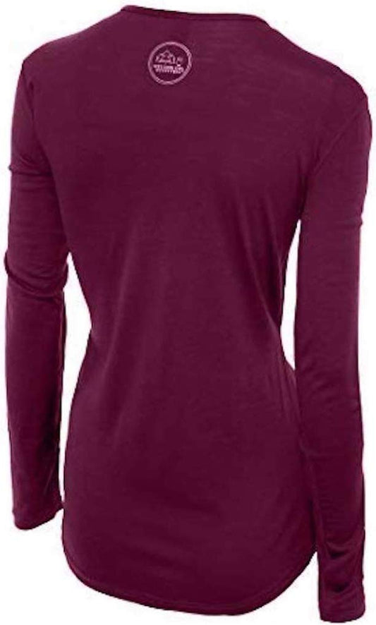
Our merino base layers are 100% Australian merino at 17.5 micron, and a long sleeve merino wool base layer for women is the right answer to this specific climate for a reason worth spelling out. Ketchikan is rarely very cold and almost always damp, which is exactly the condition cotton handles worst: it absorbs, it stops insulating, and it holds the chill against you for the rest of the day. Merino keeps working wet, which is what a standing-still-on-a-boat-deck day asks of it, and it resists odour across several days of being damp, put away and worn again. A merino beanie and merino glove liners both belong in the bag for a shoulder season or winter trip and are unlinked here only because the six link cap is already full.
Feet, and the standing water problem
A waterproof hiking boot is the versatile choice and covers the boardwalks, the hillside staircases and a Tongass trail. Pair it with merino wool hiking socks, which is the half that decides whether a wet day is tolerable, and bring more pairs than you think you need because drying anything here takes longer than you expect.
The honest local answer is a rubber knee boot and we cannot link you one. The registry carries no rubber boot in any form, so there is nothing to point at, but a great many people in this town wear one all year and they are right: nothing else deals as well with standing water, a flooded dock, a creek bank or a skiff. If you are spending real time on the water or in the forest rather than on the main street, buy a pair locally, where they are sold everywhere and where the staff know which ones last.
The boat and float plane day
A waterproof dry bag is the item most visitors wish they had brought on the first trip and do bring on the second. Spray on an open boat and rain on a float plane dock will reach the inside of an ordinary daypack, and in a place this wet a bag that keeps your camera, your spare layer and your documents dry is doing more work than it looks like. A quick dry travel towel and a rechargeable headlamp are both in our registry, both worth packing for a short winter day or a cabin trip, and both unlinked here purely because the cap is reached.
Two more things we cannot link and you should not skip. Our registry holds no SUNSCREEN entry and no EYEWEAR entry at all. That sounds absurd for somewhere this grey until the first clear day on the water, when the glare arrives off the surface as well as out of the sky and there is nothing to stand behind. Bring both. They will spend most of the trip in the bag and earn their place in a single afternoon.
Recommended Tours and Experiences
Essential Resources for Women in Ketchikan
Emergency numbers: 911 for police, ambulance and fire, free from any phone including a locked mobile. Calls are answered locally and dispatchers will stay on the line. For non-urgent police matters many cities also run a 311 information line.
Main hospital or clinic: PEACEHEALTH KETCHIKAN MEDICAL CENTER is the hospital serving the city and the surrounding area, and it is a critical access hospital, which is the federal designation for a small rural facility. We print no bed count or trauma designation, because we could not source either from an authority. What matters to a visitor is the consequence of the geography rather than the numbers: this is a small hospital on an island with no road out, so anything beyond its scope means being transferred by air to a larger centre, and that is expensive. Urgent care and the emergency department are the right choices for very different problems, and the cheaper one is almost always the right one for a sprain, an infection or stitches.
This is the single biggest practical difference for a visitor: there is no public health system, an emergency room visit without insurance can run into thousands of dollars, and an ambulance is billed separately and is not free. Comprehensive travel insurance with a high medical limit is not optional in the United States, and you should carry your policy number and the insurer's 24 hour number somewhere you can reach them. Urgent care clinics handle anything short of an emergency far more cheaply and quickly than an emergency room, and are the right choice for a sprain, an infection or stitches.
Tourist police: the United States has no tourist police force of any kind. The Ketchikan Police Department is the municipal force, the Alaska State Troopers cover the wider area, and the United States Coast Guard is the service to reach for anything on the water, which in a town built on a working waterfront is a meaningful distinction. 911 reaches all of them.
US State Department travel advisory: there is none, and this is not an omission. The State Department issues travel advisories for other countries, not for the United States itself, so no US advisory for this destination exists to link. In its place, the Government of Canada advice for the United States gives an equivalent third-country assessment.
UK FCDO travel advice: gov.uk/foreign-travel-advice/usa, and read the safety and security page rather than only the landing page, because that is where the substance sits. The FCDO names no advised-against areas anywhere in the United States. The same advice also covers Puerto Rico, the US Virgin Islands, Guam, American Samoa and the Northern Mariana Islands.
Official health authority: the CDC travellers' health pages, the US federal health authority for visitors, and its cruise ship health pages are the directly relevant ones here, because in season the large majority of people arriving in Ketchikan arrive on a ship.
Embassy contact: the United States is the host country, so there is no US embassy to contact. Your own country's embassy is in Washington DC, with consulates in New York, Los Angeles, Chicago, Houston, San Francisco, Miami and Boston. Find yours before you travel and save the number.
Official tourism authority: Brand USA, the national tourism marketing body, covers the country, and the Ketchikan Visitors Bureau at visitktn.com publishes the daily cruise ship schedule that decides how busy the centre will be, while the US Forest Service publishes the Tongass National Forest alerts and closures that govern the Misty Fiords trips, the public cabins and every forest trail around the town.
Solo women travellers. Ketchikan is an easy and low-stress place to travel alone and a woman on her own here draws no comment at all; it is a small town where people talk to strangers and a solo traveller at a counter is normal rather than conspicuous. The honest cautions are three and none of them is about other people. The first is the ground: wet boardwalks, wet dock ramps and the public hillside staircases are where solo travellers get hurt, and a fall alone on a quiet stairway is worse than the same fall in company, so take them slowly and keep a hand free. The second is distance: the outdoor totem parks and most accommodation outside the centre are miles along the waterfront road, transport is not frequent, and you should know how you are getting back before you set out in the evening. The third is the water and the forest: go with an operator for anything on the sea, tell your accommodation where you have gone if you are walking a Tongass trail alone, and treat a salmon stream in season as bear country, because it is. Book accommodation well ahead for summer, because a town of this size runs out.
Takeaways
Ketchikan has no land connection to the mainland and no road to the outside world, so you arrive by air or by water, and the airport is on a different island reached by a seven-minute ferry with your luggage. The rain is the defining fact and it is measured in feet rather than inches: our sources disagree on the annual figure so we print neither, but both put it well above twelve feet, and the practical standard is a real shell, waterproof legs and waterproof feet rather than anything shower-resistant. The climate is mild maritime, with summers in the high sixties Fahrenheit and winters in the high thirties with heavy wind-driven rain, so merino rather than cotton is the right call for a coast that is damp more than it is cold. The town holds what is described as the world's largest collection of standing totem poles across four sites, and the Totem Heritage Center's unrestored nineteenth century poles, recovered from Tlingit settlements and the Haida village of Old Kasaan, are the ones to see first. This is the meeting place of the Tlingit, Haida and Tsimshian nations and they are present-day communities rather than history. It is a cruise port with four berths, three of them downtown, and the town is a different place on a day with no ship, so check the daily schedule before you fix your plans. Keep a spare day for Misty Fiords, because the weather will take one.
Reading On
Juneau is the obvious pair with this post: the other roadless Southeast Alaska port on the same ferry route and the same rain, and the state capital you cannot drive to either. Anchorage and Denali cover the other Alaska, the one with roads and a continental climate, and they want a noticeably different bag. Seattle is where most visitors connect, since the jet service here runs through it. Tofino and Olympic National Park are the same temperate rainforest further south along the same coast, with the same argument about waterproofing. The United States travel guide covers the regions, our guide to merino base layers for women has the fibre reasoning, and the travel packing guide indexes the library.
If the outer journey is calling you, the inner one usually is too. Explore SoulMap at romantrail.com/blogs/soulmap.