

Photograph: Coconut Island in Hilo Bay by W Nowicki, CC BY 3.0, via Wikimedia Commons.
Hilo is the largest town on Hawaii Island and the seat of Hawaii County, and it sits on the wet side. It faces east across Hilo Bay into the trade winds, so the clouds that leave the Kona coast dry drop their rain here instead. Wikipedia ranks it the fourth-wettest city in the United States, behind three towns in southeast Alaska. Pack for warm rain and for cold air uphill.
Disclosure: This post contains affiliate links. If you buy through them, Roman Trail earns a small commission at no extra cost to you.
This post is the wet-side counterpart to the Kailua-Kona packing list. Kona is the dry leeward town on the west coast; Hilo is the green working town on the east coast, with rain, rivers, gardens and the shorter drive to the volcano. Plenty of visitors see only one side, and the two need different bags. The Big Island packing list covers the island as a whole.
We receive a fee when you get a quote from World Nomads using this link. We do not represent World Nomads. This is not a recommendation to buy travel insurance.
What the Photograph Shows, and What It Cannot
The photograph at the top is Coconut Island, called Mokuola in Hawaiian, a small low island of palms and ironwood trees with a pavilion, seen across calm shallow water edged with black lava rock under a pale, cloudy sky. The cloud is typical. What the frame cannot show is most of the town: downtown, Rainbow Falls, the Japanese gardens beside the island, Banyan Drive, the farmers market, the volcano and Mauna Kea are all outside it. So is the footbridge to the shore, which matters.
Check before you go: in November 2025 the footbridge to Coconut Island collapsed and the county closed the park indefinitely. According to Wikipedia it gave way under a county mini-excavator, and we have no source saying the park has reopened, so treat a visit as uncertain until the County of Hawaii says otherwise. When open it is a small park with a lawn, picnic tables and a few tiny beaches. Its Hawaiian name is usually translated as healing island, and it once held a temple dedicated to healing.
What Is Here
Hilo is a workaday town rather than a resort. Wikivoyage notes that it sees few tourists and that clothes are very casual, resort casual at most, so nobody expects you to change for dinner.
Downtown sits between the Wailuku River and the bay along Kamehameha Avenue. It became the town's cultural centre in the 1980s as galleries and museums opened. The farmers market at the corner of Mamo Street and Kamehameha Avenue runs on Wednesdays, Saturdays and Sundays, with Wednesday and Saturday mornings the big ones; Wikivoyage's advice is to go early, as locals do, before the best produce, flowers and fish sell out.
Liliuokalani Park and Gardens is the calm green heart of the bayfront: about 24 acres on land given by Queen Liliuokalani, laid out from 1917 to 1919 as Edo-style Japanese gardens with ponds, bridges, pagodas and a teahouse. Coconut Island lies just offshore from it.
Banyan Drive loops around the same peninsula past the largest hotels on this side of the island, under banyan trees planted by visiting celebrities from 1933 onward, Babe Ruth among them. The trees have survived the tsunamis that wrecked the town around them.
Rainbow Falls, Waianuenue in Hawaiian, meaning rainbow water, is uphill from downtown on Waianuenue Avenue, in Wailuku River State Park. The Wailuku River drops about 80 feet, roughly 24 metres, into a pool nearly 100 feet across, over a lava cave that tradition makes the home of the goddess Hina. On sunny mornings around ten o'clock the mist throws a rainbow, so go early. The falls are best seen from the viewing platform, which Wikivoyage describes as very wheelchair accessible; the Boiling Pots further up the same river need a short hike.
Two more stops for a wet afternoon: the Imiloa Astronomy Center, about the mountain's observatories, and the Merrie Monarch Festival, a week of hula with three nights of competition held every year after Easter. If your trip falls in that week, book your room early.
For swimming, Wikivoyage's local picks are Richardson's Ocean Park for snorkelling and Four Mile, a reef-protected pool where fresh springs make the water colder than you expect.
The Tsunami Story Is the Bayfront
The open lawns along Hilo's bayfront are not an accident. Wikipedia records that the bayfront has been destroyed by tsunamis twice, and that the funnel shape of the bay makes the town exposed.
On 1 April 1946 an earthquake near the Aleutian Islands sent a wave about 14 metres high into Hilo 4.9 hours later. It killed 159 people across the islands, 96 of them in Hilo, and the Pacific Tsunami Warning Center was set up in 1949 in response. In May 1960 a magnitude 9.5 earthquake off Chile sent another tsunami across the Pacific: waves as high as 10.7 metres were recorded at Hilo, more than 10,000 kilometres from the epicentre, and 61 people died, reportedly because many did not heed the warning sirens. After that the low-lying bayfront, which had been homes and shops, was turned into parks and memorials. Those are the lawns you walk across today.
The Pacific Tsunami Museum at 130 Kamehameha Avenue tells this story through survivors. It opened in 1998 in a 1930 bank building. Wikipedia notes that in November 2024 its board laid off the paid staff and suspended operations, with former employees volunteering to keep it open, so check its hours before you plan a morning around it.
What this means for you is one habit. A distant earthquake gives hours of warning, which is what the sirens are for, so take a siren seriously and follow the evacuation signs posted at the beaches. A strong earthquake felt near the coast is different: treat the shaking itself as the warning and walk inland and uphill at once.
Rain, Temperature and When to Go
The 1991 to 2020 climate normals at Hilo International Airport give a little over 120 inches of rain a year, about three metres, and measurable rain on 273 days of it. More falls at higher elevations behind the town. There is no dry season, only a less wet one: May is the driest month at just under 7 inches, about 178 millimetres, and November the wettest at over 14 inches, about 366 millimetres. January and February average about 16 rainy days each, the fewest in the year, while August averages about 27.
It is warm all year, so the rain is warm too. January averages a high of 78.7 Fahrenheit, about 26 Celsius, and a low of 64.1, about 18 Celsius. August averages 82.9 and 70.4, about 28 and 21 Celsius. The UK Foreign Office notes that the Pacific hurricane season normally runs from May to November and that hurricanes can affect Hawaii, so in those months watch the forecast in the days before you fly.
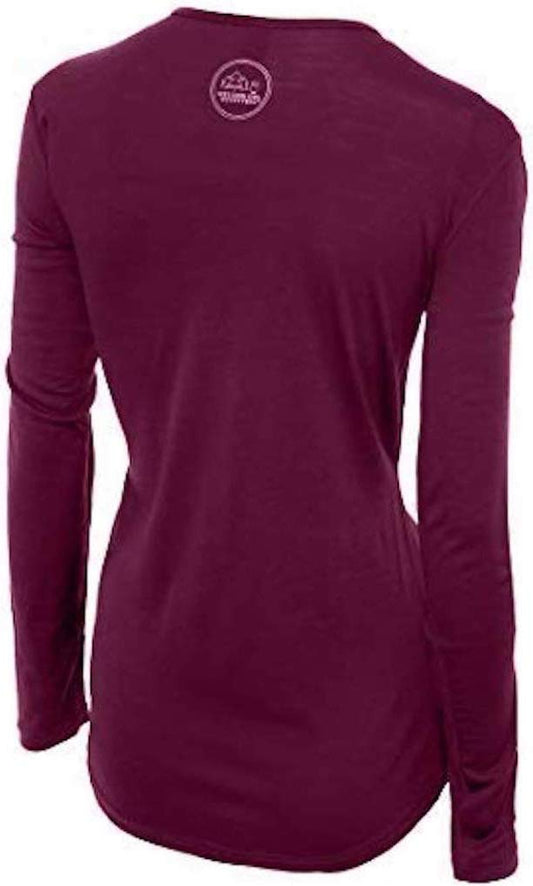
Warm and wet is the hard case for clothing: cotton stays wet and clings, synthetics start to smell by the second wear. A merino wool base layer for women stays comfortable when damp, does not hold odour after a humid day, and is the same layer you want under a fleece when you drive up the mountain.
Uphill: the Volcano and Mauna Kea
Hilo is the usual base for Hawaii Volcanoes National Park, because the park is on the same east side of the island. Wikivoyage puts the entrance in Volcano Village roughly 40 minutes' drive from downtown. Above the town stand Mauna Loa, which Wikipedia calls the largest active volcano on the planet, and Mauna Kea, the highest point in the Hawaiian Islands.
We print no eruption status, because it changes. The USGS Hawaiian Volcano Observatory, linked below, publishes the current status of Kilauea and Mauna Loa, and the National Park Service publishes closures. The UK Foreign Office names Hawaii among the US states with the most active volcanoes and tells visitors to follow local authorities, including evacuation orders. Check both on the morning you drive up.
The cold is the packing surprise. The Mauna Kea visitor centre is about 45 kilometres west of Hilo on Route 200 at roughly 9,300 feet, about 2,800 metres, and Wikivoyage tells visitors to bring warm clothing in several layers. The summit road beyond it needs four-wheel drive, so check your hire agreement before you go.
Getting There and Getting Around
Hilo International Airport, code ITO, serves the town. Hawaiian, Southwest and Mokulele fly there, and Wikivoyage notes that most flights arrive from Honolulu. Kona International is on the far side of the island: allow at least two hours by the Saddle Road across the middle, or two and a half by the northern road through Waimea.
The county's Hele-On bus serves Hilo, but Wikivoyage notes that virtually all visitors hire a car, and for the volcano and the mountain you will want one.
Is Hilo Safe for Women?
The FCDO publishes no advised-against areas anywhere in the United States and no country-level warning. Its guidance concentrates on the practical differences a British visitor meets: entry requirements and ESTA, the cost of healthcare without insurance, extreme weather including hurricanes on the Atlantic and Gulf coasts between June and November, and wildfire and heat risk in the west and south-west.
Hilo is an easy town for a woman travelling alone. Wikivoyage calls it generally quite safe, and the UK Foreign Office says violent crime and gun crime rarely affect tourists, while advising care in unfamiliar areas and not walking through quieter areas alone at night. Plan to drive or take a taxi back after dark rather than walk the bayfront alone.
The car is the target, not you. The FCDO warns not to leave passports in rental cars, especially in the boot, and that gangs may target vehicles that look like tourists' cars. At trailheads and the falls, take everything with you. Carry a passport showing your permission to be in the US, and remember the drinking age is 21 nationwide.
The hazards that matter here are water and ground. Rivers like the Wailuku rise fast when it rains upslope, even if it is dry where you stand, so stay on the platforms and out of the streams after heavy rain; the FCDO tells visitors to check National Weather Service warnings for flash floods. The FCDO also lists Hawaii among the states at higher risk of earthquakes.
The Hilo Packing List
Warm rain at sea level, cold air at altitude.
A packable rain jacket is the first thing in the bag and the one you will wear most; breathable matters more than heavy in warm rain.
Waterproof hiking shoes with grip, because paths to the falls and around the gardens are wet stone, roots and mud for much of the year, and sandals on wet lava are a slip waiting to happen.
For the mountain and the volcano, a Columbia Fast Trek II fleece over the base layer and a merino wool beanie. Both sound absurd for Hawaii until the sun goes down at 2,800 metres.
A dry bag for your phone and passport on rainy walks and on the water, and a quick dry travel towel, because in this humidity a cotton towel never dries.
Not linked and worth packing: a sun hat, in our registry and unlinked only because the six-link cap is full; sunscreen and sunglasses, unlinked because our registry holds neither; water shoes for rocky entries, unlinked because the only such entry in our register has an unconfirmed product identity; and spare dry socks.
Our merino base layers are 100% Australian merino at 17.5 micron, and a town where you are damp at breakfast and cold on a mountain by dinner is exactly the case they were made for.
Recommended Tours and Experiences
Essential Resources for Women in Hilo
Emergency numbers: 911 for police, ambulance and fire, free from any phone including a locked mobile. Calls are answered locally and dispatchers will stay on the line. For non-urgent police matters many cities also run a 311 information line.
Main hospital: Hilo Benioff Medical Center, formerly known as Hilo Medical Center, has a 24-hour emergency department; it is on Waianuenue Avenue, a little beyond the turning for Rainbow Falls. For anything serious, call 911.
This is the single biggest practical difference for a visitor: there is no public health system, an emergency room visit without insurance can run into thousands of dollars, and an ambulance is billed separately and is not free. Comprehensive travel insurance with a high medical limit is not optional in the United States, and you should carry your policy number and the insurer's 24 hour number somewhere you can reach them. Urgent care clinics handle anything short of an emergency far more cheaply and quickly than an emergency room, and are the right choice for a sprain, an infection or stitches.
Tourist police: the United States has no tourist police. The Hawaii County Police Department covers the island, and 911 reaches police, ambulance and fire.
US State Department travel advisory: there is none, and this is not an omission. The State Department issues travel advisories for other countries, not for the United States itself, so no US advisory for this destination exists to link. In its place, the Government of Canada advice for the United States gives an equivalent third-country assessment.
UK FCDO travel advice: gov.uk/foreign-travel-advice/usa, and read the safety and security page rather than only the landing page, because that is where the substance sits. The FCDO names no advised-against areas anywhere in the United States. The same advice also covers Puerto Rico, the US Virgin Islands, Guam, American Samoa and the Northern Mariana Islands.
Official health authority: the CDC travellers' health pages, the US federal health authority for visitors, and the state health department is the Hawaii State Department of Health.
Embassy contact: the United States is the host country, so there is no US embassy to contact. Your own country's embassy is in Washington DC, with consulates in New York, Los Angeles, Chicago, Houston, San Francisco, Miami and Boston. Find yours before you travel and save the number.
Official tourism authority: Brand USA, the national tourism marketing body, covers the country; for volcano status the authority is the USGS Hawaiian Volcano Observatory, for park closures Hawaii Volcanoes National Park, for flood and storm warnings the National Weather Service office in Honolulu, for tsunami messages the Pacific Tsunami Warning Center, and for Rainbow Falls Wailuku River State Park.
Solo women safety assessment: Hilo is a small, relaxed town and a comfortable base for a woman alone. Crime that touches visitors is mostly theft from hire cars, so carry your valuables, and drive or take a taxi after dark rather than walk quiet streets. The real risks are natural: rivers that rise after rain upslope, a coast with a tsunami history, and a volcano and a mountain nearby. Check the observatory, the weather service and the park before each day out.
Takeaways
Hilo is the wet side. Pack a rain jacket, grippy waterproof shoes and a merino layer that stays comfortable damp.
Coconut Island's footbridge collapsed in November 2025. Check it has reopened before you plan on it.
On the bayfront, a siren or a strong shake means walk inland and uphill. Take a fleece for the mountain.
Reading On
Hilo is one town on a large island, and the Big Island packing list is its parent, while the Kailua-Kona packing list covers the dry west coast you will probably cross to at some point. For the state, see the Hawaii packing list and the Hawaii travel guide for women. Elsewhere in the islands, see the Honolulu, Maui, Kauai and Hanalei packing lists. The United States travel guide for women covers the country, and the guide to merino wool base layers for women explains the fibre. Every destination we cover is indexed at the travel packing guide for women, and the base layers are at the Roman Trail collection.
If the outer journey is calling you, the inner one usually is too. Explore SoulMap at romantrail.com/blogs/soulmap.