

Cape Breton Island is the northern third of Nova Scotia, separated from the mainland by a strait and joined to it by a causeway. It holds a highland national park, a saltwater inland sea, the best known scenic drive in Canada, and something no other place in North America has: a Scottish Gaelic culture that was carried here in the nineteenth century and never entirely stopped.
Disclosure: This post contains affiliate links. If you buy through them, Roman Trail earns a small commission at no extra cost to you.
What Is Here
THE CABOT TRAIL IS THE REASON MOST PEOPLE COME AND IT IS ABOUT 300 KILOMETRES. The hero image is it in autumn colour. The loop runs round the northern highlands, climbing over headlands with the Gulf of St Lawrence on one side and the Atlantic on the other, and roughly a third of it runs through Cape Breton Highlands National Park. DRIVING IT IN A DAY IS POSSIBLE AND IS A MISTAKE: allow two or three, because the point is the stops. WHICH DIRECTION YOU DRIVE IS A REAL CHOICE: clockwise puts you on the inside of the cliff sections, which nervous drivers prefer; anticlockwise puts the viewpoints on your side of the road.
THE NATIONAL PARK CHARGES AN ENTRY FEE AND THE SKYLINE TRAIL IS ITS BEST WALK. Parks Canada runs the park, a day pass or an annual Discovery Pass covers it, and the SKYLINE TRAIL is a roughly nine kilometre loop out to a headland boardwalk above the Gulf, which is where people see whales from the clifftop. The second image is that country from the air.

GAELIC IS A LIVING LANGUAGE HERE AND THAT IS NOT HERITAGE MARKETING. Highland Scots cleared from their land settled this island from the 1770s, and Cape Breton holds the only Scottish Gaelic speech community outside Scotland, with road signs in Gaelic and English, immersion schooling, and a fiddle tradition that preserved bowing styles that died out in Scotland itself. The GAELIC COLLEGE at St Anns teaches it. A CEILIDH, pronounced kay-lee, is a kitchen-scale music session and in summer they are advertised on noticeboards in village halls across the island for a few dollars: THAT IS THE BEST THING YOU CAN DO ON CAPE BRETON and it costs almost nothing.
CELTIC COLOURS IS IN OCTOBER AND IT FILLS THE ISLAND. A nine-day festival of concerts in community halls across Cape Breton timed to the autumn leaves. ACCOMMODATION BOOKS OUT MONTHS AHEAD for it and for the whole of early October.
THE FORTRESS OF LOUISBOURG IS THE LARGEST HISTORICAL RECONSTRUCTION IN NORTH AMERICA AND WE HOLD NO PHOTOGRAPH OF IT. A quarter of the 1740s French fortress town rebuilt on its original foundations on the Atlantic side, with costumed interpreters, and it is a Parks Canada site with a short season. It is an hour and a half from the Cabot Trail and most trail visitors skip it, which is a mistake.
THE BRAS D'OR LAKE IS A SALTWATER INLAND SEA in the middle of the island, a UNESCO biosphere reserve, and it is why the interior is mild and the sailing is good. BADDECK on its shore is the usual Cabot Trail base and holds the ALEXANDER GRAHAM BELL museum, where he spent his summers and tested hydrofoils and aircraft.
THE THIRD IMAGE IS A FISHING BOAT, AND THE WORKING ISLAND MATTERS. Lobster, snow crab and the coal and steel history around Sydney and Glace Bay are the other Cape Breton, less photographed than the trail. The Glace Bay Miners Museum takes you into a real colliery with retired miners as guides.
When to Go
THE SEASON IS SHORT AND THIS IS THE MOST IMPORTANT PLANNING FACT ON THE ISLAND. Most of the Cabot Trail's accommodation, restaurants, boat tours and park services run roughly from late May or June to mid-October, and a great deal of it CLOSES COMPLETELY for the winter. Arriving in early May or late October means a beautiful empty island with nowhere to eat.
Late September and the first half of October are the peak: the colour, Celtic Colours, whales still possible, and the weather usually kind.
July and August are warm, busy and the full programme runs, with the beaches briefly usable and the water cold.
June is quiet and green with black flies and mosquitoes inland.
HURRICANE AND POST-TROPICAL STORM SEASON RUNS JULY TO NOVEMBER AND IT REACHES HERE. HURRICANE FIONA struck Cape Breton in September 2022 with severe damage, flooding and long power cuts, and that is recent and real rather than historical. Insurance covering disruption is sensible in the autumn.
Getting There
By car, across the Canso Causeway, about four hours from Halifax to Baddeck. THIS IS THE PRACTICAL WAY.
By air, Sydney has limited service; Halifax Stanfield is the main airport with hire cars.
By ferry, Newfoundland services run from North Sydney to Port aux Basques and Argentia, which is how most people reach Newfoundland.
YOU NEED A CAR. There is no public transport worth the name on Cape Breton, the distances are real, services are far apart, and the Cabot Trail has no bus. This is non-negotiable in a way it is not for most destinations in this library. FUEL STATIONS ARE SPARSE ON THE NORTHERN TRAIL and some close early, so fill up at Cheticamp or Ingonish rather than running low on the highlands.
Is Cape Breton Island Safe for Women?
Cape Breton is rural, friendly and extremely safe. The FCDO publishes no advised-against areas anywhere in Canada. Its safety page does carry a terrorism warning: terrorists are likely to try to carry out attacks in Canada, and attacks could be indiscriminate, including in places visited by foreign nationals. The named risks are overwhelmingly WEATHER AND WILDLIFE rather than crime, and they are seasonal. Hurricanes and post-tropical storms on the coasts from July to November. Winter storms from November to April, which close highways and make driving genuinely dangerous rather than merely slow. Wildfires, a year-round risk concentrated in the west and in Quebec. Avalanches in the mountains of Alberta and British Columbia. Tornadoes from May to September. On crime, the FCDO names theft from unattended luggage and of valuables left in view, which is the ordinary big-city caution. On wildlife, take particular care where bears have been sighted and keep your distance from all of it.
MOOSE ON THE ROAD ARE THE MOST SERIOUS RISK HERE AND IT IS NOT A JOKE. Cape Breton has a dense moose population, they are dark, roughly 450 kilograms, and they stand taller than a car bonnet so a collision brings the animal through the windscreen rather than under the bumper. THEY ARE MOST ACTIVE AT DAWN AND DUSK AND THAT IS WHEN THE TRAIL IS MOST BEAUTIFUL. Slow down at those hours, scan the verges, and do not drive the highlands at night if you can avoid it.
THE DRIVING IS THE SECOND THING. The Cabot Trail has steep gradients, notably French Mountain and Smokey, tight bends, limited guardrail, cyclists, and viewpoints people stop at abruptly. FOG ARRIVES FAST ON THE COAST and can reduce the cliff sections to almost nothing.
BLACK BEARS AND COYOTES ARE PRESENT. Store food properly and never leave anything out at a campsite. Coyotes here are larger than elsewhere and A FATAL ATTACK ON A YOUNG HIKER OCCURRED IN THE NATIONAL PARK IN 2009, which is exceptionally rare and did happen: Parks Canada's guidance is to hike in company where possible, keep children close, never run, make yourself large and loud if approached, and report sightings.
THE ATLANTIC IS COLD, ROUGH AND HAS RIP CURRENTS, with mostly unsupervised beaches and water that rarely exceeds the mid-teens Celsius. Cliff edges along the trail are largely unfenced.
THERE ARE LONG STRETCHES WITH NO MOBILE SIGNAL on the northern trail and in the park. Tell someone your route and do not rely on a phone.
BLACK FLIES AND MOSQUITOES IN JUNE AND JULY are genuinely bad inland.
The Cape Breton Packing List
Atlantic wind, fast fog, cold water and a cool summer.
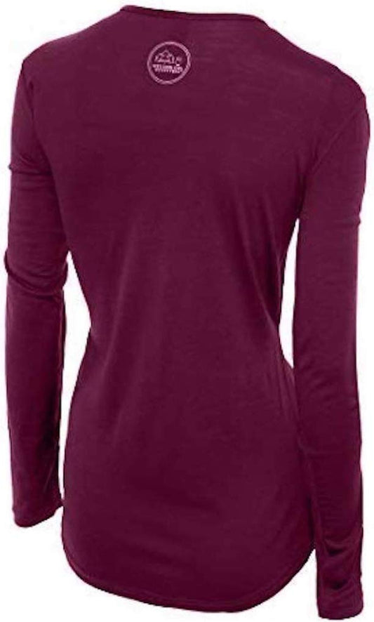
Our merino base layers are 100% Australian merino at 17.5 micron, and a long sleeve merino wool base layer for women is the correct first layer in every month on this island, because the pattern here is damp wind rather than cold: you get wet from fog and spray rather than rain, and wool is the layer that keeps insulating when it is damp while cotton starts taking heat away from you. From October to May add a heavyweight merino base layer.
A Columbia Fast Trek II fleece and a Marmot PreCip Eco rain jacket, which here is a windproof first and a raincoat second. A hood beats an umbrella on a headland.
A merino beanie, which you will want on the Skyline Trail in August.
Waterproof walking shoes with grip and Darn Tough merino socks for boardwalk, wet rock and bog.
Not linked and worth packing: STRONG INSECT REPELLENT for June and July inland, where the black flies defeat people; BINOCULARS, because the whale watching from the Skyline clifftop is free and genuinely good; A PAPER MAP, since there are long stretches with no signal; A HEADTORCH; LAYERS YOU CAN ADD AND REMOVE ALL DAY, because a headland and a sheltered valley twenty minutes apart are different climates; AND CASH, because some village halls, ceilidhs and small cafes on the trail take nothing else. Canada is otherwise card-friendly and tipping is expected at 15 to 20 per cent.
Recommended Tours and Experiences
Essential Resources for Women on Cape Breton Island
Emergency numbers in Canada: 911 for police, ambulance and fire, with full English service. 811 reaches Nova Scotia's health advice line for non-emergency medical questions. For anything at sea, the Joint Rescue Coordination Centre in Halifax coordinates search and rescue for the whole region and is reached through 911.
THE SEASON IS THE PLANNING FACT THAT MATTERS MOST: most Cabot Trail accommodation, restaurants, boat tours and park services run roughly late May or June to mid-October and a great deal closes completely in winter, so arriving in early May or late October can mean a beautiful island with nowhere to eat. MOOSE ON THE ROAD ARE THE MOST SERIOUS RISK: dense population, dark animals of around 450kg standing taller than a car bonnet, so a collision brings the moose through the windscreen; they are most active at DAWN AND DUSK, which is also when the trail is most beautiful, so slow down, scan the verges and avoid driving the highlands at night. THE CABOT TRAIL has steep gradients at French Mountain and Smokey, tight bends, limited guardrail, cyclists and FOG THAT ARRIVES FAST on the cliff sections. FUEL STATIONS ARE SPARSE on the northern trail and some close early, so fill up at Cheticamp or Ingonish. THERE IS NO PUBLIC TRANSPORT and no bus on the trail, so a car is essential. LONG STRETCHES HAVE NO MOBILE SIGNAL. BLACK BEARS AND COYOTES ARE PRESENT and a fatal coyote attack on a hiker occurred in the national park in 2009, which is exceptionally rare: hike in company, never run, be large and loud if approached, and report sightings to Parks Canada. THE ATLANTIC IS COLD, ROUGH AND RIP-PRONE with mostly unsupervised beaches, and cliff edges are largely unfenced. POST-TROPICAL STORMS REACH HERE JULY TO NOVEMBER and Hurricane Fiona caused severe damage in September 2022. Black flies and mosquitoes are bad inland in June and July. CELTIC COLOURS IN OCTOBER books the island out months ahead.
US State Department travel advisory: the Canada advisory. Read the current level there directly rather than relying on a figure printed in any guide.
UK FCDO travel advice: gov.uk/foreign-travel-advice/canada, and read the safety and security page rather than only the landing page, because that is where the substance sits.
Main hospital or clinic: the Cape Breton Regional Hospital in Sydney is the island's main hospital with a 24 hour emergency department, and smaller facilities serve Inverness and Cheticamp on the western side. For major trauma the regional centre is the QEII Health Sciences Centre in Halifax, about four hours away, which is the practical reason not to take risks in the highlands. Visitors are not covered by provincial health insurance and will be billed, so travel insurance is essential. Canada has no reciprocal health agreement with the UK and treatment is EXPENSIVE, which makes travel insurance with medical cover genuinely non-optional here rather than advisable. An ambulance is billed. Care itself is excellent and English is universal in Newfoundland. A walk-in clinic handles minor problems far more cheaply and quickly than an emergency department, and a pharmacy will deal with the smallest things. Tap water is drinkable everywhere. The two health issues a visitor actually meets are cold injury in winter and ticks in long grass in summer.
Official health authority: the Public Health Agency of Canada, covers the Canadian public health guidance, with Environment Canada the authority for fog, wind and post-tropical storm warnings
US Embassy: the United States Embassy in Ottawa.
Official tourism authority: Destination Canada, covers Nova Scotia and Cape Breton visitor information, the Celtic Colours dates and the Cabot Trail services, with Parks Canada the authority for Cape Breton Highlands National Park fees, trail conditions and the Fortress of Louisbourg season
Takeaways
Allow two or three days for the Cabot Trail. One is a mistake.
Most of the island closes from mid-October to late May. Check before you go.
Slow down at dawn and dusk. A moose comes through the windscreen.
Find a village hall ceilidh. It costs a few dollars and it is the best thing here.
Solo women safety assessment: Cape Breton is among the safest and friendliest destinations in this library, and travelling it alone is genuinely pleasant rather than merely tolerable: this is rural Nova Scotia, where people talk to strangers as a matter of course, crime against visitors is close to nonexistent, and turning up alone at a village hall ceilidh will get you included rather than ignored. 911 REACHES POLICE, AMBULANCE AND FIRE with full English service, 811 is the Nova Scotia health line for non-emergencies, and anything at sea goes through 911 to the Joint Rescue Coordination Centre in Halifax. The Cape Breton Regional Hospital in Sydney has a 24 hour emergency department, and for major trauma the regional centre is in Halifax FOUR HOURS AWAY, which is the practical reason to be conservative on the highlands rather than bold. VISITORS ARE NOT COVERED BY PROVINCIAL HEALTH INSURANCE and will be billed, so insurance is essential. EVERY REAL RISK HERE IS THE ROAD, THE WILDLIFE OR THE WEATHER. Moose are the serious one: there are many of them, they are dark, they weigh around 450 kilograms and they stand taller than a bonnet, so a collision comes through the windscreen rather than under the car, and they are most active at exactly the dawn and dusk hours when the trail is most beautiful. Slow right down then, and avoid driving the highlands at night. The Cabot Trail itself has steep climbs, tight bends, little guardrail and fog that can close in within minutes on the cliff sections, and there are long stretches with no mobile signal, so tell somebody your route and carry a paper map. Black bears and coyotes are present, and a fatal coyote attack on a young hiker happened in the national park in 2009, which is extraordinarily rare and is why Parks Canada asks people to walk in company, never run, and make themselves large and loud. The Atlantic is cold, rough and largely unsupervised, and the cliff edges are unfenced.
Reading On
Cape Breton is the northern end of Nova Scotia and the Halifax packing list covers the provincial capital four hours south, which is the airport, the hire car and the trauma centre for this island, so the two belong in one trip. Further east, the St John's packing list covers Newfoundland, reached by the ferry that leaves from North Sydney on this island. West, the Quebec City packing list and the Montreal packing list cover French Canada, and the Toronto packing list the largest city. For comparable North Atlantic coast, the Acadia packing list covers the Maine coast across the Gulf of Maine, which shares the fog, the granite and the cold water. For Scotland, which is where the Gaelic here came from, the Scottish Highlands packing list is the direct comparison and the reason this island feels the way it does. For the country, the Canada travel guide for women and the Canada packing list carry the regions and the practicalities. For why wool is the layer that works when you get wet from fog rather than rain, read the guide to merino wool base layers for women. Every destination we cover is indexed at the travel packing guide for women, and the base layers are at the Roman Trail collection.

If the outer journey is calling you, the inner one usually is too. Explore SoulMap at romantrail.com/blogs/soulmap.