

Photograph: The Neck isthmus joining North and South Bruny by andrew mcmillan, CC BY 3.0, via Wikimedia Commons.
Bruny Island is a coastal island of Tasmania, about 362 square kilometres, lying south of Hobart at the mouths of the Derwent and Huon estuaries and separated from the Tasmanian mainland by the D'Entrecasteaux Channel. It is really two islands, North Bruny and South Bruny, joined by the long, narrow, sandy isthmus everyone calls The Neck, which is what the photograph above shows from the top of the lookout stairs.
Disclosure: This post contains affiliate links. If you buy through them, Roman Trail earns a small commission at no extra cost to you.
Most people meet Bruny as a single day out from the city, and our Hobart packing list covers that day trip in its section on Port Arthur, Bruny and the rest of the south-east, while the Tasmania packing list hands the whole south-east corner to the Hobart guide. This post picks up where those leave off: what changes when you stay the night, how the two halves of the island differ, what it takes to get to Cape Bruny at the far south, how the weather on an exposed island behaves, and why the ferry, not the distance, is the thing that shapes every plan you make here.
We receive a fee when you get a quote from World Nomads using this link. We do not represent World Nomads. This is not a recommendation to buy travel insurance.
What the Photograph Shows, and What It Cannot
From the lookout at The Neck, the seaward side is on the left, a long white surf beach and open ocean, and the sheltered side on the right, a calm shallow bay. Adventure Bay lies on the eastern side of the isthmus and Isthmus Bay on the western, so you see the island's two personalities at once.
What one photograph cannot show is most of what you will actually do. There is no Adventure Bay settlement in it, no Cape Bruny lighthouse, none of the high sea cliffs at Fluted Cape, no ferry and no wildlife. The road at the bottom of the frame is gravel. Read it as the island's geography in one view, not as a picture of the whole place.
Two Halves, Two Different Stays
North Bruny is where the ferry lands, at Roberts Point, and it is the quieter half. The holiday village of Dennes Point is up here, and the island's small public airfield sits just north of The Neck, though it has no scheduled flights and is mostly suited to small aircraft, so for practical purposes there is one way on and off, which is the boat.
South Bruny is where the settlements of Alonnah, Adventure Bay and Lunawanna are, and where most of the overnight accommodation sits. Most began life as timber ports and now serve as shack towns and holiday places: small, scattered and self-catering. Much of the southeastern coast is protected as South Bruny National Park.
Why Stay the Night
Bruny is primarily a day-trip destination, and that is exactly why staying is worth it. A day visitor arrives on a morning ferry, drives the length of the island, joins the same queues at the same food stops as everyone else from the same sailing, and has to turn back in time to make a crossing home. The island runs to roughly 50 kilometres end to end, much of it on narrow and sometimes unsealed roads, so a day spent reaching Cape Bruny and back is mostly a day spent driving.
Stay one or two nights on South Bruny and the shape changes. You reach the lighthouse when the day crowd has not yet arrived or has already gone, you walk the beaches at Adventure Bay or Cloudy Bay in the long southern summer evenings, and you can wait out a front rather than driving through it. The cheese, oysters and cafes are also far more pleasant met at your own pace than as a convoy. Bring food basics from the mainland, because supplies are limited.
Recommended Tours and Experiences
The Ferry Is the Constraint
Access to the island is by a vehicle ferry across the D'Entrecasteaux Channel, between Kettering on the Tasmanian mainland and Roberts Point on North Bruny. A vehicle ferry has run this route since 1954, and in practice it is the island's only road. That single fact governs everything: when you can arrive, when you must leave, and how much slack you need around both.
This post prints no timetable, crossing time or fare, because all of them change. Check the current schedule, plan as though your sailing might be full on summer weekends, keep a warm layer in the car rather than the boot, and never book dinner in Hobart against the last boat.
The FCDO notes that hire car insurance often does not cover driving on unsurfaced roads, and tells travellers to check their policy before setting off. The road in the photograph is gravel, and so are some of the island's other roads. Ask your hire company directly whether Bruny's unsealed roads are covered, and drive them slowly, especially at dusk, when animals are on the road and the light is flat.
The Weather of an Exposed Island
Bruny has a cool oceanic climate with short, cool summers and chilly, wet winters with snowfalls, and it is near-constantly buffeted by cold fronts off the Roaring Forties, even through the height of summer. That last clause is the one to pack for. The island sits at the mouth of Storm Bay, open to the Southern Ocean, and the weather arrives fast.
The numbers recorded at Cape Bruny are a useful corrective to the word summer. The mean January high there is 19.1 degrees Celsius and the mean July high is 11.8, with July lows around 6.6. The island is very windy, with a mean 3pm wind speed of 27.8 kilometres an hour, it records around 242 cloudy days a year against roughly 19 clear ones, and rain falls on around 200 days a year. On 15 November 2021, which is late spring there, snow fell to beach level.
Put plainly, a single summer day can run through sun, squall and sun again, and the wind is what makes it cold. Pack for wind first and temperature second.
The UV is the thing to take seriously, more than the temperature: Australia has among the highest ultraviolet levels of any inhabited country, and the reason is structural rather than seasonal. The southern ozone layer is thinner, the Earth is closer to the sun during the southern summer, and the air is clean, so UV reaches the ground at an intensity northern visitors have no instinct for. In summer the index routinely passes 11, which is rated EXTREME, and unprotected skin can burn in well under fifteen minutes. IT IS NOT A HEAT PROBLEM AND DOES NOT FEEL LIKE ONE: you burn as readily on a cool windy day in Melbourne or through cloud. Australians are taught five words for it, slip on a shirt, slop on sunscreen, slap on a hat, seek shade and slide on sunglasses, and the reason it is a national slogan is that this country has the highest skin cancer rates in the world.
Cape Bruny and the Lighthouse
The Cape Bruny Lighthouse stands at the southern tip of the island. It was commissioned after a series of shipwrecks south of Bruny, built by convict labour from locally quarried dolerite, first lit in March 1838 and decommissioned in 1996, when a newer light tower nearby took over. Since December 2000 the light station has been part of South Bruny National Park, and tours run inside the tower.
Reaching it is the longest drive on the island, down to the far end of South Bruny, and the headland is fully exposed to whatever is coming in off the ocean. Bring the windproof shell even on a calm morning in Hobart, wear shoes with grip for the path, and check with Parks and Wildlife Service Tasmania whether a parks pass is required for South Bruny National Park before you go, since this post does not assert either way.
Wildlife and The Neck
Bruny is an Important Bird Area, and it supports every one of Tasmania's endemic bird species, along with the endangered forty-spotted pardalote and the swift parrot. The Neck itself is an important breeding site for short-tailed shearwaters and little penguins. Stay on the boardwalk and the stairs and keep off the dunes. A pair of binoculars is the single most useful extra for this island. It is unlinked because our affiliate register carries no binocular entry.
Swimming on Bruny
The seaward beaches are surf beaches facing the open ocean, and the water is cold. The FCDO names rip currents as the main hazard for all swimmers and surfers in Australia, says they can happen at any beach and can sweep even the strongest swimmer out to sea, and notes that British nationals have been injured diving into water that was too shallow. Bruny's beaches are remote and you should not assume a patrol. Check conditions on Beachsafe, swim only where it is plainly calm, never alone, and do not dive. The channel side is the gentler water.
Is Bruny Island Safe for Women Travelers
Australia carries no advised-against area anywhere, and the phrase "advise against" appears nowhere on the FCDO's landing or safety pages for the country. Bruny is not named at all. It is a small, quiet, rural island that recorded about a thousand residents at the 2021 census.
The FCDO advises against travel to no part of Australia, and there are no advised-against areas anywhere in the country. It does carry two named warnings that are worth reading rather than skipping. The first is BUSHFIRE, which it flags as a higher risk through the spring and summer, October to February, and which can close roads and whole regions at very short notice. The second is TERRORISM: the FCDO states that terrorists are likely to try to carry out attacks in Australia and that attacks could be indiscriminate, including in places visited by foreign nationals, and it names the December 2025 antisemitic attack at Bondi Beach in Sydney, in which fifteen people were killed, and an April 2024 incident at a church in Wakeley. Australia also publishes its own national terrorism threat level, which is the thing to check rather than any figure quoted here. Beyond those two, the risks it names are environmental: extreme heat, cyclones in the north between November and April, flooding, and the sea, where RIP CURRENTS are the hazard it puts first and the one that actually kills visitors. On crime it names ordinary precautions against petty theft, and separately warns about scams. The practical shape for a visitor is that the everyday risk here really is weather and water, but the advisory does not describe this as a country with nothing but environmental hazards and neither should we.The FCDO also warns that bushfires can occur in any part of Australia, especially at the height of the summer from November to February, and can start and change direction very suddenly. On an island with one ferry, check the fire danger rating for the day.
The Bruny Island Packing List
Pack as if for a cool, windy, wet coast, whatever the month says.
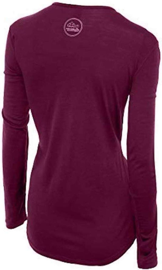
A merino wool base layer is the foundation, and Bruny is close to the ideal case for it: merino stays warm when damp, handles a day that swings from sun to squall without leaving you clammy, and resists odour across several days in a self-catering shack where laundry is not a given.
The most important single item is a packable rain jacket that blocks wind as well as rain. Over the base layer, a fleece mid-layer handles the evenings and the lighthouse headland. Together the three make the layering system that copes with a front arriving mid afternoon.
For your head and hands, a merino beanie and a pair of merino glove liners weigh almost nothing and make the difference at the top of The Neck stairs in a wind.
On your feet, waterproof hiking shoes with merino hiking socks cover the stairs, the bush tracks and wet sand. That is six links, which is our cap, so a dry bag for an eco cruise, a towel for the beach and an insulated bottle for the long drive south are all advised and left unlinked for that reason.
Sunscreen and sunglasses are both advised and neither is linked, because our affiliate register carries no sunscreen and no eyewear entry at all. Binoculars are unlinked for the same reason. Bring a full tank of fuel.
Essential Resources for Women on Bruny Island
Emergency number: 000 for police, fire and ambulance anywhere in Australia, which is the number the FCDO gives.
Main hospital: the Royal Hobart Hospital in Hobart is the state's major hospital, reached via the ferry and the drive north. Ask your accommodation where the nearest medical help on the island is. The FCDO notes that it can take hours to get help in an emergency in the bush or national parks, and on an island served by one ferry that is the honest planning assumption.
Parks and walking: Parks and Wildlife Service Tasmania publishes alerts and track closures for South Bruny National Park and decides pass requirements. The Tasmania Fire Service issues fire danger ratings.
Beach safety: Beachsafe, run by Surf Life Saving Australia, is the place to check a beach before you swim.
Official health authority: the Australian Government Department of Health, Disability and Ageing, covers the national guidance.
US Embassy: the United States Embassy in Canberra.
Official tourism authority: Tourism Australia, covers the national picture. For the island itself the local visitor information site brunyisland.org.au is the closer source.
US State Department travel advisory: the Australia advisory. Read the current level there directly rather than relying on a figure printed in any guide.
UK FCDO travel advice: gov.uk/foreign-travel-advice/australia, and read the safety and security page rather than only the landing page, because that is where the substance sits.
Australia has a RECIPROCAL HEALTH CARE AGREEMENT with the UK, which is unusual and worth knowing: it covers medically necessary treatment in a public hospital or a public clinic on the same basis as a Medicare patient, and you enrol at a Medicare office or present a UK passport at the hospital. IT IS NOT COMPREHENSIVE COVER. It does not pay for ambulances, which are billed separately and are expensive, it does not cover repatriation, it does not cover treatment in private hospitals, and it does not cover the Royal Flying Doctor Service, which is how you leave a remote area in an emergency. Travel insurance with a high medical limit is still the thing that matters, and the distances in this country are why. A pharmacy, called a chemist, handles small problems, and tap water is drinkable everywhere.Solo women safety assessment: Bruny Island is an easy place to travel alone in every social sense. Australia has no advised-against area, the FCDO names nothing here, and the island is small, rural and quiet, with a visitor economy used to independent travellers in hire cars. What deserves respect is the rest: weather that turns fast in summer, rip currents on unpatrolled beaches, gravel roads at dusk, and a hospital on the other side of a ferry crossing. Tell your accommodation your plans and keep warm layers and fuel in the car.
Reading On
The Hobart packing list is the companion to this one, covering the city you will sleep in before and after, kunanyi, Port Arthur and the Bruny day trip itself. The Tasmania packing list covers the rest of the island state, from Cradle Mountain to the east coast. For another island reached by vehicle ferry and best done slowly, see Kangaroo Island, and for the mainland coast across Bass Strait, the Great Ocean Road and Melbourne. The Australia travel guide for women is the hub, and the travel packing guide covers the system this list is built on.
If the outer journey is calling you, the inner one usually is too. Explore SoulMap at romantrail.com/blogs/soulmap.
For why wind and constant damp argue for merino rather than cotton, see our guide to the best merino wool base layers for women, and the full range is in the Roman Trail collection.