

Tasmania is an island state about 240 kilometres south of the Australian mainland across Bass Strait, roughly the size of Ireland, with 575,000 people and almost half its area under some form of protection. Nearly a fifth of it is the Tasmanian Wilderness World Heritage Area, one of the last temperate wilderness tracts on Earth, and nothing stands between its west coast and Argentina.
Disclosure: This post contains affiliate links. If you buy through them, Roman Trail earns a small commission at no extra cost to you.
THE FIRST THING TO UNDERSTAND IS THAT TASMANIA IS NOT A WARM-WEATHER DESTINATION, and the packing list is the one place in Australia where you will look European. This is 40 to 43 degrees south, which is the latitude of Barcelona reversed, with the Southern Ocean upwind and the Roaring Forties blowing across it. Summer days are commonly 21 or 22C rather than hot. The highlands record SNOW IN EVERY MONTH OF THE YEAR. Visitors who arrive from Queensland with shorts and a t-shirt are a standing local joke and occasionally a search and rescue callout.
THE SECOND IS THAT IT IS SMALLER THAN IT LOOKS AND SLOWER THAN IT LOOKS. You can drive Hobart to Launceston in two and a half hours, and Hobart to Cradle Mountain in about four and a half, so the whole island is reachable from either end. But the roads are narrow, winding and shared with a great deal of wildlife, so the times are honest rather than generous and night driving is actively discouraged. A week covers the island properly; four days covers half of it.
THE THIRD IS HOW THE ISLAND DIVIDES, and this post is organised around it. THE NORTH-WEST holds Cradle Mountain and the alpine plateau. THE EAST COAST holds Freycinet, Wineglass Bay and the Bay of Fires, and is the warm, dry, sheltered side. THE WEST is rainforest, rivers and the old mining towns, and gets several times the rainfall of the east. THE SOUTH-EAST is Hobart, Bruny Island and the Tasman Peninsula, which our Hobart packing list covers in full, including Port Arthur and the Bruny day trip, so this guide leaves the city to it.
And the fourth thing, which surprises people: TASMANIA HAS THE STRONGEST ULTRAVIOLET IN AUSTRALIA. The ozone layer is thinnest over the far south and the air is exceptionally clean, so you burn here on cool cloudy days at temperatures where nothing happens in Europe.
We receive a fee when you get a quote from World Nomads using this link. We do not represent World Nomads. This is not a recommendation to buy travel insurance.
Is Tasmania Safe for Women Travelers
Among the safest places in this guide. The weather is the hazard that hurts people.
The FCDO advises against travel to no part of Australia, and there are no advised-against areas anywhere in the country. It does carry two named warnings that are worth reading rather than skipping. The first is BUSHFIRE, which it flags as a higher risk through the spring and summer, October to February, and which can close roads and whole regions at very short notice. The second is TERRORISM: the FCDO states that terrorists are likely to try to carry out attacks in Australia and that attacks could be indiscriminate, including in places visited by foreign nationals, and it names the December 2025 antisemitic attack at Bondi Beach in Sydney, in which fifteen people were killed, and an April 2024 incident at a church in Wakeley. Australia also publishes its own national terrorism threat level, which is the thing to check rather than any figure quoted here. Beyond those two, the risks it names are environmental: extreme heat, cyclones in the north between November and April, flooding, and the sea, where RIP CURRENTS are the hazard it puts first and the one that actually kills visitors. On crime it names ordinary precautions against petty theft, and separately warns about scams. The practical shape for a visitor is that the everyday risk here really is weather and water, but the advisory does not describe this as a country with nothing but environmental hazards and neither should we.
The FCDO publishes no separate advice for any Australian state, so those two pages cover the island. It does point readers at each state's own bush safety guidance, and Tasmania's is linked at the end of this guide.
THE WEATHER IS THE FIRST AND MOST SERIOUS RISK AND IT KILLS WALKERS IN SUMMER. The mechanism is specific and worth understanding rather than generalising: the central plateau and the western mountains sit above 1,000 metres, they are exposed to the Roaring Forties with no landmass upwind, and a front can arrive in under an hour. A 22C morning in Launceston and horizontal sleet on the Overland Track are routinely the same day. Hypothermia here is a WARM SEASON problem, because that is when unprepared people are on the tracks. The whole of the advice is this: carry a windproof and waterproof shell, a warm mid layer and a wool base layer on ANY highland walk regardless of the forecast, register your intentions where a log book exists, and TURN BACK WHEN THE CLOUD COMES DOWN rather than pressing on to a summit. Walkers who died on these tracks did so wearing cotton.
The UV is the thing to take seriously, more than the temperature: Australia has among the highest ultraviolet levels of any inhabited country, and the reason is structural rather than seasonal. The southern ozone layer is thinner, the Earth is closer to the sun during the southern summer, and the air is clean, so UV reaches the ground at an intensity northern visitors have no instinct for. In summer the index routinely passes 11, which is rated EXTREME, and unprotected skin can burn in well under fifteen minutes. IT IS NOT A HEAT PROBLEM AND DOES NOT FEEL LIKE ONE: you burn as readily on a cool windy day in Melbourne or through cloud. Australians are taught five words for it, slip on a shirt, slop on sunscreen, slap on a hat, seek shade and slide on sunglasses, and the reason it is a national slogan is that this country has the highest skin cancer rates in the world.
In Tasmania that is sharper than the block suggests, because the mildness disguises it: this state has among the highest melanoma rates in the world, and people burn badly on 18C breezy days. Sunscreen on a cool overcast day here is not excessive.
What is actually dangerous in Australia, and what is not: the reputation and the statistics point in different directions, so it is worth being specific. SPIDERS KILL ESSENTIALLY NOBODY. Redback deaths have been all but unknown since antivenom arrived in the 1950s, with one disputed case since, funnel-web antivenom has held a record of no deaths since it was introduced, and the huntsman that frightens everyone is harmless. SNAKES ARE SERIOUS AND RARE: Australia has many of the world's most venomous species, bites run to a couple of thousand a year and deaths to roughly two, and almost all bites happen to people handling or standing on a snake rather than being hunted by one. Walk heavily, look where you put your feet and hands, and leave them alone. SHARKS AVERAGE ONE OR TWO DEATHS A YEAR nationally, which is fewer than lightning. SALTWATER CROCODILES ARE THE ONE TO GENUINELY RESPECT, in the tropical north above roughly Rockhampton and across to Broome: they are ambush predators in rivers, estuaries and the sea, the warning signs mean it, and the rule is simply not to enter or stand at the edge of any water in croc country unless a local authority says it is safe. BOX JELLYFISH AND IRUKANDJI are the other northern hazard, in the wet season, which is why beaches there have stinger nets and why vinegar sits at the surf club. AND THE THING THAT ACTUALLY KILLS VISITORS IS NONE OF THE ABOVE: it is drowning in rip currents, followed by heat and by long-distance driving.
TASMANIA REMOVES MOST OF THAT PICTURE, which is a genuine advantage of the island and worth stating plainly. THERE ARE NO SALTWATER CROCODILES, NO BOX JELLYFISH AND NO IRUKANDJI anywhere in Tasmania, so the tropical hazards that shape a Queensland or Kimberley trip simply do not apply. Three snake species are present and all are venomous, which means closed shoes on bush tracks and watching where you put your hands on rock, and that is the extent of it. Jack jumper ants deliver a sting that causes severe allergic reactions in a small number of people and are worth knowing about if you carry an adrenaline autoinjector.
THE WILDLIFE RISK HERE IS ON THE ROADS RATHER THAN IN THE BUSH, and Tasmania has among the worst roadkill rates anywhere. Wallabies, pademelons, possums, wombats, echidnas and devils are all nocturnal and all cross roads, so driving between dusk and dawn carries a real chance of hitting something. Slow down well below the limit after dark, brake in a straight line rather than swerving, and plan to be off the roads by nightfall.
THE WATER IS COLD AND MOSTLY UNPATROLLED. The sea sits between about 12 and 18C, swimmable in February for the committed and strength-sapping the rest of the year, and the surf beaches on the east and south coasts have rips with no lifeguards outside a few summer locations. The west coast is genuinely dangerous water and is not a swimming coast at all.
Australia has a RECIPROCAL HEALTH CARE AGREEMENT with the UK, which is unusual and worth knowing: it covers medically necessary treatment in a public hospital or a public clinic on the same basis as a Medicare patient, and you enrol at a Medicare office or present a UK passport at the hospital. IT IS NOT COMPREHENSIVE COVER. It does not pay for ambulances, which are billed separately and are expensive, it does not cover repatriation, it does not cover treatment in private hospitals, and it does not cover the Royal Flying Doctor Service, which is how you leave a remote area in an emergency. Travel insurance with a high medical limit is still the thing that matters, and the distances in this country are why. A pharmacy, called a chemist, handles small problems, and tap water is drinkable everywhere.
And note the island factor: Tasmania is a small state with one major hospital at each end, and a serious case can mean an air transfer to Melbourne, which the reciprocal agreement does not cover.
Socially, Tasmania is among the safest and easiest places in this guide. It is small, rural, friendly and thoroughly used to walkers and visitors travelling alone. Hobart and Launceston are quiet cities with low crime, the small towns are welcoming, and a woman walking, eating or camping alone here is entirely unremarkable. The practical cautions are about weather and roads, not people.
Best Time to Visit Tasmania
December to March for walking, and bring the same clothes whenever you come.
Cool temperate maritime, with a small annual range and very large daily variability. Summer from December to February averages 21 to 23C in the lowlands and can briefly reach the 30s in a northerly; winter from June to August sits at 11 to 13C with frost, and snow on the mountains. The east coast is markedly drier and sunnier than the west, which gets several times the rainfall.
DECEMBER TO MARCH IS THE WALKING SEASON and the only sensible window for the Overland Track or any multi-day highland route: long days, the high tracks clear of snow, and everything open. January is the Australian school holidays and is the busiest and dearest. FEBRUARY AND MARCH ARE THE PICK, settled, slightly quieter and with the warmest sea.
AUTUMN IN APRIL AND MAY is quiet and often beautiful, and it has one thing found nowhere else: the FAGUS, Australia's only winter-deciduous native tree, turns gold and red across the highlands in late April, which is the island's one real autumn colour event and is concentrated around Cradle Mountain and Mount Field.
WINTER IS COLD, DARK AND HAS ITS OWN FOLLOWING: snow on the mountains, open fires, the lowest prices, Dark Mofo in Hobart in June, and the best chance of the AURORA AUSTRALIS, which is visible from southern Tasmania on strong nights and is one of the few accessible places in the world for it.
SPRING FROM SEPTEMBER TO NOVEMBER is the most changeable and the windiest, with wildflowers in the highlands and snow still possible on the tracks into November.
THE ONE SCHEDULING NOTE THAT CATCHES PEOPLE: the SYDNEY TO HOBART YACHT RACE finishes between about 27 December and New Year and fills Hobart completely, and Dark Mofo does the same in June. Both are worth planning around in either direction.
Recommended Tours and Experiences
The Wilderness, and What It Asks of You
Nearly a fifth of the island is World Heritage wilderness, and it is not a park with railings.
The Tasmanian Wilderness World Heritage Area covers about 1.6 million hectares and meets more of the UNESCO criteria than almost any other property on Earth. What that means for a visitor is that large parts of this island are genuinely wild: no phone coverage, no shelter, weather that turns in minutes, and tracks that are muddy, rooty and unmarked by the standards of a European national park.
THE OVERLAND TRACK is the famous one: about 65 kilometres from Cradle Mountain to Lake St Clair over six days, through alpine plateau, buttongrass and rainforest, with huts that are first-come and tent platforms beside them. IT RUNS A BOOKING SYSTEM WITH A FEE, A SEASON AND A DAILY DEPARTURE LIMIT, all of which change year to year, so book through Parks and Wildlife well ahead and take the current conditions from them rather than from any guide. It is not technical and it is not easy: the mud is legendary, the weather is the whole challenge, and people are evacuated off it every season.
IF SIX DAYS IS TOO MUCH, the alternatives are real rather than consolation. The DOVE LAKE CIRCUIT at Cradle Mountain is six kilometres, boardwalked, flat and one of the great short walks anywhere, with the mountain reflected in the lake and the boatshed that appears in every photograph of Tasmania. Marions Lookout above it is a steep two hours return for the plateau view. At MOUNT FIELD, Russell Falls is a twenty minute stroll on sealed path and the Tall Trees walk stands among swamp gums over 70 metres high. The THREE CAPES TRACK on the Tasman Peninsula is a four day hut walk with proper beds, which is the comfortable way into serious coastal scenery.
AND THE RULE THAT GOVERNS ALL OF IT: in this landscape the layers in your pack matter more than the distance in your legs.
Top Regions and What Each One Requires
Cradle Mountain and the North-West Highlands
The island's signature landscape and the start of the Overland Track. Cradle Mountain rises above Dove Lake on an alpine plateau at around 900 to 1,500 metres, with wombats grazing the buttongrass at dusk and a shuttle bus system from the visitor centre that is the only way to reach the lake in peak season. Expect cloud: the mountain is clear perhaps one day in three. Nearby, the Tarkine or takayna in the far north-west is the largest temperate rainforest in Australia and is reached on gravel roads. Requires: full three-layer system, waterproof boots, and the expectation of rain and wind on the same day as sun.
Freycinet and the East Coast
The warm, dry, sheltered side, and the easiest part of Tasmania to enjoy. FREYCINET NATIONAL PARK holds WINEGLASS BAY, whose perfect curve of white sand is reached by a steep 1.5 hour return climb to the lookout or a longer walk down to the beach itself, and the Hazards are the pink granite peaks behind it. The BAY OF FIRES further north runs for about 30 kilometres with white sand and orange lichen-covered boulders, and the northern end at Binalong Bay is the accessible part. Add Maria Island, a car-free national park with wombats and convict ruins, and the oyster and wine country around Coles Bay. Requires: layers, swimwear for the brave, and sun protection because the east coast is the sunniest part of the state.
The West Coast
Wild, wet and industrial in a way that is genuinely interesting. STRAHAN sits on Macquarie Harbour, six times the size of Sydney Harbour, and is the base for cruises up the GORDON RIVER into the World Heritage area, where the water is stained dark with tannin and reflects the rainforest perfectly. The ruins of Sarah Island, the most feared penal station in the colony, sit in the harbour. QUEENSTOWN inland is a mining town surrounded by hills stripped bare by a century of smelting, which is a startling and honest landscape, and the West Coast Wilderness Railway climbs out of it. Requires: proper waterproofs, because this coast gets rain on most days of the year.
Launceston and the Tamar
The island's second city, in the north, with CATARACT GORGE cutting through its edge, a chairlift across it and swimming in the basin. The Tamar Valley runs north to the sea through cool-climate vineyards, and Bridestowe's lavender fields bloom in December and January. Note that Launceston itself has no dedicated guide in this library yet. Requires: city clothes and a light warm layer.
Hobart, Bruny and the Tasman Peninsula
The south-east, and the part of the island this guide hands over. Hobart has the waterfront, Salamanca Market, MONA and kunanyi behind it; Bruny Island is a day of cheese, oysters and a narrow sand isthmus; Port Arthur on the Tasman Peninsula is the most significant convict site in Australia and is also the place where 35 people were killed in 1996, with a memorial garden at the site. All three are covered in detail in the Hobart packing list.

What to Pack for Tasmania
Base layers, which are the foundation here rather than an extra
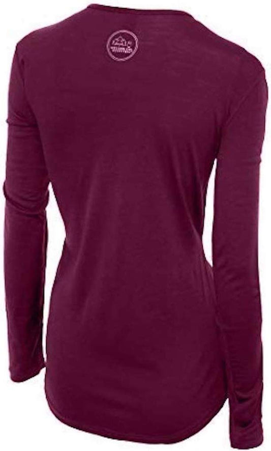
This is the Australian destination where merino earns its place most obviously. A maritime climate that changes hourly, constant Southern Ocean wind, mountains ten degrees colder than the coast, and frequent light rain all point the same way: you need a fibre that keeps insulating when damp. Wool does, cotton does not, and that distinction is the difference between uncomfortable and hypothermic on a highland track. Our merino base layers are 100% Australian merino at 17.5 micron with no synthetic blend. A long sleeve merino wool base layer for women will be on most days of a Tasmanian trip in any month, and it is the first of the three layers every walk here requires.
A windproof and waterproof shell, which is the safety item
A packable rain jacket for women, and prioritise WIND resistance as much as waterproofing. The Roaring Forties are what make you cold here, the rain is usually light and frequent rather than heavy, and an umbrella is useless anywhere above the treeline. This is not an optional item for a highland walk, it is the layer that the rescue statistics are about.
A proper warm mid layer
A fleece mid layer, in every season including January. The third of the three layers, needed on the Cradle Mountain plateau, on a Gordon River cruise deck, and on any evening.
Waterproof boots, not trainers
Waterproof hiking boots with ankle support. Tasmanian tracks are mud, roots and rock for much of the year, the Overland Track mud is a genuine feature rather than an exaggeration, and the Wineglass Bay climb is steep and uneven. Merino wool socks, which matter here because wet feet in cold weather is the fastest route to a miserable walk.
Sun protection, which the temperature will talk you out of
A wide brim sun hat and high factor sunscreen, used on cool and cloudy days. Tasmania's UV is the strongest in the country and an 18C breezy afternoon on the east coast will burn you, which is the most counterintuitive line on this list and the one most often ignored.
Water and warmth for the walks
An insulated water bottle. There is nothing to buy at Dove Lake beyond the shuttle stop, nothing at Mount Field past the visitor centre, and nothing at all on the Overland Track.
The small things
A warm hat and gloves between April and October and for any highland walk at any time of year. Gaiters if you are walking the Overland Track, where they are close to standard. A head torch. A dry bag for the Gordon River cruise and the open boats. Swimwear, briefly, for February. Binoculars for the wildlife and the sea cliffs. AND THE TWO RULES THAT MATTER MOST: carry all three layers on any highland walk no matter what the forecast says, and do not drive between dusk and dawn if you can avoid it.
Getting Around Tasmania
Hobart and Launceston both have airports with direct flights from the mainland capitals, and the SPIRIT OF TASMANIA ferry crosses Bass Strait overnight from Geelong to Devonport, which takes about eleven hours and carries vehicles, so bringing your own car is realistic.
A CAR IS EFFECTIVELY ESSENTIAL. Public transport between towns exists but is slow and sparse, and almost everything worth seeing is outside a town. Roads are sealed on the main routes and narrow and winding nearly everywhere; gravel appears on the approaches to the Tarkine and some park access roads, and standard hire agreements often prohibit unsealed roads, so check if the north-west is on your itinerary. Allow more time than the map suggests and do not plan to arrive anywhere after dark.
A PARKS PASS IS REQUIRED for every national park and the holiday vehicle pass covering all parks for eight weeks is better value than single entries if you are visiting more than two. At Cradle Mountain in peak season private vehicles cannot drive to Dove Lake and the SHUTTLE IS COMPULSORY, which catches people out.
Costs: What to Budget
Tasmania is moderately priced by Australian standards and cheaper than Sydney or Melbourne, with the exception of peak summer accommodation, which is genuinely expensive because supply is limited.
A hostel dorm in Hobart or Launceston runs about 40 to 55 Australian dollars, a mid-range hotel room 160 to 250, and the same room at Cradle Mountain or Freycinet in January can be 300 to 450. Cabins and caravan parks sit between, and national park campsites are inexpensive. Booking three to six months ahead for a summer trip is the single biggest saving available.
Food is good value: a cafe breakfast is 18 to 25 dollars, a pub main 26 to 36, and the island's produce, oysters, cheese, berries and cool-climate wine, is a genuine reason to eat well here. Self-catering is easy and the supermarkets are in every town of any size.
The costs worth planning for are the parks pass, the Gordon River cruise and the Overland Track booking, each of which is a meaningful sum, plus car hire, which is in strong demand in summer and should be booked with the flights rather than later.
Where to Stay
MOST ITINERARIES USE TWO OR THREE BASES rather than one, because the island divides geographically. Hobart for the south-east, Launceston for the north and the Tamar, and one of Cradle Mountain or Freycinet for the wilderness.
At CRADLE MOUNTAIN the accommodation clusters near the visitor centre and ranges from a backpacker lodge to a serious wilderness hotel; there is nothing at Dove Lake itself. At FREYCINET, Coles Bay is the base and books out furthest ahead of anywhere on the island. STRAHAN has a small cluster of hotels on the harbour and is the only practical west coast stop.
Across the island, summer accommodation is the binding constraint on a Tasmanian trip: there is simply not much of it outside the two cities, and in January what remains is expensive. Book first, plan second.

Essential Resources for Women in Tasmania
Emergency numbers: 000 for police, fire and ambulance, and 112 from a mobile. 131 444 for non-urgent police. 132 500 for the State Emergency Service. MOBILE COVERAGE FAILS across most of the World Heritage area and much of the west coast, so leave your walk plan with someone and carry the Emergency Plus app, which reports coordinates. A hired personal locator beacon is standard practice for multi-day walks here and is available free from some Parks offices and police stations.
Bush and park safety: the FCDO points readers at each Australian state's own bush safety guidance, and Tasmania's is the Parks and Wildlife Service at parks.tas.gov.au, which carries the walk grading, the three-layer requirement, track closures, the parks pass and the Overland Track booking system with its current season, fee and departure limit.
Weather, which is the thing to check daily: the Bureau of Meteorology issues separate mountain forecasts for Tasmania, and the highland forecast is not the town forecast. On a highland walk that distinction is the single most useful check you can make.
Main hospital: the Royal Hobart Hospital has a 24 hour emergency department in the south and the Launceston General Hospital in the north, with the North West Regional Hospital at Burnie covering the north-west. There is no hospital on the west coast. Anything serious can require an air transfer to Melbourne, which the reciprocal health agreement does not cover. Dial 000.
Official health authority: the Australian Government Department of Health, Disability and Ageing. Australia's reciprocal health care agreement with the UK covers public hospital treatment but not the ambulance, which is billed separately, and not repatriation or an interstate air transfer, which on an island with two major hospitals is a realistic scenario
US Embassy: the United States Embassy in Canberra.
Official tourism authority: Tourism Australia. And with TOURISM TASMANIA at discovertasmania.com.au for the island itself, plus the Parks and Wildlife Service for passes, track closures and the Overland Track booking system linked above
Snow falls in the Tasmanian highlands in every month of the year. Carry a shell, a warm mid layer and a wool base layer on any highland walk whatever the forecast says.
Tasmania has the strongest UV in Australia. You will burn on an 18C cloudy day, and the mild temperature is exactly why people do not expect it.
No crocodiles, no box jellyfish, no Irukandji. The island removes the tropical hazards that shape a Queensland or Kimberley trip entirely.
Do not drive between dusk and dawn. Tasmania has among the worst roadkill rates anywhere and the wildlife is all nocturnal.
US State Department travel advisory: the Australia advisory. Read the current level there directly rather than relying on a figure printed in any guide.
UK FCDO travel advice: gov.uk/foreign-travel-advice/australia, and read the safety and security page rather than only the landing page, because that is where the substance sits.
Solo women safety assessment: Tasmania is among the safest and easiest destinations in this guide, a small, rural, friendly island thoroughly used to walkers and to people travelling alone, where Hobart and Launceston are quiet low-crime cities, the small towns are welcoming, and a woman walking, eating or camping alone is entirely unremarkable. The cautions here are about weather and roads rather than people. THE WEATHER IS THE RISK THAT ACTUALLY KILLS, and it kills in SUMMER, which is the counterintuitive part: the central plateau and western mountains sit above 1,000 metres fully exposed to the Roaring Forties with no landmass upwind, a front arrives in under an hour, and a 22C morning in Launceston with horizontal sleet on the Overland Track is routinely the same day, so hypothermia is a warm-season problem because that is when unprepared people are on the tracks. The whole of the answer is to carry a windproof waterproof shell, a warm mid layer and a wool base layer on ANY highland walk regardless of forecast, register your intentions where a log book exists, and turn back when the cloud comes down instead of pressing for a summit. Second is the sun, which the mildness disguises completely: this state has the strongest UV in Australia and among the highest melanoma rates in the world, and people burn badly at 18C. Third is driving, where roadkill rates are among the worst anywhere and every mammal involved is nocturnal, so slow well below the limit after dark and plan to be off the roads by nightfall. Fourth is cold, unpatrolled water at 12 to 18C. And the island genuinely removes the tropical hazards: no crocodiles, no stingers.
Reading On
For the country-level picture, start with the Australia travel guide for women. For the capital, Bruny Island and Port Arthur in detail, see the Hobart packing list, and for the other state-sized region in this library the Western Australia packing list. For why wool rather than cotton when the rain is constant and the wind decides the temperature, read the guide to merino wool base layers for women. Every destination we cover is indexed at the travel packing guide for women, and the base layers are at the Roman Trail collection.
If the outer journey is calling you, the inner one usually is too. Explore SoulMap at romantrail.com/blogs/soulmap.