Bariloche Travel Guide for Women: Everything You Need to Know

San Carlos de Bariloche sits at 770 meters on the southern shore of Lake Nahuel Huapi, in Río Negro province at the northern end of Argentine Patagonia. Behind it the Andes rise past 3,400 meters at Monte Tronador, and around it lies Parque Nacional Nahuel Huapi, Argentina's first national park, created in 1934 from land donated by the explorer Francisco Moreno, covering about 7,000 square kilometres.
Disclosure: This post contains affiliate links. If you buy through them, Roman Trail earns a small commission at no extra cost to you.
The town of roughly 135,000 people was settled largely by German, Swiss and northern Italian immigrants around the turn of the twentieth century, which is why the civic centre is grey stone in Alpine style, why there is a chocolate house every thirty meters along Calle Mitre, and why the region gets called the Argentine Switzerland. That comparison undersells it. The lakes here are larger, the forest is lenga and coihue beech rather than pine, and the wind is Patagonian.
The single most useful thing to understand about Bariloche is that it is two separate destinations. From December to March it is a trekking and lakes destination with long daylight and 24-degree afternoons. From June to September it is the largest ski area in South America. The two crowds barely overlap, the prices peak twice, and what you pack differs substantially.
What both seasons share is wind. The Pacific westerlies cross the Andes, lose their moisture on the Chilean side, and arrive here dry and fast. A windproof waterproof shell is the non-negotiable item in every season, and under-packing it is the most common mistake visitors make.
This guide covers safety and mountain risk, the seasons, the regions, transport, costs, accommodation and the packing list.
Is Bariloche Safe for Women Travelers
Yes, and it is one of the easier places in South America to travel alone, largely because of the trekking and hostel culture. Finding people to share a hike or a car is straightforward if you want to, and eating alone is unremarkable.
The risks here are overwhelmingly about the mountains.
Weather and the mountains
The weather changes within the hour. Sun, wind, hail and sun again on Cerro Catedral in one morning is ordinary at this latitude and altitude. People get into trouble by leaving town in sunshine without the shell.
Wind is the specific Patagonian hazard. It is strong enough on exposed ridges to affect your footing, and it makes the temperature reading close to meaningless. Fleece is useless against it.
Stream crossings rise fast after rain or a warm spell melting snow above you.
Isolation. On the less-travelled Nahuel Huapi routes you may not see anyone for hours, and mobile coverage is absent across most of the park.
The remedy is institutional and you should use it. Club Andino Bariloche coordinates mountain rescue in this region and maintains the refugio network. Registering your route with them before a multi-day trek is standard local practice, not bureaucracy, and it is the mechanism by which anybody would know to come looking. They also hold current trail and snow conditions, which change week to week.
Roads
The Seven Lakes Road and the access to Tronador are narrow, partly gravel, unbarriered in places and driven fast. The Tronador road is one-way by timed hours, which matters if you are self-driving. This is the most likely way to be hurt around Bariloche after the mountains themselves.
In town
Petty theft is the main complaint: from hostel dorms, and from cars left at trailheads, which are a known target. Take nothing visible out of a car, and use lockers.
The centre is busy in the evening and safe. The streets below the civic centre towards the lake and the neighbourhoods further out are quieter late. Use remises, booked cars, or apps rather than unmarked vehicles.
Emergency numbers: 911 generally, with 101 police, 107 ambulance, 100 fire. Argentina runs a tourist assistance line on 0800 999 2838.
Best Time to Visit Bariloche
December to March, summer
The trekking season and the busiest. 20 to 26 degrees by day and 8 to 12 at night, with daylight until nine or ten. All trails open, lifts running for walkers and bikers, refugios staffed, and the lakes swimmable if you are hardy. January is the Argentine holiday month and the town fills with domestic visitors; February is marginally calmer and just as good. March is arguably the sweet spot: warm, quieter and stable.
June to September, winter
Cerro Catedral is the largest ski area in South America, around 120 kilometres of pistes with lifts to 2,100 meters and a view over the lake from the top that no European resort can match. Minus 5 to 5 degrees, snow in town, and a completely different atmosphere. July is Argentine school holidays and the peak of the peak. August usually has the best snow.
April, May, October, November
The shoulders, and the honest assessment is mixed. Cheap, quiet and often beautiful, with the lenga beech turning deep red in April and May, which is genuinely worth seeing. Many high trails are closed or snowbound, the lifts are shut, refugios are unstaffed, and the weather is least predictable. Good for a town-and-lakes trip, poor for a trekking one.
The sun, in every season
The ozone layer over southern South America is thinner than at comparable northern latitudes. At 800 to 2,100 meters with water or snow reflecting, the UV here is severe in a way the temperature does not suggest. This is not a detail: people burn badly on cool days.
Recommended Tours and Experiences

Top Regions and What Each One Requires
The town and the Circuito Chico
Bariloche itself is a working town rather than a resort village, with a handsome stone civic centre, a cathedral, the chocolate houses on Calle Mitre, and a lakefront.
West of it, the Circuito Chico is a 65-kilometre loop around the Llao Llao peninsula between Lakes Nahuel Huapi and Moreno, and it is the best half day in the region. Stop at Cerro Campanario, where a chairlift reaches 1,050 meters and one of the great viewpoints in Argentina; the Llao Llao hotel and chapel; Bahía López; and Colonia Suiza, a small Swiss settlement that cooks curanto, a meal baked underground on hot stones, on Wednesdays and Sundays.
Do it by car in two to three hours, by bike in a day if the wind allows, or partially by local buses 20 and 21.
Terrain: paved road, short walks, one chairlift.
Pack: layers and the shell, because Campanario's summit is exposed and windy in every season.
Cerro Catedral and the Frey circuit
Twenty kilometres from town, the ski area in winter and the main trailhead in summer. The classic walk is to Refugio Frey, about 10 kilometres each way, ending at a stone hut beside a glacial lake ringed by granite spires that draw climbers from all over the world. Seven to nine hours return over rock, root and scree.
Beyond it, the refugio traverse linking Frey, Jakob and Laguna Negra is a serious multi-day route on real mountain terrain.
Terrain: rock, scree, stream crossings, some scrambling. Not a path.
Temperature: 10 degrees colder than town at the refugios, and near freezing at night even in January.
Pack: broken-in waterproof boots, merino, fleece, shell, headlamp, two litres of water, and your route registered with Club Andino.
Tronador, Pampa Linda and the glaciers
Monte Tronador, at 3,478 meters, is the highest peak in the park and carries the region's glaciers, including Ventisquero Negro, the black glacier, so loaded with rock debris that it reads as a wall of dirt. The access road beyond Pampa Linda is one-way on a timed schedule, which means going with a tour or planning around the hours.
Terrain: gravel road, then walking trails, glacial moraine.
Pack: full layers, because this is higher, colder and wetter than the lakes.
North to Villa La Angostura and the Seven Lakes
Villa La Angostura, 80 kilometres north, is a smaller, prettier and more expensive village with the Arrayanes forest, a stand of cinnamon-barked myrtle trees on a peninsula reached by boat or a 12-kilometre walk. Beyond it the Ruta de los Siete Lagos runs to San Martín de los Andes and is one of the great drives in South America.
Pack: a car, or the scheduled bus, plus the usual layers.
South to El Bolsón
Two hours south, a town founded on 1970s counterculture with a craft market on Tuesdays, Thursdays and Saturdays, raspberry farms, good beer, and trekking into the Cerro Piltriquitrón hills behind it. Warmer and drier than Bariloche.
What to Pack for Bariloche: Women's Packing List
The full seasonal detail is in the Bariloche packing list for women. The essentials:
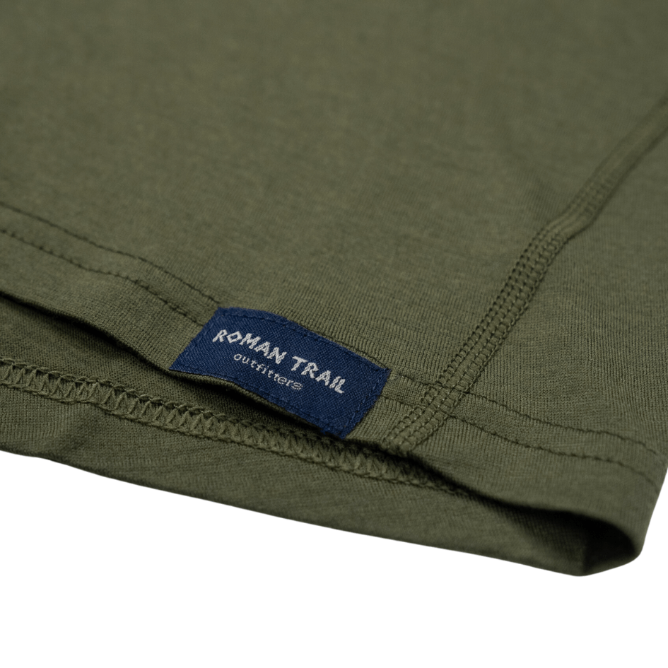
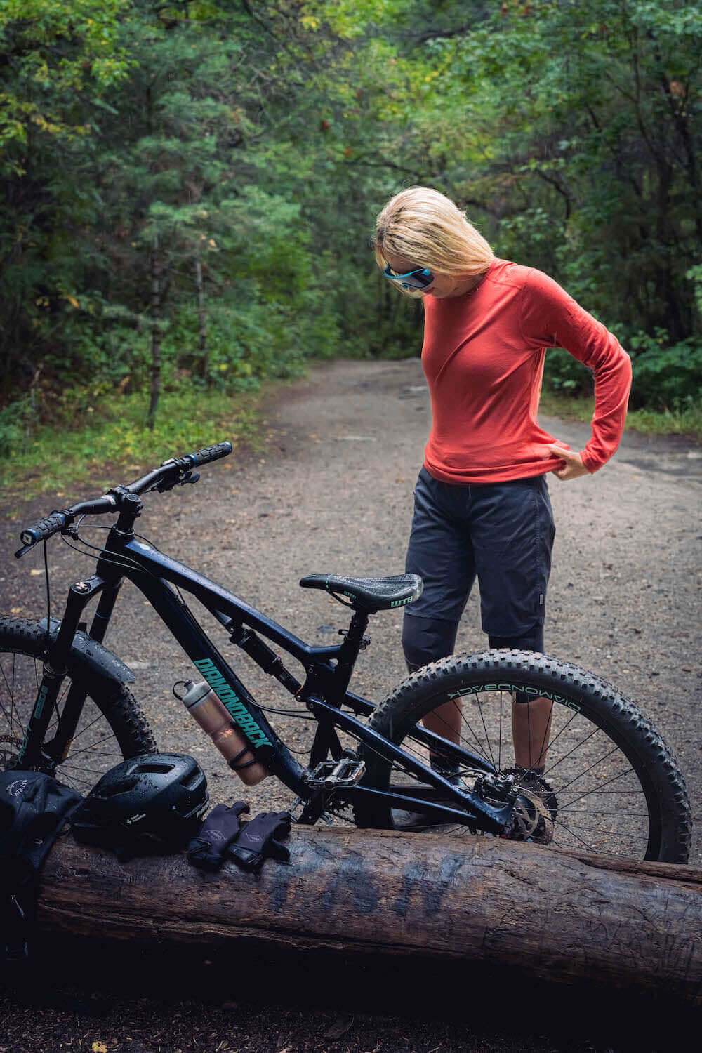
Base layers. Two Roman Trail Women's Merino Wool Base Layers ($49-59) in long sleeve. The swing is the reason: 24 degrees on a lake shore and 8 degrees on a windy ridge an hour later. Merino at 17.5 micron and 160 gsm insulates when the wind rises, moves moisture when you are climbing, and keeps insulating when damp, which neither cotton nor fleece does. On a refugio traverse it stays wearable for several days, which matters when everything is on your back. In winter it goes under ski layers, and merino bottoms belong there too rather than cotton leggings.
Mid layer. The Columbia Women's Fast Trek II Jacket ($65) for summits, evenings and boat crossings, which are always colder than the shore.
Outer layer, the mandatory one. The Marmot Women's PreCip Eco Rain Jacket ($110), windproof, waterproof, hooded and packable. This is what makes every other layer function, because Patagonian wind goes straight through fleece. Carry it even when you leave town in sunshine.
Trousers. Baleaf Women's Hiking Eco Pants ($38), which shed light rain and dry fast, plus waterproof overtrousers for anything multi-day. In winter, hire insulated ski trousers in town.
Footwear. Merrell Women's Moab 3 Waterproof Hiking Boot ($140), broken in, because Nahuel Huapi trails are rock, root, scree and stream crossings rather than paths. The Darn Tough Women's Hiker Micro Crew Merino Socks ($28), three pairs for trekking. Waterproof insulated boots for a winter trip, since the town is snowy, slushy and steep. One comfortable town shoe.
Accessories. A brimmed hat with a chin strap, because of the wind. Sunglasses with genuine UV protection, and goggles rather than sunglasses on the ski hill. High-factor sunscreen reapplied often, since the UV here is severe at any temperature. A merino beanie and insulated gloves with liners for winter, plus a neck gaiter, because a chairlift in Patagonian wind is the coldest you will be. Trekking poles for the descents, a headlamp for refugio nights, two litres of water capacity, and a swimsuit for the lakes.
Documents and health. Passport, travel insurance that explicitly covers hiking and, in winter, skiing, since many policies exclude both, prescriptions in original packaging, and your route registered with Club Andino before anything multi-day.
Organisation. The Eagle Creek Pack-It Cube Set ($59), which keeps the mountain kit and the town kit apart in a bag you are living out of.

Getting Around Bariloche
Getting here: Bariloche has its own airport, about 15 kilometres east, with flights from Buenos Aires in around two hours and connections to other Patagonian cities. Long-distance buses from Buenos Aires take 20 to 22 hours and are genuinely comfortable in cama or semi-cama class, which is a normal way to travel in Argentina. There is also a bus route across the Andes to Puerto Montt and Osorno in Chile, and a longer lake-and-bus crossing to Puerto Varas that is a scenic journey in its own right.
Local buses: the town system, run on a rechargeable SUBE-style card, covers the town and reaches Cerro Catedral, Llao Llao and the start of the Circuito Chico. Routes 20, 21 and 55 are the useful ones. Cheap, reliable and used by everyone.
Hire car: the best way to do the Circuito Chico, the Seven Lakes Road and Villa La Angostura on your own schedule. Roughly $50 to $90 a day. Roads are paved on the main routes and gravel on the interesting ones. Fill up in town, because stations are sparse.
Remises and taxis: plentiful and inexpensive, and the standard way to get back into town after dark. Book through your accommodation rather than flagging one late at night.
Tours: the practical choice for Tronador, given the one-way timed road, and for the Circuito Chico without a car.
Boats: lake crossings run to Isla Victoria, the Arrayanes forest and Puerto Blest, and are a good half or full day. They are always colder than the shore.
Costs: What to Budget
Argentina's prices move with its currency, so treat these as orientation and check current rates before you travel. Bariloche is one of the more expensive places in Argentina, and still cheaper than an equivalent Alpine town.
Budget, $35 to $60 a day: a hostel dorm at $15 to $28, cooking some meals and eating empanadas and pizza otherwise at $12 to $20, local buses, free trails.
Mid-range, $90 to $160 a day: a guesthouse or small hotel at $50 to $100, restaurant meals at $25 to $45, a hire car for a day or two, the Campanario lift, a lake boat.
Higher end, $300 and up: the Llao Llao and the lakeside lodges from $250, private guides, a ski week with lessons, helicopter and fishing charters.
Specific costs: Nahuel Huapi park access fee for some sectors, Cerro Campanario chairlift around $12, Cerro Catedral lift ticket $60 to $95 a day in high season with ski and boot hire $35 to $55 a day, a refugio bed $25 to $45 with meals extra, a full-day Tronador tour $60 to $90, a Circuito Chico tour $35 to $55, a lake boat to the Arrayanes forest $45 to $70, a hire car $50 to $90 a day, a good steak dinner with wine $30 to $50.
Money: the Argentine peso, in a country where the exchange situation has been complicated for years. Foreign cards now generally receive a favourable tourist rate on card payments, which has made cards more useful than they were, but cash is still necessary in smaller places, refugios, craft markets and for remises. Bring clean US dollar notes as a backup, keep an eye on current guidance before travelling because this changes, and expect ATMs to have low withdrawal limits and high fees. Park fees and lift prices are published at barilocheturismo.gob.ar.
Where to Stay: Hostels, Guesthouses and Hotels for Women
The town centre, around the civic centre and Calle Mitre, is where the hostels, budget hotels and most restaurants are, within walking distance of the bus stops for Catedral and the Circuito Chico. Convenient and the right base for a trekking trip without a car.
Along Avenida Bustillo, the road west towards Llao Llao, are the lakeside cabañas, guesthouses and hotels, numbered by kilometre. Quieter, often with lake views and gardens, and dependent on buses or a car. Kilometre 8 to 12 is a good compromise between view and access.
Llao Llao and the peninsula hold the grand hotels, including the famous one, in the most beautiful setting and furthest from the town.
Cerro Catedral village makes sense for a ski trip: ski-in convenience, and dead in summer.
Hostels: Bariloche has one of the best hostel scenes in South America, oriented around trekking, with female dorms, kitchens, gear storage, and staff who know current trail conditions. For a solo trekker this is the practical choice, because it is where you find partners for the refugio routes.
Refugios: the mountain huts run by Club Andino are dormitory accommodation with basic meals, and they are the way to do the multi-day routes. Book through Club Andino, carry cash, and bring a sleeping bag liner.
What to check as a woman travelling alone: whether the property is on a bus route and how late the last bus runs, because the Bustillo road is dark and long on foot. Whether there are lockers, since dorm theft is the commonest complaint here. Whether heating is adequate for a winter trip, which not all cabañas are. And whether the hostel runs its own trips, which is the easiest way to reach Tronador without a car.
Essential Resources for Women in Bariloche
Emergency numbers in Argentina: 911 for a general emergency, with 101 police, 107 ambulance, 100 fire and 103 civil defence also in use.
Mountain rescue: through Club Andino Bariloche, which coordinates rescue in this region, or via the national park administration and police. Register your route with Club Andino before any multi-day trek; it is standard practice and it is how anyone knows to look for you. They also publish current trail and refugio conditions.
National park: Parque Nacional Nahuel Huapi maintains an administration office in town, charges an access fee for certain sectors, and posts trail closures and fire restrictions, which are enforced strictly in dry summers.
Tourist assistance: a tourist-facing police presence operates in the civic centre in high season, and Argentina runs a national tourist assistance line on 0800 999 2838.
US consular services: the US Embassy in Buenos Aires covers Argentina, and there is no consulate in Bariloche. Contact details and the after-hours emergency number are at ar.usembassy.gov.
Main hospitals: Hospital Zonal Ramón Carrillo is the main public hospital with a 24-hour emergency department, and Sanatorio San Carlos the main private option. Both handle mountain trauma as routine work. Argentine public hospitals treat emergencies regardless of nationality; private care requires payment or an insurance guarantee up front. Confirm your insurance covers hiking and skiing.
Official health authority: the Argentine Ministry of Health at argentina.gob.ar/salud.
Official tourism authority: argentina.travel nationally and barilocheturismo.gob.ar locally, which publishes trail status, lift opening and fees.
US State Department travel advisory for Argentina: current advisory level and detail.
UK FCDO travel advice for Argentina: entry requirements, safety and health guidance.
Solo women safety assessment: Bariloche is a genuinely easy place to travel alone, with a hostel and trekking culture that makes finding company for a hike or a shared car simple, and a town centre that is busy and safe in the evening. Violent crime is low. What should concern you is the mountains: weather that turns within the hour, wind strong enough to affect your footing on a ridge, stream crossings that rise after rain, and routes where you will not see another person and will have no phone signal. Register with Club Andino before anything multi-day, carry the windproof shell even in sunshine, and turn back rather than commit to a summit in worsening weather. In town, the real nuisance is theft from hostel dorms and from cars at trailheads, so use lockers and leave nothing visible in a vehicle. Use booked remises rather than walking the long dark stretch of Avenida Bustillo at night, and treat the Seven Lakes and Tronador roads with respect, because they are narrow, partly gravel and driven fast.
Reading On
Bariloche is the easiest door into Patagonia and the only place in South America running a serious ski season and a serious trekking season from the same town. The Bariloche packing list for women has the seasonal gear detail, and the Argentina travel guide for women covers the country, with Buenos Aires the usual arrival. Across the Andes, the Chile travel guide for women and Santiago are a bus ride away. Anyone continuing south should read the Patagonia packing list for women, which covers the harder end of this weather, and the travel packing guide for women is the parent for every destination. For why merino plus a shell beats a heavier fleece against Patagonian wind, the merino wool base layer guide explains the fibre, and the full collection is at Roman Trail women's merino base layers.
If the outer journey is calling you, the inner one usually is too. Explore SoulMap at romantrail.com/blogs/soulmap.
Blog posts
View all-

Packing List for Skardu, Pakistan: What Women S...
What to pack for Skardu, Pakistan: the capital of Baltistan, the cold desert, Deosai plains, the road head for K2, and how to get there legally.
Packing List for Skardu, Pakistan: What Women S...
What to pack for Skardu, Pakistan: the capital of Baltistan, the cold desert, Deosai plains, the road head for K2, and how to get there legally.
-

Packing List for Naran, Pakistan: What Women Sh...
What to pack for Naran, Pakistan: the Kaghan valley, Saiful Muluk lake, the Babusar Pass as the compliant road north, and the permission you need before you go.
Packing List for Naran, Pakistan: What Women Sh...
What to pack for Naran, Pakistan: the Kaghan valley, Saiful Muluk lake, the Babusar Pass as the compliant road north, and the permission you need before you go.
-

Packing List for Multan, Pakistan: What Women S...
What to pack for Multan, Pakistan's city of saints: the Sufi shrines, the blue tilework, the mango orchards, and heat that reaches the high forties.
Packing List for Multan, Pakistan: What Women S...
What to pack for Multan, Pakistan's city of saints: the Sufi shrines, the blue tilework, the mango orchards, and heat that reaches the high forties.


Contact form

Roman Trail Outfitters
Merino Wool Women's Long Sleeve Top | Crew Neck Shirt | Deep Olive