Annapurna Circuit Travel Guide for Women: Everything You Need to Know

The Annapurna Circuit is the most ecologically diverse long-distance trek in the world. In two to three weeks it takes you from subtropical rice terraces at 800 meters, through pine forest and Tibetan-influenced high villages, across the 5,416-meter Thorong La Pass, and down into the deepest gorge on earth. No other trek crosses that many climate zones, and very few cross that much culture.
It is also the trek most often compared with Everest Base Camp, and the honest comparison is this: the circuit is longer, more varied, better fed and culturally richer, and its high point is higher than anything on the EBC route. EBC has Everest itself and the Sherpa Khumbu. Both are extraordinary, and the circuit is the better choice if you want variety over a single iconic destination.
Disclosure: This post contains affiliate links. If you buy through them, Roman Trail earns a small commission at no extra cost to you.
This guide covers the route stage by stage, the Thorong La crossing and its 3am start, acclimatisation and the HRA aid post at Manang, ACAP and TIMS permits, the guide question, seasons, costs in USD, Pokhara, and exactly what to pack.
The route, and what the roads changed

The circuit rings the Annapurna massif anticlockwise from Besisahar in the east to Jomsom and Pokhara in the west, between 160 and 230 kilometers depending on how much road you walk.
Besisahar to Chame, 760 to 2,670 meters. Subtropical and humid: terraced rice and millet, waterfalls, long suspension bridges, banana palms. The most road-affected section, and the NATT walking trails on the opposite bank of the Marsyangdi exist specifically to keep trekkers off it. Follow them.
Chame to Manang, 2,670 to 3,519 meters. Pine forest, then the vast Paungda Danda rock face, then the landscape dries out into high desert. At Pisang the route splits: the high route through Ghyaru and Ngawal is steeper, far more beautiful and significantly better for acclimatisation than the valley road through Hongde. Take the high route.
Manang, 3,519 meters. A substantial Tibetan-influenced village with bakeries, a cinema showing mountaineering documentaries, and the Himalayan Rescue Association aid post. Two nights minimum.
Manang to Thorong Phedi, 3,519 to 4,450 meters. Above the treeline through Yak Kharka and Ledar. Short days on purpose. Cold, unheated nights.
Thorong La, 5,416 meters. The crux, described in full below.
Muktinath to Jomsom, 3,760 to 2,720 meters. Muktinath is sacred to both Hindus and Buddhists, with 108 water spouts fed by the Kali Gandaki. Below it, the gorge becomes the windiest valley in Nepal, where a fierce afternoon gale is so reliable that walking is done before noon.
Jomsom onward. Many trekkers fly or jeep out from here because the lower western section is heavily road-affected. Those who walk continue through Marpha, the apple village with the best pie on the circuit, and the hot springs at Tatopani.
What the roads mean for you. Jeep tracks now reach deep into both the Manang and Mustang valleys. This is a genuine loss of remoteness, and it is also a flexibility gain: you can skip the dullest road sections without skipping the trek. The trap is using a jeep to reach altitude fast and arriving unacclimatised, which is covered below.
The Thorong La crossing
One day decides this trek, and it is worth understanding in advance.
You sleep at Thorong Phedi at 4,450 meters or High Camp at 4,925 meters. You wake between two and three in the morning, eat something you do not want, and start walking by headlamp around three or four.
Why so early. The pass generates ferocious winds from late morning, and by early afternoon a crossing becomes genuinely dangerous. Starting in the dark is not machismo, it is weather management.
The ascent is four to six hours of switchbacks on rock and snow, with several false summits that are famously demoralising. The top is marked with prayer flags and a sign, it is bitterly cold and windy, and nobody lingers long.
Then the descent, which is the part people underprepare for: more than 1,600 vertical meters down to Muktinath in a single afternoon, on loose scree and rough switchbacks. It takes three to four hours and it is where knees, ankles and toenails get wrecked. Poles are not optional.
If the weather is bad, do not go. Teahouses at Phedi and High Camp will tell you honestly, and waiting a day is normal. People have died on this pass in storms and in deep snow, and the decision to wait is always available.
In winter and early spring the pass can hold deep snow and occasionally closes entirely. Microspikes are worth carrying in those shoulder periods.
Altitude, acclimatisation and the HRA
The circuit's profile is gentle for a week and then asks you to cross a pass higher than Everest Base Camp. That combination is why altitude is the dominant risk here.
Acute mountain sickness. Headache plus nausea, appetite loss, dizziness, fatigue or disturbed sleep. Common above 3,000 meters, and the signal to stop ascending until it resolves.
HAPE. Fluid in the lungs: breathlessness at rest, a wet cough, frothy sputum, blue lips. Life-threatening. Descend immediately.
HACE. Fluid on the brain: confusion, loss of coordination, inability to walk heel to toe, behaviour out of character. Life-threatening, often noticed by others first. Descend immediately.
The Manang acclimatisation days are the most important part of the itinerary. Spend two nights and walk high during the day: Ice Lake at 4,600 meters, or the Chongkor and Praken Gompa viewpoints, then come back down to sleep. Climbing high and sleeping low is what builds the red blood cells you will need on the pass.
The Himalayan Rescue Association aid post at Manang is staffed seasonally by volunteer doctors specialising in altitude medicine, and it runs free altitude awareness talks most afternoons in season. Attend one. If you have any symptoms, consult there before going higher, and note the HRA also staffs a post at Thorong Phedi in peak season. Information at himalayanrescue.org.np.
Keep sleeping-elevation gain under 500 meters a day above 3,000 meters, drink three to four litres daily, skip alcohol above Manang, and eat even when appetite goes.
Diamox assists acclimatisation and is widely used. It is a prescription conversation for your own doctor before you travel, ideally with a trial dose at home. It is a diuretic and increases your water needs, and it is not permission to ascend faster.
The jeep trap. Because the road now reaches far up the Manang valley, it is possible to be at 3,500 meters within a day or two of Kathmandu. That is the single most common way trekkers get into altitude trouble on this circuit. If you shortcut the road, add the acclimatisation days back in.
Is the Annapurna Circuit safe for women travelers
The Annapurna region is among the more comfortable trekking areas in Asia for a woman, and the circuit is walked by large numbers of solo women every season.
The trail is busy in spring and autumn, teahouses are family-run and frequently managed by women, the villages are long accustomed to trekkers, and harassment is uncommon.
Altitude is the dominant risk, as set out above, and the Thorong La is where it concentrates.
The guide question. Guides are recommended rather than universally mandatory on the Annapurna Circuit as of 2024, unlike on Kilimanjaro or in Nepal's restricted areas. Nepal has however moved toward requiring guides for foreign independent trekkers and enforcement has varied by region and season, so confirm the current position when you obtain your permits. Regardless of the legal position, a guide is strongly advisable for a first Himalayan trek, and especially for the pass, where weather judgement and altitude assessment need local experience. A porter-guide who both carries and leads is the common and affordable compromise.
Teahouse practicalities. Rooms have thin walls and simple latches rather than real locks. Bring a small padlock for your duffel and keep passport, permits and cash on you. Toilets are often outside the building, so keep a headlamp beside you.
Periods at altitude. Bring more supplies than you expect to need plus sealable bags, because there is no disposal above Manang. Cycles can shift at altitude, and cold plus dehydration worsens cramps.
Trail hazards. Mule and donkey trains have right of way and will not stop; always step to the uphill side of the trail, because being nudged on the outside edge above the Kali Gandaki is how people get seriously hurt. Landslides affect the lower sections in and after the monsoon. Suspension bridges are safe and they sway.
Jeep and bus travel on the Besisahar and Jomsom roads is the least safe part of the whole trip, on narrow unsealed mountain tracks with long drops. Sit away from the cliff side if you can, and if a driver seems reckless, get out.
Permits
Two documents are required. The ACAP, Annapurna Conservation Area Project permit, and the TIMS card, Trekkers Information Management System registration. Both are issued at the Nepal Tourism Board offices in Kathmandu or Pokhara, and a trekking agency will arrange them as part of a package. Bring passport photos and your passport.
Checkpoints along the circuit inspect both, at Dharapani, Chame, Manang and elsewhere. Keep them accessible rather than buried in your duffel, which a porter may be carrying hours behind you.
Restricted areas are separate. Upper Mustang beyond Kagbeni and the Nar Phu valley require special permits at considerably higher cost, with a minimum group size and a registered guide. These are not covered by ACAP.
Insurance must be specific. You need cover for trekking to 6,000 meters and helicopter evacuation. Standard travel policies exclude both, and a helicopter off the Thorong La side runs into thousands of dollars.
Best time to trek
October and November. The best window. Post-monsoon air gives the clearest views of the year, the pass is usually snow-free, and the trail is busy in a sociable way. Cold nights above Manang.
March to May. The other good window. Rhododendron forests in bloom in the lower valleys, warmer days, and more haze building toward late May. Some snow possible on the pass in March.
December to February. Cold, clear and very quiet, with many high teahouses closed and real risk of the Thorong La being snowbound or closed. For experienced, well-equipped trekkers only.
June to September. Monsoon. Cloud, leeches in the lower forest, landslides on the roads and no views. The exception is Upper Mustang beyond the pass, which sits in the Himalayan rain shadow and is one of the few trekkable regions of Nepal in summer.
What to pack for the Annapurna Circuit, women's packing list
Base layers, three required
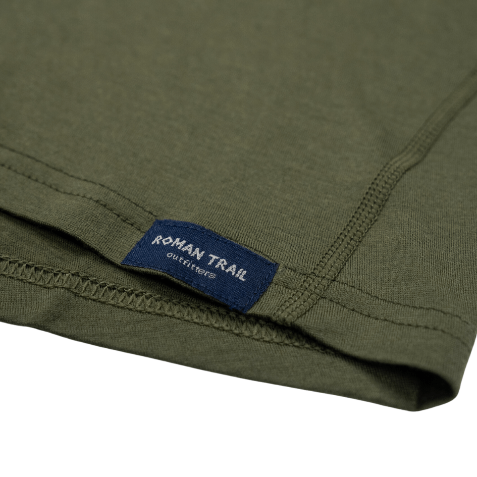
Three Roman Trail women's merino wool base layers. Three, because a 14 to 21 day trek has limited laundry and because the same garment must work in humid subtropical farmland and at minus conditions on the pass. One hikes, one sleeps, one stays dry in reserve for the Thorong La day.
Mid and insulated layers
The Columbia fleece for the temperate and alpine zones, and the Columbia insulated hooded jacket for the high desert above Manang and the unheated teahouse evenings at Yak Kharka and Phedi.
Shells
The Marmot rain shell for the subtropical lower valleys and for weather at any altitude, plus waterproof overtrousers for the pass, where wind rather than rain is the problem. Over the top for the pass itself, a warm insulated parka, rentable in Kathmandu or Pokhara for a few dollars a day.
Footwear and poles
The Merrell waterproof hiking boots, broken in over 100 kilometers, which must handle subtropical paths, alpine rock and snow on the pass approach. The Black Diamond trekking poles, which matter more on this trek than most because of the 1,600-meter descent to Muktinath and the narrow exposed trails above the gorge.
The rest
Six pairs of merino socks. Warm hat, buff, liner and insulated gloves. Full-UV sunglasses for snow on the pass. Factor 50 and SPF lip balm. Headlamp with spare batteries for the 3am start. Sleeping bag to minus 10 or colder plus a liner, rentable locally. Two litres of insulated water capacity, since bladder hoses freeze above Yak Kharka. Water treatment. Pass-day snacks. A padlock. Wet wipes. An oversized power bank. First aid kit with blister treatment and rehydration salts. Microspikes in winter or early spring.
The full detail, stage by stage, is in the Annapurna Circuit packing list for women.
Teahouses and food
The Annapurna teahouses are among the best in Nepal and noticeably better than Khumbu equivalents at comparable elevations, largely because the road brings supplies further up the valley.
Rooms are twin, simple and unheated above Chame, where night temperature inside matches outside. Typically 400 to 1,000 rupees, often nominal on the understanding you eat dinner and breakfast there, which is the expectation rather than an imposition.
Food. Dal bhat is the staple, refillable, and the right fuel. The region grows apples at Marpha, which appear as pie, brandy and cider, and Manang and Tatopani bake genuinely good bread and cake. Eat vegetarian above Manang, since meat travels unrefrigerated for days.
The dining room with its stove is the only heated space in the building, lit in the early evening, and it is where the day's social life happens.
Water. Never drink untreated. Boiled water is sold by the flask at every lodge, and safe drinking water stations along the circuit refill bottles cheaply, which is both the cheapest option and the one that keeps plastic out of the valley.
Charging, wifi and showers all cost money and the price rises with elevation. Expect patchy connectivity above Manang and solar-heated showers that are sporadic above it.
Costs, what to budget
Nepal is inexpensive and the circuit is cheaper than Everest Base Camp, mostly because there is no Lukla flight.
Independent with a porter-guide: 700 to 1,100 US dollars for two to three weeks, all in.
Local Nepali agency package: 900 to 1,500 dollars including guide, porter, permits, teahouses and transport.
International operator: 1,600 to 3,000 dollars for the same itinerary.
Component costs. ACAP permit around 30 dollars. TIMS card around 10 to 20. Guide 25 to 35 dollars a day. Porter 18 to 25 a day. Teahouse room 3 to 8 dollars. Meals 20 to 35 a day in total, rising with elevation. Hot shower 2 to 5. Charging 2 to 4. Wifi 2 to 5. Jeep Besisahar to Chame 20 to 40. Flight Jomsom to Pokhara 110 to 140. Sleeping bag and jacket rental 1 to 2 dollars per item per day.
Tips are customary and meaningful, commonly 10 to 15 percent of the trek cost split between guide and porter at the end.
Money. Nepali rupees in cash. ATMs exist in Besisahar, Chame, Manang and Jomsom and run dry or charge heavily, so draw what you need in Kathmandu or Pokhara. Nothing high on the circuit takes cards. Official tourism information is at ntb.gov.np.
Pokhara, and where to stay

Pokhara is the gateway and, for most trekkers, the finish. A relaxed lakeside city on Phewa Lake at 820 meters, with the Annapurnas and the unmistakable fishtail of Machhapuchhre rising directly behind, reflected in the water on a still morning. It is the best place in Nepal to spend the days either side of a trek.
Lakeside is where visitors stay, a strip of guesthouses, gear shops, bakeries and restaurants along the water. Budget guesthouses run 10 to 25 dollars, good mid-range hotels 35 to 90, and the hillside resorts at Sarangkot considerably more. Most will store your city luggage free while you trek, which is standard.
What to do either side. A boat on Phewa Lake to the Tal Barahi temple. Sunrise from Sarangkot, which is the classic Annapurna panorama. The World Peace Pagoda above the lake. Paragliding, for which Pokhara is one of the best sites in the world. And the International Mountain Museum, which is better than it sounds.
In Kathmandu, Thamel is the trekking district and where permits, gear and agencies cluster. Noisy and convenient; Boudha near the great stupa is the quieter alternative.
On the circuit, you do not book ahead outside the busiest weeks, and your guide arranges rooms on arrival. At Thorong Phedi and High Camp in peak October the limited beds do fill, and a guide with relationships is the difference between a room and a dining-room floor. Solo women are usually given a twin room alone outside peak season at no extra cost.
Language and communication
Nepali is the national language, with Gurung, Manangi and Thakali spoken in the villages along the circuit and Tibetan dialects in the upper valleys. English is widely understood along the trekking route because the local economy depends on it.
Words worth having. Namaste as a greeting. Dhanyabad for thank you. Tato pani for hot water, which you will ask for daily. Kati paisa for how much. Bistarai, slowly, which is also the correct way to walk.
Etiquette. Walk clockwise around stupas and mani walls, keeping them on your right. Do not point your feet at an altar. Ask before photographing people. Step to the uphill side for mule trains.
Connectivity. An Ncell or NTC SIM from Kathmandu or Pokhara covers the lower valleys and thins out above Manang. Tell people at home you will be out of contact for stretches so silence is not alarming.
Essential resources for women on the Annapurna Circuit
Emergency numbers: Police 100. Note that Nepal has no central public ambulance service, so in an emergency you contact the nearest hospital directly. On the trail your guide, your agency and your insurer's 24 hour emergency line are the people who will coordinate a rescue, so carry those numbers written down as well as in your phone.
On-trail medical care: The Himalayan Rescue Association aid post at Manang, staffed seasonally by volunteer doctors specialising in altitude illness, with free altitude talks most afternoons in season and a second post at Thorong Phedi in peak periods. Details at himalayanrescue.org.np. There are also health posts at Chame and Jomsom.
Main hospital: CIWEC Hospital, Kapurdhara Marg, Kathmandu 44600, telephone +977 1 4524111, which has specialised in travel and altitude medicine since 1982 and is the standard referral for evacuated trekkers. CIWEC also operates a clinic in Pokhara at Lakeside, which is the nearer option coming off the circuit.
US Embassy: US Embassy Kathmandu, telephone +977 1 423 4000, with an after-hours emergency line for US citizens. Website np.usembassy.gov.
US State Department travel advisory: Nepal travel advisory.
UK FCDO travel advice: gov.uk/foreign-travel-advice/nepal.
Official tourism authority: Nepal Tourism Board, ntb.gov.np.
Solo women safety assessment: The Annapurna Circuit is walked by large numbers of solo women every season and the region is among the more comfortable in Asia for it: the trail is busy in spring and autumn, teahouses are family-run and often managed by women, and harassment is uncommon. The genuine dangers are environmental. Altitude is the first, and it concentrates on the Thorong La, which is why the two acclimatisation nights at Manang are non-negotiable, why the HRA talk there is worth your time, and why the jeep shortcut up the Manang road is the most common route into altitude trouble on this trek. The pass itself must be started between three and four in the morning to beat the afternoon wind, and if the teahouse at Phedi tells you the weather is wrong, waiting a day is the normal and correct decision. The descent to Muktinath does more damage than the climb, so carry poles. Beyond altitude, step to the uphill side of the trail whenever a mule train passes, because the outside edge above the Kali Gandaki is unforgiving, and treat the jeep and bus journeys on the access roads as the least safe part of the entire trip. A guide or porter-guide is strongly advisable on a first Himalayan trek even where not strictly required, and confirm the current guide rules when you collect your permits, since Nepal has been tightening them.
Ready to pack
The circuit spans subtropical farmland to a 5,416-meter pass, and the base layer is the one garment that has to work in every zone.
Shop 100% merino wool base layers for women. 17.5 micron Australian merino, 160gsm and 250gsm weights, sizes XS to L. No synthetic blends. No microplastics. Machine washable cold, hang dry.
Related reading
- Annapurna Circuit Packing List for Women
- Everest Base Camp Travel Guide for Women
- Nepal Travel Guide for Women
- Kathmandu Travel Guide for Women
- Travel Packing Guide for Women
- Best Merino Wool Base Layers for Women
If the outer journey is calling you, the inner one usually is too. Explore SoulMap at romantrail.com/blogs/soulmap.
Blog posts
View all-

Packing List for Keszthely: What Women Should B...
What to pack for Keszthely. The cultured end of Lake Balaton, with a baroque palace, a 100,000 volume library and a thermal lake nearby you can swim in the snow.
Packing List for Keszthely: What Women Should B...
What to pack for Keszthely. The cultured end of Lake Balaton, with a baroque palace, a 100,000 volume library and a thermal lake nearby you can swim in the snow.
-

Packing List for Yosemite: What Women Should Bring
What to pack for Yosemite. Granite walls, snowmelt waterfalls that dry up by August, and a 1,200 metre valley floor with 3,000 metre passes above it.
Packing List for Yosemite: What Women Should Bring
What to pack for Yosemite. Granite walls, snowmelt waterfalls that dry up by August, and a 1,200 metre valley floor with 3,000 metre passes above it.


Contact form

Roman Trail Outfitters
Merino Wool Women's Long Sleeve Top | Crew Neck Shirt | Deep Olive