

Valdivia is a city of about 170,000 people in southern Chile, built where three rivers meet about fifteen kilometres inland from the Pacific, and it is defined by an event. ON 22 MAY 1960 THE LARGEST EARTHQUAKE EVER RECORDED ANYWHERE ON EARTH HAPPENED HERE. It measured magnitude 9.5, it lasted something like ten minutes, it destroyed most of the city, and it DROPPED THE LAND BY UP TO TWO METRES, which permanently flooded farmland and created the wetlands that are now a nature sanctuary. The tsunami it generated crossed the Pacific and killed people in Hawaii, Japan and the Philippines. Everything you see in this city postdates it, and the geography itself is partly a product of it.
Disclosure: This post contains affiliate links. If you buy through them, Roman Trail earns a small commission at no extra cost to you.
What Is Here
THE RIVERS ARE THE CITY AND THE FERIA FLUVIAL IS ITS BEST HOUR, THOUGH IT IS ABSENT FROM OUR PHOTOGRAPHS. Said plainly because it is the thing people remember: the riverside fish market on the Costanera, where the morning catch is sold from open stalls and SOUTH AMERICAN SEA LIONS HAUL OUT ON THE STEPS AND THE PONTOONS AMONG THE TRADERS, waiting for scraps. They are large, wild and entirely unbothered by people, and they are not a zoo exhibit; keep a proper distance. The market runs every morning and is busiest early.
THE GERMAN SETTLEMENT IS WHY THERE IS A BREWERY TRADITION. German colonists arrived from the 1850s under a state immigration programme and shaped the architecture, the farming and the beer. KUNSTMANN, on the road to Niebla, is the best known brewery and runs a restaurant and tours; the city holds a BIERFEST in January. The architectural legacy is thinner than in Puerto Varas or Frutillar because 1960 took most of it, which is itself part of the story.

THE SPANISH FORTS AT THE RIVER MOUTH ARE THE OTHER HALF OF THE HISTORY AND THEY ARE ALSO ABSENT FROM OUR IMAGES. Valdivia was the most heavily fortified place on the Pacific coast of the Americas: Spain built a system of forts at NIEBLA, CORRAL and on MANCERA ISLAND to protect the river approach, and the 1820 assault that took them for Chilean independence, led by Lord Cochrane, is one of the more remarkable actions in naval history. The forts are reached by road to Niebla, about twenty minutes, or by boat down the river, which is the better way.
THE RIVER BOATS ARE THE ACTIVITY. Trips run from the Costanera down the Rio Valdivia to Corral and Mancera, and up the RIO CRUCES into the CARLOS ANWANDTER NATURE SANCTUARY, the wetland created by the 1960 subsidence, which holds black-necked swans and a great deal else. The second and third photographs are the river the boats leave from.
AND IT IS A UNIVERSITY CITY, WHICH CHANGES THE FEEL ENTIRELY. The Universidad Austral de Chile has a riverside campus with a botanical garden, and a large student population gives Valdivia more bars, music and cheap food than a city of this size in southern Chile would otherwise have.
When to Go
December to March is summer and it is the only reliably dry window, in the high teens to low twenties, with the river boats running fully, the Bierfest in January and the city at its busiest. Even then expect rain.
October, November and April are good and quieter, in the mid teens, with more rain and fewer people.
MAY TO SEPTEMBER IS GENUINELY WET AND THIS IS THE DEFINING CLIMATE FACT. Valdivia receives somewhere around 2,000 to 2,500 millimetres of rain a year, several times London's, concentrated in the southern winter, with daytime temperatures in the high single figures to low teens. It is not cold; it is relentlessly wet. The city is handsome in rain and the museums, the breweries and the markets work in any weather, but a visitor who has not packed for it will be miserable.
Getting There
Santiago is about an hour and three quarters by air to Pichoy airport, twenty minutes from the city. By road Santiago is about ten hours and Puerto Montt about three; overnight buses run and are comfortable by Chilean standards.
The city centre is compact and walkable, with the Costanera, the Feria Fluvial, the market and the bridge all within fifteen minutes.
You need either a car or the boats for everything else. Niebla and the forts are twenty minutes by road or an hour or so by river; the Rio Cruces sanctuary is only sensibly reached by boat; and the Kunstmann brewery is on the Niebla road. Local buses serve Niebla.
Valdivia is the natural first stop on a northern Patagonian route, with Puerto Varas and Puerto Montt three hours south and Chiloe beyond them.
The Valdivia Packing List
Two thousand millimetres of rain a year, mild damp cool, a river wind and boats.
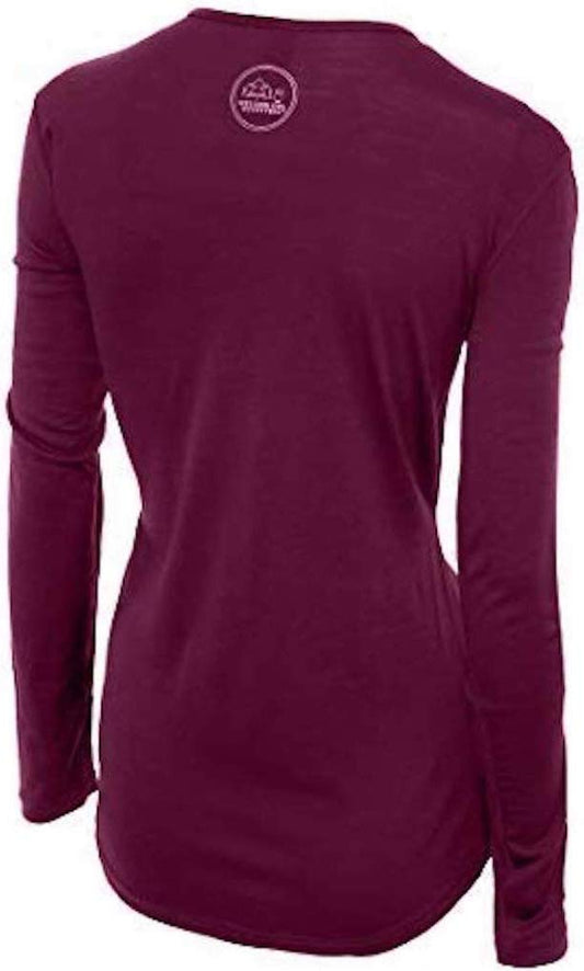
Our merino base layers are 100% Australian merino at 17.5 micron, and a long sleeve merino wool base layer for women is close to the correct answer for this city, and the reason is precise. Valdivia is not cold, it is DAMP AND ABOUT TWELVE DEGREES for much of the year, which is the exact band where cotton fails worst: it takes up the moisture, stops insulating and leaves you chilled for hours. Wool keeps insulating when it is damp, which here is the normal state of affairs rather than an accident. From May to September add a heavyweight merino base layer.
A Columbia Fast Trek II fleece in every month, and a Marmot PreCip Eco rain jacket, which is the single most important item on this list. An umbrella is of limited use on a river front with wind.
Waterproof walking boots rather than trainers. The Feria Fluvial is wet underfoot by definition, the fort sites are grass and earth, and the wetland walkways are boards and mud.
Merino glove liners and a merino beanie from April to October, and worth having on a river boat in any month.
Not linked and worth packing: A DRY BAG OR A WATERPROOF PHONE CASE for the boat trips, where spray is certain; TROUSERS THAT DRY, since this is the garment visitors most regret in a wet climate; CHILEAN PESOS IN CASH for the fish market and the small boats; AND A SPARE PAIR OF SOCKS IN YOUR DAYPACK, which sounds trivial and is the single best piece of advice for a city with this rainfall.
Recommended Tours and Experiences
Essential Resources for Women in Valdivia
Emergency numbers in Chile: 131 reaches the ambulance service, 132 the fire service and 133 the Carabineros police, all free from any phone. 137 is the maritime rescue service, which on a city built on three rivers and a tidal estuary is the relevant one for trouble on the water, and 130 reaches CONAF for a forest fire. Coverage is good in the city and along the Niebla road.
EARTHQUAKES AND TSUNAMI ARE THE SERIOUS GEOLOGY AND THIS IS THE PLACE TO TAKE THEM SERIOUSLY. The FCDO notes that Chile is one of the most seismically active countries on earth, that building regulations require new structures to account for it, and that safety measures are widely known and practised locally, which is true and is reassuring: Chile handles earthquakes better than almost anywhere. READ THE INSTRUCTIONS POSTED IN YOUR HOTEL ROOM, which every Chilean hotel displays, and note the evacuation route. THE COASTAL RULE IS THE ONE THAT SAVES LIVES AND IT IS THE SAME HERE AS IN NEW ZEALAND AND OREGON: after a strong quake, MOVE INLAND AND UPHILL IMMEDIATELY RATHER THAN WAITING FOR A SIREN, because a local tsunami can arrive in minutes. That applies with particular force at Niebla, Corral and Mancera at the river mouth, which are at sea level and were devastated in 1960; the city itself is fifteen kilometres upriver and was reached by the water along the channel. Chile's national emergency service marks evacuation routes with signs and publishes the plans. THE LANDMINE WARNING DOES NOT REACH HERE, and saying so matters as much as repeating it would: the FCDO's landmine section names REGIONS XV, I AND II near the Peru and Bolivia borders in the far north and region XII in the far south, and Valdivia is in LOS RIOS, region XIV, with no minefields anywhere near it. THE ACTIVE VOLCANO CHAIN THE FCDO NAMES IS IN THE NEIGHBOURING REGION rather than this one: it lists the Los Lagos chain, Chaiten, Llaima, Lascar, Copahue and Villarrica, and while Villarrica is about 170 kilometres northeast and Puyehue and Calbuco are south, Valdivia itself has no volcano above it. Monitor local media if you travel on. ORDINARY CRIME IS WHAT THE FCDO ACTUALLY COVERS AT LENGTH FOR CHILE, and it names muggings as frequent in Santiago and Valparaiso, increasingly with weapons and in daylight, with the explicit advice NOT TO RESIST. Valdivia is a much quieter city than either, and the realistic risk here is opportunistic theft at the bus terminal, the market and on the riverfront at night rather than street robbery. It also names DRINK SPIKING in Santiago nightlife districts, which is worth carrying to a university city's bar scene, and TAXI SCAMS AT SANTIAGO AIRPORT, where criminals pose as authorised drivers inside the arrivals hall, so book and pay inside the terminal before you exit, which matters because almost everyone arrives through Santiago. THE RAIN IS THE EVERYDAY HAZARD rather than an inconvenience: wet wooden boardwalks, wet market steps and wet boat decks are where people fall. THE SEA LIONS AT THE FISH MARKET ARE WILD ANIMALS weighing up to 300 kilograms with a serious bite; they are used to people and that is not the same as tame.
US State Department travel advisory: the Chile advisory. Read the current level there directly rather than relying on a figure printed in any guide.
UK FCDO travel advice: gov.uk/foreign-travel-advice/chile, and read the safety and security page rather than only the landing page, because that is where the substance sits.
Main hospital: the Hospital Base de Valdivia is the regional hospital with a full emergency department and is the referral centre for the whole of Los Rios, and the Universidad Austral's medical school is attached to it, which makes this better served than a city of this size usually is in southern Chile. Private clinics in the city handle routine care and are the faster option if you are insured. Dial 131 for an ambulance. Chile has no reciprocal health agreement with the UK or the United States, so travel insurance with medical cover is essential. Private clinics in Santiago and the larger cities are excellent and expensive and will ask for payment or an insurance guarantee before treating you; the public system is good by regional standards but slower for a visitor. A farmacia handles minor problems. TAP WATER IS DRINKABLE across most of the country including Santiago, which is unusual in South America, though it is heavily mineralised in the north and many visitors prefer bottled there. THE TWO REAL ENVIRONMENTAL RISKS ARE ALTITUDE AND ULTRAVIOLET: the altiplano and the Atacama run above 4,000 metres on ordinary excursions, and the combination of thin dry air and latitude gives northern Chile some of the highest surface ultraviolet measured anywhere.
Official health authority: the Chilean Ministry of Health on the national government portal, covers the health ministry's own pages on the government portal, which is the working address for it
US Embassy: the United States Embassy in Santiago.
Official tourism authority: Chile Travel, the national tourism board, covers the country, and the regional tourism office publishes the river boat timetables, the fort opening hours and the Bierfest dates, with the boat services contracting sharply in winter
Takeaways
The largest earthquake ever recorded struck here in 1960 and dropped the land two metres.
Sea lions haul out among the stalls at the morning fish market. Keep your distance.
Around two thousand millimetres of rain a year. The rain jacket is the whole list.
After a strong quake on the coast, move inland and uphill at once. Do not wait for a siren.
Solo women safety assessment: Valdivia is one of the easier Chilean cities to travel alone. It is a university city of about 170,000 with a large student population, a compact riverside centre, an active cafe and bar scene, and a visitor economy of boats, markets and breweries; eating alone is completely ordinary and the riverfront is busy into the evening. Chile has NO advised-against areas anywhere. What the FCDO covers at length is ordinary crime, and it names muggings as frequent in SANTIAGO AND VALPARAISO rather than here, increasingly with weapons and in daylight, with the explicit instruction not to resist; Valdivia is considerably quieter and the realistic risk is opportunistic theft at the bus terminal, in the market crowd and on the riverfront late rather than street robbery. The advisory's drink-spiking warning is worth carrying into a student bar scene, and its Santiago airport taxi scam matters because almost everyone arrives that way: book and pay inside the terminal. THE LANDMINE WARNING DOES NOT REACH THIS REGION, which is worth saying rather than leaving ambiguous, and the active volcanoes the FCDO names are in neighbouring regions. THE REAL RISK IS GEOLOGICAL AND THE PROCEDURE IS SIMPLE. Chile is among the most seismically active countries on earth and handles it well: read the instructions in your hotel room and note the evacuation route. On the coast at Niebla, Corral or Mancera, after a strong quake move inland and uphill immediately rather than waiting for a siren, because a local tsunami arrives in minutes and those places were devastated in 1960. Day to day the hazard is the rain and wet boardwalks, market steps and boat decks. The sea lions are wild animals weighing up to 300 kilograms. 131 IS THE AMBULANCE, 133 THE POLICE AND 137 MARITIME RESCUE, and the regional hospital here is the referral centre for the whole of Los Rios.
Reading On
Valdivia is the northern gateway to the Chilean lake district and this library follows the route south. The Puerto Varas packing list covers the German-settled lake town three hours south with the volcanoes above it, and the Puerto Montt packing list the port beyond it where the road to Patagonia begins. Further south, the Chiloe packing list covers the island of wooden churches and the Carretera Austral packing list the road into the far south, with the Coyhaique packing list, Torres del Paine packing list, Punta Arenas packing list and Puerto Williams packing list covering the rest of it. North, the Santiago packing list and Valparaiso packing list cover the capital and the port everyone passes through, and the Atacama packing list the desert at the other end of the country. For the country, the Chile travel guide for women carries the regions, the transport and the seasons in full. For why wool is the right fibre in a place that is damp and twelve degrees most of the year, read the guide to merino wool base layers for women. Every destination we cover is indexed at the travel packing guide for women, and the base layers are at the Roman Trail collection. Inland and northeast, the Villarrica packing list covers the lake town under one of South America's most active volcanoes, in the Araucania region the FCDO gives its own section.

If the outer journey is calling you, the inner one usually is too. Explore SoulMap at romantrail.com/blogs/soulmap.