

Snaefellsnes is a peninsula about ninety kilometres long on Iceland's west coast, two hours north of Reykjavik, with a glacier-capped volcano at the far end of it. It is routinely called Iceland in miniature, which is marketing and is also broadly true: it has lava fields, black beaches, basalt cliffs, fishing villages, a glacier, waterfalls and seabird colonies within a single day's drive.
Disclosure: This post contains affiliate links. If you buy through them, Roman Trail earns a small commission at no extra cost to you.
Snaefellsjokull, the volcano at the tip, is the one Jules Verne used as the entrance to the centre of the earth. The peninsula is also the most practical way to see a cross-section of Iceland without committing to the full ring road, which is why it has become the standard two-day trip from Reykjavik.
One honest note about the photographs, and it is a large one. Our set is thirty nine frames by twenty photographers and ESSENTIALLY EVERY ONE IS KIRKJUFELL, a single 463 metre mountain near Grundarfjordur. That is a true picture of what people photograph here and a poor picture of the peninsula. The three used are the only frame that is not the mountain, an aerial of the coast with a lighthouse, then Kirkjufell at dawn and Kirkjufell with a house for scale. Snaefellsjokull, Arnarstapi, Djupalonssandur and the villages are absent from the set and are described below.
We receive a fee when you get a quote from World Nomads using this link. We do not represent World Nomads. This is not a recommendation to buy travel insurance.
What Is Here
Kirkjufell is the mountain and it deserves its reputation and about forty minutes. A 463 metre arrowhead standing alone beside the water, with the small Kirkjufellsfoss waterfall in front of it, which is the composition in every photograph. There is a car park, a short path and a great many people. It is a photograph rather than a walk; climbing it is a genuine scramble with fatalities and is not a casual outing.
Snaefellsjokull National Park covers the western tip and the glacier sits on a 700,000 year old stratovolcano. Snowcat and guided trips go onto the ice in summer. Around its base are lava fields, the Vatnshellir lava tube, which you descend into on a spiral staircase, and the Saxholl crater, which has a steel stair up it and takes ten minutes.

Djupalonssandur is a black pebble beach reached through a lava gap, with the rusted remains of a British trawler wrecked in 1948 scattered across it, left in place as a memorial. Four lifting stones sit on the sand, used historically to grade fishing crews by strength, the heaviest at 154 kilograms. The sea here is dangerous and the signage says so.
Arnarstapi and Hellnar are two small settlements on the south coast joined by a two and a half kilometre clifftop path, with basalt columns, a natural stone arch at Gatklettur and nesting Arctic terns that will dive at you in season. The Londrangar basalt pinnacles are nearby.
Stykkisholmur in the north is the peninsula's main town, with a harbour, a notable modern church and the ferry across Breidafjordur. Grundarfjordur is the town beside Kirkjufell. Bjarnarhofn makes fermented shark and has a small museum about it, which is as unpleasant and as interesting as it sounds.
When to Go
June to August gives the longest light, all roads open, the glacier trips running and the seabirds on the cliffs. It is also the busiest and Kirkjufell's car park reflects that.
September and early October are the best weeks: the roads are still open, the coaches have thinned, and aurora becomes possible from late September.
Winter, November to March, gives the peninsula under snow with Kirkjufell at its most photogenic and aurora over it, and the roads become the question. The 54 round the peninsula closes in weather and the exposed northern stretch is often the first to shut.
April and May are unreliable and quiet. Check road.is and vedur.is before setting out in any month.
Getting There
By car, Route 1 north from Reykjavik then Route 54 onto the peninsula, about two to two and a half hours to Grundarfjordur. The loop round the peninsula is roughly 200 kilometres and a rushed day; two days is the honest minimum.
By organised tour, day trips run from Reykjavik and are long, typically twelve hours, with two-day trips considerably better value for what you see.
By bus, scheduled services reach Stykkisholmur and Grundarfjordur but will not get you round the peninsula, which is where everything is.
The Baldur ferry crosses Breidafjordur from Stykkisholmur to the Westfjords, which is the obvious onward route.
If you hire a car in Iceland there is one clause worth knowing before you sign, and the FCDO states it rather than hinting at it: THE WEATHER CAN CAUSE DAMAGE TO RENTAL CARS THAT IS NOT COVERED BY INSURANCE. Strong winds are common and throw up sand and ash that strips paintwork, and in its own words BRITISH TOURISTS HAVE HAD TO PAY LARGE AMOUNTS OF MONEY to repair hire cars damaged that way. Sand and ash protection is sold as a separate product by most Icelandic hire companies and is the one add-on that is usually worth taking. Two related points: BREAKDOWN RECOVERY COSTS IN REMOTE AREAS CAN BE VERY HIGH, and OFF-ROAD DRIVING IS STRICTLY CONTROLLED and illegal outside marked tracks, with large fines, because the vegetation does not recover.
Is Snaefellsnes Safe for Women?
Snaefellsnes is extremely safe from crime and has two environmental hazards that have both killed visitors. One sentence on Iceland's safety page deserves to be read twice, because it names the three things that actually hurt visitors and all three are things people come here to look at: GOING TOO CLOSE TO THE OCEAN, CLIFF EDGES AND HOT SPRINGS ARE COMMON CAUSES OF ACCIDENTS IN ICELAND. That is not a generic caution. The ocean here produces sneaker waves, which run far higher up a beach than the sets before them with no visible warning and which have killed people standing on black sand looking out to sea. Cliff edges in Iceland are frequently unfenced, often undercut, and made of material that gives way. Hot springs and mud pots are at or near boiling, the ground around them can be a thin crust over water at that temperature, and the burns are severe. The rule in all three cases is the same and it is unglamorous: keep back further than feels necessary, never turn your back on the sea, and stay on the boardwalks and marked paths in a geothermal area.
The first is the sea at Djupalonssandur and the southern beaches. This is the same mechanism as Reynisfjara: a steeply shelving black beach, open Atlantic, and waves that periodically run much further up than the ones before. The signage here is explicit. Do not turn your back on the water, stay well above the highest wet line, and treat a calm-looking sea as the condition in which people are caught out.
The second is the weather on the peninsula road. The 54 is exposed, particularly on the northern side, and Icelandic wind here is strong enough to take a car door off and to push a vehicle across a lane. The road closes and the closure is published.
Kirkjufell itself is a third and avoidable one. The mountain is a technical scramble with a record of deaths, it is not a hiking route, and the photograph everyone wants is taken from the car park.
Iceland runs a national system for exactly the situation a visitor gets into and the FCDO points at it by name. SAFETRAVEL ICELAND publishes route conditions and hazard guides and LETS YOU LODGE A TRAVEL PLAN, so that if you do not return someone knows where to look, and the FCDO's own instruction is to leave your plans and contact details either with your hotel or on Safe Travel. Alongside it, the Icelandic Met Office carries weather and aurora and seismic alerts, the Road Administration carries road status, and 112 is both the emergency number and an app that transmits your position to the rescue services. None of that costs anything, and in a country where SEARCH AND RESCUE MAY BE LIMITED IN SOME AREAS, which the FCDO says plainly because Iceland is inside the Arctic Circle, using it is the difference between an incident and a statistic.
Icelandic driving rules differ from British ones in ways that carry fines of up to about five hundred pounds, and the FCDO lists them. KEEP DIPPED HEADLIGHTS ON YEAR ROUND, day and night, which is a legal requirement. Speed limits are lower than in the UK and the DRINK DRIVING LIMIT IS LOWER TOO. Suitable tyres are required, including winter tyres when conditions call for them. A UK photocard licence is valid for thirty days. Beyond the rules, the conditions are the thing: the weather changes fast, distances between towns are far greater than the map suggests, SOME MAIN ROUTES ARE GRAVEL OR DIRT, and some roads and bridges are SINGLE LANE WITH PASSING AREAS. Highland and interior F-roads need four wheel drive, open only for a short part of the summer, and where they cross rivers the instruction is to DRIVE AT FIVE TO TEN KILOMETRES AN HOUR and to understand that RIVER LEVELS CAN CHANGE WITHIN THE SAME DAY. Check the Icelandic Road Administration before every driving day rather than once at the start of the trip.
The Snaefellsnes Packing List
Two days of getting in and out of a car on an exposed peninsula, with wind, spray and lava underfoot.
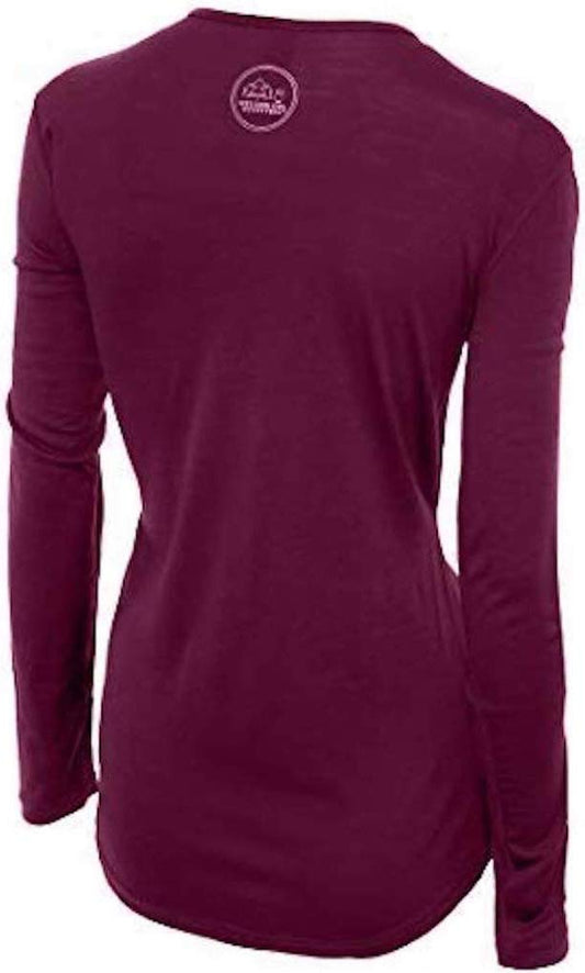
Our merino base layers are 100% Australian merino at 17.5 micron, and a long sleeve merino wool base layer for women is the layer that makes this trip work, because the pattern is twenty stops in a day in wind that does not stop. You are warm in the car and cold within a minute of leaving it, repeatedly, and wool is the only common fibre comfortable across that without changing. A heavyweight merino base layer from October.
Over it, a Marmot PreCip Eco rain jacket with a hood that stays up, which on this peninsula is a windproof layer first. In winter add an insulated jacket beneath.
Merrell Moab 3 waterproof hiking boots with Darn Tough merino socks. THE GROUND IS LAVA, which is sharp, uneven and hard on soft soles, and the beaches are rounded pebble that rolls. The Arnarstapi clifftop path and the Saxholl stair both want ankle support.
Kahtoola MICROspikes from November to March, for the car parks and the paths rather than the glacier.
Not linked and worth packing: a NECK GAITER, where the only entry in our range has a contested product identity and which is among the most useful items in Icelandic wind; a HEADLAMP, because winter days are short and the lava tube is lit but dim; a hat and gloves in any month; and a dry bag for the camera, since spray reaches the clifftop path.
Recommended Tours and Experiences
Essential Resources for Women on Snaefellsnes
Emergency numbers: 112 reaches police, ambulance, fire and mountain and sea rescue from any phone including a locked mobile, and English is spoken. Download the 112 Iceland app before you travel: it sends your GPS position to the emergency services with one button and logs your location periodically so you can be found, which is the single most useful free thing a visitor to Iceland can do. For non-urgent medical advice the health service line is 1700.
Djupalonssandur and the southern beaches have the same sneaker-wave mechanism as Reynisfjara and the signage is explicit: never turn your back on the sea and stay well above the highest wet line. Kirkjufell is a technical scramble with a record of fatalities and is not a hiking route; the photograph is taken from the car park. Route 54 round the peninsula is exposed, particularly on the northern side, and closes in weather, with closures published at road.is. The loop is about 200 kilometres and two days is the honest minimum. Weather at vedur.is.
US State Department travel advisory: the Iceland advisory. Read the current level there directly rather than relying on a figure printed in any guide.
UK FCDO travel advice: gov.uk/foreign-travel-advice/iceland, and read the safety and security page rather than only the landing page, because that is where the substance sits.
Main hospital: there is no hospital on the peninsula. Health centres operate at Stykkisholmur and Grundarfjordur for routine matters; the nearest hospital is Akranes, about an hour and a half east, and the national referral centre is Landspitali in Reykjavik, two to two and a half hours away. A UK Global Health Insurance Card or an EU European Health Insurance Card gives you state-provided medically necessary care in Iceland on the same terms as a resident, which is not the same as free: Iceland charges patient co-payments for primary care and outpatient visits, so expect to pay something and keep the receipts. Travel insurance still matters and matters more here than in most of Europe, because the FCDO notes that EMERGENCY MEDICAL ASSISTANCE AND SEARCH AND RESCUE MAY BE LIMITED IN SOME AREAS and because an evacuation from a remote part of the country is expensive. Tap water is among the best in the world and buying bottled is pointless; the hot tap smells of sulphur because it is geothermal, which is harmless. Pharmacies are apotek.
Official health authority: the Directorate of Health of Iceland, covers the health centre network on the peninsula
US Embassy: the United States Embassy in Reykjavik.
Official tourism authority: the Icelandic Tourist Board, publishes Snaefellsjokull National Park conditions and the Route 54 status
Takeaways
Give it two days. The loop is 200 kilometres with twenty worthwhile stops and a day trip from Reykjavik is twelve hours of which five are driving.
See more than Kirkjufell. The mountain is forty minutes; Djupalonssandur, Arnarstapi and the glacier are why the peninsula is called Iceland in miniature.
Do not climb Kirkjufell. It is a technical scramble with deaths on it, and the photograph is from the car park.
Treat Djupalonssandur like Reynisfjara. Same mechanism, same mistake, and the signs there say so.
Solo women safety assessment: Snaefellsnes is about as safe from other people as travel gets, and both of its real hazards have killed visitors. Iceland has one of the lowest violent crime rates in the world, the peninsula's villages are tiny and ordinary, English is universal and a woman driving the loop alone is unremarkable. The FCDO's Iceland page carries no crime warning of substance and names environmental accidents instead, at the coast, at cliff edges and in hot springs, pointing at SafeTravel.is. THE FIRST HAZARD IS THE SEA AT DJUPALONSSANDUR AND THE SOUTHERN BEACHES, and it is the Reynisfjara mechanism exactly: a steeply shelving black beach facing open Atlantic, where a wave periodically runs much further up the sand than the ones before it without looking like a large wave coming in. The signage here is explicit. Never turn your back on the water, stay well above the HIGHEST wet line rather than the current one, and understand that a calm-looking sea is the condition in which people are caught. THE SECOND IS THE ROAD. Route 54 is exposed, particularly along the northern side, and Icelandic wind there is strong enough to take a car door off its hinges and to push a vehicle across a lane; the road closes and the closure is published, so check road.is in both directions. A third is avoidable entirely: KIRKJUFELL IS A TECHNICAL SCRAMBLE WITH A RECORD OF DEATHS and is not a hiking route, while the photograph everyone wants is taken from the car park. Hire car insurance in Iceland generally excludes SAND AND ASH DAMAGE, and the exposed coast is where that happens.
Reading On
Snaefellsnes is the west and most of this library's Icelandic coverage is south and north of it. The Reykjavik packing list covers the capital two hours away, which is where the trip starts, and the Thingvellir packing list and Gullfoss packing list cover the Golden Circle inland. Along the south coast the Skogafoss packing list, the Reynisfjara packing list and the Vik packing list cover the waterfall, the black beach and the village, with the Skaftafell packing list and Jokulsarlon packing list further east. The Akureyri packing list and Myvatn packing list cover the north. For the country as a whole the Iceland travel guide for women and the Iceland packing list carry the transport, the weather and the practical material in full. For why wool is the layer for twenty stops a day in wind, read the guide to merino wool base layers for women. Every destination we cover is indexed at the travel packing guide for women, and the base layers are at the Roman Trail collection.

If the outer journey is calling you, the inner one usually is too. Explore SoulMap at romantrail.com/blogs/soulmap.