

Photograph: Archer Park railway station (now museum), 2016 by Kerry Raymond, CC BY 4.0, via Wikimedia Commons. It is cropped and resized.
Rockhampton is a city on the Fitzroy River in Central Queensland, just north of the Tropic of Capricorn. Wikipedia places it about 45 km from where the river reaches the Coral Sea and some 600 km north of Brisbane, and says almost everyone calls it Rocky. Packing for Rockhampton means packing for the tropics' southern edge: hot, humid summers with cyclones and floods possible, mild dry winters with cool nights, a heritage riverfront to walk, and a coast and islands to the east.
The photograph above was taken on a July morning in 2016, according to its Commons record. It shows a long single storey railway station painted deep red, with a covered verandah on slender posts, ornate cream brackets, and a projecting entrance under a shaped gable lettered Railway Station and Archer Park, reached by red steps from a paved forecourt. It shows one heritage building. It does not show the platform or the steam tram, Quay Street, the Fitzroy River, the Botanic Gardens, Mount Archer, the coast at Yeppoon or the islands offshore.
Disclosure: This post contains affiliate links. If you buy through them, Roman Trail earns a small commission at no extra cost to you. As an Amazon Associate I earn from qualifying purchases.
We receive a fee when you get a quote from World Nomads using this link. We do not represent World Nomads. This is not a recommendation to buy travel insurance.
What Is Here
The building in the photograph is the old Archer Park railway station, now a rail museum. Wikipedia says it was built between 1897 and 1908 as Rockhampton Central station, and was added to the Queensland Heritage Register on 21 October 1992. It describes the entrance in the photograph: a shaped timber gable with the date and title A.D. 1899 Railway Station in raised lettering, paired cast iron columns either side of a wide central arch, and central concrete steps. The museum's main attraction, it says, is a French Purrey steam tram rebuilt from parts of the city's own fleet, which ran from 1909 to 1939. Check its opening days locally; we print none.
The city's history begins long before the station. Wikipedia says the district is the traditional home of the Darumbal people. British colonisation began in 1853, when the Archer brothers arrived looking for grazing land, and Wikipedia records that it was violent, quoting one account of a Native Police reprisal in which about a hundred people were rounded up and most were shot. The town was proclaimed in 1858, gold was found at Canoona within a year, and later gold from the Mount Morgan mine paid for much of the city's Victorian architecture. To learn about Aboriginal culture from local guides, Wikivoyage describes the Dreamtime Cultural Centre, about 6 km north of the centre.
Quay Street and the River
The heritage quarter runs along the river. Wikipedia says the historic quarter is three city blocks of Quay Street, from Fitzroy Street to Derby Street, listed by the National Trust, and that the line of native plum trees along the street was planted by the French botanist Anthelme Thozet in 1867. Wikivoyage says the sandstone Customs House now houses the tourist information centre, with a riverside esplanade across the road. In our view the esplanade and Quay Street make a good first walk in the city, early in the morning before the heat builds.
Wikipedia says the Botanic Gardens were founded in 1869 and hold the war memorial and the city zoo, and Wikivoyage says the centre is flat and compact enough to see many sights on foot. Three bridges join the two halves of the city across the Fitzroy, according to Wikipedia, one for trains and two for vehicles and people. The city promotes itself as the Beef Capital of Australia, Wikipedia says, a title the New South Wales town of Casino has disputed more than once.
Heat, Cyclones and Floods
Plan for weather that is not like southern Australia's. Wikipedia describes a humid subtropical climate with hot, humid summers and very mild, relatively dry winters with cool nights. The FCDO says extreme heat is a serious risk in Australia, that tropical cyclones affect mainly Queensland, the Northern Territory and Western Australia, and that the cyclone season normally runs from November to April. Wikipedia records that a cyclone severely damaged the city on 2 March 1949, and that Cyclone Marcia damaged hundreds of homes and businesses on 20 February 2015.
The river floods too. A Wikipedia photograph caption records that in early 2011 the swollen Fitzroy surrounded the western half of the city. The FCDO says heavy rain and tropical cyclones can cause flooding, including flash floods, that spillways, flood plains and drains can quickly become submerged, and that local authorities may issue stay at home or leave now orders, which you must follow. Check warnings with the Bureau of Meteorology and the state's Get Ready Queensland service. In our view never drive or walk through floodwater.
Crocodiles
Rockhampton is crocodile country. Wikivoyage says the city is about as far south as the saltwater crocodile's habitat extends, that these animals are dangerous to humans, and that crocodiles are seen in the Fitzroy River. The Queensland Government says estuarine crocodiles are known to occur between Gladstone and Cape York Peninsula, which takes in this stretch of coast, and publishes its Be Crocwise advice for swimming, boating, camping and fishing. In our view do not swim in the river, keep well back from the water's edge, and obey every warning sign.
When to Go
In our view the dry, mild winter months are the easiest time to visit, with cool nights that need a layer. Summer brings heat, humidity, the cyclone season and the chance of floods. The FCDO says bushfires are a higher risk in Australia from October to February and can occur close to towns and cities. Check events and opening times at the tourist information centre in the Customs House.
Getting There
Rockhampton sits on the main road and rail route up the Queensland coast. Wikivoyage says the Bruce Highway runs north from Brisbane through the city and on to Cairns, that the Tilt Train runs here from Brisbane while the Spirit of Queensland continues up the coast to Cairns, that Greyhound and Flixbus run daily coaches from Brisbane and Cairns, and that the airport is just west of the city. Check current timetables before you go; we print none. The FCDO also notes that conflict in the Middle East has disrupted flights worldwide, so check connections on a long haul trip.
East of the city, Wikipedia says the coast is called the Capricorn Coast, with Yeppoon its main town, and Wikivoyage says trips to the Great Barrier Reef and the Keppel Islands leave from Yeppoon. On the beaches, the FCDO says rip currents are the main hazard for all swimmers and can happen at any beach, so swim between the flags at patrolled beaches; Beachsafe lists them. If you drive, the FCDO says to carry enough water, tell someone your plans, check road conditions and the weather, stay with your vehicle if it breaks down, and carry your licence and passport when driving.
Is Rockhampton Safe for Women Travelers
Rockhampton is named nowhere in the FCDO's advice for Australia, read on 20 November 2026, and Australia has no area the FCDO advises against. The national warning applies: the FCDO says terrorists are likely to try to carry out attacks in Australia, that attacks could be indiscriminate, including in places visited by foreign nationals, and that 15 people were killed in an antisemitic terrorist attack at Bondi Beach, Sydney, in December 2025.
For everyday crime the FCDO's advice is practical. It says not to leave bags unattended, to keep luggage out of sight in cars, to keep valuables and your passport in a hotel safe, and to take particular care at night in busy tourist areas. It warns of many kinds of scams, and says some drinks served in Australian bars can be stronger than those in the UK. It also says mobile coverage outside cities and large towns can be very limited or non existent, which in our view matters if you head inland or up Mount Archer alone. The bigger risks here, in our view, are heat, water and wildlife.
The Rockhampton Packing List
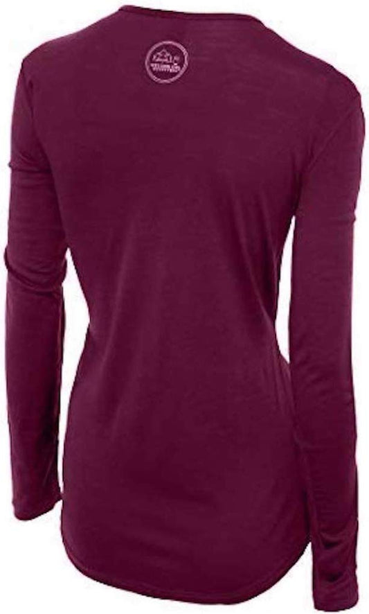
Our merino base layers are 100% Australian merino at 17.5 micron. A long sleeve merino wool base layer for women is, in our view, the top for Rockhampton's cool winter nights and for sun cover on a hot day.
For the Heat and the Sun
Pack a long sun hoodie and a wide brim sun hat, and carry water in an insulated water bottle. Our affiliate register carries no sunscreen and no sunglasses, so bring high factor ones of your own.
For Mosquitoes
The FCDO lists dengue and Japanese encephalitis among Australia's health risks, so pack a DEET insect repellent spray and use it as the label directs.
For the Wet Season and the Walks
Pack a packable rain jacket for summer storms, and wear waterproof hiking shoes for Mount Archer and the bush. That is our sixth affiliate link, which is our limit per post, so we have not linked swimwear or a towel: bring your own for the coast.
Recommended Tours and Experiences
Essential Resources for Women in Rockhampton
Emergency numbers: 000 for ambulance, fire and police, according to the FCDO's getting help page; its health page says to dial 000 and ask for an ambulance.
Hospital: Rockhampton Hospital, 2 Canning Street, The Range, a public hospital with an emergency department, according to Wikipedia. The FCDO says UK residents can get essential and urgent hospital treatment free under the UK and Australia reciprocal agreement, that ambulance services and medical evacuations are excluded and very expensive, and that anyone not covered by that agreement can face high treatment costs. Check your own cover before you travel.
Weather and safety: the Bureau of Meteorology, Get Ready Queensland, the Queensland Government's crocodile advice and Beachsafe.
US State Department travel advisory: the Australia advisory. Read the current level there directly rather than relying on a figure printed in any guide.
UK FCDO travel advice: gov.uk/foreign-travel-advice/australia, and read the safety and security page rather than only the landing page, because that is where the substance sits.
Official health authority: the Australian Government Department of Health, Disability and Ageing.
US Embassy: the United States Embassy in Canberra.
Official tourism authority: Tourism Australia covers the whole country, including Queensland.
Solo women safety assessment: Rockhampton is named nowhere in the FCDO's warnings, and in our view it is a straightforward regional city to visit alone, with a walkable centre along the river. The realistic risks are heat, the cyclone and flood season, crocodiles in the river, rip currents on the coast, poor phone coverage outside town, and ordinary theft from cars. Stay out of the river, swim between the flags, carry water, tell someone your route, and keep valuables out of sight. Emergency 000.
Takeaways
Rockhampton is a river city just north of the Tropic of Capricorn, with a heritage Quay Street, an old railway station turned museum, and the Capricorn Coast to the east. Pack for heat, humidity and sun, keep away from the river's edge, and check the weather in the cyclone season.
Reading On
North up the Bruce Highway, the Townsville packing list covers Townsville, and to the south the Brisbane packing list covers the state capital where the trains start. For the reef, read the Great Barrier Reef packing list. The Australia packing list and the Australia travel guide for women cover the whole country. For why one merino layer works from a hot day to a cool tropical night, read the guide to merino wool base layers for women, and every destination we cover is indexed at the travel packing guide for women. The base layers themselves are in the Roman Trail collection.
If the outer journey is calling you, the inner one usually is too. Explore SoulMap at romantrail.com/blogs/soulmap.