

Mount Maunganui is a beach suburb at the end of a sand spit in the Bay of Plenty, on New Zealand's North Island, and the name belongs to the hill rather than to the town. MAUAO is a 232 metre volcanic dome standing at the tip of the peninsula, and its Maori name means caught by the dawn, from a story in which the hill, unable to follow the one it loved, is dragged toward the sea by the patupaiarehe and is caught by the sunrise where it now stands. It is a sacred site. The track in the first photograph is the one everybody walks, locals before work and visitors at any hour, and the summit view is the reason this is the Bay of Plenty's best-known destination. Note the geography: the Mount is administratively part of TAURANGA CITY, with the ocean on one side and the harbour and the country's busiest port on the other.
Disclosure: This post contains affiliate links. If you buy through them, Roman Trail earns a small commission at no extra cost to you.
We receive a fee when you get a quote from World Nomads using this link. We do not represent World Nomads. This is not a recommendation to buy travel insurance.
What Is Here
THE MAUAO SUMMIT WALK IS THE MAIN EVENT AND THERE ARE TWO ROUTES. The base track is a flat four kilometre loop round the foot of the hill, suitable for anyone, with the cliffs in the second photograph on the seaward side. The summit track climbs about 232 metres in roughly 45 minutes to an hour, steeply, partly on steps and partly on a zigzag gravel path, and the view at the top takes in the ocean beach, the harbour, the port and the Kaimai ranges. It is free, it is open all hours, and it is busy from dawn. BECAUSE IT IS A SACRED SITE the respectful conventions are observed: stay on the track, do not take food to the summit, and do not fly a drone.
MAIN BEACH IS ONE OF NEW ZEALAND'S BEST SURF BEACHES AND IT IS PATROLLED. About three kilometres of white sand running away from the base of the hill, with a consistent beach break, surf schools, and SURF LIFE SAVING patrols flying flags in season. It is also where the whole of the Waikato and Bay of Plenty comes in January, so the population of the spit multiplies and parking becomes the main irritation of a visit.

THE HARBOUR SIDE IS A DIFFERENT TOWN AND THE THIRD PHOTOGRAPH IS IT. Pilot Bay, on the sheltered inner side of the spit, is flat, calm, shallow and warm, which makes it the swimming option when the ocean side is rough and the right choice with small children. Beside it sits the working port: TAURANGA IS NEW ZEALAND'S LARGEST PORT BY CARGO VOLUME, handling the country's log, dairy and kiwifruit exports, and container ships and log stacks are part of the view. People find that either jarring or interesting; it is honest to say it is there.
THE HOT SALT WATER POOLS AT THE BASE OF THE HILL ARE THE LOCAL INSTITUTION. Geothermally heated seawater in public pools directly below Mauao, open late, and they are what people do after the climb. Small entry fee.
AND WHAKAARI WHITE ISLAND IS 50 KILOMETRES OFFSHORE, VISIBLE ON A CLEAR DAY, AND IS NOT A TOUR TO BOOK CASUALLY. Said here rather than buried: on 9 December 2019 Whakaari erupted while tour groups were on it, killing 22 people and severely injuring many more. Landings have not resumed and the legal consequences are still working through the New Zealand courts. Boat and flight trips that view the island from a distance operate from Whakatane and Tauranga. If anything is ever sold to you as a landing, check what the authorities actually permit before you pay.
When to Go
December to March is summer and it is the season, in the low to mid twenties with the sea around 20 to 22 degrees, every surf patrol operating and the spit at capacity. January is the peak and accommodation is booked months ahead at prices that surprise people.
October, November and April are the best value by a wide margin, in the high teens to low twenties, with the beach quiet and the water still swimmable in April.
June to September is mild and wet, in the mid teens by day, with the best surf of the year, the clearest air and almost nobody on the summit track. The Bay of Plenty is one of the sunniest parts of New Zealand, which makes winter here better than its latitude suggests.
THE SPIT IS EXPOSED AND THE WEATHER CHANGES FAST, with ex-tropical cyclones reaching this coast between January and April, which is when the heaviest rain and the biggest swells arrive.
Getting There
Tauranga Airport is about ten minutes away with domestic flights from Auckland, Wellington and Christchurch. By road Auckland is about two and a half hours, Rotorua an hour and Taupo about two.
The Mount is walkable once you are there, with the summit track, Main Beach, Pilot Bay, the pools and the shops and cafes on Maunganui Road all within fifteen minutes of each other.
A car is useful for everything beyond the spit and is a liability in January, when parking near the base of the hill is genuinely difficult. Tauranga's centre is across the harbour bridge, about ten minutes.
Note that this is a cruise port, so a ship in means several thousand extra people on the summit track and in the cafes for a day.
The Mount Maunganui Packing List
Extreme UV, a warm humid summer, a steep climb, a mild wet winter and an exposed coast.
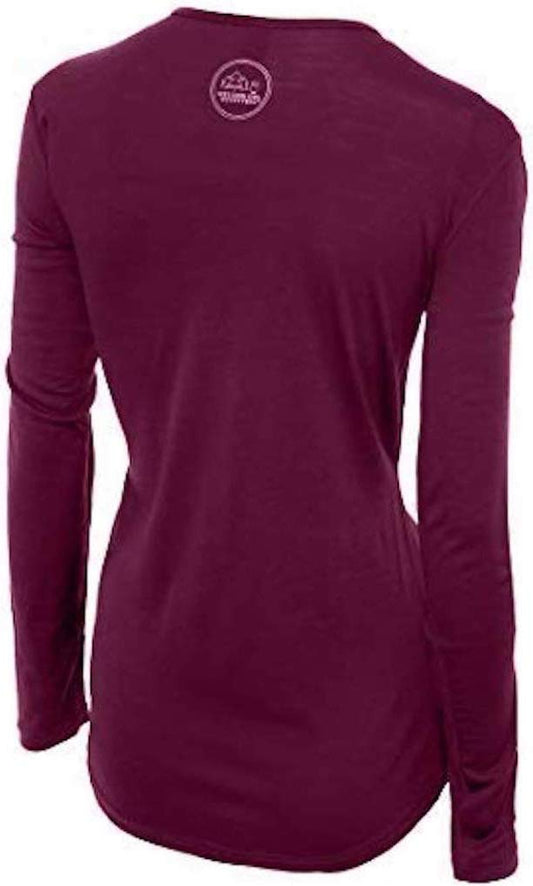
Our merino base layers are 100% Australian merino at 17.5 micron, and a long sleeve merino wool base layer for women earns a place in a beach town because of the hill. The summit climb is 232 metres of steep work that will soak you even in the mid teens, and the top is exposed, windy and several degrees cooler than the beach, so you arrive hot and wet and then stand still in wind. That is the sequence wool handles and cotton does not. For the winter months it is simply the right layer under a shell on an exposed coast.
A Columbia Fast Trek II fleece for the summit, winter and evenings, and a Marmot PreCip Eco rain jacket, which here is a windbreak on the top as much as a rain layer.
NEW ZEALAND'S UV IS AMONG THE HIGHEST IN THE WORLD AND THIS IS THE PART VISITORS GET WRONG. A long sun hoodie and a wide brim UPF 50 sun hat. Latitude, a thin ozone layer and very clean air mean you can burn badly at twenty degrees with a sea breeze on you, and the summit track is almost entirely unshaded.
Walking shoes with grip for the summit track, which is steps, gravel and worn rock and is slick in rain. Flip flops are what the local teenagers climb it in and are a bad idea.
Not linked and worth packing: A RASH TOP, which on a New Zealand beach is better sun protection than anything you can apply and is what locals wear; SUNSCREEN BOUGHT LOCALLY, where the formulations are made for this UV; SUNGLASSES; A WATER BOTTLE for the climb, where there is none on the route; SWIMWEAR FOR THE HOT POOLS as well as the sea; AND A TOWEL YOU CAN CARRY.
Recommended Tours and Experiences
Essential Resources for Women at Mount Maunganui
Emergency numbers: 111 for police, ambulance and fire, free from any phone and reaching a single national dispatch. 105 for non-urgent police matters. Healthline on 0800 611 116 gives free nurse advice at any hour. Maritime rescue is reached through 111 or on VHF channel 16. Coverage is good across the spit and on the summit.
RIP CURRENTS ON MAIN BEACH ARE THE REAL HAZARD AND THE ESCAPE IS COUNTERINTUITIVE. This is an exposed ocean beach with a consistent bar-and-trough system, which means rips, and they look like the calmest water on the beach because they are. SWIM BETWEEN THE RED AND YELLOW FLAGS, which mark the area a surf lifesaving patrol is actually watching; patrol hours are posted and are much shorter outside summer, and A BEACH WITH NO FLAGS IS UNPATROLLED RATHER THAN SAFE. If you are caught, do not swim against the pull, because you will lose: raise an arm and float, or swim parallel to the beach. Pilot Bay on the harbour side is the sheltered alternative and is the right choice on a big swell. THE SUMMIT TRACK CAUSES MORE INJURIES THAN THE SEA, which surprises people: it is steep, it is worn smooth in places, it is slick in rain, it is climbed by thousands of people a day in unsuitable footwear, and the commonest call-out is a twisted ankle or a fall on the descent. Take the descent slowly and wear something with grip. NEW ZEALAND'S UV IS AMONG THE HIGHEST ON EARTH and the sea breeze hides it completely, so slip, slop, slap and wrap, with the hours roughly ten to four in summer. EARTHQUAKES AND TSUNAMI apply as they do nationally: indoors DROP, COVER, HOLD, and on the coast, IF A QUAKE IS LONG OR STRONG, MEANING YOU CANNOT STAND UP OR IT LASTS MORE THAN A MINUTE, MOVE INLAND OR UPHILL IMMEDIATELY WITHOUT WAITING FOR A WARNING. Here that instruction is unusually easy to follow, because Mauao is 232 metres high and is right there; the spit itself is low, flat and narrow, which is exactly the geography a tsunami threatens, and the evacuation signage reflects that. THE VOLCANIC RISK IS OFFSHORE AND IT IS REAL: Whakaari White Island killed 22 people in December 2019, GNS Science publishes the volcanic alert level, and the central North Island volcanoes an hour or two inland are also active. The FCDO publishes no advised-against areas anywhere in New Zealand and names geology, rapidly changing weather and theft from parked cars, which is the one real crime risk and is concentrated at beach and trailhead car parks.
US State Department travel advisory: the New Zealand advisory. Read the current level there directly rather than relying on a figure printed in any guide.
UK FCDO travel advice: gov.uk/foreign-travel-advice/new-zealand, and read the safety and security page rather than only the landing page, because that is where the substance sits.
Main hospital: Tauranga Hospital, across the harbour in the city about fifteen minutes away, has a 24 hour emergency department and is the base hospital for the whole Bay of Plenty, with Waikato Hospital in Hamilton about an hour and three quarters for the most specialised care. There are urgent care clinics on the Mount itself and in Tauranga, which are the right choice for a sprained ankle off the summit track rather than the emergency department. New Zealand's Accident Compensation Corporation covers treatment for ACCIDENTAL INJURY for visitors, which is genuinely useful here given what the track does to ankles, and it does NOT cover illness, repatriation or lost earnings, so travel insurance remains necessary. Dial 111 for an emergency. New Zealand has a RECIPROCAL HEALTH AGREEMENT with the UK covering medically necessary treatment in public hospitals, which is genuinely useful and is not comprehensive: it does not cover repatriation, it does not cover private care, and it does not cover a rescue. WHAT MAKES INSURANCE NON-OPTIONAL HERE IS THE ACCIDENT COMPENSATION CORPORATION, the ACC, which is the thing visitors find surprising. ACC covers treatment for accidental injury for everyone in New Zealand including tourists, no-fault, which means a broken ankle on a trail is largely paid for. In exchange you cannot sue, and ACC does NOT pay for repatriation, for a helicopter off a mountain in every circumstance, or for the cost of cutting a trip short. Tap water is drinkable, and a pharmacy, called a chemist, deals with small problems.
The authority that decides what is open: Tauranga City Council manages the Mauao reserve and publishes the track status and any closures, which happen for storm damage and for cultural observance, and the Department of Conservation covers the wider reserves. Surf Life Saving New Zealand publishes the patrolled beaches and hours, which is the page that matters on a swimming day, and GNS Science publishes the volcanic alert levels.
Official health authority: the New Zealand Ministry of Health, Manatu Hauora, covers the national health information and the accident compensation scheme that covers visitors for injury
US Embassy: the United States Embassy in Wellington.
Official tourism authority: Tourism New Zealand, covers the country, and the Tauranga and Western Bay tourism office publishes the surf patrol hours, the hot pools opening times and the cruise ship calendar, which is what decides how busy the summit track will be
Takeaways
Mauao is a sacred site. Stay on the track, no food at the summit, no drones.
The summit track injures more visitors than the sea does. Wear grip and descend slowly.
Swim between the flags. Pilot Bay on the harbour side is the calm alternative.
If a quake is long or strong, go up Mauao. The spit is low, flat and narrow.
Solo women safety assessment: Mount Maunganui is a very easy place to travel alone. It is a prosperous New Zealand beach suburb with a cafe strip, hostels and holiday parks, a summit track climbed by hundreds of people from dawn onward, and a beach patrolled through the summer; eating alone is completely ordinary, the area is busy and well lit into the evening, and there is no district to avoid. New Zealand has no advised-against areas anywhere, and the one real crime risk the FCDO names is theft from parked cars, concentrated at exactly the beach and trailhead car parks a visitor uses, so leave nothing visible. THE RISKS HERE ARE THE SEA, THE TRACK AND THE GEOLOGY. Main Beach is an exposed ocean beach with rips that look like the calmest water on it, so swim between the red and yellow flags, treat an unflagged beach as unpatrolled, and if caught float and signal or swim parallel rather than against the pull; Pilot Bay on the harbour side is the sheltered option. The summit track causes more injuries than the water, mostly falls and twisted ankles on the descent, so wear grip and take it slowly. New Zealand's UV is among the highest on earth and a sea breeze hides it completely. For earthquakes the rule indoors is DROP, COVER, HOLD, and on this low narrow spit, if a quake is long or strong, go up Mauao immediately without waiting for a warning. Whakaari White Island, 50 kilometres offshore, killed 22 people in December 2019 and landings have not resumed. 111 REACHES EVERYTHING, Tauranga Hospital is fifteen minutes away, and the accident compensation scheme covers visitors for injury.
Reading On
Mount Maunganui is in the Bay of Plenty and this library covers the North Island around it. The Rotorua packing list covers the geothermal town an hour inland and is the standard pairing with a Bay of Plenty beach stay, and the Taupo packing list the lake and the volcanoes two hours south, which are the active geology this coast's alert levels refer to. The Auckland packing list covers the largest city two and a half hours north and the Wellington packing list the capital on its own fault line. On the South Island, the Kaikoura packing list covers the whale coast, the Christchurch packing list the rebuilt city, and the Queenstown packing list, Wanaka packing list, Milford Sound packing list and Dunedin packing list the mountains and the south, with the South Island packing list carrying the whole island. For the country, the New Zealand travel guide for women carries the islands, the driving and the seasons in full. For why wool suits a steep sweaty climb followed by a windy summit, read the guide to merino wool base layers for women. Every destination we cover is indexed at the travel packing guide for women, and the base layers are at the Roman Trail collection. On the South Island, the Picton packing list covers the ferry town at the head of the Marlborough Sounds.

If the outer journey is calling you, the inner one usually is too. Explore SoulMap at romantrail.com/blogs/soulmap.