

Jervis Bay is a large natural harbour on the south coast of New South Wales, and the single fact that shapes a visit here is that the bay is split between two different jurisdictions. Part of it sits inside the Jervis Bay Territory, a piece of land the state of New South Wales surrendered to the Commonwealth Government in 1915, and part of it sits in ordinary NSW. Booderee National Park is in the Commonwealth territory. Jervis Bay National Park is the separate, NSW-administered park nearby. A visitor standing on one beach and walking to the next can cross that line without ever seeing a sign for it.
Disclosure: This post contains affiliate links. If you buy through them, Roman Trail earns a small commission at no extra cost to you.
We receive a fee when you get a quote from World Nomads using this link. We do not represent World Nomads. This is not a recommendation to buy travel insurance.
What Is Here
The photograph above shows one cove from directly overhead, and it is worth being precise about what that view does and does not tell you. A small crescent of very white sand sits against dense dark eucalypt bush. The water runs out from the sand through pale jade shallows into deeper green and then a darker blue-green further out, with patches of submerged reef and seagrass showing as mottled shadows under the surface. A low shelf of tan and orange rock cuts across the middle of the frame, separating this cove from the open bay beyond it, and one small boat sits at anchor to the right. No people are in the shot, and nothing in it tells you how cold that water is, which it is: this is the NSW south coast rather than tropical Australia, and the bay's water runs noticeably cooler than its bright, clear colour from above suggests.
What that single frame cannot show is most of what a trip to Jervis Bay is actually made of. It cannot show Huskisson, the main town on the bay, or the smaller villages scattered along its shore. It cannot show Hyams Beach by name, which Jervis Bay's own Wikipedia article singles out specifically as a white sandy beach in its own right, separate from whichever cove this particular photograph happens to be. It cannot show the bush of Booderee National Park, which is run jointly with its traditional owners, a fact worth knowing and respecting rather than reducing to a line about scenery. It cannot show the whales that pass this stretch of coast. And it cannot show the cliffs at Point Perpendicular, on the bay's northern headland, which this frame is nowhere near.
Two Parks, Two Jurisdictions
This is the detail almost nobody explains clearly, and it genuinely changes how you plan a day here. Booderee National Park sits inside the Jervis Bay Territory, Commonwealth land that New South Wales surrendered to the federal government in 1915. Jervis Bay National Park, despite the near-identical name, is a different park under NSW administration. The bay's wider protected area also includes the Jervis Bay Marine Park, covering the water itself rather than the land around it. Three protected areas, two different levels of government, sharing one stretch of coastline. No source for this post carries a specific entry fee, a permit requirement or an emergency number for either park, so none is printed here: confirm the current arrangement for whichever side of the bay you are visiting before you go, rather than assuming one park's rules apply to the other.
Booderee is jointly managed with its traditional owners, and that relationship is the park's defining fact rather than a footnote to it. This post does not have a source in front of it that sets out the legal terms of that arrangement, so none is invented here. What is worth carrying into a visit is simple respect: this is not an empty wilderness that happens to have a name, and a visitor's conduct in it should reflect that.
Hyams Beach and the Rest of the Bay
Hyams Beach is named specifically, in its own right, as a white sandy beach, and it is the single most repeated name attached to Jervis Bay anywhere you look. You will see it described as having the whitest sand in the world, often with a Guinness World Records claim attached. This post is not asserting that superlative: the only source read for it describes Hyams Beach plainly, as a white sandy beach, and nothing more specific than that. The claim is widely repeated online, and we are naming that fact rather than repeating the claim itself as settled.
The photograph above is not Hyams Beach and is not identified as any single named spot within the bay beyond being a cove seen from above. Jervis Bay is a large natural harbour with multiple coves, beaches and a main town, Huskisson, none of which this one aerial frame attempts to represent on its own. Treat the photograph as evidence of the kind of coastline you are packing for, a mix of fine white sand, clear shallow water and low rock shelves, rather than as a guide to any one specific beach you will stand on.
The Water Is Colder Than It Looks
This is the packing instruction that matters most for Jervis Bay, and the photograph above is the best illustration of why it needs saying. Seen from directly overhead, the water reads as pale, bright and inviting, almost tropical in colour. It is not tropical water. This is the temperate NSW south coast, and the bay runs cooler than its colour suggests at any time of year outside the height of summer. Pack for getting in and out of genuinely cold water, not for the water the drone photograph appears to promise.
What is actually dangerous in Australia, and what is not: the reputation and the statistics point in different directions, so it is worth being specific. SPIDERS KILL ESSENTIALLY NOBODY. Redback deaths have been all but unknown since antivenom arrived in the 1950s, with one disputed case since, funnel-web antivenom has held a record of no deaths since it was introduced, and the huntsman that frightens everyone is harmless. SNAKES ARE SERIOUS AND RARE: Australia has many of the world's most venomous species, bites run to a couple of thousand a year and deaths to roughly two, and almost all bites happen to people handling or standing on a snake rather than being hunted by one. Walk heavily, look where you put your feet and hands, and leave them alone. SHARKS AVERAGE ONE OR TWO DEATHS A YEAR nationally, which is fewer than lightning. SALTWATER CROCODILES ARE THE ONE TO GENUINELY RESPECT, in the tropical north above roughly Rockhampton and across to Broome: they are ambush predators in rivers, estuaries and the sea, the warning signs mean it, and the rule is simply not to enter or stand at the edge of any water in croc country unless a local authority says it is safe. BOX JELLYFISH AND IRUKANDJI are the other northern hazard, in the wet season, which is why beaches there have stinger nets and why vinegar sits at the surf club. AND THE THING THAT ACTUALLY KILLS VISITORS IS NONE OF THE ABOVE: it is drowning in rip currents, followed by heat and by long-distance driving.
That national guidance applies here with one adjustment worth making plain: marine stingers, box jellyfish and Irukandji, are a tropical northern-Australia hazard and have no bearing on a trip to the NSW south coast. What does carry over directly is the point about rip currents, which the same guidance names as the hazard that actually kills visitors around Australia's coastline, and cold water, which is the far more relevant risk on a bay like this one than anything tropical.
Sun on an Open Bay
The UV is the thing to take seriously, more than the temperature: Australia has among the highest ultraviolet levels of any inhabited country, and the reason is structural rather than seasonal. The southern ozone layer is thinner, the Earth is closer to the sun during the southern summer, and the air is clean, so UV reaches the ground at an intensity northern visitors have no instinct for. In summer the index routinely passes 11, which is rated EXTREME, and unprotected skin can burn in well under fifteen minutes. IT IS NOT A HEAT PROBLEM AND DOES NOT FEEL LIKE ONE: you burn as readily on a cool windy day in Melbourne or through cloud. Australians are taught five words for it, slip on a shirt, slop on sunscreen, slap on a hat, seek shade and slide on sunglasses, and the reason it is a national slogan is that this country has the highest skin cancer rates in the world.
An overhead photograph of clear water and white sand gives no sense of how exposed that same cove is to stand in for an afternoon. There is no shade on open sand or on a boat, and the glare off pale sand and shallow water adds to direct sun rather than softening it. Pack as if the UV here is as serious as anywhere else in Australia, because it is.
Recommended Tours and Experiences
Getting There
The only source read for this post carries no transport detail for Jervis Bay at all, so none is printed here rather than supplied from memory. What can be said plainly is that the bay sits on the NSW south coast, within reach of both Sydney and Canberra as day-trip or weekend destinations, and that confirming your own route, drive time and the current road conditions before you travel is the honest substitute for a specific set of directions this post is not sourced to give.
Is Jervis Bay Safe for Women Travelers
The FCDO advises against travel to no part of Australia, and there are no advised-against areas anywhere in the country. It does carry two named warnings that are worth reading rather than skipping. The first is BUSHFIRE, which it flags as a higher risk through the spring and summer, October to February, and which can close roads and whole regions at very short notice. The second is TERRORISM: the FCDO states that terrorists are likely to try to carry out attacks in Australia and that attacks could be indiscriminate, including in places visited by foreign nationals, and it names the December 2025 antisemitic attack at Bondi Beach in Sydney, in which fifteen people were killed, and an April 2024 incident at a church in Wakeley. Australia also publishes its own national terrorism threat level, which is the thing to check rather than any figure quoted here. Beyond those two, the risks it names are environmental: extreme heat, cyclones in the north between November and April, flooding, and the sea, where RIP CURRENTS are the hazard it puts first and the one that actually kills visitors. On crime it names ordinary precautions against petty theft, and separately warns about scams. The practical shape for a visitor is that the everyday risk here really is weather and water, but the advisory does not describe this as a country with nothing but environmental hazards and neither should we.
Jervis Bay is a quiet coastal area built around national parks, small towns and the water, and the practical risks here are environmental rather than criminal. There is no tourist-crime pattern specific to this bay in anything this post is sourced to say. What deserves real respect is the water itself: it is colder than a sunlit overhead photograph suggests, rip currents are the hazard that actually causes harm on Australian coastlines generally, and a bay split between two different park jurisdictions means the exact rules for where you can walk, swim or camp can change without an obvious sign as you move around its shore. Confirm current park guidance for whichever side of the bay you are on rather than assuming either jurisdiction's rules apply to the other.
The Jervis Bay Packing List
Footwear for sand, rock shelves and bush tracks
The rock shelf visible in the photograph above, and the bush tracks that connect the bay's coves, are not a barefoot environment. A grippy waterproof hiking shoe handles wet rock and sandy bush tracks without sliding, and merino hiking socks deal with repeated wet-dry cycles far better than cotton, which stays damp and starts to rub.
Water shoes are genuinely useful over a rock shelf like the one in the photograph, but the only water-shoe entry in our registry is contested and unverified, so it is left unlinked here rather than pointed at a product we cannot stand behind.
Sun cover for an open bay with no shade
A long sleeve sun hoodie and a wide brim UPF 50 sun hat cover the exposed walk to and along any cove and a day on or near the water, where glare off pale sand and shallow water adds to direct sun rather than reducing it. Our registry carries no sunscreen entry and no sunglasses entry at all, and both matter here: buy real sunscreen and proper sunglasses before you travel, because we would rather say so plainly than point you at something we cannot stand behind. A swim top or rash vest is also worth having for sun cover in the water, and is unlinked for the same reason: our registry carries no swimwear entry.
Keeping things dry on the water
A waterproof dry bag protects a phone, a camera and a change of clothes on a boat, a kayak or a snorkel day, none of which comes with a sheltered place to leave your things dry. It weighs almost nothing and earns its place on any day that involves getting in and out of the water more than once.
A warm layer for cooler evenings on the coast
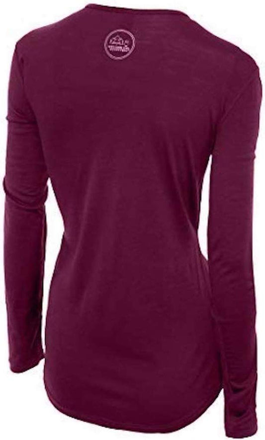
Our merino base layers are 100% Australian merino at 17.5 micron, and a merino wool base layer for women is the single most useful thing in a Jervis Bay bag once the sun goes down, because this stretch of coast cools off faster in the evening than the bright daytime photograph above suggests, at any time of year outside the height of summer. Add a packable fleece for anything outside peak summer, and treat evenings here as cooler than the day led you to expect.
Essential Resources for Women at Jervis Bay
Emergency number. In Australia the emergency number is 000 for police, fire and ambulance. Ambulances are billed separately in Australia and are expensive, which is the detail that catches visitors out.
Australia has a RECIPROCAL HEALTH CARE AGREEMENT with the UK, which is unusual and worth knowing: it covers medically necessary treatment in a public hospital or a public clinic on the same basis as a Medicare patient, and you enrol at a Medicare office or present a UK passport at the hospital. IT IS NOT COMPREHENSIVE COVER. It does not pay for ambulances, which are billed separately and are expensive, it does not cover repatriation, it does not cover treatment in private hospitals, and it does not cover the Royal Flying Doctor Service, which is how you leave a remote area in an emergency. Travel insurance with a high medical limit is still the thing that matters, and the distances in this country are why. A pharmacy, called a chemist, handles small problems, and tap water is drinkable everywhere.
Medical care near Jervis Bay. There is no major hospital inside the bay area itself. A visitor needing anything beyond minor first aid should expect to travel to a larger regional centre on the NSW south coast, and anyone with a condition that needs specialist or urgent care should plan around that distance in advance rather than discovering it on the day.
Official health authority: the Australian Government Department of Health, Disability and Ageing, covers the general guidance on travel health for Australia, and is the body to check for anything specific to the NSW south coast before you travel.
US Embassy: the United States Embassy in Canberra, in Canberra, which also happens to be the nearest capital city to Jervis Bay.
Official tourism authority: Tourism Australia, covers the national picture; for Jervis Bay specifically, confirm current park rules for whichever side of the bay, Commonwealth territory or NSW, you are visiting, since none is printed here as a fixed set of conditions.
US State Department travel advisory: the Australia advisory. Read the current level there directly rather than relying on a figure printed in any guide.
UK FCDO travel advice: gov.uk/foreign-travel-advice/australia, and read the safety and security page rather than only the landing page, because that is where the substance sits.
Solo women safety assessment: Jervis Bay is a quiet, low-key coastal area built around national parks and small towns rather than a nightlife destination, and there is nothing in the sources behind this post to suggest it is anything other than an easy, low-stress place to visit alone. What deserves genuine respect is not other people but the water and the land: it is colder than the bright overhead photograph suggests, rip currents are a real Australian coastal hazard, and a bay administered under two different jurisdictions means the rules for where you can go can change without warning as you move around its shore. None of that amounts to danger for a woman travelling alone, and all of it yields to sensible shoes, a warm layer for the evening, and confirming current park guidance before you set out.
Reading On
For the next stretch of this coast, Batemans Bay is the next sizeable town north along the NSW south coast, and Wollongong is the larger city further north again, on the same stretch of coastline. Inland, Canberra is the nearest capital city and the Jervis Bay Territory's own parent jurisdiction in miniature, and Sydney is the nearest major gateway for a longer trip. packing-list-booderee-women does not exist as its own post in this library yet, so Booderee is covered here rather than linked elsewhere. For a trip across more than one Australian state, see our Australia packing list, and for the regions and seasons more broadly, our Australia travel guide for women. For why one fine wool layer covers a cool evening on an open bay, read our guide to merino wool base layers for women. Every destination we cover is indexed at the travel packing guide for women, and the base layers themselves are at the Roman Trail collection.
If the outer journey is calling you, the inner one usually is too. Explore SoulMap at romantrail.com/blogs/soulmap.