

The Isle of Wight lies a few miles off the Hampshire coast across the Solent, a diamond of about 380 square kilometres with roughly 140,000 residents. It is England's largest island and it functions as a single destination: one ferry system in, one tourist board, and a coastal path of around 110 kilometres that goes all the way round. Half of it is a designated National Landscape, formerly an Area of Outstanding Natural Beauty.
Disclosure: This post contains affiliate links. If you buy through them, Roman Trail earns a small commission at no extra cost to you.
The image is the Needles: three chalk stacks running out from the island's western tip with a red and white lighthouse on the last of them, and a fourth that collapsed in 1764. Above them, the chalk downs come to a point at Tennyson Down, named for the poet who lived below it at Farringford and walked there daily. The view from the top takes in the stacks, the multicoloured sand cliffs of Alum Bay, and the Solent full of shipping.
The island's other claim is older. It is one of the richest dinosaur fossil sites in Europe, and at low tide actual footprints are exposed in the rock at Compton Bay and Hanover Point. You can find fossils loose on the beach and take them; digging into the cliff is not permitted and the cliffs are actively eroding, which is both why fossils keep appearing and why standing under them is a poor idea.
What you pack is set by sea weather, which is changeable and windy, a long exposed coastal path, and tides that control what you can reach.
We receive a fee when you get a quote from World Nomads using this link. We do not represent World Nomads. This is not a recommendation to buy travel insurance.
The Needles, the Downs and the Coastal Path
Chalk stacks, a poet's hill, and a footpath round an entire island.
The Needles are approached from Alum Bay, where there is a chairlift down to the beach and a cluster of commercial attractions that are frankly tacky, and the honest advice is to walk past them. The Needles Old Battery, a Victorian fort run by the National Trust, sits on the headland with a tunnel out to a searchlight position directly above the stacks, which is the best view there is. Walking out along Tennyson Down from Freshwater Bay is better than driving to the car park.
The coastal path is the island's real asset: around 110 kilometres, waymarked, and walkable in sections or as a multi-day circuit. The south-west coast between Freshwater and Ventnor is the dramatic part, with high chalk and sandstone cliffs and very little shelter. Note that the path is periodically rerouted because the cliffs are eroding and sections do fall into the sea, so check the current route rather than relying on an old map.
Ventnor on the south coast sits in a natural sun-trap below a steep undercliff and has a genuinely mild microclimate, with the Botanic Garden growing subtropical plants outdoors without glass. It is the prettiest of the island's towns and feels more Mediterranean than English in June. Shanklin and Sandown have the long sandy beaches and the traditional seaside end of things.
Osborne House, Queen Victoria's seaside palace at East Cowes, is the big heritage visit: her private apartments, the Swiss Cottage the children played in, and her private beach with the bathing machine. Carisbrooke Castle in the middle of the island is where Charles I was imprisoned before his trial.
Recommended Tours and Experiences
Ferries, Festivals and Getting Around
Everything arrives by boat, and two festivals fill the island.
There are three crossings: Portsmouth to Fishbourne and Southampton to East Cowes by car ferry, Portsmouth to Ryde and Southampton to West Cowes by fast catamaran, and Lymington to Yarmouth. The car ferries take forty-five minutes to an hour, the catamarans around twenty-five minutes. They are frequent and they are also expensive by the standards of the distance, and they are cancelled in strong wind. Book a car crossing well ahead in summer.
The rule this library applies to every island applies here: never plan to leave on the same day as an onward flight.
Two events dominate the calendar. Cowes Week at the start of August is one of the oldest and largest sailing regattas in the world and fills Cowes completely. The Isle of Wight Festival in June is a major music festival with a lineage going back to 1968 and 1970, when Hendrix played here. Both book out the island's accommodation, so check the dates before planning a summer visit.
Getting around: Southern Vectis buses cover the island reasonably well and an island-wide day ticket is good value. There is a short train line from Ryde to Shanklin using former London Underground stock. Cycling is popular and the island is hilly in the south, flat in the north. A car makes the west end much easier.

When to Go
May, June and September. July and August are busy and festival-bound.
The island claims more sunshine than almost anywhere in Britain and the southern coast genuinely has a mild microclimate, but this is still the English Channel: daytime highs run from about 8C in January to 21C in July, rain falls in every month, and wind is the constant.
Late spring, May and June, is the best window: long days, the downs green and full of wildflowers, the coastal path at its best, and the Botanic Garden at Ventnor in flower. The festival is in June, so check dates.
July and August are the holiday season, the beaches at Sandown and Shanklin are busy, Cowes Week fills the start of August, and ferry prices peak. The sea is at its warmest in late August, which is still cold by most standards.
September is excellent: warm enough, the sea at its warmest, the crowds gone after the first week and the light better. October turns wet and windy.
Winter, November to March, is mild, wet and windy, around 8 to 10C. Much of the tourist infrastructure closes or reduces hours, ferries run less often and are more likely to be cancelled, and the coastal path in a January gale is a serious proposition rather than a walk. Ventnor and the main towns keep functioning.
Is the Isle of Wight Safe for Women Travelers
Very safe. The hazards are entirely environmental: cliffs, tides and ferries.
The US State Department publishes a United Kingdom advisory and the UK's own FCDO publishes nothing for its own territory, because it advises on travel abroad only. Neither records advised-against areas for ordinary visitors. The named risks are terrorism, which the UK assesses at a national threat level published by MI5 and which is a general rather than a localised concern, and the usual urban property crime in the big cities.
On crime the island is quieter than mainland England by most measures, and a visitor's realistic exposure is petty theft from a beach or an unlocked car. The towns are small, the atmosphere is family-holiday, and a woman walking or eating alone anywhere here is completely unremarkable. The nightlife is modest outside Cowes Week and the festival, both of which bring large drinking crowds and the usual care that implies about drinks and about getting back to where you are staying.
The real risks are the coast, and they are substantial enough to take seriously. The cliffs are actively eroding: rockfalls happen, the coastal path is rerouted because sections collapse, and standing at the base of a chalk or sandstone cliff is how people are killed on this coast. Stay back from cliff edges, which are undercut and unfenced in most places, and do not shelter or fossil-hunt directly beneath them.
Tides are the second. The fossil footprints at Compton and Hanover Point are only exposed at low water, and the beaches below the undercliff can be cut off by a rising tide. Check a tide table, which the island's tourist information publishes, and give yourself margin rather than cutting it fine.
Third, the water. The Solent is one of the busiest shipping channels in the world and has strong tidal streams, which is why swimming is for the supervised beaches rather than anywhere that looks inviting. Lifeguards patrol Sandown, Shanklin and a few others in season only.
Fourth, the ferries, which are a logistics risk rather than a danger: strong wind cancels crossings, particularly the catamarans, and the island's entire connection to the mainland is boats.
Emergency treatment in an NHS accident and emergency department is free to everyone regardless of nationality or insurance. Beyond that, overseas visitors can be charged for NHS hospital care, so travel insurance still matters, and a UK GHIC or EU EHIC covers medically necessary state care for eligible visitors. Prescriptions are charged in England and free in Scotland and Wales. Pharmacies can advise on minor problems without an appointment, and NHS 111 is the free triage line for anything you are unsure about.
The Isle of Wight Packing List
Base layers, for wind and for a long exposed path
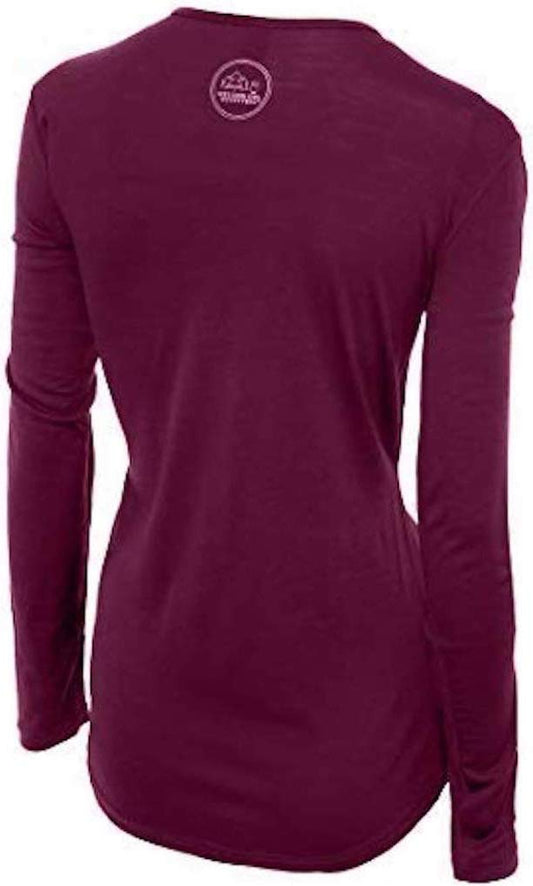
Island weather is not cold so much as persistently windy and damp, and the pattern that matters is working hard on a chalk climb and then standing in wind on an exposed down. Merino at 160gsm keeps insulating when damp, which is where cotton fails and leaves you chilled, and it regulates across a day that changes repeatedly. Our merino base layers are 100% Australian merino at 17.5 micron with no synthetic blend. A long sleeve merino wool base layer for women is the garment that makes Tennyson Down in a breeze pleasant rather than endured.
A proper waterproof with a hood
Not showerproof, and a hood that stays up, because wind on this coast is constant and an umbrella is useless on a clifftop. A packable rain jacket for women is the first thing to pack.
Waterproof boots if you are walking the path
Waterproof hiking boots for the coastal path, which is chalk, clay and grass, slippery when wet, and genuinely muddy on the undercliff sections for much of the year. For the towns and Osborne House, walking shoes with grip are enough. Merino wool socks in either case, which keep insulating damp.
A warm mid layer, most of the year
A fleece mid layer. Needed September to May and useful on a July evening or a ferry deck, which is cold at speed in any month.
Sun protection, which people skip here and regret
A wide brim sun hat with a chin cord for the wind, plus high SPF sunscreen and sunglasses. The downs and the beaches have no shade at all, the island is genuinely sunny by British standards, and sea light plus a cooling breeze is how people burn without noticing.
The small things
A tide table or tide app, which is the most useful item on this list if Compton or the undercliff beaches are in the plan. A contactless card, which works on the buses and ferries. A refillable bottle; tap water is good. A UK three-pin adapter. Binoculars for the Solent shipping and the seabirds. A swimsuit and quick-dry towel if you are brave about cold water. And a ferry booking made in advance for a car in summer.
Essential Resources for Women on the Isle of Wight
Emergency numbers: 999 for police, ambulance, fire and mountain rescue, free from any phone including a locked mobile. 112 also works everywhere in the UK. For a health problem that is not an emergency, NHS 111 gives free advice 24 hours a day and will direct you to the right service, which is the number most visitors actually need.
Non-emergency police: dial 101 for Hampshire and Isle of Wight Constabulary for anything not in progress, and 999 for an emergency. A theft needs a crime reference number to support an insurance claim and reports can be made online.
Main hospital or clinic: St Mary's Hospital at Newport is the island's hospital and has an emergency department. Serious and specialist cases are transferred to Southampton on the mainland, which goes by ferry or by air ambulance, and that transfer can be affected by weather. Dial 111 for urgent but non-emergency advice and 999 for an emergency. A pharmacy handles minor problems without an appointment.
Official health authority: the NHS. Emergency treatment in an NHS A and E department is free to everyone, but follow-up and non-emergency care are chargeable for visitors, and note that serious cases here are transferred to Southampton by ferry or air ambulance
US Embassy: the United States Embassy in London. London, which from this island means a ferry and a train, so keep a copy of your passport separately
Official tourism authority: VisitBritain. With Visit Isle of Wight for tide tables, the current coastal path route, which is rerouted as cliffs erode, and the Cowes Week and Isle of Wight Festival dates, which fill the island's accommodation
Cliffs: actively eroding chalk and sandstone. Rockfalls happen, path sections collapse, and the edges are undercut and mostly unfenced. Stay back from the top and do not shelter or fossil-hunt directly beneath a cliff face.
Tides: the dinosaur footprints at Compton and Hanover Point are exposed only at low water, and beaches below the undercliff can be cut off by a rising tide. Check a tide table and leave margin.
Ferries: three crossings, all cancelled in strong wind, particularly the fast catamarans. Never plan to leave the island on the same day as an onward flight, and book a car crossing well ahead in summer.
US State Department travel advisory: the United Kingdom advisory. Read the current level there directly rather than relying on a figure printed in any guide.
UK FCDO travel advice: there is none, and this is not an omission. The FCDO advises British nationals on travel abroad, so it publishes nothing for the United Kingdom itself and both gov.uk/foreign-travel-advice/united-kingdom and /uk return 404. In its place, the Government of Canada advice for the United Kingdom gives an equivalent third-country assessment.
Solo women safety assessment: the Isle of Wight is among the lowest-risk destinations in this library for a woman travelling alone. The towns are small and family-oriented, crime is lower than mainland England by most measures, a visitor's realistic exposure is petty theft from a beach towel or an unlocked car, and walking or eating alone anywhere here is entirely unremarkable. The nightlife is modest outside Cowes Week in August and the festival in June, both of which bring large drinking crowds and the ordinary care that implies. What genuinely deserves attention is the coast rather than anything human. The cliffs are actively eroding, rockfalls occur, path sections collapse into the sea and the edges are undercut and unfenced, so stay well back from the top and never shelter or fossil-hunt directly beneath a face. The tides control access: the dinosaur footprints are only exposed at low water and undercliff beaches can be cut off by a rising one, so carry a tide table and leave margin. The Solent has strong tidal streams and heavy shipping, which is why swimming belongs on the lifeguarded beaches in season. And the island's entire link to the mainland is boats that strong wind cancels, so never book an onward flight for the day you intend to leave.
Reading On
For the country-level picture, start with the UK travel guide for women. For why fine wool is the right layer on a windy exposed coast, read the guide to merino wool base layers for women. Every destination we cover is indexed at the travel packing guide for women, and the base layers are at the Roman Trail collection.

If the outer journey is calling you, the inner one usually is too. Explore SoulMap at romantrail.com/blogs/soulmap.