

Iquique sits on a narrow shelf of land in northern Chile with the Pacific on one side and a coastal escarpment rising 500 metres directly behind it. It is a beach city, a duty-free port and the capital of the Tarapaca region, and it is surrounded by the driest desert on earth.
Disclosure: This post contains affiliate links. If you buy through them, Roman Trail earns a small commission at no extra cost to you.
THE GEOGRAPHY IS THE WHOLE EXPLANATION OF THIS PLACE. The city is squeezed between the ocean and the CERRO DRAGON, an enormous active sand dune that sits inside the urban area and is why Iquique is one of the world's best paragliding sites: pilots launch from the top of the escarpment and land on the beach. Behind the escarpment is the Atacama, which in this stretch includes places that have recorded no rainfall in any measured period. Our Chile travel guide for women covers the country.
THE SECOND THING IS THAT IQUIQUE WAS BUILT ON NITRATE and the wealth is still visible. In the late nineteenth century the saltpeter mined inland made this one of the richest cities in South America, and the legacy is a centre of Georgian-style timber architecture, imported Oregon pine, in a place with no trees: the TEATRO MUNICIPAL of 1890, the ASTORECA PALACE, and the wooden colonnades of BAQUEDANO STREET. The industry collapsed after synthetic nitrogen was invented and left ghost towns in the desert, two of which are a UNESCO site.
THE THIRD IS THAT THIS IS A WORKING CHILEAN CITY RATHER THAN A RESORT. The ZOFRI free trade zone is the reason many Chileans and Bolivians come, it is a large shopping complex rather than an attraction, and the city's rhythm is domestic. Foreign visitors are a small minority and the place is cheaper and less polished for it.
The Beaches, the Dune and the Nitrate Towns
City beaches that work, a dune for flying off, and two UNESCO ghost towns inland.
PLAYA CAVANCHA is the main city beach and is genuinely good: a sheltered curve right in town, patrolled in season, with a promenade and restaurants, and warm enough to use most of the year. PLAYA BRAVA, south of it, is longer, emptier and is named for a reason, with heavy surf and strong currents, and it is a beach to walk rather than to swim. PLAYA HUAYQUIQUE is the further southern option.
PARAGLIDING IS THE SIGNATURE ACTIVITY and Iquique is internationally rated for it: the thermals off the escarpment are reliable almost every day of the year, and tandem flights from Alto Hospicio down to the beach are routine and heavily operated. Check the operator's credentials and whether your insurance covers it, because many policies exclude paragliding outright.
HUMBERSTONE AND SANTA LAURA are the UNESCO saltpeter works, about 45 minutes inland: abandoned company towns with a theatre, a swimming pool, workers' housing and processing plant standing in the desert, preserved by the total absence of rain. They are genuinely affecting rather than merely photogenic, and the site has a dark labour history it does not hide.
THE GEOGLYPHS AT PINTADOS, in the Pampa del Tamarugal about 90 minutes south, are several hundred figures laid out on hillsides by pre-Columbian caravan peoples, and the GIANT OF THE ATACAMA at Cerro Unita, a 86 metre human figure, is the largest prehistoric anthropomorph in the world.
IN THE CITY: Baquedano Street for the wooden architecture and the old tram, the PLAZA PRAT with its 1877 clock tower, and the fish market and sea lions at the port in the morning.
Recommended Tours and Experiences
The Desert, the Oases and the Altiplano
Oasis villages, a national park at 4,000 metres, and the Atacama proper to the south.
PICA is the classic desert excursion, about two hours inland: an oasis village of citrus groves with spring-fed pools, and the source of the lime used in a pisco sour across Chile. MAMINA is a smaller hot-spring oasis in the same direction.
THE ALTIPLANO IS THE SERIOUS TRIP. ISLUGA VOLCANO NATIONAL PARK sits above 3,000 metres on the Bolivian border, with Aymara villages, salt flats, flamingos and the colonial church at Isluga. ALTITUDE IS THE LIMITING FACTOR: Iquique is at sea level and these places are at 3,500 to 4,000 metres, so going straight up in a day is how people get altitude sickness. Build in an acclimatisation night if you can, drink more water than feels necessary, and treat a headache as a reason to descend.
FOR THE REST OF NORTHERN CHILE: SAN PEDRO DE ATACAMA and the central Atacama are a long way south and are covered in the Atacama packing list. ARICA is three and a half hours north at the Peruvian border.
Getting around: Diego Aracena airport is about 40 minutes south with frequent flights to Santiago, which is the practical way in; the drive from Santiago is around 1,800 kilometres. The city is walkable along the front and you will want a taxi or ride-hailing otherwise. FOR THE DESERT AND THE ALTIPLANO, hire a car or go with an operator, and note two things: fuel stops are far apart, and ALL THE WARNINGS BELOW ABOUT MINEFIELDS AND HIGHWAY VERGES APPLY TO THIS REGION SPECIFICALLY.

When to Go
Any month. It genuinely does not rain, and the temperature barely moves.
A coastal desert climate moderated by the Humboldt current, which is the reason it is not hotter: 13 to 20C in winter, 18 to 27C in summer, and effectively no rainfall at all in any month.
DECEMBER TO MARCH is the Chilean summer and the high season, warmest and busiest, with the sea around 18 to 20C, which is bracing rather than warm because the Humboldt brings cold water up the coast.
APRIL TO NOVEMBER is pleasant, quieter and cheaper, with daytime temperatures in the low twenties and cool evenings. The paragliding runs all year.
THE CAMANCHACA is the thing to know about the mornings: a thick coastal fog that rolls in off the cold ocean and can sit over the city until midday, particularly in winter. It burns off, but a dawn arrival in June can look like the wrong city. Above the escarpment it is clear.
AND JULY'S FIESTA DE LA TIRANA, in a village 70 kilometres inland, is one of South America's great religious festivals, with tens of thousands of dancers in masks over several days. If your dates are near 16 July it is worth building the trip around, and accommodation for a wide radius books out.
Is Iquique Safe for Women Travelers
Safe, with two unusual and specific risks: minefields in the region and tsunami on the coast.
US State Department travel advisory: the Chile advisory. Read the current level there directly rather than relying on a figure printed in any guide.
UK FCDO travel advice: gov.uk/foreign-travel-advice/chile, and read the safety and security page rather than only the landing page, because that is where the substance sits.
UK FCDO: there are NO advised-against areas anywhere in Chile, and the word advise does not appear on either the safety and security page or the regional risks page. ONE REGION carries its own section: the ARAUCANIA REGION, where there is ongoing civil unrest especially around Temuco, with attacks by groups of demonstrators on people and property, and an ongoing STATE OF EMERGENCY in the provinces of Biobio, Arauco, Cautin and Malleco with the military assisting regional police. What the FCDO does cover at length instead is ordinary crime and natural hazard: MUGGINGS, which it says happen frequently in Santiago and Valparaiso, increasingly with guns and knives, in daylight and in plain sight, with the explicit advice not to resist; DRINK SPIKING in the Suecia and Bellavista areas of Santiago; and TAXI SCAMS AT SANTIAGO AIRPORT, where criminals dress as authorised drivers inside the arrivals hall, so the rule is to book and pay for an official taxi inside the building before you exit.
Landmines are a named FCDO risk in northern Chile and the warning is specific about roads. Most Chilean minefields lie near the borders with Peru and Bolivia in the extreme north, which the FCDO identifies as REGIONS XV, I AND II, and near the Argentine border in region XII in the far south. Accidents mainly affect livestock and people crossing borders at unauthorised points rather than visitors. The part that matters for an ordinary trip is the FCDO's own wording that although most minefields are clearly marked, SOME SIGNS AND FENCES ARE OLD AND DAMAGED AND MAY BE HARD TO SPOT, and that IN SOME CASES MINEFIELDS ARE LAID RIGHT UP TO THE EDGE OF HIGHWAYS. So the rule in the far north is to stick to marked roads, not to wander off a highway verge for a photograph, and to check with local authorities before going into rural border country.
TO BE CONCRETE ABOUT WHAT THAT MEANS FOR AN ORDINARY TRIP HERE: you are not going to walk into a minefield on Cavancha beach or on the road to Humberstone. The risk sits in rural border country towards Peru and Bolivia, which is exactly where the altiplano excursions go. The practical rules are to stay on marked roads, not to walk out onto a desert verge for a photograph in border areas, to take warning signs seriously even where fences look derelict, and to ask local authorities or your operator before going into rural ground near either border.
Chile is one of the most seismically active countries on earth and the honest advice is procedural rather than alarming. Major earthquakes are a real risk, building regulations require new structures to account for them, and the FCDO notes that safety measures are widely known and practised by local authorities. Read the instructions in your hotel room, which every Chilean hotel posts, and know that the coastal drill is to move inland and uphill after a strong quake rather than to wait for a siren, because a local tsunami can arrive in minutes. A CHAIN OF VOLCANOES IS ACTIVE IN THE LOS LAGOS REGION, which the FCDO names along with Chaiten, Llaima in Conguillio National Park, Lascar in the north, Copahue on the Argentine border and Villarrica above Pucon. Monitor local media and the official volcano monitoring advice if you are travelling in those areas.
THE TSUNAMI RULE IS THE OTHER SPECIFIC ONE AND IT APPLIES TO THIS CITY DIRECTLY. Iquique sits on a narrow coastal shelf in one of the most seismically active subduction zones on earth and was hit by a magnitude 8.2 earthquake in 2014. EVACUATION ROUTES ARE SIGNED THROUGHOUT THE CITY and lead uphill towards the escarpment. The drill is simple and worth knowing on arrival: after a strong or long earthquake, move inland and uphill immediately and do not wait for an official warning, because a local tsunami can arrive within minutes. Look at the signs near your hotel on the first day.
ORDINARY CRIME is moderate and lower than Santiago's. The FCDO's mugging warning names Santiago and Valparaiso rather than here. Petty theft happens at the beaches, in the ZOFRI crowds and at the bus terminal, and the usual care with bags and phones covers it. The area around the port and parts of the centre are quieter and less comfortable late at night.
THE SUN IS THE RISK PEOPLE ACTUALLY UNDERESTIMATE. Northern Chile records some of the highest surface ultraviolet measured anywhere on earth, because of the altitude inland, the dry cloudless air and the latitude, and the cool coastal breeze removes any sensation of burning. A 22C day here burns faster than a 32C day in Europe.
Chile has no reciprocal health agreement with the UK or the United States, so travel insurance with medical cover is essential. Private clinics in Santiago and the larger cities are excellent and expensive and will ask for payment or an insurance guarantee before treating you; the public system is good by regional standards but slower for a visitor. A farmacia handles minor problems. TAP WATER IS DRINKABLE across most of the country including Santiago, which is unusual in South America, though it is heavily mineralised in the north and many visitors prefer bottled there. THE TWO REAL ENVIRONMENTAL RISKS ARE ALTITUDE AND ULTRAVIOLET: the altiplano and the Atacama run above 4,000 metres on ordinary excursions, and the combination of thin dry air and latitude gives northern Chile some of the highest surface ultraviolet measured anywhere.
Socially this is easy and unremarkable. Chile is among the more straightforward South American countries for a woman travelling alone, Iquique is a working city used to outsiders from the free trade zone, and a woman eating alone or on the beach draws no attention. English is limited outside hotels and paragliding operators, so Spanish or an app helps considerably.
The Iquique Packing List
Serious sun protection, which here is not a formality
This is the first item and it is not negotiable in a region with the world's highest recorded ultraviolet. A wide brim sun hat, a long sleeve sun hoodie, and high factor sunscreen used far more liberally than you would in Europe. Our affiliate registry holds no sunscreen, so that is advice rather than a product recommendation; read the label for broad spectrum cover.
Layers, because the coast is cool and the altiplano is cold
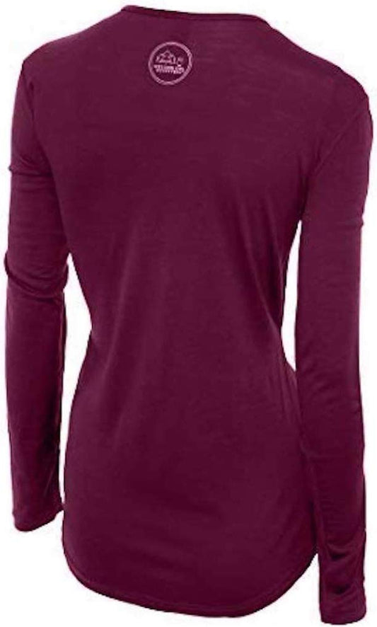
The sea breeze and the camanchaca keep the city cooler than the desert sun suggests, and an altiplano day trip reaches 4,000 metres where it can be near freezing with wind. Our merino base layers are 100% Australian merino at 17.5 micron, and a long sleeve merino wool base layer for women covers a foggy coastal morning and a cold high-altitude afternoon in the same day. Add a fleece mid layer for the altiplano.
A windproof layer rather than a rain one
A packable rain jacket for women, taken entirely for wind. It does not rain here in any meaningful sense. The wind on the escarpment, on a boat and at altitude is the reason to carry it.
Shoes for desert ground
Closed shoes with a real sole for Humberstone's broken concrete and metal, the geoglyph sites and any altiplano walking. Sandals for the beach only. Nothing open-toed in the nitrate ruins, where the ground is debris.
Water, in genuine quantity
An insulated water bottle. The desert excursions have nothing, the air is extraordinarily dry, and altitude compounds dehydration. Chilean tap water is drinkable including here, though it is heavily mineralised in the north and many visitors prefer bottled.
The small things
Sunglasses, which are protective equipment here rather than an accessory. Heavy moisturiser and lip balm for the driest air you will ever stand in. A power bank for long desert days. Cash in pesos for the smaller places, with cards fine in the city. And on day one, look at where the tsunami evacuation route near your hotel goes.
Essential Resources for Women in Iquique
Emergency numbers: 131 ambulance, 132 fire, 133 police, Carabineros. 137 is the maritime rescue service, which is relevant on this coast. Mobile coverage is good in the city and along the main highway and absent across much of the desert and altiplano.
Tourist police: Chile has no dedicated tourist police force. The Carabineros handle visitor matters on 133, and the SERNATUR regional office in Iquique is the right route for a complaint about an operator, which here most often means a paragliding or desert tour.
Main hospital or clinic: the Hospital Regional Dr Ernesto Torres Galdames is the public regional hospital with a 24 hour emergency department, and the Clinica Iquique is the main private option and the one most international insurers will direct you to. A farmacia handles minor problems. For an emergency dial 131.
Official health authority: the Chilean Ministry of Health on the national government portal. Chile has no reciprocal health agreement with the UK or the United States, so insurance with medical cover is essential, and check whether your policy excludes paragliding, which many do. Clinica Iquique is the private option insurers usually direct you to
US Embassy: the United States Embassy in Santiago.
Official tourism authority: Chile Travel, the national tourism board. And with the SERNATUR regional office in Iquique, which is the right body for a complaint about a paragliding or desert operator and publishes the Humberstone opening hours
The FCDO names this region in its landmine advice. Minefields lie near the Peru and Bolivia borders in regions XV, I and II, and Iquique is the capital of region I. Some markings are old and damaged, and in places minefields reach the edge of highways. Stay on marked roads in border country.
Learn the tsunami route on day one. Iquique is on a narrow coastal shelf in a major subduction zone and was hit by a magnitude 8.2 quake in 2014. After a strong or long earthquake, move inland and uphill at once rather than waiting for a warning.
Northern Chile has some of the highest ultraviolet on earth, and a cool sea breeze removes the sensation of burning entirely.
Many insurance policies exclude paragliding. Check yours before booking the flight that is the main reason people come.
Solo women safety assessment: Iquique is straightforward for a woman travelling alone, and Chile is among the easier South American countries for it. This is a working city used to outsiders through its free trade zone, a woman eating alone or on the beach draws no attention, and the FCDO's mugging warning names Santiago and Valparaiso rather than here; ordinary crime is moderate and lower than the capital's, with petty theft concentrated at the beaches, in the ZOFRI crowds and at the bus terminal, and the port area and parts of the centre quieter and less comfortable late at night. English is limited outside hotels and the paragliding operators, so Spanish or an app helps. TWO RISKS HERE ARE GENUINELY UNUSUAL AND BOTH ARE WORTH PREPARING FOR. The FCDO names THIS REGION in its landmine section, since most Chilean minefields lie near the Peru and Bolivia borders in regions XV, I and II and Iquique is the capital of region I; the FCDO's own wording is that some signs and fences are old and damaged and that minefields are in places laid right up to the edge of highways, so stay on marked roads in border country, take derelict-looking warning signs seriously, and ask before entering rural ground near either border. The second is TSUNAMI: the city sits on a narrow coastal shelf in one of the most active subduction zones on earth, was struck by a magnitude 8.2 earthquake in 2014, and is signed throughout with evacuation routes leading uphill, so after a strong or long quake move inland and up immediately rather than waiting for an official warning. THE SUN IS THE THIRD and is the one most underestimated, because northern Chile records some of the highest surface ultraviolet measured anywhere and the cool breeze hides it. Altitude is the fourth if you take an altiplano excursion, which climbs from sea level to around 4,000 metres in a morning.
Reading On
For the country-level picture, start with the Chile travel guide for women. For the central Atacama and its own set of extremes, read the Atacama packing list. At the other end of the country the Torres del Paine packing list, the Chiloe packing list and the Carretera Austral packing list cover a Chile that could not be less like this one. For why merino rather than cotton when a day runs from coastal fog to 4,000 metres, read the guide to merino wool base layers for women. Every destination we cover is indexed at the travel packing guide for women, and the base layers are at the Roman Trail collection.

If the outer journey is calling you, the inner one usually is too. Explore SoulMap at romantrail.com/blogs/soulmap.