

Horton Plains is a plateau at about 2,100 metres where the Sri Lankan highlands flatten out into montane grassland and patches of stunted cloud forest, and then stop abruptly. The southern edge of the plateau is a cliff. At the point called World's End the ground falls away roughly 880 metres in one go, and on a clear morning you can see across the southern plains to the sea. It is a UNESCO World Heritage Site, the headwaters of three of the island's major rivers, and nothing else in Sri Lanka looks remotely like it.
Disclosure: This post contains affiliate links. If you buy through them, Roman Trail earns a small commission at no extra cost to you.
It is also the coldest place most visitors to Sri Lanka will go, which is the thing people get wrong. Frost forms here in the dry season, the wind on the open grassland is constant, and the standard visitor arrives from a beach in a t-shirt. The loop walk is nine and a half kilometres on exposed ground, and the park has a genuinely strict no-plastic rule that will cost you your water bottle at the gate if you have brought the wrong one.
The Walk, and the Cloud
The circuit is a nine-and-a-half-kilometre loop taking three to four hours, usually walked anticlockwise: out across the grassland to the Lesser World's End, on to World's End itself, then back past Baker's Falls to the entrance. It is not difficult walking. It is flat to gently undulating, on a made path for much of the way, and the only real challenge is the altitude, the cold and the length.
The cloud is the entire reason the day starts before dawn. World's End is reliably clear only in the early morning: by about nine or ten o'clock the cloud comes up the escarpment from the south and the view is replaced by white, often for the rest of the day. So the standard arrangement is to leave Nuwara Eliya or Haputale at around half past four or five in the morning, be at the gate when it opens at six, and reach World's End by half past seven. Arriving at ten means a cold walk with no view, which a great many people do.
Baker's Falls, on the return leg, is a twenty-metre waterfall reached by a short set of steps off the main path and is worth the detour. Kirigalpoththa, the island's second highest peak, is a separate and much longer out-and-back from the same entrance for people who want a real walk. The Chimney Pool and the old Farr Inn, now a visitor centre, are the other landmarks.
One thing this page cannot show you. We illustrate destinations from photographs whose captions name the place, and none of the Horton Plains frames available to us is identifiably World's End. The three images here are the rolling grassland, a misty sunrise over the plateau and the stunted cloud-forest trees, which is a fair picture of the park and is not its famous cliff. We would rather tell you that than caption some other viewpoint as World's End.

Getting There
There is no public transport into the park and no accommodation inside it. The three realistic bases are Nuwara Eliya, about an hour and a half by road, Haputale or Bandarawela, roughly the same, and the hamlet of Ohiya, which is the closest and is on the railway line.
The Ohiya option is the interesting one. The Colombo to Badulla train stops at Ohiya, and from the station it is about eleven kilometres uphill to the park entrance, which people do by tuk-tuk in roughly forty minutes or on foot in three hours. Taking the first train is not early enough for the view, so if you want to do it this way, stay at Ohiya the night before.
Otherwise it is a hired car or tuk-tuk from your guesthouse, arranged the evening before, leaving in the dark. Entry is a national park ticket bought at the gate, and it is one of the more expensive park tickets in Sri Lanka for foreign visitors. A guide is not compulsory on the main loop.
The No-Plastic Rule, Which Is Enforced
Horton Plains does not allow single-use plastic into the park and the check at the gate is real. Staff will go through your bag, and plastic water bottles, wrappers and bags are either confiscated or logged and checked on your way out. This is not a formality and it catches a lot of people.
The practical answer is to arrive with a reusable bottle, food in a reusable container or paper, and nothing in a wrapper. There is nowhere to buy anything inside the park, and the walk is three to four hours at altitude, so going without food and water is not an option either. Sort this out the night before.
When to Go
Sri Lanka has two monsoons that arrive from opposite directions, which is why there is no bad time to visit the island and every wrong time to visit half of it. The YALA monsoon brings rain to the south and west from roughly May to September, and the MAHA monsoon brings it to the north and east from roughly October to January, with inter-monsoonal rain either side. So the south coast and the hill country are at their best from December to March, and Jaffna, Trincomalee and the east coast are at their best from April to September, which is the exact inverse. The FCDO records that monsoon rains cause flooding, displacement, injuries and occasional deaths, that heavy rain and landslips close roads and disrupt transport, and names the Disaster Management Centre and the Department of Meteorology as the sources to watch. Planning a single trip around both coasts means accepting rain somewhere.
January to March is the clearest and driest window and is when the World's End view is most reliable. The plateau catches rain from both monsoons because of its altitude and exposure, and the wettest stretch is roughly October to December. April and the shoulder months can be fine or can be solid cloud.
The temperature is the headline. Daytime on the plateau is around fifteen degrees and often less with the wind; early mornings in the dry season drop to around five, and ground frost is normal in January and February. The combination most people are unprepared for is five degrees, a stiff wind and no shelter on open grassland at half past six in the morning. It then reaches the high teens by midday and you will be carrying the layers you were wearing.
Is Horton Plains Safe for Women Travelers
UK FCDO: Sri Lanka has NO ADVISED-AGAINST AREAS ANYWHERE, which for a country that ended a twenty-six year civil war in 2009 is the headline. What its regional-risks page carries instead is LANDMINE content for the north and east and a note on the military presence there, and what its safety-and-security page carries is a harassment warning that names locations rather than people. On terrorism the wording is the mild form. Sri Lanka also had a severe economic crisis in 2022 with fuel shortages and power cuts, and while the situation has stabilised considerably the advisory still asks visitors to carry cash, expect occasional power interruptions and check locally before long road journeys.
Sri Lanka's harassment warning names where rather than who, and the locations are public transport and tourist sites rather than hotels. The FCDO records that women CONTINUE to report incidents of verbal and physical harassment by men, ranging from sexually suggestive or lewd comments to physical advances and sexual assaults, and that while incidents can happen anywhere the MAJORITY OF REPORTED CASES take place in crowded areas including MARKETS, BUS AND RAILWAY STATIONS OR ON BUSES, SPORTING EVENTS and TOURIST SITES. THAT IS A DIFFERENT PATTERN FROM THE ONES THIS LIBRARY HAS RECORDED ELSEWHERE and it needs different countermeasures. In Turkey and Egypt the reported harm concentrated inside hotels and spas, by staff and by people met during the day, so the advice was about a familiar face. Here it is crowds and transit, so the advice is about position: take a reserved seat or a first-class carriage rather than a crowded one, avoid the packed buses that are otherwise the cheapest way to travel, keep to the busier parts of a temple site, and treat a crush as something to leave. The FCDO also suggests taking care when travelling alone or in small groups and CONSIDERING CARRYING A PERSONAL ALARM, which is a concrete packing item and one of very few times these pages recommend a specific object.
The park itself is among the most benign places in this guide for a woman walking alone. The loop is a single well-used path, you will be among a steady stream of other walkers from the moment the gate opens in high season, park staff are at the entrance and at World's End, and the whole thing is over by late morning. The harassment pattern the advisory describes belongs to crowded transport and town centres, and the practical exposure here is the journey rather than the walk: the pre-dawn drive and, if you take the Ohiya route, a tuk-tuk on an empty mountain road in the dark. Arrange that through your guesthouse rather than at the roadside, which is how everyone does it anyway.
What is actually dangerous here is the cliff and the weather, and people have died of both. World's End has no barrier. It is a sheer 880-metre drop with a grass and rock edge, often wet, sometimes in cloud so thick you cannot see the bottom or judge the lip, and the instinct to step closer for a photograph is exactly the wrong one. Treat the edge with the respect you would give a cliff in Scotland with no fence. Separately, the plateau produces genuine exposure: cold, wind and driving rain on open ground three hours from the gate, and people get hypothermic here in a tropical country because they walked out in a t-shirt.
Some Sri Lankan animals are genuinely dangerous and the advisory names which. It records that WILD ELEPHANTS AND CROCODILES WILL ATTACK HUMANS ON OCCASION, that venomous insects and snakes are found in many parts of the country though not commonly in populated areas, and that FERAL DOGS ARE COMMON AND SOMETIMES CARRY RABIES. The instruction is to follow the advice of authorised guides or your tour operator if in any doubt. The elephant point is the one visitors underestimate: Sri Lanka has the highest density of wild elephants in Asia, human-elephant conflict kills people here every year, and a wild elephant on a road at dusk is a common sight rather than a rare one. Do not approach, do not feed, and do not get between an elephant and its herd. Rabies is the reason not to pet a friendly street dog.
Two park-specific notes. Leopards live here and are essentially never seen; sambar deer are everywhere, habituated, and should not be approached or fed. Leeches are common on the damp sections in the wet months. And the path is slippery rather than technical: smooth rock, wet grass and mud, which is where the ankles go.
The Horton Plains Packing List
A merino base layer, which is the item this destination exists to justify
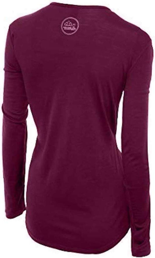
Our merino base layers are 100% Australian merino at 17.5 micron, and a long sleeve merino wool base layer for women is the correct first layer for Horton Plains for a reason specific to this walk. You start at five or six degrees in wind, warm up walking, cool down again standing at the viewpoints, and finish in the high teens, and the whole time you are on exposed ground with no shelter. That is the condition in which a cotton layer soaked with your own sweat makes you genuinely cold, which is how people get into trouble in a tropical country. Merino regulates across that range, keeps insulating when damp, and is light enough to be carrying by eleven o'clock.
A windproof, waterproof shell
Not optional. A packable Marmot PreCip Eco rain jacket handles the two things the plateau does reliably, which are wind and horizontal rain, and the wind alone is the reason a fleece is not enough. The plateau can go from clear to driving cloud in twenty minutes.
A warm hat and gloves, in Sri Lanka
Yes, genuinely. At five degrees with wind at half past six in the morning, bare hands and head are the first things to become unpleasant and they are cheap to solve. Thin merino glove liners and a beanie are enough and pack to nothing. We are not linking them here only because this post is already at the six-link cap our affiliate rules set, and the shell, the shoes and the bottle matter more.
Shoes with grip, and waterproof ones
A waterproof hiking shoe is the right tool: nine and a half kilometres on wet grass, smooth rock and mud, with sections of standing water in the wet months. Trainers do the distance and slip on the rock, and wet feet for four hours at fifteen degrees is miserable.
Wool socks
A pair of Darn Tough merino hiking socks for warmth and for the fact that they keep working damp, which cotton does not. Worth a spare pair in the car.
A reusable bottle, because the park will take a plastic one
An insulated water bottle is the single most practical item on this list given the no-plastic rule at the gate, and insulation means you can carry something warm for the viewpoint. Fill it before you leave; there is nothing inside the park.
Food in something that is not a wrapper
Your guesthouse will make a breakfast parcel if you ask the night before, and asking for it in paper or a box rather than plastic solves the gate check. You will have been walking for three hours before you are back at the entrance.
A headlamp and sun protection, which sounds contradictory and is not
A rechargeable headlamp for the pre-dawn start and the gate queue in the dark. And a wide brim UPF 50 sun hat plus sunglasses for the walk back, because at 2,100 metres on open grassland with no shade the midday UV is severe and the cold air disguises it completely.
The small things
Rupees in cash for the park ticket, which is not payable by card. Leech socks or trousers tucked into socks in the wet months. A power bank. And a plastic-free bag for anything you need to carry out, because you are expected to.
Recommended Tours and Experiences
Essential Resources for Women in Horton Plains
Emergency numbers: 119 for police, 1990 for the free Suwa Seriya ambulance, 110 for fire and 1912 for the Tourist Police. Inside the park the first point of contact is the Department of Wildlife Conservation office at the entrance, which is staffed during opening hours and is who deals with an incident on the loop. There is no ranger station at World's End, although staff are usually present in high season. For violence against women the national helpline is 1938. Mobile coverage on the plateau is patchy to absent, which is the most important practical line in this section: do not rely on a phone working at World's End, and tell your driver or guesthouse your expected return time.
US State Department travel advisory: the Sri Lanka advisory. Read the current level there directly rather than relying on a figure printed in any guide.
UK FCDO travel advice: gov.uk/foreign-travel-advice/sri-lanka, and read the safety and security page rather than only the landing page, because that is where the substance sits.
Main hospital: there is no medical facility at the park. The nearest hospitals are the district hospital at Boralanda and the provincial hospital at Bandarawela, roughly an hour and fifteen minutes away by mountain road, with the teaching hospitals at Badulla and Nuwara Eliya the larger options at a similar distance. Government care is free at the point of use even for visitors. For anything serious the answer is Kandy, about five hours away, or Colombo at seven, and the journey is slow mountain road in every direction. That distance is the argument for insurance that names HIKING and covers domestic transfer, because a broken ankle three hours out on the loop is a stretcher carry followed by a long drive.
Official health authority: the Ministry of Health, Sri Lanka. Insurance must name HIKING or TREKKING for this destination. The loop is 9.5km at 2,100m with no vehicle access and no medical facility, mobile coverage is patchy, and the nearest real hospital is over an hour away by mountain road
US Embassy: the United States Embassy in Colombo.
Official tourism authority: Sri Lanka Tourism, the national tourism authority. Sri Lanka Tourism and the Department of Wildlife Conservation are both worth checking for the current park entry fee and opening time, and for the no-plastic rule, which is enforced at the gate rather than advertised
Be at the gate at six. The cloud closes World's End by about nine or ten and does not usually clear.
No single-use plastic, and the bag check is real. Reusable bottle, food not in wrappers.
World's End has no barrier. An 880-metre drop, often wet, sometimes in cloud.
Solo women safety assessment: Horton Plains is among the most benign places in this guide for a woman walking alone, and the risks here are environmental almost entirely. Sri Lanka carries NO advised-against areas anywhere. The loop is a single well-used path, you will be among a steady stream of walkers from the moment the gate opens in season, and the whole thing is finished by late morning. The FCDO's national harassment warning concerns crowded markets, bus and railway stations, buses and tourist sites, and recommends considering a personal alarm; the realistic exposure for this destination is the JOURNEY rather than the walk, meaning a pre-dawn car or, on the Ohiya route, a tuk-tuk on an empty mountain road in the dark, so arrange transport through your guesthouse the evening before rather than at the roadside. WHAT ACTUALLY KILLS PEOPLE HERE IS THE CLIFF AND THE COLD. World's End is a sheer 880-metre drop with no barrier, a grass and rock lip that is often wet, and cloud thick enough that you cannot judge the edge; the urge to step closer for a photograph is the specific danger. And the plateau produces real exposure: five degrees with wind and horizontal rain on open grassland three hours from the gate, where people become hypothermic in a tropical country because they set out in a t-shirt. Carry a windproof shell, a warm layer and a hat even if the coast you came from was thirty degrees. MOBILE COVERAGE IS PATCHY TO ABSENT on the plateau, so tell somebody your expected return time, and there is no medical facility at the park with the nearest real hospital over an hour away by mountain road. The path is slippery rather than technical, which is where ankles go. Leeches are common in the wet months, sambar deer are habituated and should not be fed, leopards are present and essentially never seen. Single-use plastic is confiscated at the gate. 119 for police, 1912 for tourist police, 1990 for a free ambulance, the Wildlife Conservation office at the entrance for anything on the loop, and Bandarawela or Badulla for a hospital.
Reading On
Horton Plains is a day trip from somewhere, and the somewheres are all covered here. The Nuwara Eliya packing list and the Haputale packing list are the two usual bases, roughly ninety minutes away each, and Haputale's Lipton's Seat has the same before-the-cloud discipline as World's End. The Ella packing list covers the third hill-country option with Little Adam's Peak, which is a much gentler walk. For the railway that gets you to Ohiya, the Kandy packing list covers the northern end of the line. For the highest comparable walking in South Asia at altitude, read the Munnar packing list for the Western Ghats and the Langtang packing list for genuine Himalayan trekking. The Sri Lanka travel guide for women and the Sri Lanka packing list carry the country-level advice. For why merino is the right first layer when you will be cold, hot, wet with your own sweat and cold again inside four hours, read the guide to merino wool base layers for women. Every destination we cover is indexed at the travel packing guide for women, and the base layers are at the Roman Trail collection.

If the outer journey is calling you, the inner one usually is too. Explore SoulMap at romantrail.com/blogs/soulmap.