

Dettifoss is a waterfall in the Jokulsargljufur canyon in north east Iceland, inside Vatnajokull National Park, and by volume of water and drop combined it is the most powerful waterfall in Europe. The Jokulsa a Fjollum, fed by the Vatnajokull glacier, falls forty four metres across a hundred metre width at an average of around a hundred and ninety three cubic metres a second, and in summer flood a great deal more.
Disclosure: This post contains affiliate links. If you buy through them, Roman Trail earns a small commission at no extra cost to you.
The number is not the experience. What you notice standing there is that the water is grey with glacial sediment rather than white, that the sound is low rather than high, and that the ground shakes. It is not a pretty waterfall. It is a frightening one, and that is the reason to go.
The single most useful thing this page can tell you is which side to drive to, because the two sides are not interchangeable and people get this wrong. Dettifoss has a viewing area on each bank of the canyon, reached by completely different roads from completely different directions, with no crossing between them for about thirty kilometres. Choosing wrongly costs you two hours.
We receive a fee when you get a quote from World Nomads using this link. We do not represent World Nomads. This is not a recommendation to buy travel insurance.
What Is Here
The west bank, reached by Route 862, is the paved road and the one to take. It runs south from Route 85 near Asbyrgi and is sealed for its whole length, usable in a two wheel drive car, open for a longer season, and it leads to a proper car park, toilets and a short walk to the viewpoints. The west side view looks across the fall and gives you the classic framing, and it is the side that stays open longest into the autumn.
The east bank, reached by Route 864, is gravel. It is a rough washboard road, slower, hard on a hire car, and the FCDO's note that some main routes are gravel or dirt applies to it directly. The reward is that you can get much closer to the lip of the fall and the perspective is more dramatic, and there are fewer people. In a small two wheel drive car in bad weather it is not worth it; in anything with clearance, on a dry day, it is the better side.
Selfoss is five hundred metres upstream from Dettifoss on either bank and is reached by a short walk. It is a wide, low, curtain-shaped fall across the whole river and is almost always ignored by people who have come for the big one. Note that this is a different Selfoss from the town of the same name in southern Iceland, which trips up search results and has previously tripped up our own image surveys.
Hafragilsfoss is a kilometre downstream and is visible from a viewpoint on the east road. The canyon itself, Jokulsargljufur, runs about twenty five kilometres north to Asbyrgi, a horseshoe-shaped canyon which Norse myth says was made by Odin's horse Sleipnir putting a hoof down, and the full canyon hike between them takes two days.
The whole set of sights here is marketed as the DIAMOND CIRCLE, which links Husavik, Asbyrgi, Dettifoss and Myvatn in a loop from Akureyri. It is a long day as a loop and a comfortable two days with a night at Myvatn or Husavik.
And the landscape around Dettifoss was used as the opening alien planet in Prometheus, which tells you something true about it: this is the part of Iceland that looks least like Earth.

When to Go
Mid June to early September for reliable access, and this is a seasonal destination rather than a year round one. Route 862 on the west side is open longest but both roads are subject to winter closure, and the east road on 864 is generally shut from autumn to late spring. In winter Dettifoss is reachable only by organised super-jeep tours and is often not reachable at all.
Summer gives you near twenty four hour light in June, the highest water flow from glacial melt, and both roads open. July and August are the busy months and busy here means a full car park rather than a queue.
The second photograph on this page is the winter version, which exists and which you should not plan on seeing independently: the FCDO's advice about checking road.is before every driving day is the operative instruction, and in this part of Iceland in October a road can be open in the morning and closed by afternoon.
Check road.is on the morning of your visit, not the night before. That is not caution, it is how Icelanders drive.
Getting There
Akureyri is about two hours west and is the practical base; Myvatn is about an hour. There is no accommodation at Dettifoss and no fuel, no food and no shelter beyond the toilets at the west car park. This is a place you drive to and leave.
From the ring road, Route 1, you turn onto 862 or 864 depending on the side, and the junctions are well signed. From Myvatn the southern end of 862 is a shorter approach but is gravel on that section, so most visitors coming from Myvatn still go round to the north.
Icelandic driving rules differ from British ones in ways that carry fines of up to about five hundred pounds, and the FCDO lists them. KEEP DIPPED HEADLIGHTS ON YEAR ROUND, day and night, which is a legal requirement. Speed limits are lower than in the UK and the DRINK DRIVING LIMIT IS LOWER TOO. Suitable tyres are required, including winter tyres when conditions call for them. A UK photocard licence is valid for thirty days. Beyond the rules, the conditions are the thing: the weather changes fast, distances between towns are far greater than the map suggests, SOME MAIN ROUTES ARE GRAVEL OR DIRT, and some roads and bridges are SINGLE LANE WITH PASSING AREAS. Highland and interior F-roads need four wheel drive, open only for a short part of the summer, and where they cross rivers the instruction is to DRIVE AT FIVE TO TEN KILOMETRES AN HOUR and to understand that RIVER LEVELS CAN CHANGE WITHIN THE SAME DAY. Check the Icelandic Road Administration before every driving day rather than once at the start of the trip.
If you hire a car in Iceland there is one clause worth knowing before you sign, and the FCDO states it rather than hinting at it: THE WEATHER CAN CAUSE DAMAGE TO RENTAL CARS THAT IS NOT COVERED BY INSURANCE. Strong winds are common and throw up sand and ash that strips paintwork, and in its own words BRITISH TOURISTS HAVE HAD TO PAY LARGE AMOUNTS OF MONEY to repair hire cars damaged that way. Sand and ash protection is sold as a separate product by most Icelandic hire companies and is the one add-on that is usually worth taking. Two related points: BREAKDOWN RECOVERY COSTS IN REMOTE AREAS CAN BE VERY HIGH, and OFF-ROAD DRIVING IS STRICTLY CONTROLLED and illegal outside marked tracks, with large fines, because the vegetation does not recover.
And the gravel point is not abstract at Dettifoss. Route 864 is exactly the kind of washboard gravel that chips paint, cracks windscreens and shreds tyres on a car not rated for it, and the hire agreement for a small two wheel drive car commonly excludes damage sustained on it. Read the agreement, take the sand and ash and gravel protection if offered, and if you have a small city car take the west side.
Organised day tours run from Akureyri and Myvatn and are a reasonable choice: they handle the road, they know which side is open, and the driving is the hardest part of this destination.
Is Dettifoss Safe for Women Travelers
The FCDO publishes no advised-against areas anywhere in Iceland and the country has no /regional-risks page, so there is no partial advisory behind the summary. On terrorism it is unusually mild by its own standards, saying that ALTHOUGH THERE IS NO RECENT HISTORY OF TERRORISM IN ICELAND, ATTACKS CANNOT BE RULED OUT. On crime it says levels are LOW, with petty theft and antisocial behaviour PARTICULARLY AROUND BARS IN DOWNTOWN REYKJAVIK, which is the only location it names in the whole country. What the landing page does carry is a named VOLCANIC ERUPTIONS warning, and the detail there matters more than the headline: the eruptions since December 2023 have affected THE TOWN OF GRINDAVIK AND THE SURROUNDING AREA, and the FCDO states plainly that THE CAPITAL CITY, REYKJAVIK, KEFLAVIK INTERNATIONAL AIRPORT AND THE REST OF ICELAND HAVE NOT BEEN AFFECTED. So this is a named-town situation rather than a country-level one, which is the opposite of how a reader skimming headlines would take it.
Personal safety is not the question at a waterfall in the Icelandic interior, and the honest subject of this section is the waterfall itself. Iceland is the safest country in the world by most measures, the FCDO's single named crime location is around bars in downtown Reykjavik four hundred kilometres away, and the only people here are other visitors and the park rangers. What this place requires is respect for the ground you are standing on.
One sentence on Iceland's safety page deserves to be read twice, because it names the three things that actually hurt visitors and all three are things people come here to look at: GOING TOO CLOSE TO THE OCEAN, CLIFF EDGES AND HOT SPRINGS ARE COMMON CAUSES OF ACCIDENTS IN ICELAND. That is not a generic caution. The ocean here produces sneaker waves, which run far higher up a beach than the sets before them with no visible warning and which have killed people standing on black sand looking out to sea. Cliff edges in Iceland are frequently unfenced, often undercut, and made of material that gives way. Hot springs and mud pots are at or near boiling, the ground around them can be a thin crust over water at that temperature, and the burns are severe. The rule in all three cases is the same and it is unglamorous: keep back further than feels necessary, never turn your back on the sea, and stay on the boardwalks and marked paths in a geothermal area.
At Dettifoss the cliff edge clause is the one that kills people and the detail is the spray. The viewpoints stand on basalt above a hundred metre canyon, and much of the rock near the fall is permanently wet from airborne spray, which makes it genuinely slippery in a way dry basalt is not. Some of the paths are fenced and a good deal of the canyon rim is not, because this is a national park in a country that expects adults to manage themselves. In winter that spray freezes into clear ice on the rock. People have died here and at comparable Icelandic falls by going for a better photograph on wet rock above a drop.
The rules are unglamorous and they work: stay on the marked paths, stay behind the ropes and the fences where they exist, assume all rock within sight of the fall is slippery whether it looks it or not, do not climb down toward the water, and do not stand on the edge for a photograph. The same applies at Selfoss, which is less visited and less managed.
Iceland runs a national system for exactly the situation a visitor gets into and the FCDO points at it by name. SAFETRAVEL ICELAND publishes route conditions and hazard guides and LETS YOU LODGE A TRAVEL PLAN, so that if you do not return someone knows where to look, and the FCDO's own instruction is to leave your plans and contact details either with your hotel or on Safe Travel. Alongside it, the Icelandic Met Office carries weather and aurora and seismic alerts, the Road Administration carries road status, and 112 is both the emergency number and an app that transmits your position to the rescue services. None of that costs anything, and in a country where SEARCH AND RESCUE MAY BE LIMITED IN SOME AREAS, which the FCDO says plainly because Iceland is inside the Arctic Circle, using it is the difference between an incident and a statistic.
And the isolation is the other half of the risk. There is no shelter at Dettifoss, limited mobile signal in the canyon, and the nearest hospital is in Akureyri two hours away. The FCDO notes that emergency medical assistance and search and rescue may be limited in some parts of Iceland, which is a statement about places exactly like this one. Lodge your plan, carry the 112 app, and do not go in weather you would not walk in at home.
The Dettifoss Packing List
Permanent airborne spray, wet basalt above a hundred metre canyon, no shelter and a two hour drive each way.
Merino base layers, and the spray is the whole argument
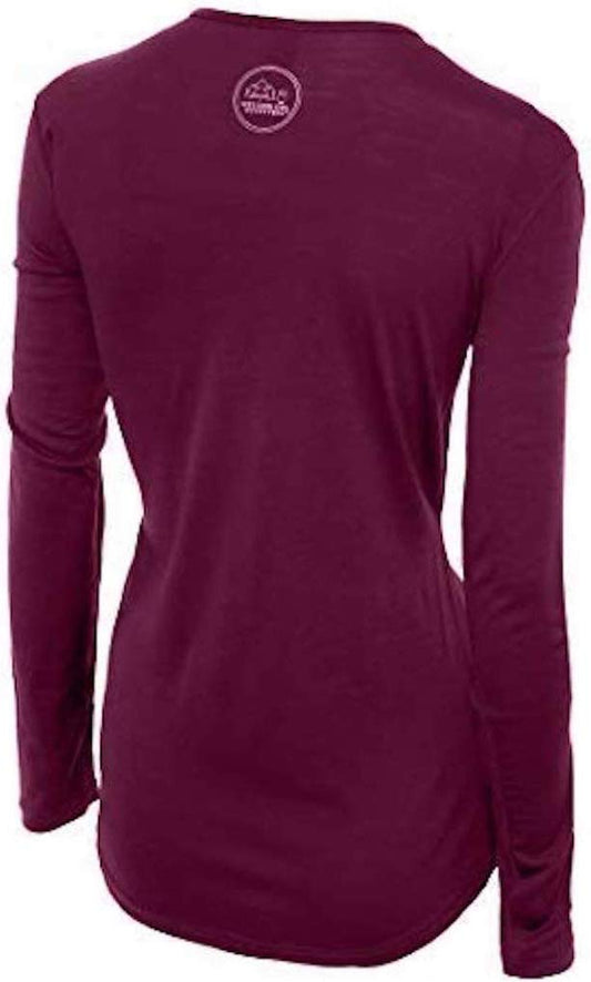
Our merino base layers are 100% Australian merino at 17.5 micron, and a long sleeve merino wool base layer for women is the right first layer here in any month for a reason specific to this destination. You will get wet. Not rained on, but soaked by airborne glacial spray carried on the wind, standing still, in temperatures that in summer are ten to fourteen degrees and in a wind that does not stop. A cotton layer in that situation is cold within minutes and stays cold for the two hour drive back. Wool keeps insulating when it is wet through, which is the entire reason Icelanders wear it. A merino base layer bottom is worth having whenever you come.
A waterproof shell that is genuinely waterproof, not showerproof
A Marmot PreCip Eco rain jacket. At most destinations the shell's job is rain; here it is sustained spray driven sideways by wind, which finds every gap. A hood that cinches down, closable cuffs and a cut you can tighten are what matter. Waterproof trousers are worth having too if you intend to walk to Selfoss as well.
A fleece and, outside midsummer, insulation
A Columbia Fast Trek fleece year round under the shell, and a waterproof insulated parka from September to May. Ten degrees with spray and wind is colder in effect than the number, and you will be standing still looking at it rather than walking.
Boots with grip, which is the safety item on this page
Merrell Moab 3 waterproof hiking boots with Darn Tough merino hiking socks. Permanently wet basalt above an unfenced hundred metre canyon is the single most dangerous surface in this batch, and grip is what stands between you and the statistic. Waterproof is essential because the ground is wet for a radius around the fall, and ankle support matters on broken rock.
The small things
A dry bag or a waterproof case for a phone or camera, because spray will reach it and salt-free glacial grit is still grit in a lens. A microfibre cloth for the same reason. Water and food, since there is nothing here. A full tank of fuel before you turn off the ring road. The 112 Iceland app, downloaded in advance. A warm hat and gloves from September to May, which are wind items. Sunglasses, because the low northern light off wet rock is strong. And a check of road.is on the morning you go.
Recommended Tours and Experiences
Essential Resources for Women at Dettifoss
Emergency numbers: 112 reaches police, ambulance, fire and mountain and sea rescue from any phone including a locked mobile, and English is spoken. Download the 112 Iceland app before you travel: it sends your GPS position to the emergency services with one button and logs your location periodically so you can be found, which is the single most useful free thing a visitor to Iceland can do. For non-urgent medical advice the health service line is 1700.
There is nothing at Dettifoss but toilets at the west car park. No fuel, no food, no shop, no shelter and limited mobile signal in the canyon. Check road.is on the morning of your visit for the status of Routes 862 and 864, because the east gravel road in particular closes and reopens at short notice, and vedur.is for the weather. Lodge your plan with Safe Travel Iceland or your accommodation.
US State Department travel advisory: the Iceland advisory. Read the current level there directly rather than relying on a figure printed in any guide.
UK FCDO travel advice: gov.uk/foreign-travel-advice/iceland, and read the safety and security page rather than only the landing page, because that is where the substance sits.
Main hospital: there is nothing nearer than Akureyri Hospital, two hours west, which is the referral centre for the whole north. Myvatn has a health centre an hour away. A UK Global Health Insurance Card or an EU European Health Insurance Card gives you state-provided medically necessary care in Iceland on the same terms as a resident, which is not the same as free: Iceland charges patient co-payments for primary care and outpatient visits, so expect to pay something and keep the receipts. Travel insurance still matters and matters more here than in most of Europe, because the FCDO notes that EMERGENCY MEDICAL ASSISTANCE AND SEARCH AND RESCUE MAY BE LIMITED IN SOME AREAS and because an evacuation from a remote part of the country is expensive. Tap water is among the best in the world and buying bottled is pointless; the hot tap smells of sulphur because it is geothermal, which is harmless. Pharmacies are apotek.
Official health authority: the Directorate of Health of Iceland. THERE IS NO MEDICAL FACILITY AT DETTIFOSS AND LIMITED MOBILE SIGNAL IN THE CANYON. The nearest health centre is at MYVATN an hour away and the nearest hospital is AKUREYRI, two hours west, which is the referral centre for the whole north. The FCDO notes that EMERGENCY MEDICAL ASSISTANCE AND SEARCH AND RESCUE MAY BE LIMITED IN SOME AREAS of Iceland, which describes this place exactly. DOWNLOAD THE 112 ICELAND APP, which transmits your GPS position to the emergency services at one button
US Embassy: the United States Embassy in Reykjavik.
Official tourism authority: the Icelandic Tourist Board. THE SINGLE MOST USEFUL THING TO KNOW IS WHICH SIDE TO DRIVE TO, because the two banks are reached by different roads from different directions with no crossing for about thirty kilometres. ROUTE 862 ON THE WEST BANK IS PAVED for its whole length, usable in a two wheel drive car, open longer in the season, and has a car park and toilets. ROUTE 864 ON THE EAST BANK IS ROUGH GRAVEL, generally shut from autumn to late spring, hard on a hire car and commonly excluded from a small car's insurance, and gets you closer to the lip. SELFOSS is five hundred metres upstream and is almost always ignored; note it is A DIFFERENT SELFOSS from the southern town of the same name. CHECK ROAD.IS ON THE MORNING OF YOUR VISIT rather than the night before. THERE IS NO FUEL, FOOD OR SHELTER at the site
Take Route 862 on the west bank unless you have clearance and a dry day. It is paved; the east road is rough gravel and often excluded from hire insurance.
Assume every rock within sight of the fall is slippery. Permanent spray on basalt above an unfenced hundred metre canyon, and ice on it in winter.
Walk the five hundred metres to Selfoss. A wide curtain fall across the whole river that almost everyone skips.
Check road.is the morning you go and fill the tank before leaving the ring road. There is nothing at the site at all.
Solo women safety assessment: personal safety is not the question at a waterfall in the Icelandic interior and it would be dishonest to pad this section as though it were. Iceland is ranked the safest country in the world by most measures, the FCDO publishes no advised-against areas and no regional risks page, and the single crime location it names in the entire country is AROUND BARS IN DOWNTOWN REYKJAVIK, four hundred kilometres away. The only people here are other visitors and the park rangers. WHAT THIS PLACE REQUIRES IS RESPECT FOR THE GROUND. The FCDO's own sentence names the three things that hurt visitors to Iceland and all three are things people travel to see: GOING TOO CLOSE TO THE OCEAN, CLIFF EDGES AND HOT SPRINGS ARE COMMON CAUSES OF ACCIDENTS IN ICELAND. Here it is the cliff edge, and the particular mechanism is the spray: the viewpoints stand on basalt above a hundred metre canyon, much of the rock near the fall is permanently wet from airborne glacial spray and is genuinely slippery whether it looks it or not, parts of the rim are unfenced because this is a national park in a country that expects adults to manage themselves, and in winter that spray freezes to clear ice. People have died at Dettifoss and comparable Icelandic falls going for a better photograph on wet rock above a drop. Stay on the marked paths, behind the ropes where they exist, and off the edge. The second risk is the car, where the FCDO states that WEATHER DAMAGE TO RENTAL CARS IS NOT COVERED BY INSURANCE and that British tourists have paid large sums for sand and ash damage, requires dipped headlights year round, notes a lower drink-drive limit than the UK, and warns that some main routes are gravel: Route 864 to the east bank is exactly that and is commonly excluded from a small car's agreement. The third is isolation, with no shelter, no fuel, no food, limited signal and the nearest hospital two hours away, in a country where the FCDO says search and rescue may be limited in some areas. Lodge a plan with Safe Travel Iceland and carry the 112 app.
Reading On
Dettifoss is a drive from somewhere else and that somewhere is usually Akureyri. The Akureyri packing list covers the northern capital two hours west, which is where you will sleep, eat and refuel and which carries the whole Diamond Circle in its own text. The Reykjavik packing list covers the capital, and the Gullfoss packing list covers the Golden Circle waterfall in the south west, which is the busier and more accessible counterpart to this one. The Hofn packing list covers the south east and the glacier coast. For the country as a whole the Iceland travel guide for women and the Iceland packing list carry the ring road, the driving rules and the practical material in full. For why wool is the only fibre that works when you are soaked by spray and standing still, read the guide to merino wool base layers for women. Every destination we cover is indexed at the travel packing guide for women, and the base layers are at the Roman Trail collection.

If the outer journey is calling you, the inner one usually is too. Explore SoulMap at romantrail.com/blogs/soulmap.