

Chopta is not really a town. It is a high meadow in the Garhwal Himalaya at roughly 2,700 metres with a scatter of lodges and tea shops along the road, and it exists because of what is above it: TUNGNATH, THE HIGHEST SHIVA TEMPLE IN THE WORLD at 3,680 metres, and the summit of Chandrashila at 4,000.
Disclosure: This post contains affiliate links. If you buy through them, Roman Trail earns a small commission at no extra cost to you.
What Is Here
THE TREK IS THE WHOLE REASON TO COME AND IT IS SHORT, STEEP AND HIGH. Tungnath is about 3.5km from the road with roughly a thousand metres of ascent, on a paved and stepped path. Chandrashila is another 1.5km and 300 metres above the temple. People do the round trip in a day; the altitude is what makes it harder than the distance suggests.
Tungnath is one of the Panch Kedar, the five temples of the Kedarnath cycle, and it is a working place of worship rather than a viewpoint with a building on it. It closes for winter, usually from November, when the deity is moved down to Mukku.

THE VIEW FROM CHANDRASHILA IS THE PAYMENT, in the second image: a 360 degree sweep taking in Nanda Devi, Trishul, Kedarnath peak and Chaukhamba. Sunrise is the classic time and means walking up in the dark.
The meadow itself is a bugyal, high alpine pasture, grazed in summer and under snow in winter. Deoria Tal, a lake with the peaks reflected in it, is a separate short trek from Sari village nearby and is the best easy walk in the area.
There is very little infrastructure and that is the character of the place. Lodges are basic, electricity is intermittent, and there is no mobile signal in much of the area. Rudraprayag and Ukhimath are the nearest towns of any size.
When to Go
April to June and September to November. May and October are the best months.
In winter, December to March, Chopta is a SNOW TREK and Tungnath is closed. The route is still walked, in snow, with crampons or spikes and a guide, which is a different undertaking from the summer walk.
AVOID THE MONSOON, JULY TO MID SEPTEMBER: heavy rain, leeches on the path, no views, and landslides closing the approach roads.
Nights are cold in every month. In May the meadow can be near freezing after dark.
Getting There
By road from Rishikesh, about 8 to 9 hours for roughly 200km via Devprayag, Rudraprayag and Ukhimath, which again tells you about the road.
By train to Haridwar or Rishikesh, then road.
By air, Dehradun's Jolly Grant is the nearest airport, about 9 hours by road.
Shared jeeps run as far as Ukhimath reliably and to Chopta less so. Most visitors hire a car with a driver from Rishikesh or Haridwar.
Is Chopta Safe for Women?
Chopta is remote rather than dangerous. The risks are altitude, weather, the road and the absence of help. The FCDO does publish advised-against areas for India, and being precise about them matters more than a general warning. It advises against all travel to the Union Territory of Jammu and Kashmir, except air travel to and movement within the city of Jammu, and against all travel within 10km of the India-Pakistan border, where the Wagah-Attari crossing is closed. It advises against all but essential travel to the state of Manipur, including Imphal. None of that is anywhere near this destination, and it is worth knowing which parts of a very large country the warnings actually describe.
ALTITUDE IS THE FIRST REAL HAZARD AND PEOPLE DISMISS IT BECAUSE THE TREK IS SHORT. Chandrashila is 4,000 metres. Going from Rishikesh at 350 metres to a 4,000 metre summit within 48 hours is a fast ascent, and headache, nausea and breathlessness are common. Sleep at Chopta for a night before the summit, drink more than you want to, and turn back if a headache does not clear. Descending is the treatment.
The path is paved and stepped but steep and exposed, with ice in the shoulder seasons and snow in winter. A sunrise start means walking it in the dark.
There is no mobile signal in much of the area and no medical facility at all. The nearest help is hours away over mountain roads.
The approach roads are the usual Uttarakhand hazard: narrow, unbarriered, landslide-prone in the monsoon.
The Chopta Packing List
A high meadow with freezing nights and a thousand metre climb above it.
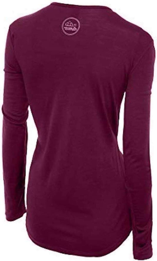
Our merino base layers are 100% Australian merino at 17.5 micron, and a long sleeve merino wool base layer for women is the foundation of the whole kit here. You climb hard and sweat, then stop at 4,000 metres in wind, and the fibre that keeps insulating while damp is the difference between cold and dangerously cold. It also covers your shoulders, which matters at a working temple. A heavyweight merino base layer is the right weight for the lodge at night in any month.
Over it a Columbia Powder Lite insulated hooded jacket and a Marmot PreCip Eco rain jacket as the shell. Fleece-lined thermal leggings under trousers for the summit push and for the nights.
Merrell Moab 3 waterproof hiking boots with ankle support, not trainers, with Darn Tough merino socks. The steps are uneven stone and often wet or iced.
Not linked and worth packing: A WARM HAT AND GLOVES, which are not optional at 4,000 metres in any month; MICROSPIKES OR CRAMPONS plus a guide if you come between December and March, when this is a snow trek; A HEAD TORCH for a sunrise start; SUNGLASSES and high-factor sun protection, since UV at altitude is severe and snow reflects it; A POWER BANK, because electricity is intermittent; and WATER PURIFICATION. Carry enough cash for the whole trip: there are no ATMs anywhere near Chopta.
Recommended Tours and Experiences
Essential Resources for Women in Chopta
Emergency numbers: 112 is the single national emergency number and works from any phone. 100 reaches police directly, 108 ambulance and 101 fire. 1091 is the national women's helpline and 1098 the child helpline.
Chandrashila is 4,000 metres and the trek is short enough that people dismiss the altitude. Coming from Rishikesh at 350 metres to a 4,000 metre summit inside 48 hours is a fast ascent: sleep at Chopta first, drink more than you want, and if a headache does not clear, descend, because descending is the treatment. THERE IS NO MEDICAL FACILITY AT CHOPTA and no mobile signal across much of the area; the nearest help is hours away over mountain roads. TUNGNATH CLOSES FOR WINTER, usually from November, when the deity moves down to Mukku. FROM DECEMBER TO MARCH THIS IS A SNOW TREK needing spikes and a guide. The monsoon, July to mid September, brings landslides on the approach roads. Carry all the cash you need: there are no ATMs.
US State Department travel advisory: the India advisory. Read the current level there directly rather than relying on a figure printed in any guide.
UK FCDO travel advice: gov.uk/foreign-travel-advice/india, and read the safety and security page rather than only the landing page, because that is where the substance sits.
Main hospital: there is none at Chopta. The nearest facilities are at Ukhimath and Rudraprayag, one to two hours away by mountain road, with the referral hospitals at Srinagar Garhwal and Dehradun considerably further. Dial 108 for an ambulance and expect a long wait. Insurance covering mountain evacuation is strongly advised. Healthcare in the large Indian cities is genuinely good in the private hospitals and variable in the public ones, and the private sector expects payment or a direct insurance guarantee up front. Carry insurance with a high medical limit and repatriation cover, and carry proof of it. The commonest problem by far is not dramatic: it is stomach upset, so drink sealed bottled or filtered water, and be more careful with raw salad and cut fruit than with hot food cooked in front of you.
Official health authority: the Indian Ministry of Health and Family Welfare. covers the Uttarakhand state health service
US Embassy: the United States Embassy in New Delhi.
Official tourism authority: Incredible India, the Ministry of Tourism's official site. publishes the Tungnath opening and closing dates, the Kedarnath Wildlife Sanctuary arrangements and monsoon road status
Takeaways
Sleep at Chopta before you go up. The summit is 4,000 metres.
Short does not mean easy. It is a thousand metres of ascent.
Tungnath closes in winter, and the trek becomes a snow trek.
No ATMs, no signal, no hospital. Arrive prepared.
Solo women safety assessment: Chopta is remote rather than risky, and the distinction matters for a woman alone. The trail to Tungnath is a pilgrimage route, so in season you are walking among Indian families and sadhus rather than by yourself, and the lodges along the Chopta road are small family operations where a solo traveller is looked after rather than ignored. Dress covered, as at any working temple, and the usual north Indian attention is minimal here because the context is religious. 112 IS THE SINGLE NATIONAL EMERGENCY NUMBER, with 100 for police, 108 for an ambulance and 1091 the women's helpline, THOUGH THE HONEST POINT IS THAT NONE OF THEM REACHES YOU QUICKLY: there is no mobile signal across much of this area and no medical facility at Chopta at all. THE FCDO'S INDIAN PROHIBITIONS ARE ELSEWHERE, in Jammu and Kashmir and Manipur, and nothing in its guidance touches Garhwal. THE FIRST REAL HAZARD IS ALTITUDE AND IT IS UNDERRATED PRECISELY BECAUSE THE WALK IS SHORT. Three and a half kilometres sounds like an afternoon; a thousand metres of ascent ending at 4,000 metres is not, and people arrive from Rishikesh at 350 metres and try the summit the next morning. Sleep a night at the meadow first, drink far more water than feels necessary, and treat a headache that will not clear as the instruction to go down rather than as something to push through. THE SECOND IS THE PATH IN THE DARK, since the classic plan is a sunrise summit, which means stone steps, ice in the shoulder seasons and a head torch. THE THIRD IS THE ROAD IN, eight or nine hours of narrow unbarriered Uttarakhand mountain highway, which is statistically the most dangerous part of the trip: go in daylight and do not accept a driver who has come through the night. Carry cash, a power bank and insurance that covers mountain evacuation.
Reading On
Chopta is Garhwal, and the Uttarakhand pilgrim routes run through it. The Rishikesh packing list covers the town most trips start from and the Haridwar packing list the Ganges pilgrimage city below it, with the Mussoorie packing list for the nearest hill station. East in Kumaon the Almora packing list covers the cultural capital of the hills. West, the Shimla packing list, Manali packing list and Dharamsala packing list cover Himachal, with the Spiti Valley packing list and Ladakh packing list for higher and drier country and the Delhi packing list for the capital. For the country the India travel guide for women and the India packing list carry the transport and the practical material in full. For why wool matters when you sweat and then stop in wind, read the guide to merino wool base layers for women. Every destination we cover is indexed at the travel packing guide for women, and the base layers are at the Roman Trail collection.

If the outer journey is calling you, the inner one usually is too. Explore SoulMap at romantrail.com/blogs/soulmap.