

Byron Bay sits on the far north coast of New South Wales, about two hours south of Brisbane and nine hours north of Sydney, on Arakwal Bundjalung country. Cape Byron, known as Walgun, is the most easterly point of mainland Australia, and the lighthouse on it is where the continent's first sunrise lands.
Disclosure: This post contains affiliate links. If you buy through them, Roman Trail earns a small commission at no extra cost to you.
IT IS WORTH BEING HONEST ABOUT WHAT BYRON IS NOW, because a great deal of writing about it describes a town that stopped existing some time ago. The surf and alternative community that gave Byron its reputation is still present, but the town is now one of the most expensive postcodes in Australia, with a wellness economy, a significant influencer and film industry presence, and a summer when the population multiplies several times over. January is chaotic and expensive. If you arrive expecting a sleepy hippie village you will be disappointed; if you arrive expecting an extremely good stretch of coast with excellent food and a strange, lush hinterland behind it, you will not be.
THE ONE THING THAT KEEPS IT LOOKING LIKE ITSELF IS A BUILDING HEIGHT LIMIT. Local planning rules prevent building above the tree line, so there are no towers, and that single decision is why Byron does not look like the Gold Coast an hour north. The contrast between the two, which you will see if you drive down, is the clearest argument for planning restraint on any coast in the country.
What you pack is set by subtropical sun, by humid summers, and by the fact that most of what you will do involves salt water or a walk.
We receive a fee when you get a quote from World Nomads using this link. We do not represent World Nomads. This is not a recommendation to buy travel insurance.
The Cape, the Beaches and the Hinterland
A lighthouse walk, a break for every ability, and a hinterland that is still odd.
THE CAPE BYRON WALKING TRACK IS THE BEST THING HERE and it is free. The loop runs about 3.7 kilometres from the Captain Cook lookout around the headland past the lighthouse, through a pocket of rainforest and along the clifftop, taking around two hours with stops. DO IT AT DAWN. You are standing at the first point on the continent to get the sun, the track is quiet, the car park is not yet full, and between roughly June and November you will see WHALES from the clifftop without a boat. Dolphins are present year round and turtles are common in the bay below.
THE BEACHES EACH DO SOMETHING DIFFERENT. MAIN BEACH is the patrolled town beach, flagged and lifeguarded, and is where to swim. CLARKES is quieter, just along. THE PASS is the famous right-hand point break and is where the surfers and the crowds are, a long gentle wave that is ideal to learn on and consequently extremely busy. WATEGOS is the sheltered, north-facing, family beach and the prettiest. TALLOW BEACH, on the far side of the cape, is seven kilometres of nearly empty sand and is UNPATROLLED with serious rips. BELONGIL, west of town, is quiet, clothing-optional in part, and also unpatrolled.
SURF LESSONS ARE THE LOCAL RITE and Byron is genuinely one of the best places in the world to take a first one, because The Pass and Main Beach both produce long, slow, forgiving waves. Every operator provides boards and rash tops.
IN TOWN, Jonson Street and the lanes off it hold the food, which is very good and expensive, and the Farmers Market runs on Thursday mornings. The lighthouse itself can be toured. Sunset drinks at the Beach Hotel are the institution.
THE HINTERLAND IS THE HALF PEOPLE MISS. BANGALOW, fifteen minutes inland, is a handsome village with the best Saturday market in the region. NIMBIN, an hour away, is the counterculture town that grew out of the 1973 Aquarius Festival and is exactly as advertised, which some find charming and others find tired. MINYON FALLS in Nightcap National Park drops 100 metres, and the Protesters Falls walk in the same park is named for the 1979 Terania Creek blockade that began the Australian forest protest movement. CRYSTAL CASTLE and the macadamia and coffee farms fill the gaps.
Recommended Tours and Experiences
Brisbane, the Gold Coast and the Coast South
Two hours to Brisbane, one to the high-rises, and a long way to Sydney.
BRISBANE is about two hours north and is the practical gateway: Ballina Byron Gateway Airport is twenty-five minutes away and Gold Coast Airport at Coolangatta is about forty-five minutes, which is usually the cheaper option. Our Brisbane packing list covers the city.
THE GOLD COAST is an hour north and is the instructive contrast: Surfers Paradise is a wall of towers on an excellent beach, and seeing it immediately after Byron explains the height limit better than any argument could. Lennox Head and Ballina are twenty and thirty minutes south, cheaper, quieter and with the same coast. Yamba and the Clarence River are two hours south.
SYDNEY IS NOT A DAY TRIP: it is nine hours by road or an hour and a half by air from Ballina. The drive down the Pacific Highway is a genuine road trip of several days.
Getting around: Byron town is small and walkable and a car is a liability in it, because PARKING IS THE TOWN'S DEFINING FRUSTRATION, metered, limited and heavily enforced, with the lighthouse car park full by mid-morning. Bikes are the local answer and the Byron Bay Rail Trail runs to Bangalow. A car is genuinely useful only for the hinterland. Shuttles run from both airports.

When to Go
April to June and September to November. Avoid January.
Subtropical, with warm humid summers and mild dry winters. Summer highs from December to February run 27 to 29C with high humidity and afternoon storms; winter days from June to August sit at a very pleasant 19 to 21C with cool nights; the sea runs from about 21C in winter to 26C in summer and is swimmable all year.
APRIL TO JUNE IS THE BEST WINDOW: warm, dry, settled, the humidity gone, the summer crowds gone, and the whales starting. SEPTEMBER TO NOVEMBER is the other one, with the whales heading south with calves and the water warming.
WHALE SEASON RUNS ROUGHLY JUNE TO NOVEMBER, with humpbacks heading north to calve from June to August and back south with calves from September to November, and Cape Byron is one of the best land-based viewing points in the country.
JANUARY IS THE ONE TO AVOID unless you want the party: Australian school holidays, peak prices, booked-out accommodation and no parking. The festival calendar also concentrates: Bluesfest at Easter and Splendour in the Grass in winter both fill every bed for a wide radius, so check before booking. SCHOOLIES in late November brings large numbers of just-finished school leavers to the region.
The summer months are also storm and cyclone-remnant season, and the 2022 floods that devastated nearby Lismore are a reminder that this region's rainfall can be extraordinary.
Is Byron Bay Safe for Women Travelers
Safe and very easy. The surf is the genuine hazard.
The FCDO advises against travel to no part of Australia, and there are no advised-against areas anywhere in the country. It does carry two named warnings that are worth reading rather than skipping. The first is BUSHFIRE, which it flags as a higher risk through the spring and summer, October to February, and which can close roads and whole regions at very short notice. The second is TERRORISM: the FCDO states that terrorists are likely to try to carry out attacks in Australia and that attacks could be indiscriminate, including in places visited by foreign nationals, and it names the December 2025 antisemitic attack at Bondi Beach in Sydney, in which fifteen people were killed, and an April 2024 incident at a church in Wakeley. Australia also publishes its own national terrorism threat level, which is the thing to check rather than any figure quoted here. Beyond those two, the risks it names are environmental: extreme heat, cyclones in the north between November and April, flooding, and the sea, where RIP CURRENTS are the hazard it puts first and the one that actually kills visitors. On crime it names ordinary precautions against petty theft, and separately warns about scams. The practical shape for a visitor is that the everyday risk here really is weather and water, but the advisory does not describe this as a country with nothing but environmental hazards and neither should we.
THE WATER IS THE FIRST AND MAIN RISK and the rule here is specific rather than general. SWIM AT MAIN BEACH OR CLARKES, BETWEEN THE RED AND YELLOW FLAGS, where there are lifeguards. TALLOW BEACH AND BELONGIL ARE UNPATROLLED and carry strong rips, and Tallow in particular looks utterly inviting precisely because nobody is on it. A rip is recognisable as a darker, calmer-looking channel with less breaking surf, which is exactly the part of the beach an inexperienced swimmer chooses, and if you are caught in one the answer is to not fight it: float, raise an arm, and let it take you out until it weakens, then swim parallel to the beach.
SHARKS, HONESTLY. This stretch of the north coast has had a higher rate of incidents than most of Australia, bull sharks use the river mouths and creek outlets after heavy rain, and there have been fatalities in the region. The realistic framing is that it remains a very low risk which you reduce further by not swimming at dawn or dusk, by staying out of the water after heavy rain when run-off clouds it, by avoiding river and creek mouths, and by swimming at patrolled beaches. Several local beaches have drone surveillance and shark listening stations, and the surf clubs act on sightings.
The UV is the thing to take seriously, more than the temperature: Australia has among the highest ultraviolet levels of any inhabited country, and the reason is structural rather than seasonal. The southern ozone layer is thinner, the Earth is closer to the sun during the southern summer, and the air is clean, so UV reaches the ground at an intensity northern visitors have no instinct for. In summer the index routinely passes 11, which is rated EXTREME, and unprotected skin can burn in well under fifteen minutes. IT IS NOT A HEAT PROBLEM AND DOES NOT FEEL LIKE ONE: you burn as readily on a cool windy day in Melbourne or through cloud. Australians are taught five words for it, slip on a shirt, slop on sunscreen, slap on a hat, seek shade and slide on sunglasses, and the reason it is a national slogan is that this country has the highest skin cancer rates in the world.
What is actually dangerous in Australia, and what is not: the reputation and the statistics point in different directions, so it is worth being specific. SPIDERS KILL ESSENTIALLY NOBODY. Redback deaths have been all but unknown since antivenom arrived in the 1950s, with one disputed case since, funnel-web antivenom has held a record of no deaths since it was introduced, and the huntsman that frightens everyone is harmless. SNAKES ARE SERIOUS AND RARE: Australia has many of the world's most venomous species, bites run to a couple of thousand a year and deaths to roughly two, and almost all bites happen to people handling or standing on a snake rather than being hunted by one. Walk heavily, look where you put your feet and hands, and leave them alone. SHARKS AVERAGE ONE OR TWO DEATHS A YEAR nationally, which is fewer than lightning. SALTWATER CROCODILES ARE THE ONE TO GENUINELY RESPECT, in the tropical north above roughly Rockhampton and across to Broome: they are ambush predators in rivers, estuaries and the sea, the warning signs mean it, and the rule is simply not to enter or stand at the edge of any water in croc country unless a local authority says it is safe. BOX JELLYFISH AND IRUKANDJI are the other northern hazard, in the wet season, which is why beaches there have stinger nets and why vinegar sits at the surf club. AND THE THING THAT ACTUALLY KILLS VISITORS IS NONE OF THE ABOVE: it is drowning in rip currents, followed by heat and by long-distance driving.
ON LAND, the local additions are small: ticks are common in the hinterland and should be removed promptly, leeches are present on rainforest walks, and the cliff edges on the Cape Byron track are unfenced in places. The clifftop track is also a genuine fire-risk area in a dry summer, which is what the FCDO's October to February warning refers to in practice.
Australia has a RECIPROCAL HEALTH CARE AGREEMENT with the UK, which is unusual and worth knowing: it covers medically necessary treatment in a public hospital or a public clinic on the same basis as a Medicare patient, and you enrol at a Medicare office or present a UK passport at the hospital. IT IS NOT COMPREHENSIVE COVER. It does not pay for ambulances, which are billed separately and are expensive, it does not cover repatriation, it does not cover treatment in private hospitals, and it does not cover the Royal Flying Doctor Service, which is how you leave a remote area in an emergency. Travel insurance with a high medical limit is still the thing that matters, and the distances in this country are why. A pharmacy, called a chemist, handles small problems, and tap water is drinkable everywhere.
Socially, Byron is one of the easiest places in Australia for a solo woman: the town is small, walkable, extremely used to visitors travelling alone, and full of other people doing the same thing. The caveats are nightlife-ordinary. The Jonson Street bars get busy and drunk, particularly during Schoolies in late November and across January, and drink spiking has been reported in the region's venues as it has in most Australian nightlife districts, so the usual care with an unattended glass applies. Walking back along the beach late at night alone is the one thing locals would advise against, not because of any particular incident but because it is dark, empty and out of earshot.
The Byron Bay Packing List
Base layers, for the dawn walk and the winter evenings
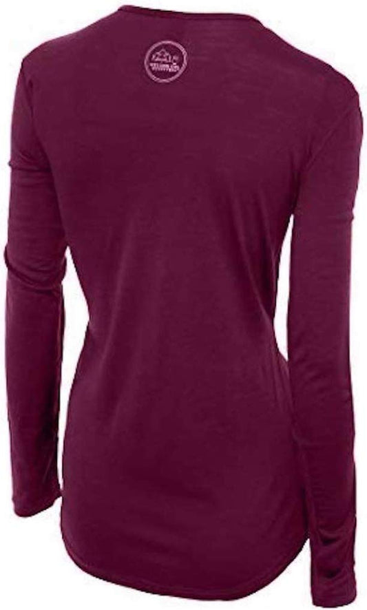
A June or July evening here drops to about 12C and the lighthouse walk at dawn in any month is cool and breezy before the sun is up. Merino handles the swing from a cool dawn to a humid afternoon better than cotton, which simply stays damp. Our merino base layers are 100% Australian merino at 17.5 micron, and a long sleeve merino wool base layer for women covers the early start and doubles as sun cover on the clifftop.
Sun protection, which is the daily discipline here
A wide brim sun hat and a long sleeve sun hoodie. Byron is at 28 degrees south with extreme summer UV, there is no shade on the Cape Byron track or on the beaches, and the sea breeze removes any sensation of burning. High factor sunscreen, reapplied after every swim.
Swimwear and a rash top
Two sets of swimwear, and a long sleeved rash top. If you are taking a surf lesson the school provides one, but your own means you will actually wear it for every swim, which is what prevents the shoulder and back burn that catches nearly everyone.
A light rain layer
A packable rain jacket for women. Summer afternoons here produce short heavy storms and the hinterland rainforest is wet in any season.
Footwear for sand and rainforest
Something for the beach, and waterproof hiking boots if you plan the Nightcap and Minyon Falls walks, which are steep, rooty and often muddy. The Cape Byron track itself is sealed and does not need boots. Merino wool socks.
Water for the walk
An insulated water bottle. There is no water on the Cape Byron track and the humidity does the rest.
The small things
Insect repellent for the hinterland, where mosquitoes and ticks both live. Binoculars for the whales, which genuinely improve the lighthouse walk between June and November. A dry bag. A bike lock if you hire a bike, because bike theft is the town's common property crime. AND TWO PIECES OF LOCAL KNOWLEDGE WORTH MORE THAN ANY ITEM: walk the cape at dawn rather than at midday, and swim at Main Beach between the flags rather than on the empty, beautiful, unpatrolled sand at Tallow.
Essential Resources for Women in Byron Bay
Emergency numbers: 000 for police, fire and ambulance, and 112 from a mobile. 131 444 for non-urgent police. 132 500 for the State Emergency Service, which is the number for flood and storm damage and is used in this region more than most. Coverage is good in town and on the cape, patchy in the hinterland valleys.
Surf and beach conditions: Surf Life Saving NSW publishes patrol times and hazard ratings for every beach here through its Beachsafe service, which also states plainly which beaches are unpatrolled. That is the thing to check before choosing where to swim rather than choosing by how empty the sand looks.
Main hospital: Byron Central Hospital at Ewingsdale, about ten minutes from town, has a 24 hour emergency department. The larger referral hospitals are at Tweed Heads and Lismore. Dial 000 for an ambulance, and note the ambulance is billed separately and is not covered by the reciprocal health agreement.
Official health authority: the Australian Government Department of Health, Disability and Ageing. Australia's reciprocal health care agreement with the UK covers public hospital treatment but not the ambulance, which is billed separately, and not repatriation, so travel insurance still matters and should cover surfing if you are taking a lesson
US Embassy: the United States Embassy in Canberra.
Official tourism authority: Tourism Australia. And with the NSW NATIONAL PARKS AND WILDLIFE SERVICE for the Cape Byron State Conservation Area, Nightcap National Park and the Minyon Falls tracks, plus Surf Life Saving NSW for which beaches here are patrolled
Swim at Main Beach or Clarkes, between the flags. Tallow Beach and Belongil are unpatrolled with strong rips, and Tallow looks inviting because it is empty.
Cape Byron is the most easterly point of mainland Australia and the 3.7km lighthouse loop is the best free thing here. Walk it at dawn.
Whales pass from roughly June to November, visible from the clifftop without a boat.
Avoid January unless you want the party, and check Bluesfest, Splendour and Schoolies dates before booking.
US State Department travel advisory: the Australia advisory. Read the current level there directly rather than relying on a figure printed in any guide.
UK FCDO travel advice: gov.uk/foreign-travel-advice/australia, and read the safety and security page rather than only the landing page, because that is where the substance sits.
Solo women safety assessment: Byron is one of the easiest places in Australia to travel alone, a small walkable town thoroughly used to solo visitors and full of other people doing exactly the same thing, so the social risk is low and the nightlife caveats are the ordinary ones: the Jonson Street bars get busy and drunk, particularly during Schoolies in late November and through January, drink spiking has been reported in the region's venues as in most Australian nightlife districts, and the one thing locals would actively advise against is walking back along the beach alone late at night, simply because it is dark, empty and out of earshot. The real hazard here is the water. Swim at Main Beach or Clarkes between the red and yellow flags where there are lifeguards, and understand that TALLOW BEACH AND BELONGIL ARE UNPATROLLED with serious rips, which matters because Tallow looks the most inviting precisely because nobody is on it; a rip reads as a darker, calmer channel with less breaking surf, which is exactly the stretch a weak swimmer picks, and if caught the answer is to float and signal rather than fight it. On sharks, honestly: this part of the north coast has a higher incident rate than most of Australia and bull sharks use creek and river mouths after rain, so the sensible reductions are to stay out at dawn and dusk, after heavy rain, and away from river mouths, while recognising the absolute risk stays very low. Add extreme subtropical UV with no shade on the cape, and ticks and leeches in the hinterland.
Reading On
For the country-level picture, start with the Australia travel guide for women. For the nearest capital and the usual way in, see the Brisbane packing list. For why wool works in a humid climate, read the guide to merino wool base layers for women. Every destination we cover is indexed at the travel packing guide for women, and the base layers are at the Roman Trail collection.

If the outer journey is calling you, the inner one usually is too. Explore SoulMap at romantrail.com/blogs/soulmap.