

Biei is a farming town of about nine thousand people in central Hokkaido, and what people come for is the shape of the land: low rolling hills divided into strips of potato, wheat, beans and beetroot that read as a patchwork from any rise, with single trees standing out in the fields and the Tokachi mountains behind. It is the most photographed farmland in Japan, it became famous through cigarette and car advertisements in the 1970s and 1980s, and almost everything written about it leaves out the part that matters most to a visitor, which is whose land you are looking at.
Disclosure: This post contains affiliate links. If you buy through them, Roman Trail earns a small commission at no extra cost to you.
We receive a fee when you get a quote from World Nomads using this link. We do not represent World Nomads. This is not a recommendation to buy travel insurance.
What Is Here
THE FAMOUS TREES ARE IN WORKING FIELDS, AND ONE OF THEM IS GONE BECAUSE OF VISITORS. The Ken and Mary Tree is named after a 1972 car advertisement, the Seven Star Tree after a cigarette brand, and the Philosophy Tree, Tetsugaku no Ki, was the best known of all. ITS FARMER CUT IT DOWN IN 2016. People had spent years walking into his field to photograph it, compacting soil, damaging crops and ignoring signs, and in the end he removed the reason they came. That is the single most useful thing to know before arriving: these are not monuments in a park, they are landmarks in somebody's livelihood, the field boundaries are the line, and the whole appeal of the place depends on farmers tolerating the people who come to look at it. View from the road, stay on the road.
THE BLUE POND IS BLUE BY ACCIDENT AND IS NOT NATURAL. Shirogane Aoiike, the first image, was formed in 1988 when erosion-control works were built on the Biei river to protect the town against mudflows from Mount Tokachi, which had just erupted. Water backed up among the larch and birch, the trees died standing, and the dissolved aluminium in the water scatters light to give that particular opaque blue. It is a by-product of flood defence that has become one of the most reproduced images in Japan, and it changes colour with the light and the season rather than being reliably postcard blue.

MOUNT TOKACHI IS AN ACTIVE VOLCANO AND IT EXPLAINS THE WHOLE LANDSCAPE. The second image is the volcanic terrain above the farmland. Tokachi has erupted repeatedly in the last century, the 1926 eruption produced a mudflow that killed well over a hundred people downstream, and the 1988 activity is what produced the pond. The Japan Meteorological Agency publishes a volcanic alert level for it, which is the thing to check rather than a sentence in any guide.
SHIRAHIGE FALLS IS WHERE THE BLUE COMES FROM. The waterfall at Shirogane Onsen drops straight out of the rock face into the Biei river, and the river below it runs the same milky blue as the pond, which is the clearest demonstration of what is actually in the water. It is a short walk from a bridge and it is free.
THE HILLS ARE TWO SIGNED DRIVING ROUTES AND A LOT OF SPACE. The Patchwork Road north west of town and the Panorama Road south east are the two loops the viewpoints sit on, with Shikisai no Oka's flower fields at the Panorama end in summer. The distances are real: this is not a village you walk around, and the sights are spread over twenty-odd kilometres of farm road.
THE LAVENDER FARM EVERYONE MEANS IS NOT IN BIEI. Farm Tomita, the lavender image most people associate with this part of Hokkaido, is in Nakafurano, about forty minutes south, and the lavender season is roughly the second half of July. Biei has flower fields of its own and the lavender is Furano's.
When to Go
The landscape is a different place in each season and the choice is real rather than a formality. Late June to August gives the green and flowering patchwork, the long Hokkaido daylight and the most comfortable weather in Japan, with highs in the mid twenties rather than the mainland's mid thirties. This is peak season and the roads are busy.
September into early October brings the harvest and the autumn colour in the hills, and is arguably the best balance.
Winter is the other Biei and it is severe. Deep snow from December into March turns the hills into white fields with the lone trees standing in them, which is the third image, and the Blue Pond is floodlit on winter evenings. Temperatures reach minus fifteen and lower, sometimes well below minus twenty, and this is among the coldest inhabited parts of Japan.
April and May are the gap, when the snow has gone and nothing has grown, and it is honestly the one time the landscape has little to offer.
Getting There
By train, the JR Furano Line from Asahikawa takes about thirty to forty minutes to Biei station. Asahikawa is reached from Sapporo in roughly an hour and a half by limited express, and has its own airport about twenty minutes from Biei.
By car, which is what most people do, because the viewpoints are spread across farm roads with thin bus service. In summer a car or a hired bicycle is the difference between seeing the hills and seeing the station.
WINTER DRIVING HERE IS A SERIOUS UNDERTAKING AND NOT A DETAIL. Hired cars come on winter tyres, the farm roads are packed snow and ice for months, ground blizzards reduce visibility to nothing in minutes on open ground, and the snow banks hide the edges of the road. If you have never driven in those conditions, the sightseeing taxis and the winter bus tours exist and are the right answer.
There are seasonal sightseeing buses and taxi tours of both loops, which solve the problem in either season.
The Biei Packing List
Comfortable summers, severe winters, long days outdoors with no shelter and a lot of standing still to look at things.
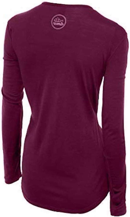
Our merino base layers are 100% Australian merino at 17.5 micron, and a long sleeve merino wool base layer for women is the foundation of a Hokkaido winter kit for a reason that is specific to this trip: you are getting in and out of a heated car into deep cold repeatedly, standing still at viewpoints for ten minutes at a time, and wool holds temperature through that cycle where a synthetic base layer chills you as soon as you stop. From November to April add a heavyweight merino base layer rather than treating it as optional.
A waterproof insulated ski parka is the right outer layer for a winter visit here, because this is minus fifteen with wind over open fields rather than city cold. Waterproof insulated snow boots matter as much, since the viewpoints are unploughed and you will be standing in snow rather than walking through it.
Insulated winter gloves and a merino beanie, and microspikes are worth their weight for the packed-ice paths around the pond and the falls, which are walked by thousands of people and polished smooth.
Not linked and worth packing: SUNGLASSES IN WINTER, because snow glare over open fields on a bright day is genuinely painful; HAND WARMERS, which every Japanese convenience store sells as kairo and which are the cheapest comfort available; A POWER BANK, since cold flattens a phone battery fast and the phone is the camera; CASH IN YEN, because rural Hokkaido is cash country; AND SHOES THAT COME OFF EASILY for any ryokan or restaurant.
Recommended Tours and Experiences
Essential Resources for Women in Biei
Emergency numbers in Japan: Police 110, ambulance and fire 119. Japan does not use a single unified emergency number. Both are free from any phone. There is no dedicated tourist police, and the koban, the neighbourhood police boxes staffed around the clock, are the normal first stop for anything minor. The Japan National Tourism Organization runs a free 24 hour English language visitor hotline on 050-3816-2787.
As of its pages updated 28 August 2026, the FCDO's advice for Japan names no area it advises against travelling to. The one restricted zone it describes is around the Fukushima Daiichi nuclear power plant, which only authorised persons can enter. Its guidance concentrates on natural hazards rather than crime: earthquakes, a typhoon season it gives as June to December, peaking between July and September, and volcanic activity. THE HAZARDS THAT REACH BIEI ARE COLD, A VOLCANO AND THE ROAD. WINTER COLD HERE IS AMONG THE MOST SEVERE IN JAPAN, regularly below minus fifteen and at times past minus twenty five, which is frostbite weather for exposed skin in a surprisingly short time and is why the clothing section above is specific rather than general. GROUND BLIZZARDS on open farmland can take visibility to nothing within minutes with no warning from the sky overhead, and people die in cars in Hokkaido every winter after driving into a snowdrift or a ditch; the response is to stay with the vehicle, keep the exhaust pipe clear of snow and call 110. MOUNT TOKACHI IS ACTIVE and the Japan Meteorological Agency publishes its volcanic alert level along with earthquake warnings, which is the authority to check rather than any guide. BROWN BEARS live in the forested country around the farmland and Hokkaido has had fatal encounters; the rule is to make noise on wooded trails, carry a bell, and never approach a bear for a photograph. And THE FIELDS ARE PRIVATE PROPERTY, which is the one risk a visitor creates rather than faces.
US State Department travel advisory: the Japan advisory. Read the current level there directly rather than relying on a figure printed in any guide.
UK FCDO travel advice: gov.uk/foreign-travel-advice/japan, and read the safety and security page rather than only the landing page, because that is where the substance sits.
Main hospital: Biei is a small town with a clinic rather than a general hospital, and the regional hospitals are in Asahikawa, around thirty to forty minutes away, which is also where a serious case would be treated by helicopter or ambulance. That distance is the reason to carry travel insurance with repatriation cover: Japanese healthcare is excellent, is not free to a visitor, and expects payment at the time, frequently in cash. A pharmacy is a yakkyoku and Asahikawa has the full range of drugstores.
Official health authority: the Japanese Ministry of Health, Labour and Welfare, covers the national health system and the rules on bringing prescription medicines into Japan, which are stricter than most visitors expect
US Embassy: the United States Embassy in Tokyo.
Official tourism authority: the Japan National Tourism Organization, publishes the seasonal sightseeing bus routes around both hill loops, the Blue Pond winter illumination dates and the Furano lavender season, and runs the free English language visitor hotline
Takeaways
The trees are in working fields. One was felled because of visitors. Stay on the road.
The Blue Pond is an accident of flood defence, not a natural lake.
Winter is minus fifteen and the driving is the real decision.
The lavender is Furano's, forty minutes south.
Solo women safety assessment: Biei is about as safe as travel gets, and the things that could go wrong here have nothing to do with other people. Rural Hokkaido is quiet, and a visitor on her own at a viewpoint or on a hired bicycle is unremarkable. There is no area to avoid and no time of day that changes the answer. What does need thought is ISOLATION AND COLD. The sights are spread over twenty kilometres of farm road with thin bus service, mobile coverage is good but not universal in the hills, and in winter the combination of severe cold, ground blizzards and ice is the genuine risk on this trip: if you are not an experienced snow driver, take the sightseeing bus or a taxi tour rather than a hire car, and tell your accommodation where you are going. ENGLISH IS LIMITED outside the station and the main attractions, so a translation app and your accommodation's name written in Japanese are worth having, and the JNTO hotline on 050-3816-2787 is free and answers around the clock. CARRY CASH. Bears are present in the surrounding forest and the farmland is private property, which between them cover both directions of the respect this landscape asks for. 110 REACHES POLICE AND 119 REACHES AMBULANCE AND FIRE, with no single combined number, and the hospital is in Asahikawa rather than in town.
Reading On
Biei sits in the middle of Hokkaido and the island's other destinations are all reachable from it. For the island as a whole, including the parts this post does not reach, the Hokkaido packing list covers the regions, the distances and the winter. The Sapporo packing list covers the island's capital and its snow festival, with the Hakodate packing list for the port city at the southern end and the Niseko packing list for the powder skiing a few hours south west. For the country, the Japan travel guide for women carries the rail passes, the regions and the seasons in full. For why wool is the base layer for a day of getting in and out of a heated car into deep cold, read the guide to merino wool base layers for women. Every destination we cover is indexed at the travel packing guide for women, and the base layers are at the Roman Trail collection. Elsewhere on the island, the Otaru packing list covers the port city up the coast from Sapporo, whose gas-lit canal and stone merchant streets are the urban half of a Hokkaido week. South, the Noboribetsu packing list covers the onsen resort built against a steaming explosion crater, which is the same volcanic country as the mountains above these fields seen from underneath. For the town over the hill, the Furano packing list covers Furano's ski area, its winter and the farms to the south.

If the outer journey is calling you, the inner one usually is too. Explore SoulMap at romantrail.com/blogs/soulmap.